5/19 - The Chief's "Very HOT" Friday Morning Forecast
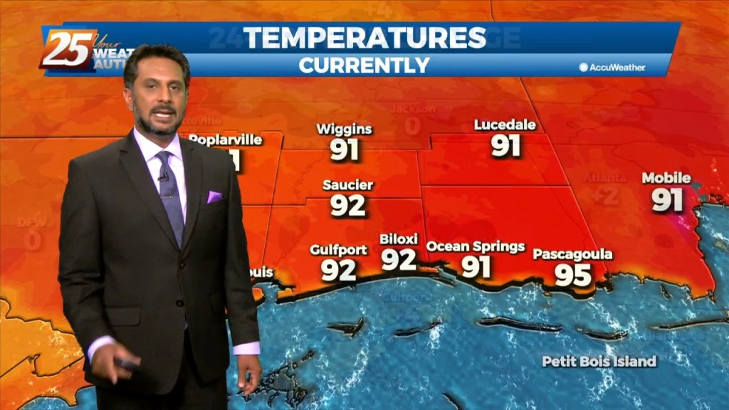
Today I’m expecting temperatures to climb into the lower 90s (heat indices nearing mid 90s) today across much of the area so be mindful to stay hydrated…
Today I’m expecting temperatures to climb into the lower 90s (heat indices nearing mid 90s) today across much of the area so be mindful to stay hydrated…
Mild and muggy conditions will be around overnight. Light fog could develop in spots that saw rain earlier but widespread fog is not expected. Tomorrow is going to…

Scattered showers and thunderstorms will gradually come to an end over the next few hours as daytime heating is lost. South Mississippi is in a summer-like pattern…
An upper-level high pressure that has been parked over the area should break down throughout the course of today. Although the ridge should be breaking…
Low moisture flow will lead to low rain chances and HOT TEMPERATURES... The upper pattern doesn’t change a lot between now and Wednesday afternoon, with the local…

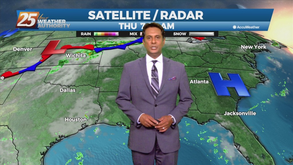
Moisture flow has decreased and there are no real saturated layers. Winds are primarily northerly from 5k upward. No real indications that anything will change significantly during…
Southerly surface winds will help to advect moisture and warm air into the environment. There will still be plenty of moisture in the atmosphere and moisture…
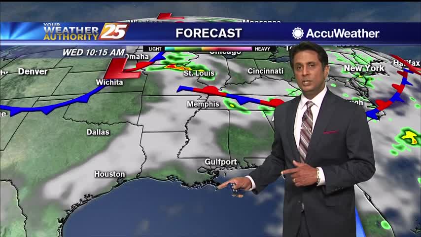
High pressure will continue to shape the forecast into the weekend. As an upper level disturbance digs through the Great Lakes and Ohio River Valley, it will…

Hot and dry pattern continues as upper level high-pressure builds SW to NE across the Mississippi Valley. This will easily supports high temperatures around 90 degrees, with…
Another day of afternoon shower and thunderstorm activity is on tap with precipitation chances a good deal higher overall than they were yesterday, mainly during the peak heating of the afternoon hours. This should in turn help to keep temperatures…

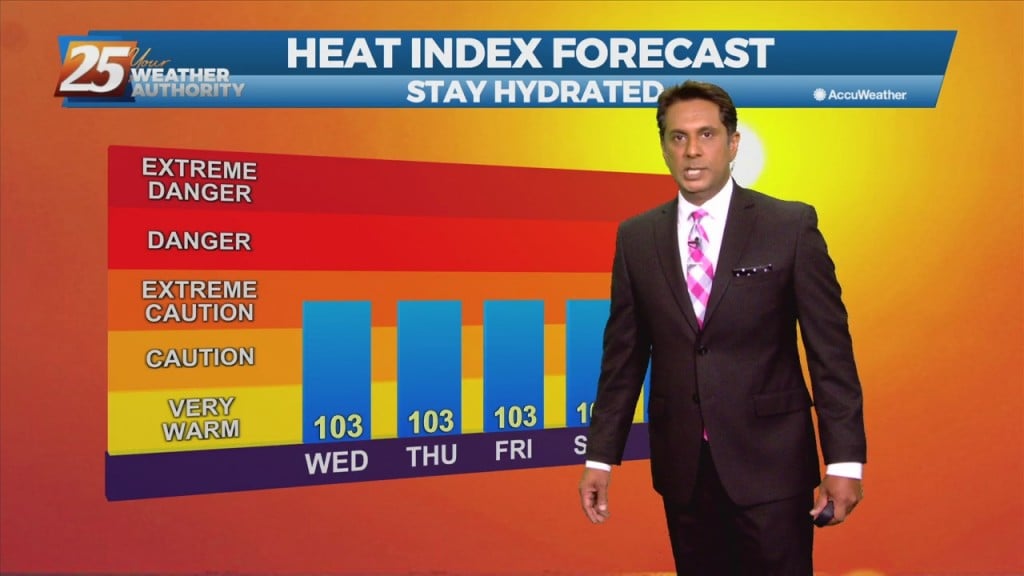
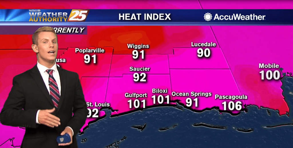
With high-pressure shaping the forecast, daily high temperatures generally in the 90 to 95 range and afternoon dew-points in the lower and mid 70s will make for somewhat uncomfortable conditions. Moisture flow south of the interstate will be more abundant than…
Not much in the way of changes expected over the next few days with high pressure over the Gulf of Mexico. Daily high temperatures generally in the 90 to 95 range and afternoon dew-points in the lower and mid 70s…
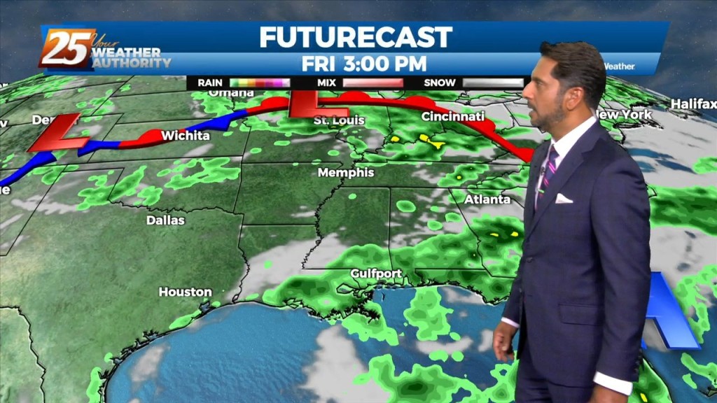
A Weak frontal boundary draped along the lower Tennessee valley will continue to slide east and out of the region, high-pressure will slowly build eastward through Friday as this weakness moves off the east coast over the next 48 hours.…
The Bermuda high-pressure is at the surface and aloft, extending westward across the Gulf Coast into east Texas early this morning. The eastern portions of the area may squeeze out one more relatively dry day today, as moisture flow will…

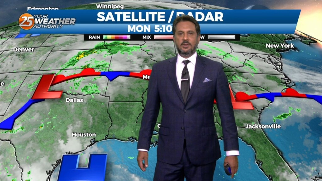
Hurricane Laura is currently in the central Gulf of Mexico currently moving northwestward. Satellite imagery does show Laura trying to have a bit more of a closed circulation and the storm has now increased to a CAT 2 hurricane. Laura…
It's hazy, hot and humid along the Gulf Coast. High temperatures will likely top out in the mid 90s, but it will feel like it's between 100 and 108 degrees. Scattered showers and thunderstorms may help cool things down in…
A very warm start with the Heat Index expected to be in the 90s by mid-morning...

As the strong humid flow continues, daytime heating is popping up isolated t-storms...

A very warm/humid start to the day has once again allowed for patchy fog to develop...
Muggy and hot days are ahead for South MS, and we'll see very little rain to cool us off....
The rain has moved on, but the humidity isn't going anywhere. Get ready for more muggy days ahead....
The rainy weather has moved on, but the muggy and hot weather is moving in....
Another warm and humid start to the day with thin upper-level clouds moving across the area...

It's the last day in May which means Hurricane Season begins tomorrow, and things are just starting to heat up closer to home....