8/10 - Rob Knight's "HEAVY RAIN THREAT" Wednesday Morning Forecast
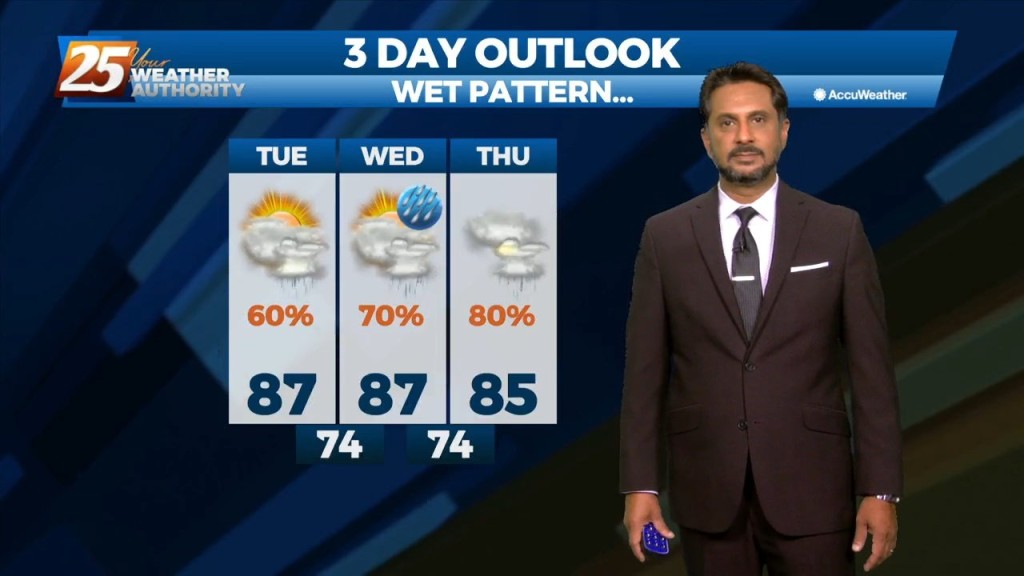
At the risk of sounding repetitive, another day of high rain chances is on tap for the area. Once again, these storms can easily produce hourly…
At the risk of sounding repetitive, another day of high rain chances is on tap for the area. Once again, these storms can easily produce hourly…
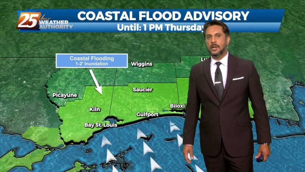
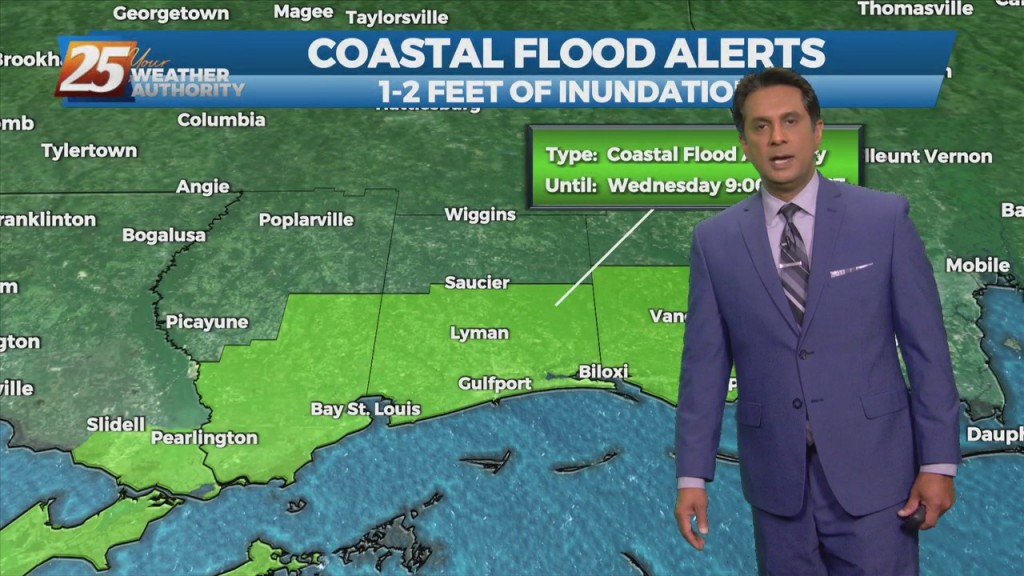
A COASTAL FLOOD ADVISORY is in effect through midday Thursday. High pressure over the western Atlantic will keep the area in a period of…
In a near carbon copy of last week, rain chances will once again continue to be high through the period. High pressure over the western Atlantic…

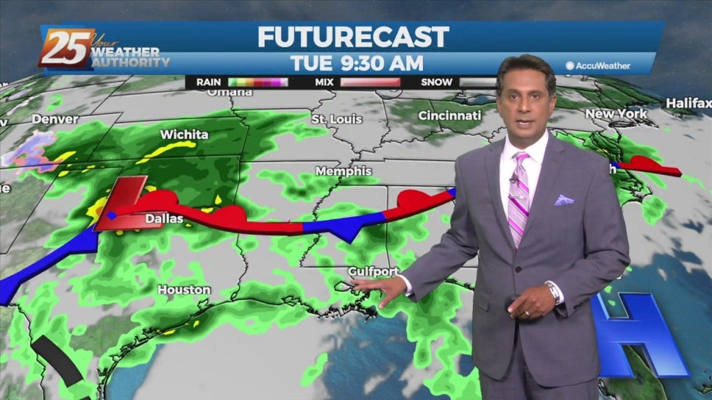
Today will bring more of the same as yesterday as numerous showers and thunderstorms are expected to develop. Deep moisture from the Gulf of…
Daytime heating will continue to flare up afternoon showers and t-storms which could produce pockets of HEAVY RAINFALL... Over the short term period a wetter period will…

Over the short term period a wetter period will begin today as general weakness in the overall patter to the north of Hattiesburg slowly moves into…
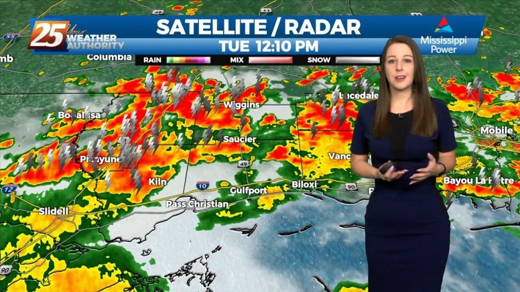
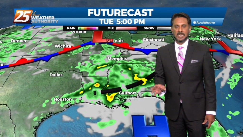
An easterly wave noted in the pattern will move westward across the area this afternoon/tonight, enhancing t-storm development. Areal coverage over land this afternoon/tonight should be fairly…

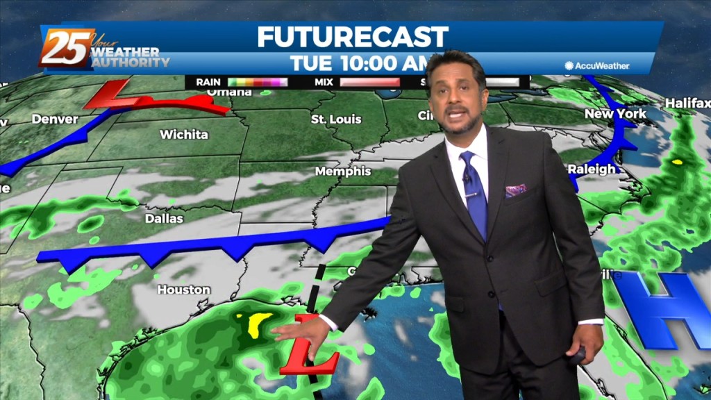
High-pressure is currently centered near the Texas-Louisiana border, with a north-south axis into the Dakotas early this morning with an easterly wave wrapping around the…
Onshore flow has been a little more persistent along the Mississippi coast, and a cluster of showers/storms has been moving northward across portions of Harrison, Hancock and…
The good news is that the threat of heat related issues has diminished for the next several days. However, that also means dealing with showers…
The main concerns are for heavy rain in the first 36 hours of the forecast...or in other words, today and Thursday. The disturbance swinging through the…
An upper level High-pressure remains off the Atlantic Coast with southwesterly upper flow across much of the southeast. Scattered showers and t-storms will taper off this…
Today we will see the moisture axis that is currently draped north to south over southeastern Louisiana almost stall out and continue to sit over the area as…
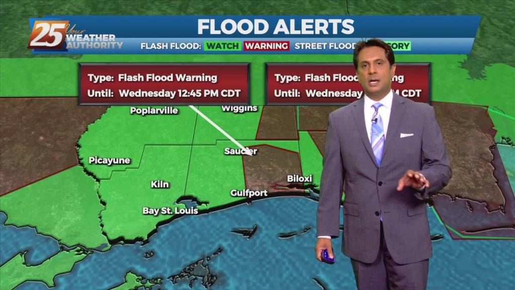
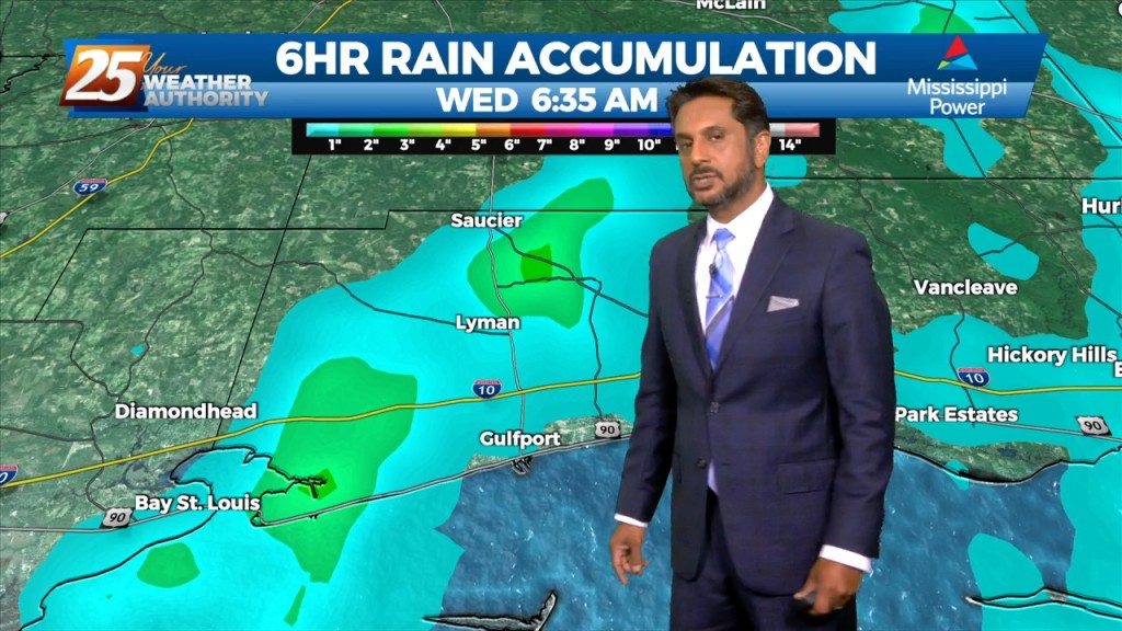
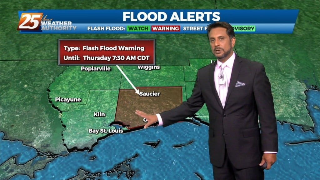
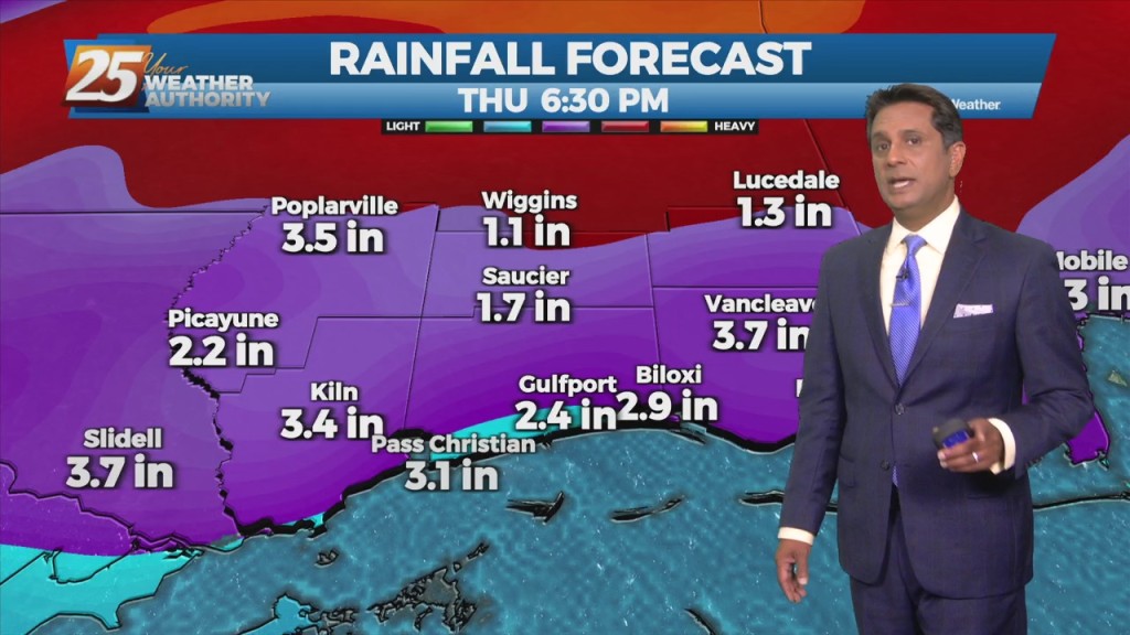
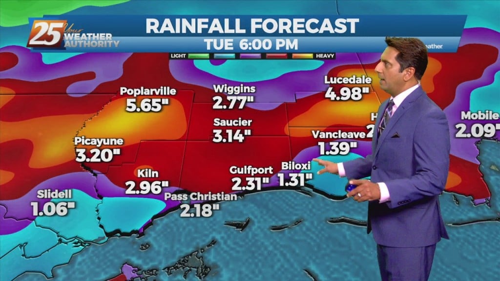
The main concern the next few days will be heavy rainfall, with the potential for ongoing flash flooding. A FLASH FLOOD WATCH and COASTAL FLOOD ADVISORY is ins effect Hourly rainfall rates can be 1.5 to 2 inches (and possibly…
A cold front will continue to push south through the area providing dry air moving into the area. Despite the passing of the front, there will not be any noticeable cool off with highs staying in the upper 80s to…
With IDA to the NNW moving towards north central Mississippi, expect gradual improvement through today. Widespread rain across the area will continue and gradually decrease to scattered showers later today as Ida tracks slowly to the north. After the center…
A stationary front will continue to slowly move south and southeastward through the plains to mid/lower Mississippi Valley area, just north of the forecast area during the period. This should lead to widespread coverage of showers and thunderstorms each day.…
The wetter than average summer pattern is expected to continue through the period, and in fact rain chances will be even higher then recent days for much of the short term periods. A stationary front will continue to slowly move/develop…
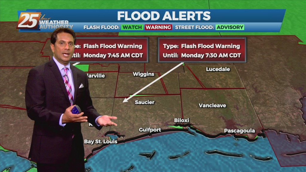
Tropical Storm Claudette started the weekend off, and even after it has moved on we're left with more rain. Flooding issues abound across South MS as the scattered showers and thunderstorms have lingered. One area of Harrison County near d'Iberville…
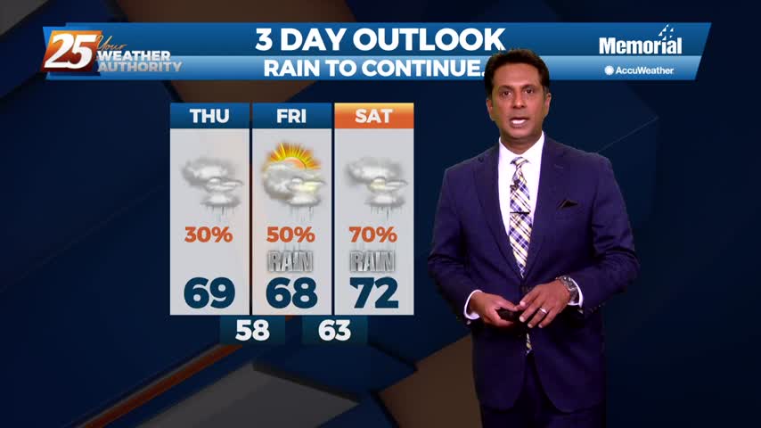
Sad to say we have a wet weekend ahead after our ridiculously wet week, but things will begin drying up quickly as we head into the next....
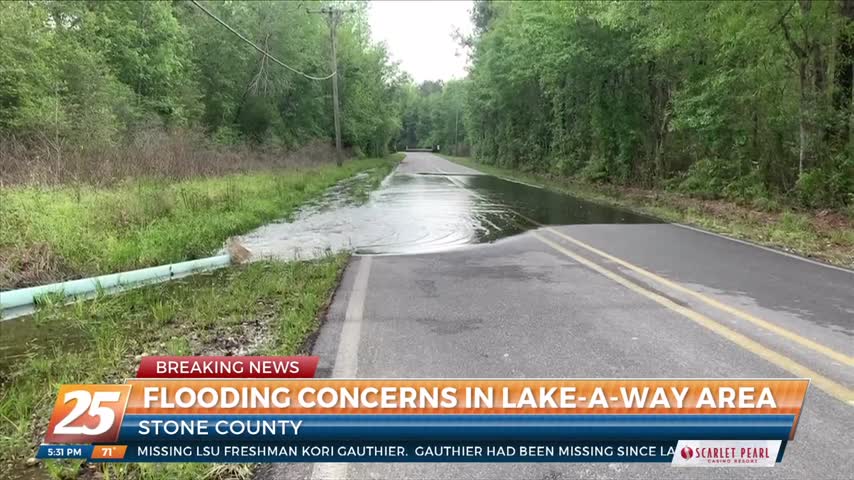
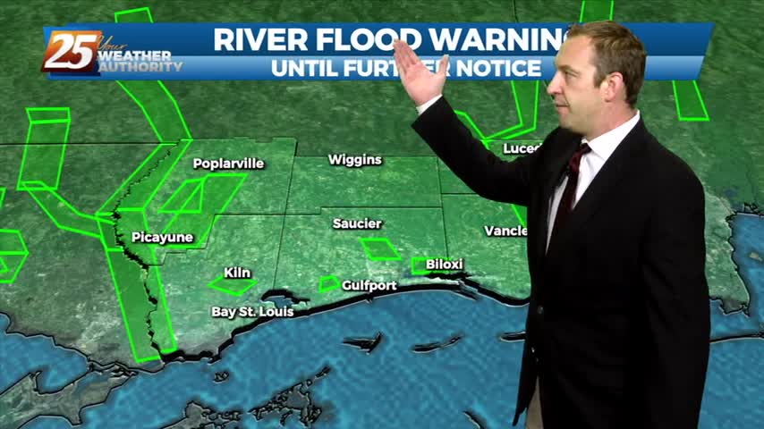
The Stone County Emergency Agency, along with the Mississippi Department of Environmental Agency, are still pumping water out of the lake near the Lake-A-Way RV park in order to reduce the risk of flooding in the area.…
The area will get a break from the torrential rainfall for the next 18 hours...

T-Storms and heavy rain will begin to taper-off by mid-afternoon...

Periods of HEAVY RAIN and STRONG WINDS continue to move into the area...