01/03 Ryan's "Foggy" Tuesday Night Forecast
Last weekend's deluge finally ended yesterday, but we'll feel the effects for a few days more. Details within.

Last weekend's deluge finally ended yesterday, but we'll feel the effects for a few days more. Details within.
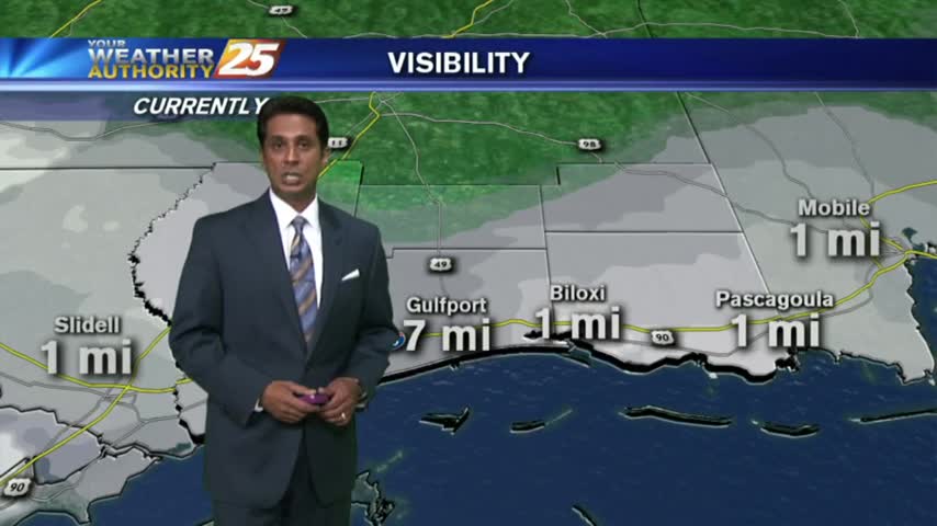
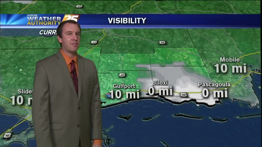
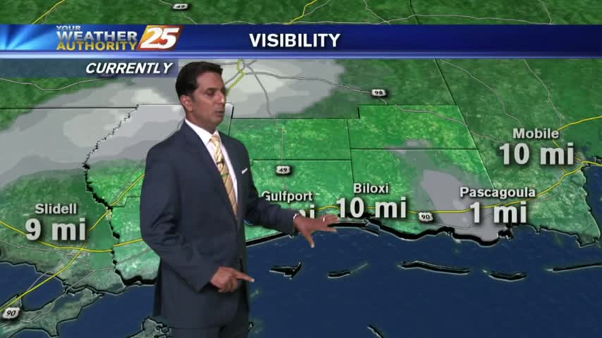
As the southerly flow continues in advance of an approaching cold front...DENSE FOG is in the area with an ADVISORY through this afternoon.
After DENSE MORNING FOG...light fog remains with warm and humid continues and a few showers this afternoon...

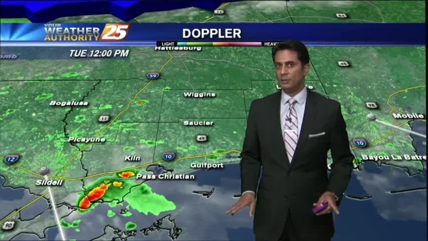
After a bit of light rain earlier this morning, the cold front has moved to the south over the sound...
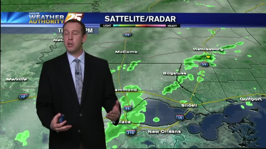
As a weak cold front is moving through the area...light rain along with patchy fog is accompanying it...

After a FOGGY start, the fog has burned off with the low clouds lifting. Partly/mostly cloudy skies will continue as upper-level clouds begin to move in...
Low level moisture still lingers in the area, but cooler & drier conditions will move in overnight. Details inside.

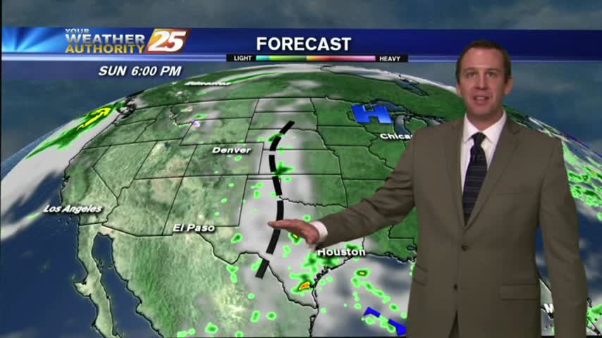
Expect another night of foggy conditions, but an approaching front will clear everything out...after dreary rainy day tomorrow.
After a bit of sunshine yesterday afternoon, the clouds rolled back in overnight with cool temps to start the morning...
Much more different conditions than we had yesterday, but despite the drier conditions I'm expecting some fog tonight. More details inside.
A south wind from yesterday continues; increasing humidity and feeding an approaching cold front to our west...
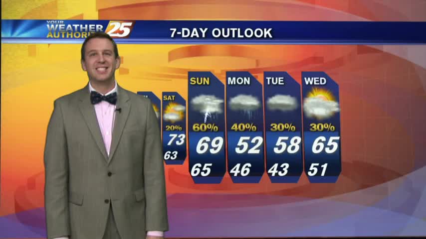
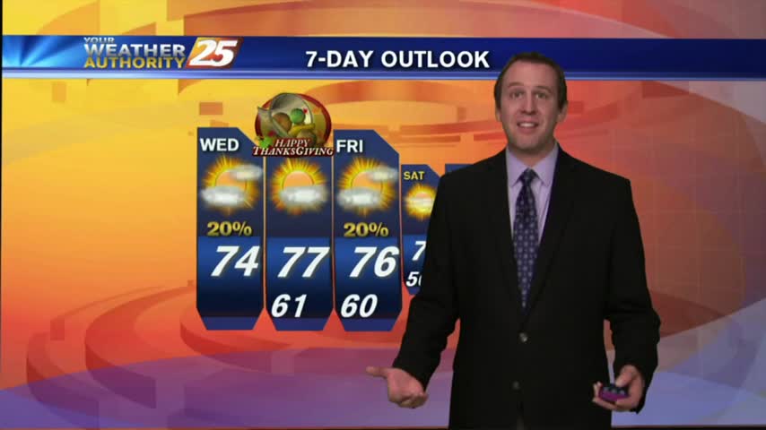
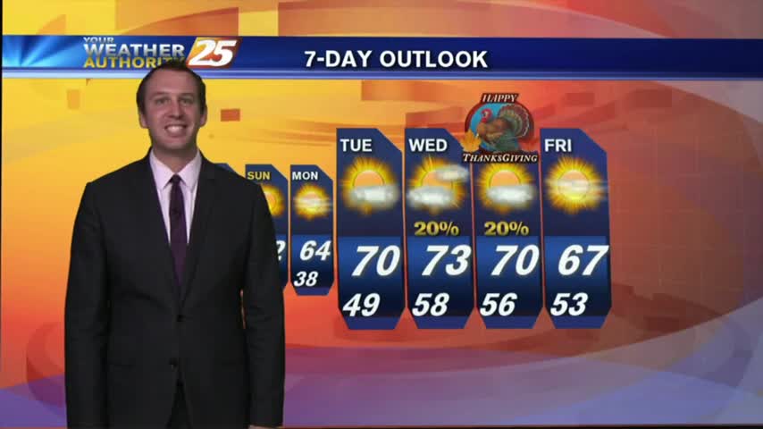
It was a bit warmer Thanksgiving afternoon, but we'll see cooler temps through the weekend. Details within.

Moisture pooling in the SE due to a weak front moving through the area, so slightly cooler and drier conditions are expected for Thanksgiving.
No Gulf Coast areas will get near freezing tonight due to additional moisture advection, a gradual trend we'll see throughout the rest of the week. Full Thanksgiving forecast inside.
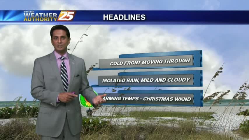
We've seen warmer, spring-like weather over the past week but that ends overnight as a cold front moves through South MS. Watch the forecast for details.
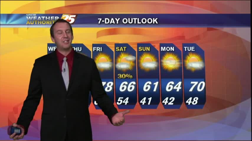
Things warmed up this afternoon despite last night's "cold front" passage, but we'll see a drastic cool down before next week. Details inside.
It was a beautiful day as promised and we even saw a few showers in the Northern Coastal Counties. What does the rest of the week hold? Watch the forecast to find out.
A cold front moved through this afternoon, but we're didn't cool down much today. What's that mean for the weekend? Find out inside.
Warm conditions last through tomorrow (Friday), but cooler days are ahead. Details within.
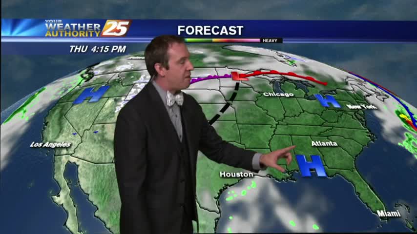
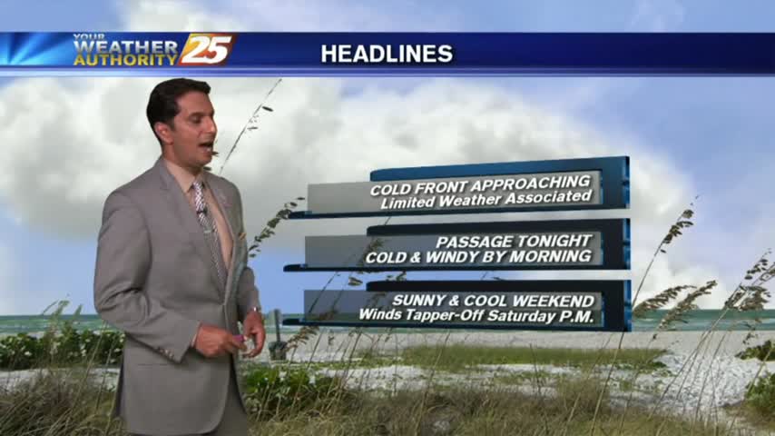
The cold front has already entered South MS and will slowly move through the area overnight. Click the link for forecast details.
This afternoon was the last time we'll see temperatures in the 80s for several days, but we're still waiting on the arrival of the cold front. Click the link for this afternoon's forecast and check back for the update at 11 pm.
With an approaching cold front...this morning brings the final day of warm/humid with low clouds and areas of patchy fog...
A mild start to the day with slightly warmer temperatures and areas of PATCHY DENSE FOG this morning...
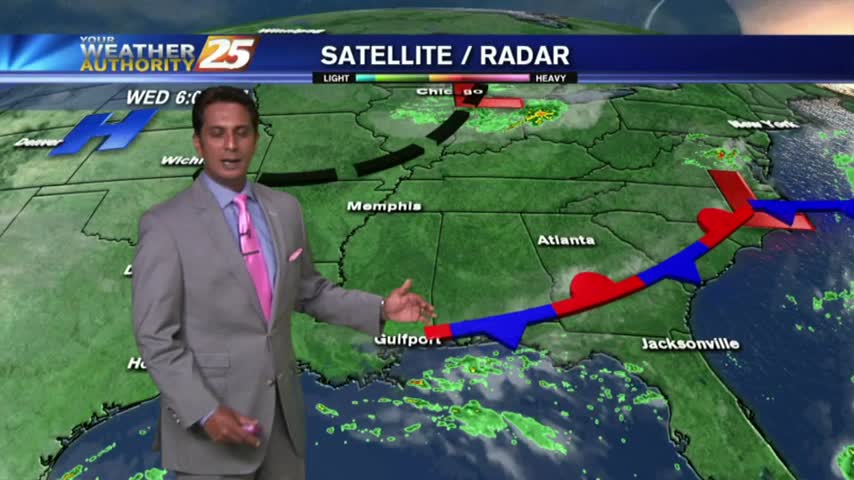
As the cold front moves east, a few clouds are in the area with mild temps and decreasing humidity...