09/21 Ryan's "Last Summer Evening" Tuesday Forecast
Enjoy the last summer night we'll see until next year as a cold front brings cooler, drier weather for the rest of the week. These changes will be…
Enjoy the last summer night we'll see until next year as a cold front brings cooler, drier weather for the rest of the week. These changes will be…
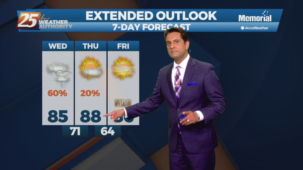
There is one last day of uncomfortable weather before a welcome changes. The disturbance moving through the Great Plains this morning will be over the Ohio River Valley by midday tomorrow. The cold front associated with this disturbance is expected…
One last day of uncomfortable weather before a welcome change arrives along the Gulf Coast as a cold front associated moves across our area tonight. The airmass ahead of this system is already drier than what we’ve had across the…
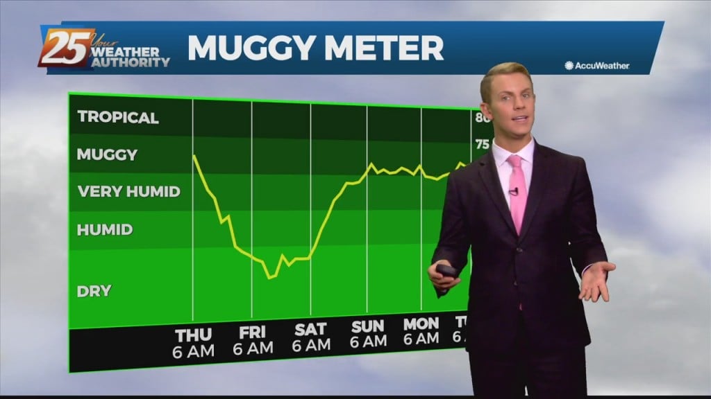
It has been a while, but some beautiful fall-ish weather is moving in! I say fall-ish, and not fall-like, because our days won't cool much, but it will be…
Good news is on the way, as the cold front moves through the region during the morning on Thursday and should be south of the area by Thursday afternoon. This will turn the winds northwest to northerly during the course…
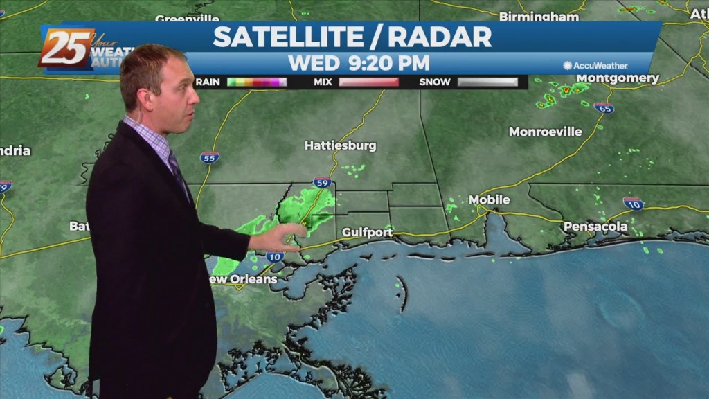
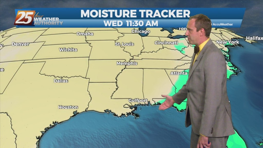
Quite the eventful day weather-wise in South MS as Mindy formed to the southeast and a front is bringing drier air and a wind shift. Locally we saw…
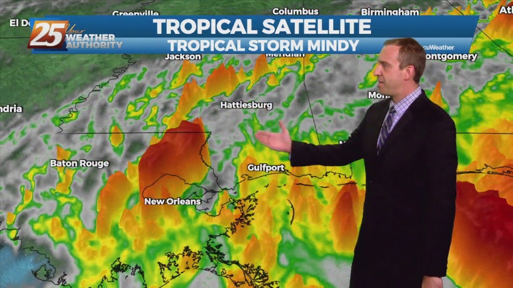
As unexpected as it was from last night's forecast, Tropical Storm Mindy formed today in the Northern Gulf. It's disorganized, and moving rapidly, but will still bring heavy…
Any significant weather impacts in the short term for most of the area should be limited to the daytime hours today. As a tropical wave south moves towards the Florida Big Bend area, expect scattered t-storms through today with any…
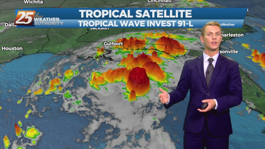
The disturbance over the central Gulf of Mexico is becoming a little better organized this morning, and more models seem to be in a little better agreement with regard to a brief, minimal development of the disturbance. This system is…

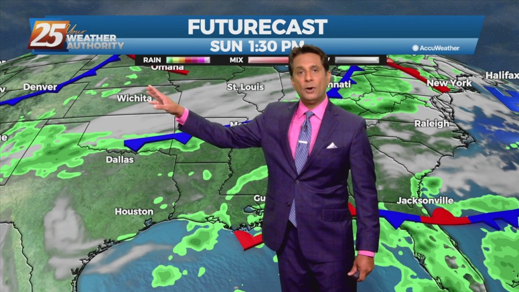
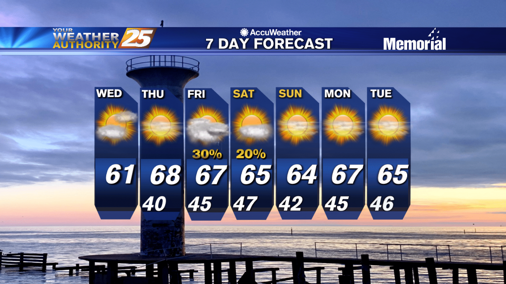
We have more rainy, damp weather ahead, but a cold front will bring drier, less humid weather for the weekend. Probably more prudent to call it a "tepid" front…
We have more rain ahead for the short-term, but a cold front will bring drier, less humid weather for the weekend. Probably more prudent to call it a…
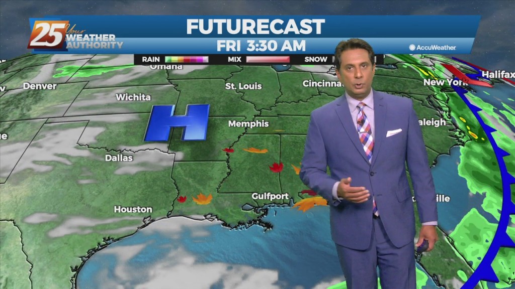
The upper level high-pressure centered along the northern Gulf Coast will continue to move south and weaken. An upper level trough digging across the Mississippi Valley and an associated surface cold front will drop southeast into the forecast area. Showers/T-Storms along…
In the wake of yesterday's cold frontal passage, a less humid flow will dominate heading into the weekend. The aforementioned frontal boundary will likely stall near the coast today through Saturday, with any diurnal afternoon convection being immediately along the…
Now that we've broken the back of the heat wave, our concern returns to thunderstorms and heavy rain. The frontal boundary currently along the interior counties will gradually work its way southward over the sound by tonight. The potential for another…
The words "cold front" and "August" are not often associated together in the Gulf coast. The persistent high-pressure over the west will allow a cold front to lag across the region through mid/late workweek. The stretch of heat and humidity…
Didn't see much in the way of afternoon showers today, but our rainy weekend ahead will more than make up for it. There were still a few afternoon showers today, but they were much fewer and more far between with…
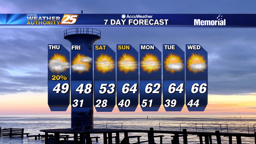
Much colder and drier air continues to flow into the region during the period in the wake of a cold front. Dry conditions continue through Friday as a large dome of cool high pressure builds into the eastern states. A…
Dry conditions over the area are expected to continue through the day Monday. Lows overnight will be cooler in the wake of the front and range from the lower 40s well inland to around 50 at the coast. Highs on…
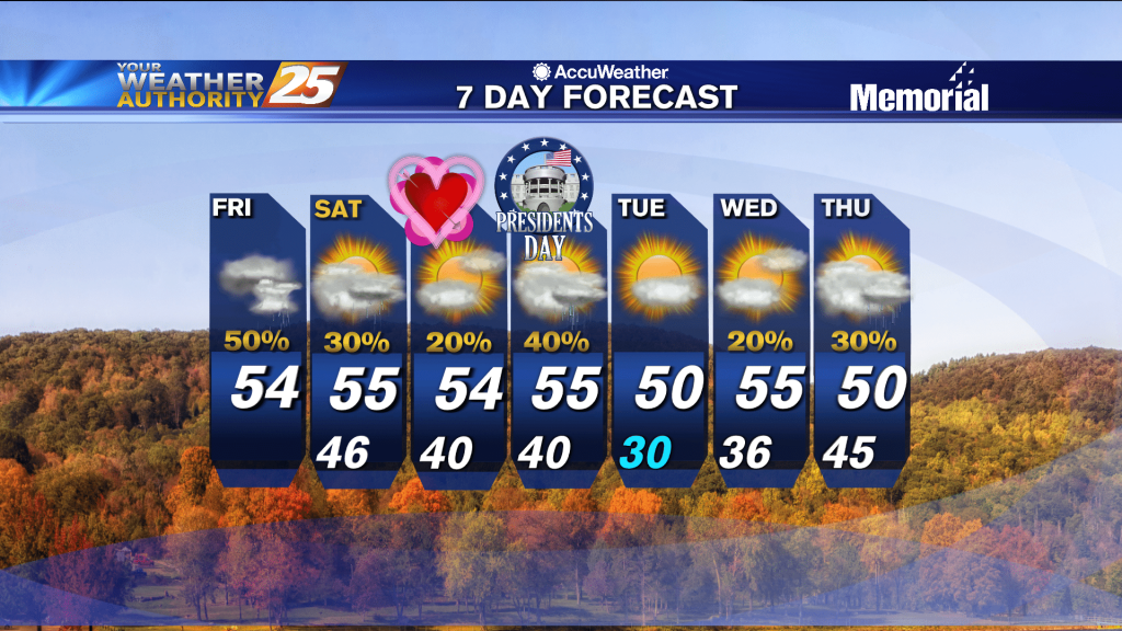
It's been a wet and stormy few days, but things are finally calming as we head into the weekend.
Rain has ended over the local area. Some clouds may still linger in the morning, but clearing is expected from west to east across the region going into the afternoon. High pressure builds in at both the surface and in…
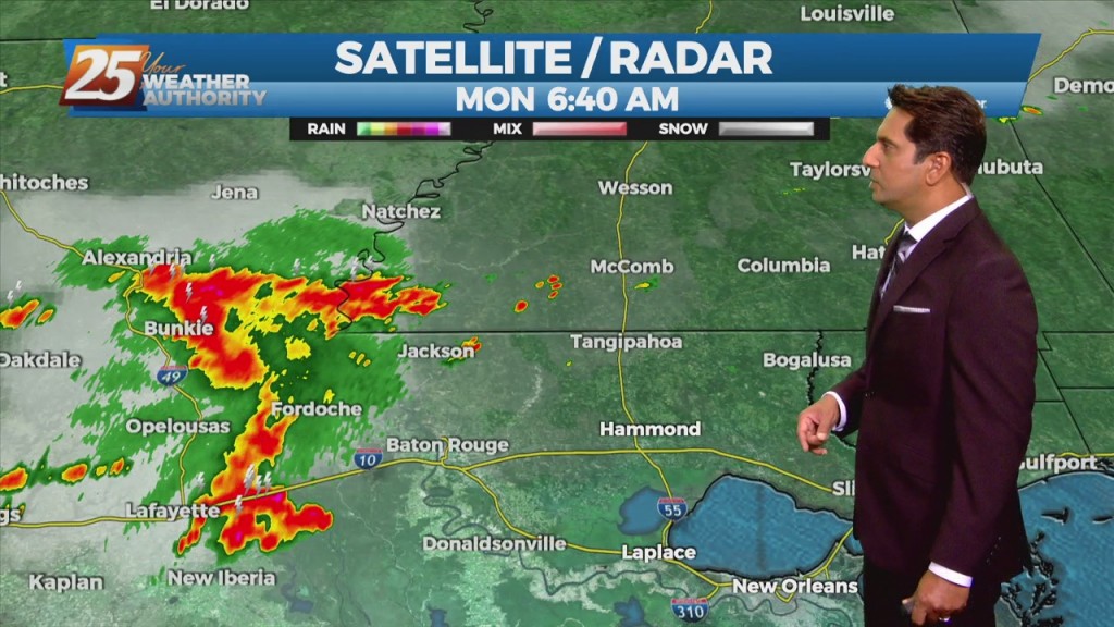
Showers and a few thunderstorms pushed across the area last night, but now we are looking at rain-free conditions with heavy cloud cover sticking around. It is likely going to take another 24-36 hours for that system to move east…
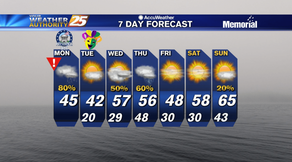
Temperatures tonight will remain cold with cold air moving in quickly at the surface and a shallow arctic air mass in place. Lows will be in the low 30s. With rain on Monday, high temperatures north of I-10 will struggle…
Not much change initially, but much cooler weather is expected in the days ahead before Arctic air moves in to begin next week.

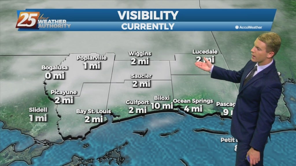
Another day... another high chance for rain. Conditions remain warm and muggy along the Gulf Coast as fog, showers, and thunderstorms continue. Rain chances stay elevated today at around 90 percent, mainly in the afternoon between 12 noon and around…