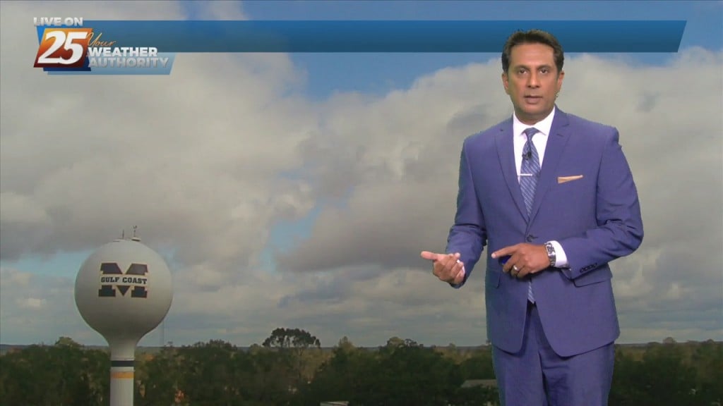
1/10 - Rob Knight's "Cold & Breezy" Monday Morning Forecast
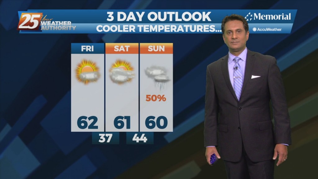
Last night's cold front continues to move east away from the area. High-pressure and strong cold air advection will result in temps struggling to reach mid/upper…
Last night's cold front continues to move east away from the area. High-pressure and strong cold air advection will result in temps struggling to reach mid/upper…
Winds are gusting to around 20 mph and will continue to stay elevated through this evening. The story for tonight will be the near freezing temperatures for areas…
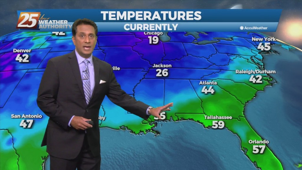
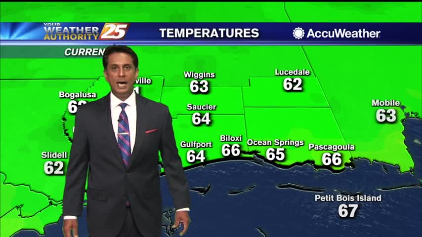
The cold front that moved through on has cleared our area to the southeast with north-northwest winds, cooler temps and lowering dew points in its wake.…
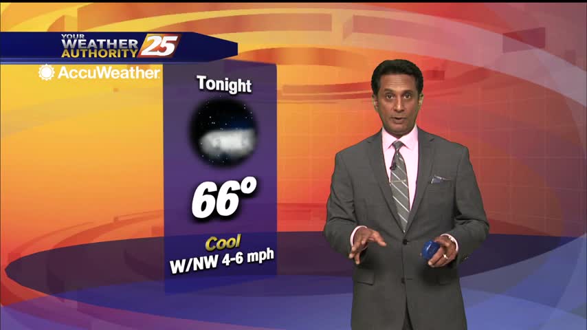
Cooler and drier air moves into the area behind the cold front, and tonight provides somewhat of a challenge regarding forecast lows. Even though it's in the relative…
South Mississippi has seen a wet couple of days, but the pattern is changing as we head into October. Showers are still drifting inland as I’m writing this,…
South Mississippi has seen a wet couple of days, but conditions are slowly improving tonight. Showers are still drifting inland as I'm writing this, but they'll be gone…
Finally drying out a bit after a long, abnormally humid couple of weeks. It won't be all that significant as it looks like dewpoints will only fall from the mid 70s into the low 60s, but it will be noticeable. …
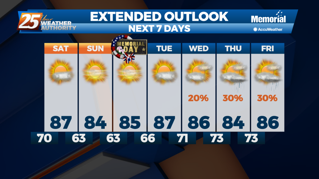
Saw a little active weather this afternoon as a weak front moved through, but now things are clearing nicely ahead of our Memorial Day weekend.
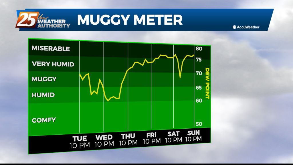
We saw a few clouds today, but overall the rest of the week will be sunny and dry. The humidity on the other hand....
Finally saw our rain moving in earlier today, and now the clouds will slowly clear through the night as things cool and dry....

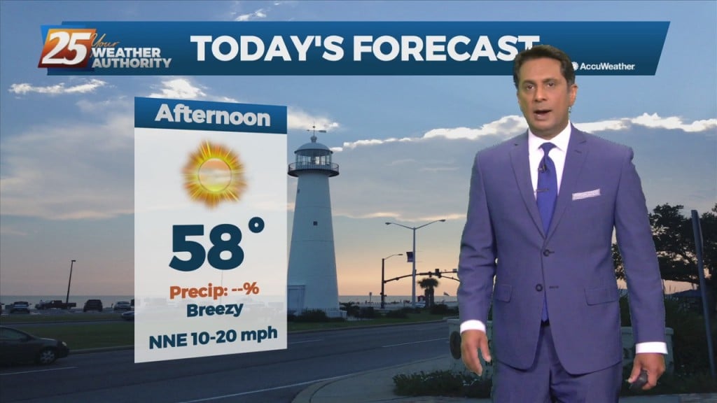
Sunny and cool this afternoon as high-pressure begin to move into the region...
As high-pressure begins to move in from the NW, skies will gradually clear...

Overnight temps stayed slightly elevated with persistent cloud coverage...
Clouds continue to clear as breezy conditions will taper-off later this evening...
Overnight rainfall/t-storms have moved east but cloud coverage continues...
Clouds continue to clear as winds are gusting into the 20 mph range...
Clouds continue to move east with spotty light rain beginning to dissipate...
As the remnants of Beta moves across N'tern Mississippi, conditions in the viewing area will continue to improve...
Still hot and humid, but much drier today...something I expect to see carry through the weekend.
Started off the day with rain, but drier air is moving in rapidly over the next few days.
One last blast of rain this morning, but clearing skies and cooling air is on the way.
After several days of cloudy skies, heavy rain, and high humidity, our weather pattern is finally about to change. A rare June cold front is moving across the Gulf Coast this afternoon. While it is technically called a "cold front,"…
Drier air is finally on the way, but until it really takes hold it'll still be raining a little longer.
The cold front and rain is out of the area with lingering clouds to clear before mid-morning...