8/20 - Rob Knight's Workweek Forecast
Another humid start to the day with very light rain moving in from the Gulf of Mexico...
Another humid start to the day with very light rain moving in from the Gulf of Mexico...
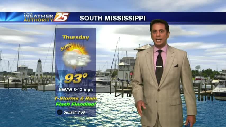
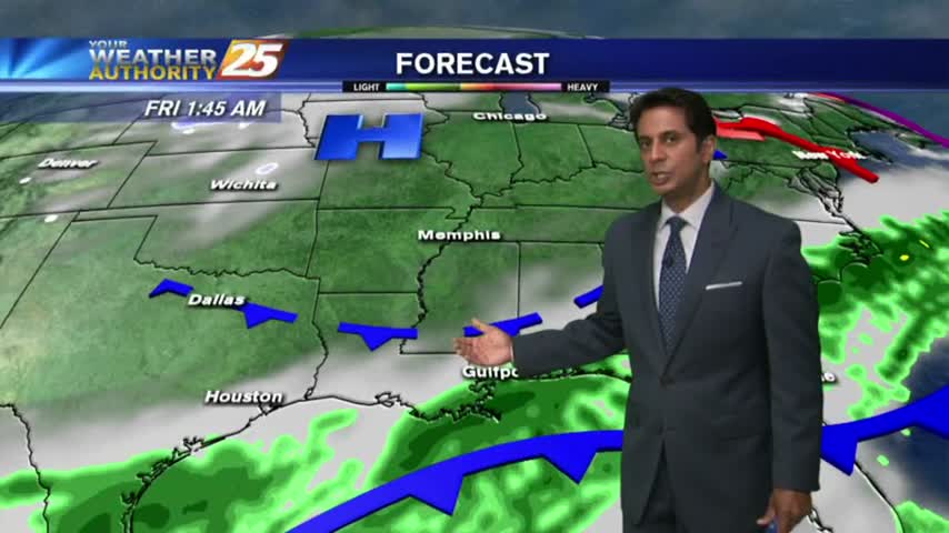
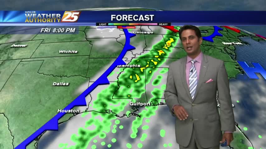
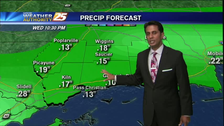
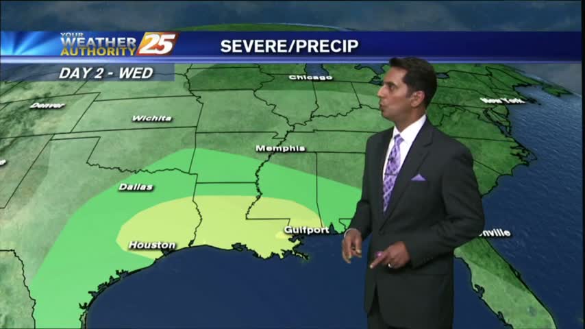
One final round of heavy rain/flash flooding before the pattern begins to change...

After a clear start to the day, a few clouds are in the area along with temperatures warming nicely...
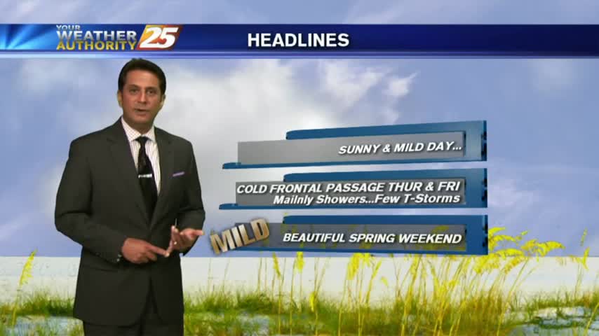
A clear & cool start to the day with changes ahead with an approaching cold front...
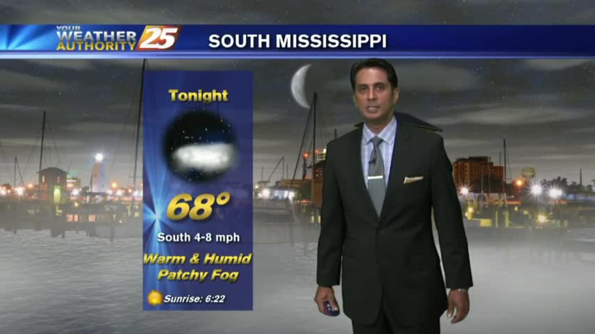
With a humid air mass south of a cold front in northern Mississippi, we have areas of patchy dense fog...
After another FRIGID start to the day, temps are a bit warmer this afternoon under sunny skies...
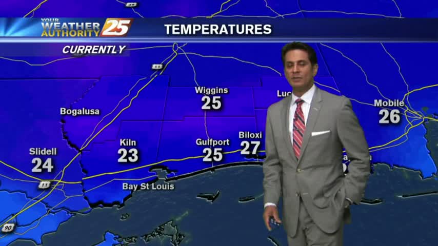
Another FRIGID start to the day as clear skies are in the area, Bundle up the kiddos as they head back to the bus stop...
After DENSE FOG overnight through this morning...improving conditions are occurring with isolated rain for this afternoon...
The warm temps continue this morning with areas of patchy fog in advance of an approaching cold front...

It feels like SPRING again as the warmer, more humid air air mass continues to move in from the Gulf of Mexico...
Patchy morning fog is out of the area as temps continue to warm into the upper 70s under a few clouds along the immediate coast...

As a zonal flow continues, warm/humid conditions along the Mississippi Gulf Coast continues to provide areas of PATCHY DENSE FOG...
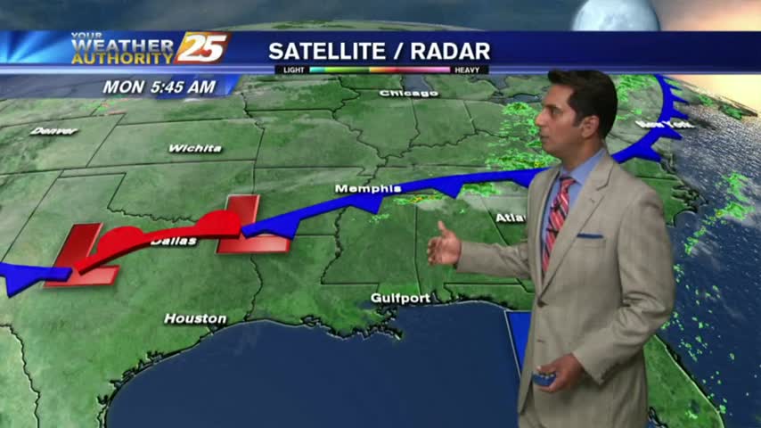
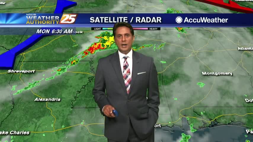
Disruptive weather to start off the work week...DENSE FOG has developed with an ADVISORY in effect through mi-morning...
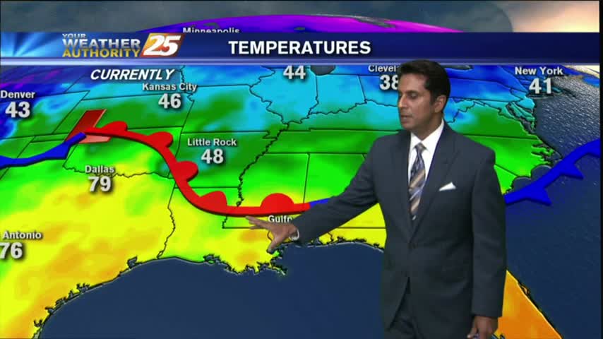
Another CHILLY morning along the Gulf Coast...but major changes on the way will bring the warm-up to the area beginning this afternoon...
As the pattern begins to shift, it's a cool start to the day with a humid air mass beginning to move into the region...

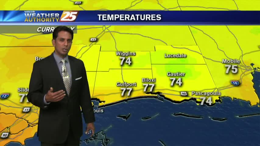
After a clear start to the day, warming temps and low-level moisture flow has developed a few clouds along the coastal counties...

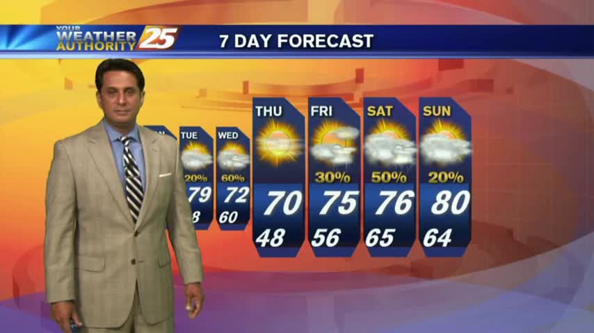
After a BEAUTIFUL start to the day with drier air providing for lower humidity, a LOVELY Friday afternoon is on-tap...

A very mild start to kick-off the weekend as drier air continues to affect the region...
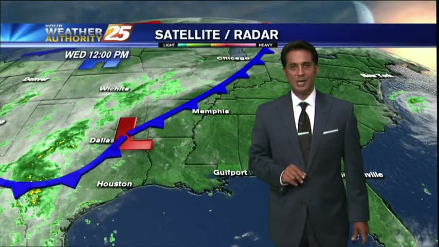
After a foggy start to the day, a cold front overhead slowly moving east will bring a few showers/t-storms to the viewing area this afternoon...
Warming temperatures and VERY HUMID conditions this afternoon, but no showers/t-storms just yet...
A HUMID start to the day with areas of light patchy fog and isolated showers/t-storms moving in from the south...
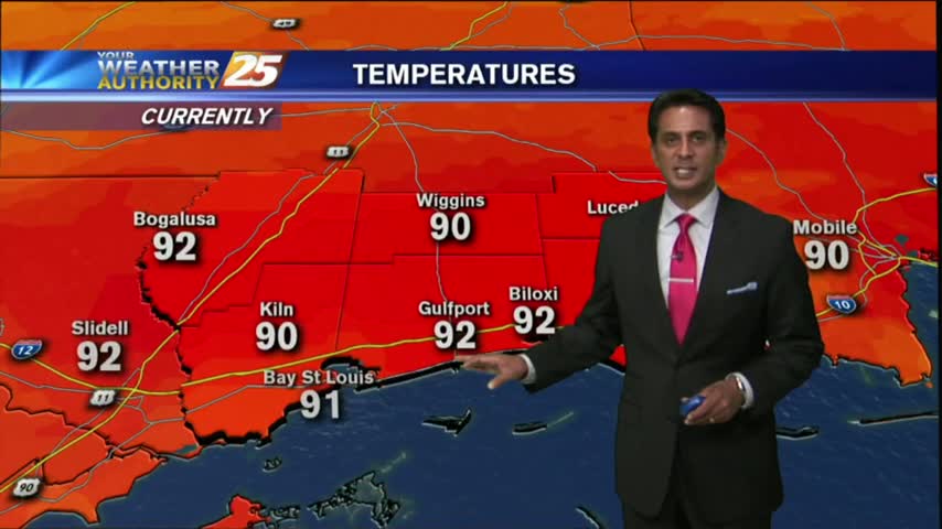
After a warm and humid start to your Friday, its downright HOT in the viewing area and through the region...
After a CHILLY morning, temperatures have warmed nicely into the 80s, under SUNNY skies...
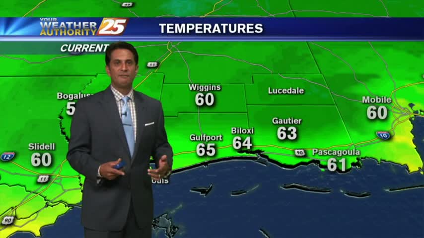
Another morning of continued southerly flow has areas of PATCHY DENSE FOG along the Southern 6...