7-Day Forecast

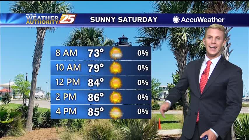
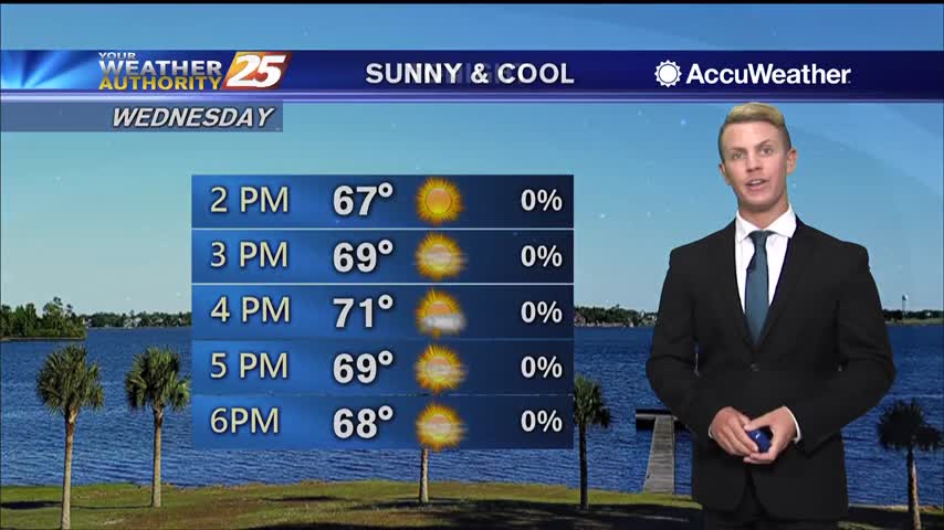
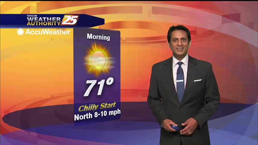
04/27 – Brantly's "Sunny" Monday Forecast

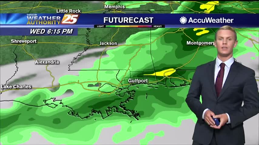
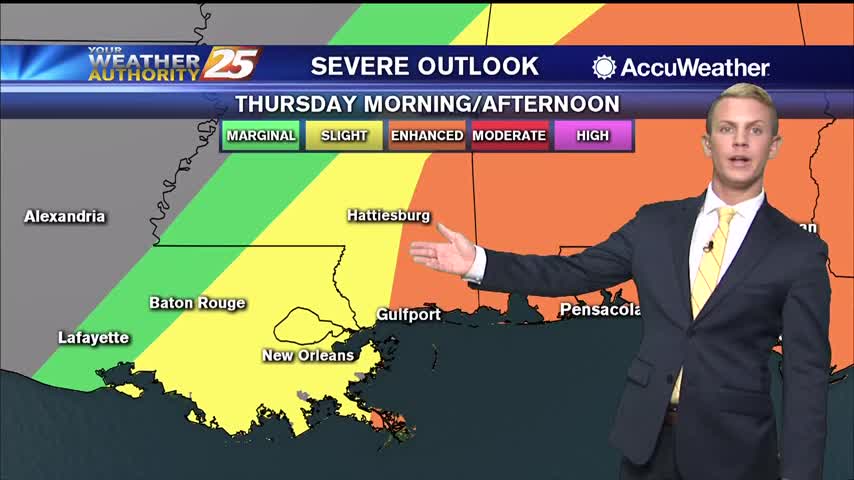
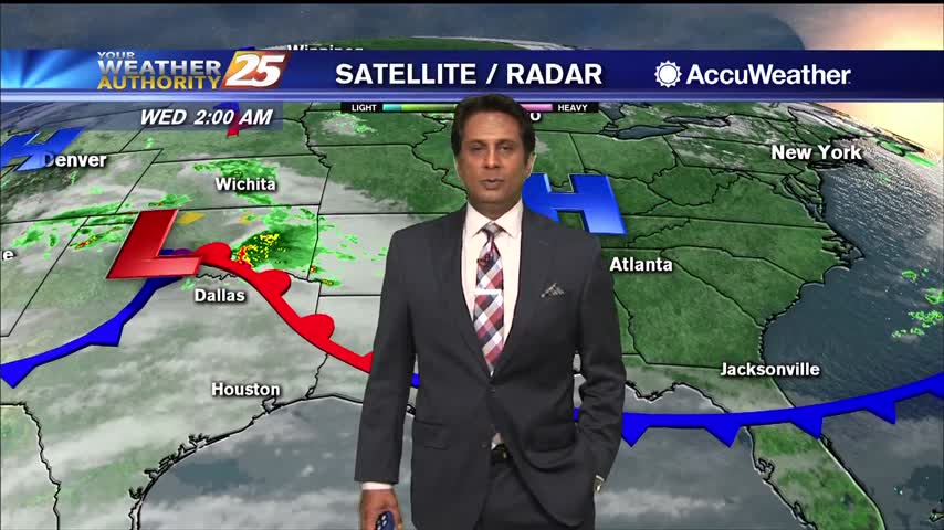
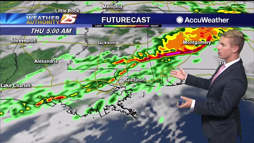
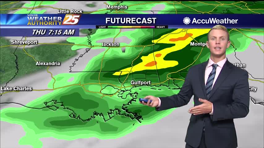
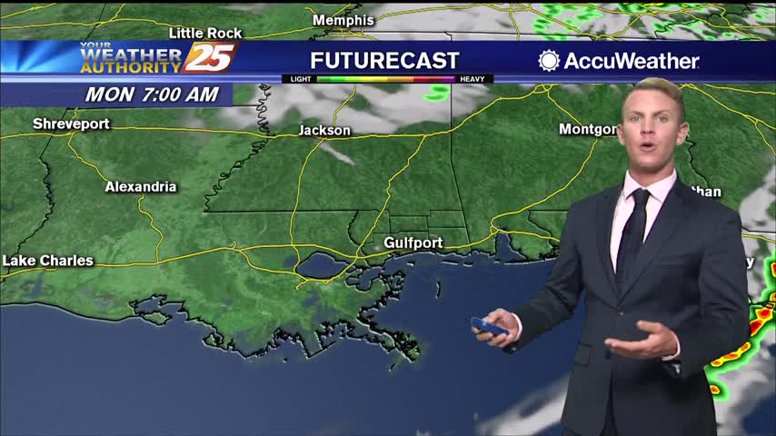
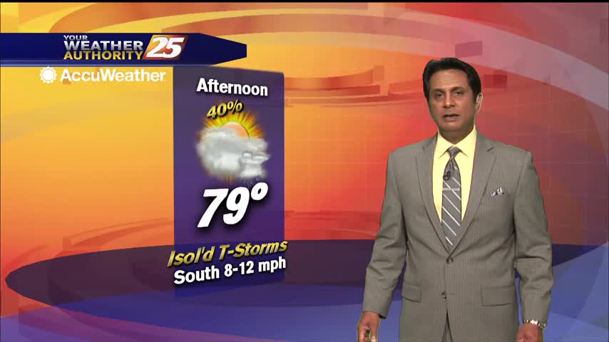
High pressure has settled into the area, creating calm conditions for most of the Gulf Coast. Generally clear skies are expected with northwesterly winds through mid-week. There will be a brief window late Tuesday night and Wednesday morning, just ahead…

04/26 – Brantly's "Mild" Sunday Night Forecast

A reinforcing surge of dry air moving through the area has dropped dew points to the mid and upper 40s, making it feel quite comfortable. High pressure has settled into the area, creating calm conditions for most of the Gulf…

04/24 – Brantly's "Sunny Weekend" Friday Forecast

Clear skies and much nicer conditions are noted today in comparison to yesterday at this time. The upper level shortwave that brought us yesterday's severe weather continues to slide up toward the Mid Atlantic and Atlantic Coast today. A cold…

04/22 – Brantly's "Stormy Thursday" Forecast

The next 36 hours will deliver showers and thunderstorms to the area with some of these becoming strong to severe. The first of these looks to arrive after dark tonight and should be mainly reserved for the northern portion of…

04/22 – Rob Knight's "Windy" Wednesday Forecast

The next 36 hours will deliver showers/t-storms to the area with some of these becoming strong to severe. The first of these looks to arrive after dark tonight and should be mainly reserved for the northern third of the area…

04/21 – Brantly's "Sunny, For Now" Tuesday Forecast

Sunny skies will continue through the remainder of the day, but clouds will begin to filter into the region overnight and tomorrow ahead of our next weather maker. The next system we're watching will be a potent disturbance currently over…

04/21 – Rob Knight's "Pattern Changing" Tuesday Forecast

The next system we're watching will be a potent disturbance currently over California that is expected to emerge in the southern plains region on Wednesday. This disturbance along with an associated potent surface low and cold front will move across…

04/16 – Rob Knight's "Comfortable" Thursday Forecast

Today will bring mild, pleasant sunny conditions across the forecast area with a few degrees warmer daytime temperature. Breezy conditions will continue with winds gusting into the upper teens to low 20 mph range at times. Surface flow will veer…

04/15 – Rob Knight's "Cooler" Wednesday Forecast

A couple of cold mornings in store as Canadian high pressure centered over central Texas and ridging into the Ohio and Allegheny Valleys remains in place through Thursday. Morning lows in the interior portion of the forecast area should settle…

04/14 – Rob Knight's "Mild" Tuesday Forecast

High pressure will continue to dominate the region through late workweek, bringing us rather calm conditions. Winds will be primarily northerly through the week with breezy conditions tonight into early Wednesday. Rain chances will also likely be lower through the…

04/12 – Brantly's "Clearing" Sunday Night Forecast

The threat for severe weather has ended across South Mississippi as of about 10:45 p.m. Sunday night. Skies will gradually become clear by mid-morning and humidity will drop significantly. Expect breezy conditions to continue with winds switching to the northwest…

04/08 – Rob Knight's "Warm" Wednesday Morning Forecast

High pressure will maintain its hold over the northeastern Gulf of Mexico throughout today before a cold front advances towards the region by early Thursday morning. While some isolated, light showers are possible this morning, most areas will stay dry. Also…

04/07 – Brantly's "Cloudy" Tuesday Afternoon Forecast

Cloudy skies will continue through the afternoon with a chance for showers and thunderstorms through the early evening hours. Temperatures today and Wednesday will remain well above-normal. One thing worthy of noting is with the surge in moisture along with…

04/07 – Rob Knight's "Humid" Tuesday Morning Forecast

Current overview of the weather maps this morning illustrates the northern Gulf coast under the control of southerly/Gulf moisture return flow west of a surface high anchored offshore of NE Florida in the Atlantic and a weak Warm front across…