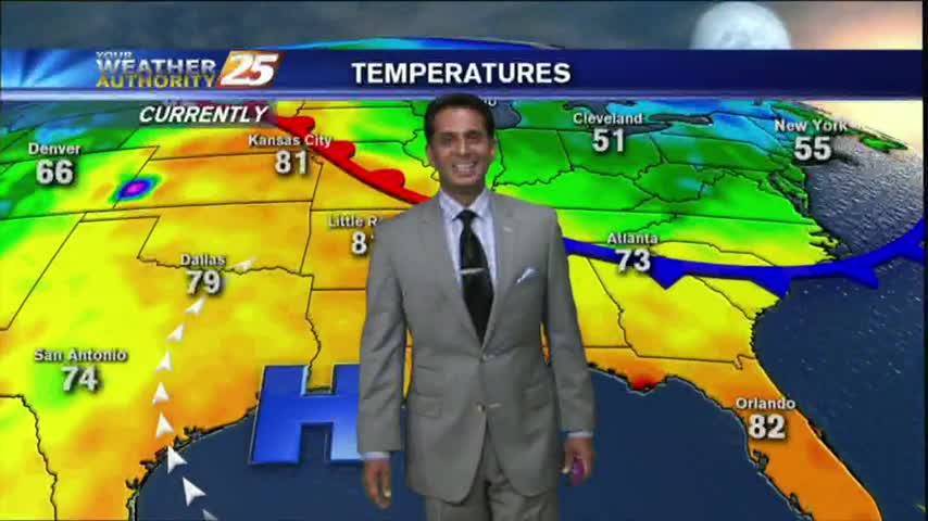
5/16 - Rob's Tuesday "Midday News" Forecast
After a few morning clouds and patchy fog, a low-deck of clouds have now formed along the coastal counties...
After a few morning clouds and patchy fog, a low-deck of clouds have now formed along the coastal counties...
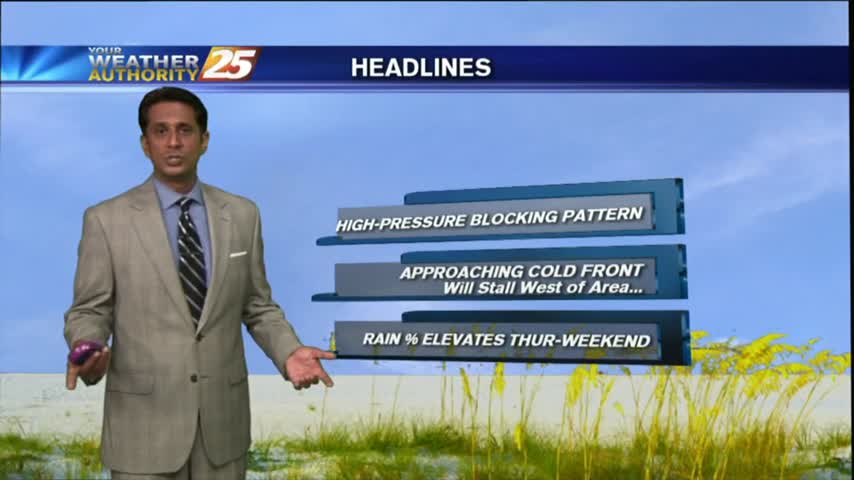
Another humid start with areas of patchy fog as an area of high-pressure continues to block the Gulf Coast...
Last night's conditions carry over into tonight, meaning light shifting winds will limit fog production, but some patchy fog is likely. Watch the full forecast for more.
After a clear start with patchy fog, temperatures continue to warm with a few clouds developing...
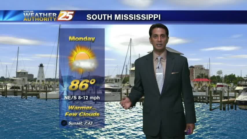
A warm/humid start to the workweek along with areas of PATCHY FOG along the Southern 6...
Mother Nature may have helped us out with a great Mother's Day afternoon, but don't expect many changes in the next few days. Watch the full forecast for the details.
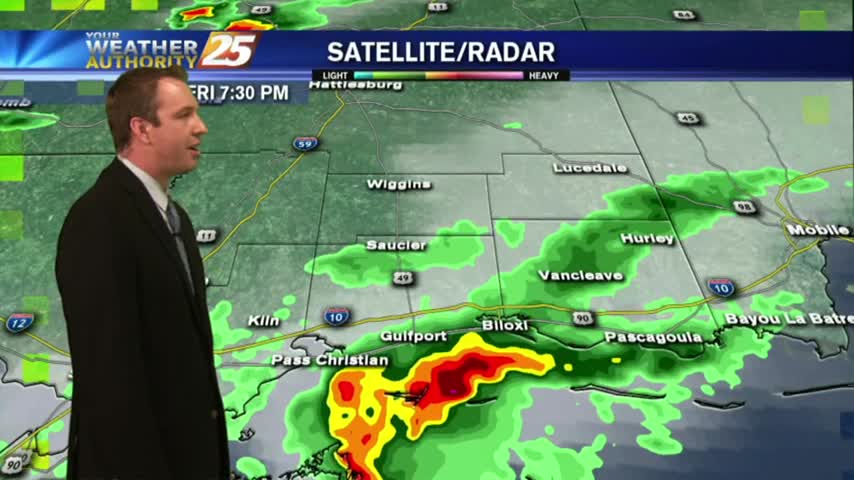
We ended up with two waves of strong storms, but still stayed away from any "severe" weather. Watch the forecast for your weekend details.
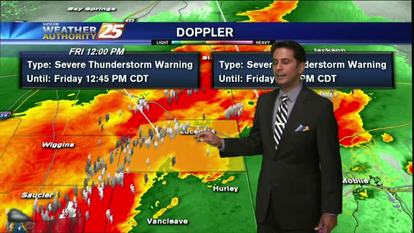
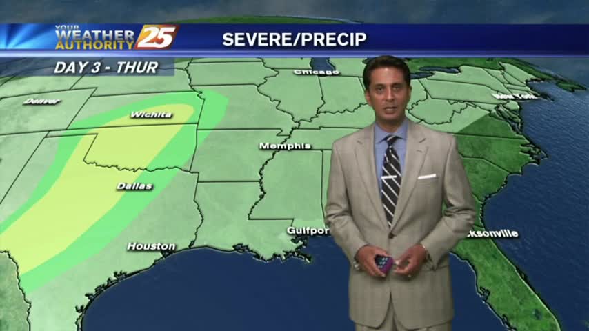
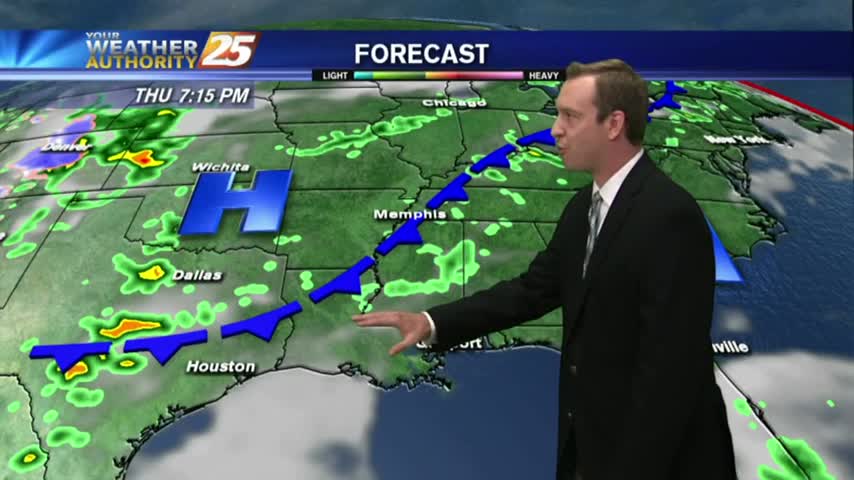
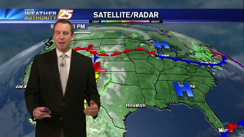
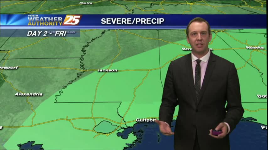
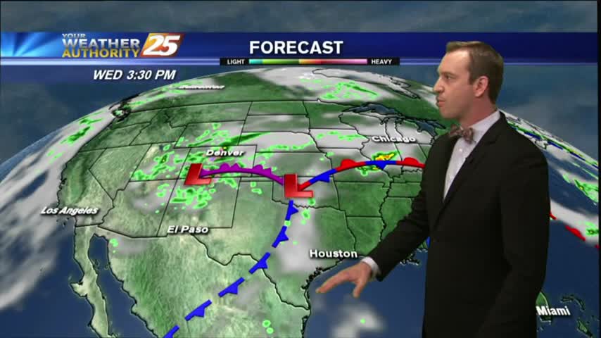
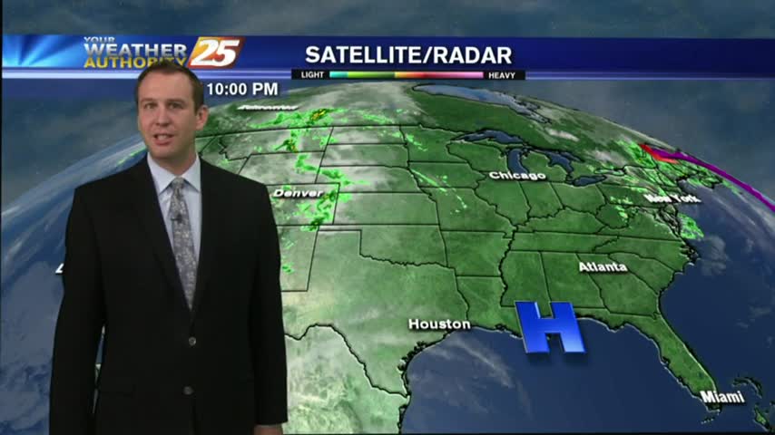
A line of T-Storms moving into the area in advance of an approaching cold front...

A warm/humid and BREEZY start to the day, along with areas of patchy fog along the coastal counties...
Our afternoon cloud cover cleared a bit for the early evening but will return overnight as the cold front continues to slide Southeastward. Full forecast details inside.
The clouds have moved in and will continue to thicken our next cold front moves in tomorrow. Rainy conditions won't last long though, so watch the full forecast for details.

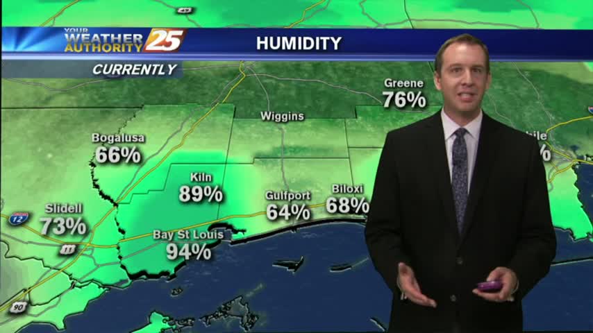
A WARM/HUMID air mass moving in from the GOM has mostly cloudy skies through the region...
As a more humid air mass moves into the region, areas of PATCHY DENSE FOG has developed once again...

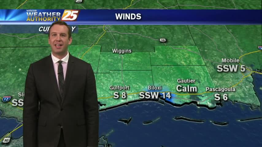
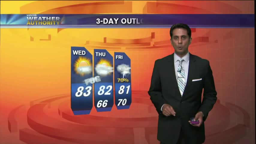
The next couple of nights will be considerably warmer & more humid than the last few, but rain will stay away until Friday. Watch the full forecast for details.
With elevated humidity, patchy fog this morning has burned off leaving a few/partly cloudy skies...

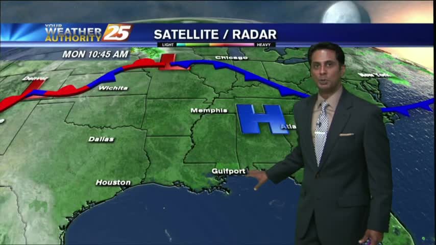
The area of high-pressure overhead has shifted to our east and is now providing for a return-flow from the GOM, with areas of patchy fog this morning...
Expect another calm night tonight, which I expect to lead to areas of patchy fog in the early morning hours. Watch the full forecast for all the details.
After a cool start to the day...warming temps continue to lower the humidity, but higher than the past couple of days...
Another cool start to the day as high-pressure continue to bring clear skies and cool overnight temps...
Skies remained mostly clear today and that's still expected to continue until around Thursday, when we'll begin feeling the effects of an approaching cold front. Details within.
After a cool start to the day/workweek, temps continue to warm under a few upper-level clouds...

After an ABSOLUTELY BEAUTIFUL weekend, the same conditions will continue through much of the workweek...
Skies remain clear though our days and nights will continue to warm through the week. Watch the full forecast for details.
Hope everyone enjoyed their Cinco de Mayo festivities responsible today, and be assured your headache will go away soon as long as you drink plenty of water. The weather certainly won't be giving anyone headaches for several days after strong…