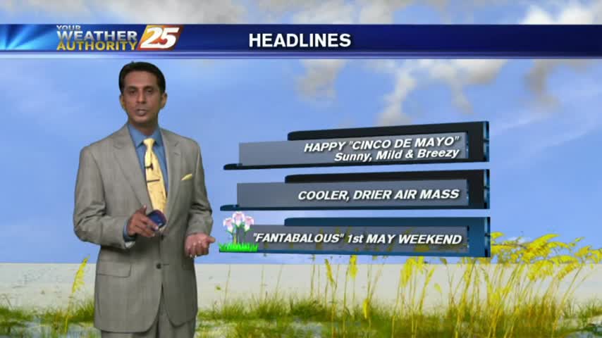
5/5 - Rob's "Cinco De Mayo" Afternoon/Weekend Forecast
After a CHILLY START earlier this morning...temps have warmed nicely on this "Cinco De Mayo" afternoon...
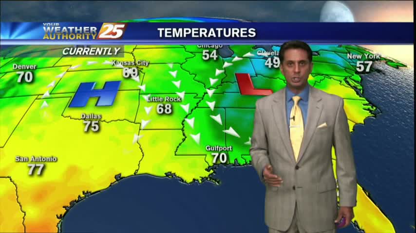
After a CHILLY START earlier this morning...temps have warmed nicely on this "Cinco De Mayo" afternoon...
Another CHILLY morning as a COOLER/DRIER air mass begins to move into the region...
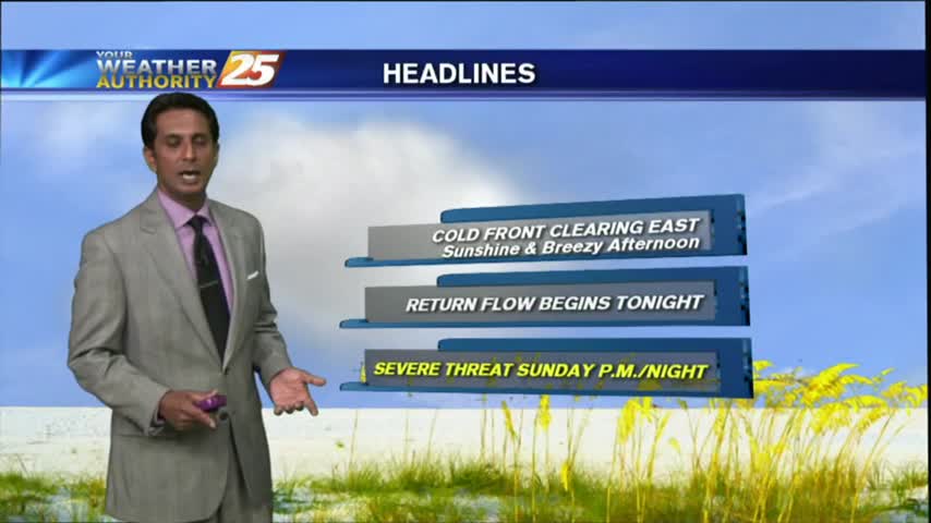
The cold front associated with last night's strong storms finally moved East of the area today, and we're already seeing significant clearing & cooling. Watch the full forecast for all the details.
After a cloudy and rainy start, skies have begun to clear as WINDY CONDITIONS move in...
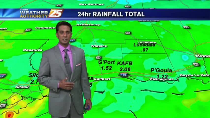
HEAVY RAINFALL from yesterday/last night is beginning to tapper-off as the cold front moves to our east...

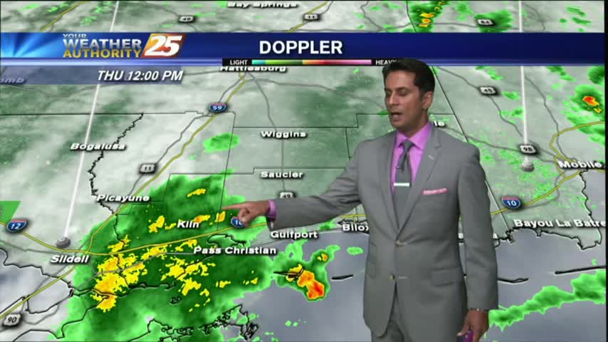
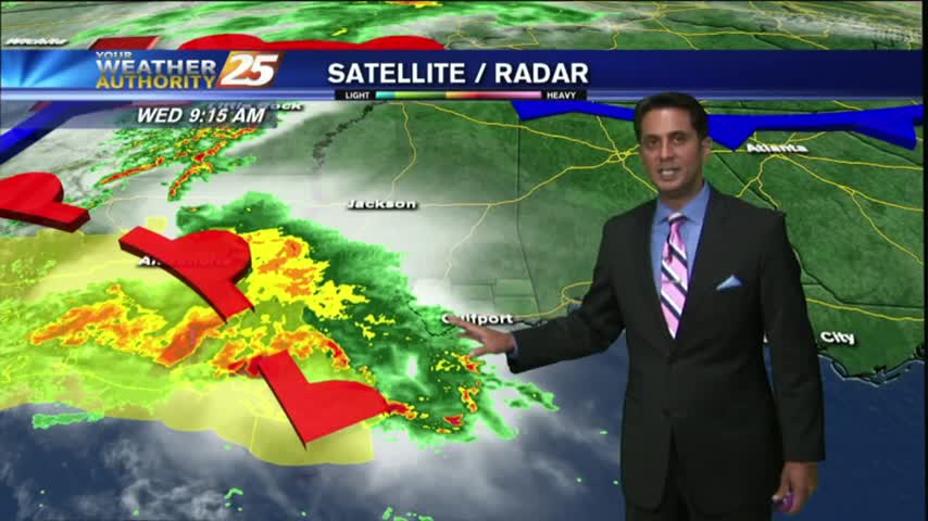
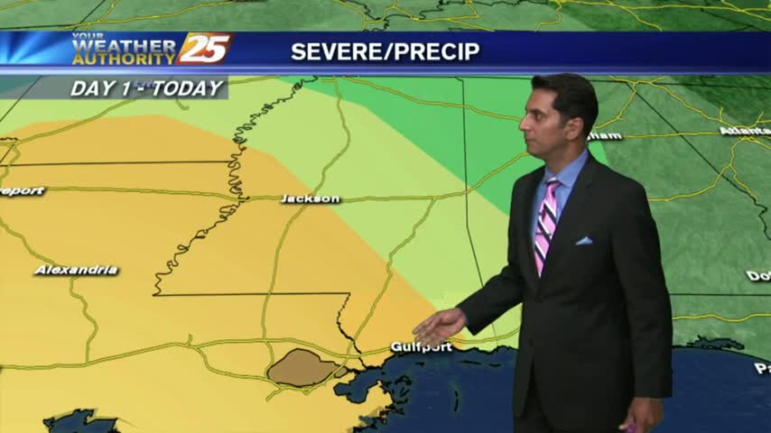
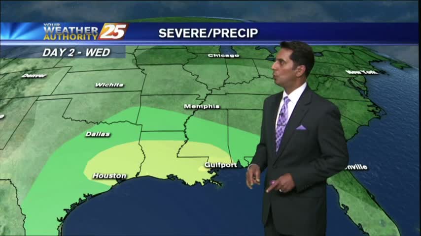
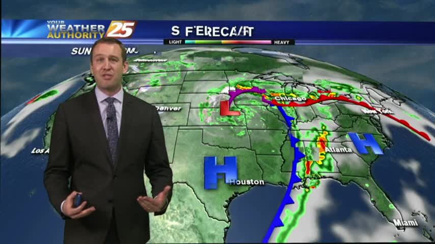
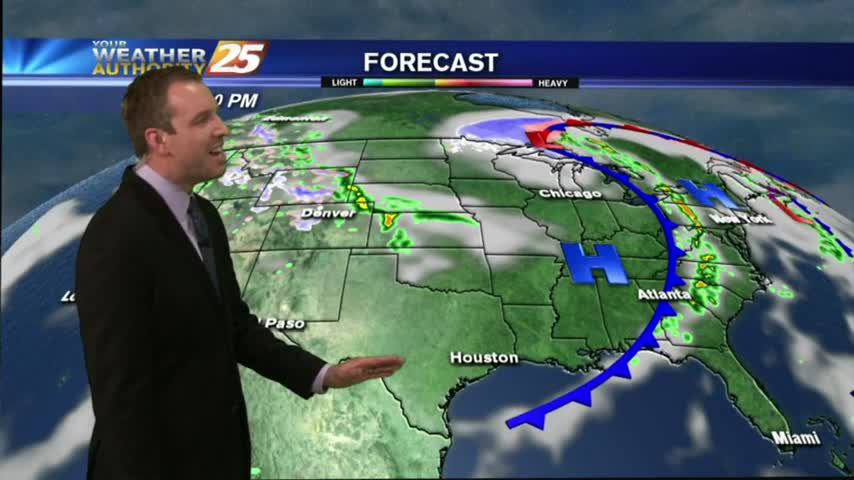
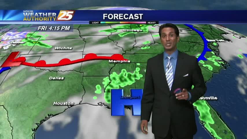
Storms are pushing into the area now and will continue over the next few hours. Our severe threat was lowered from "enhanced," "to slight," and now to "marginal," so little damaging weather is expected though we will see some strong storms. Watch the forecast for details.
After a clear start...clouds have moved in along with isolated t-storms associated with a warm front moving through the area...
A southerly component with the winds overnight has continues as a more humid air mass is now the the area, with warmer temps this morning.
Today was another beautiful South Mississippi afternoon, and most of tomorrow will be as well. Once we start heading into the evening though, showers and storms will begin moving in from the West. Be sure to watch the full forecast for details.
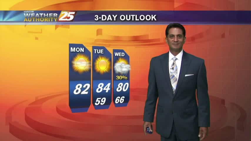
After a CHILLY morning, temperatures have warmed nicely into the 80s, under SUNNY skies...
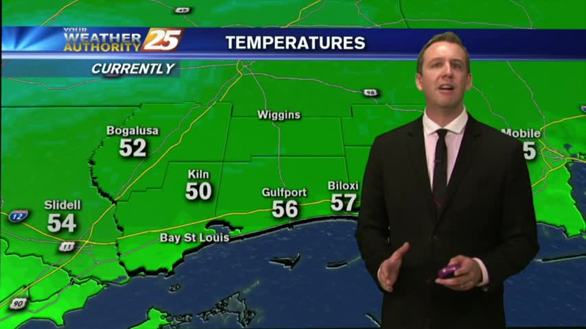
With high-pressure, clear skies and a drier air mass...it's a CHILLY start with temps in the upper 40s to low 50s...
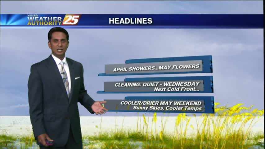
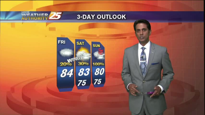
Beautiful cool & dry weather moved in after yesterday's front, and will linger in South Mississippi for another day or so. Expect another round of rain before the weekend though, watch the full forecast for details.
As the cold front from yesterday continues to move further away from the area...we are now under an abundance of sunshine...
After HEAVY RAIN and some BUMPY weather yesterday, the cold front and associated weather continues to move east of the area...
Strong storms moved through earlier today, but have now moved off towards the East. A cold front will pass through overnight leading to some cooler & drier air, so be sure to watch the full forecast for details.
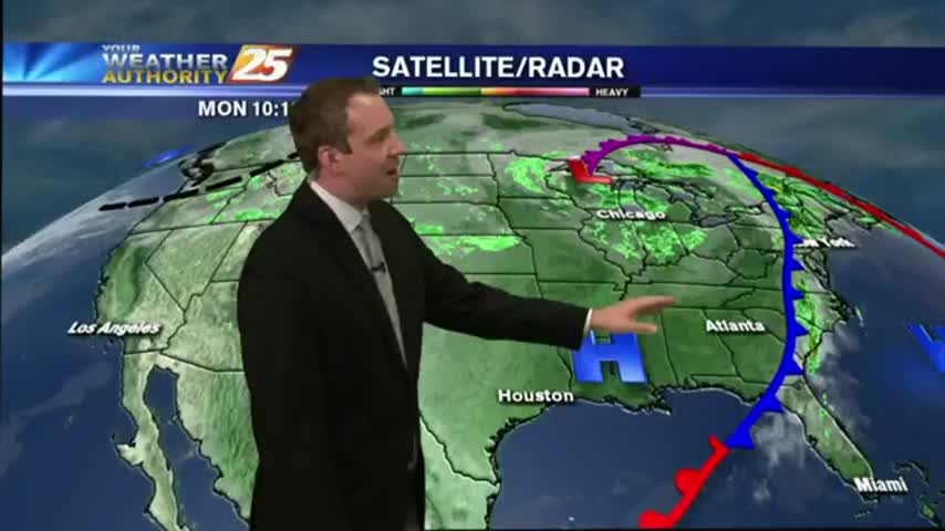
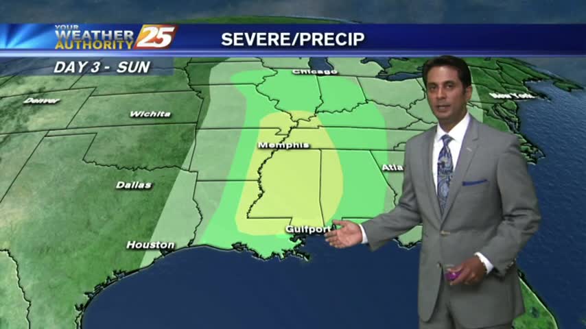
It may feel like a tropical rain-forest now, but it'll keep getting worse until a strong cold front moves through Sunday night. Watch the full forecast for details.
A warm front developed this morning with a few light sprinkles, now under warm, humid and breezy conditions...
As a warm front develops north of the area, a few light showers have been moving in from the GOM...
A cold front may have passed through overnight, but temperatures warmed today. Expect a few days of calm weather before another potential severe threat. Watch the full forecast for details.
After a CLOUDY morning...drier air moving in has cleared skies with temps warming into the 80s...

Isolated showers associated with a very weak cold front has now moved east...
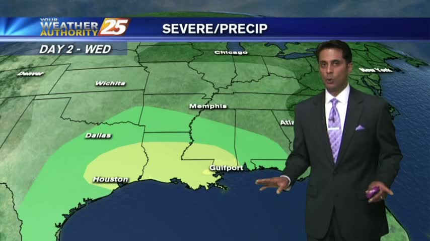
Storms are beginning to creep in from the NW, and despite our "marginal" threat for severe weather, conditions are trending for weaker storms in South MS. Watch the full forecast for more details.

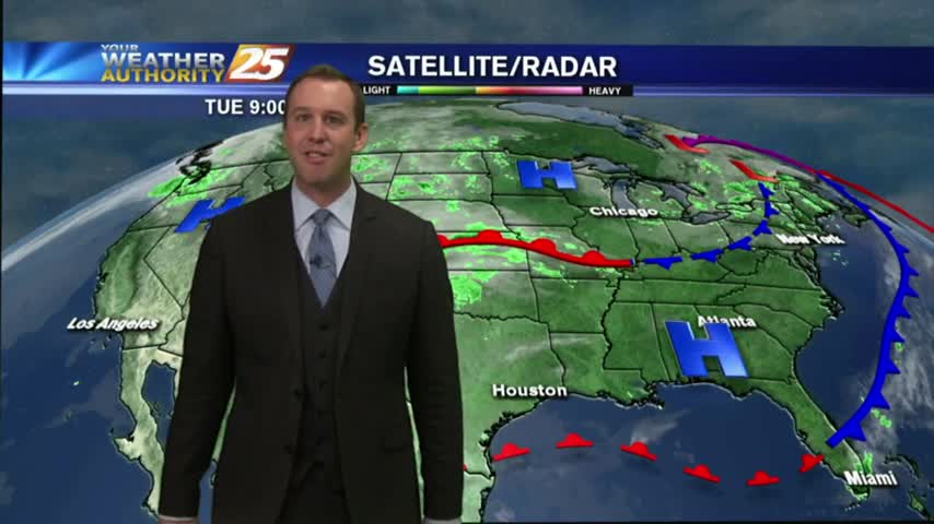
Warm, humid and breezy conditions continue in advance of an approaching cold front...
It's a warm, humid and windy start to the day in advance of an approaching cold front to the NW...