5/22 - Rob's Steamy/Wet 7-day Forecast
A humid start to the day as a strong tropical air mass continues through the region...
A humid start to the day as a strong tropical air mass continues through the region...
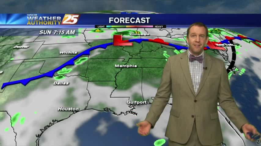
We're in for a wet week ahead as we'll see several days like today with late morning/afternoon showers and partly sunny skies. Weekend outlook not looking good....
Expect this week to be significantly different from the last with cooler temperatures, more clouds, and much more rain....
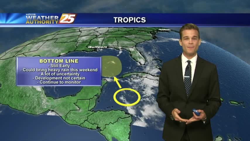
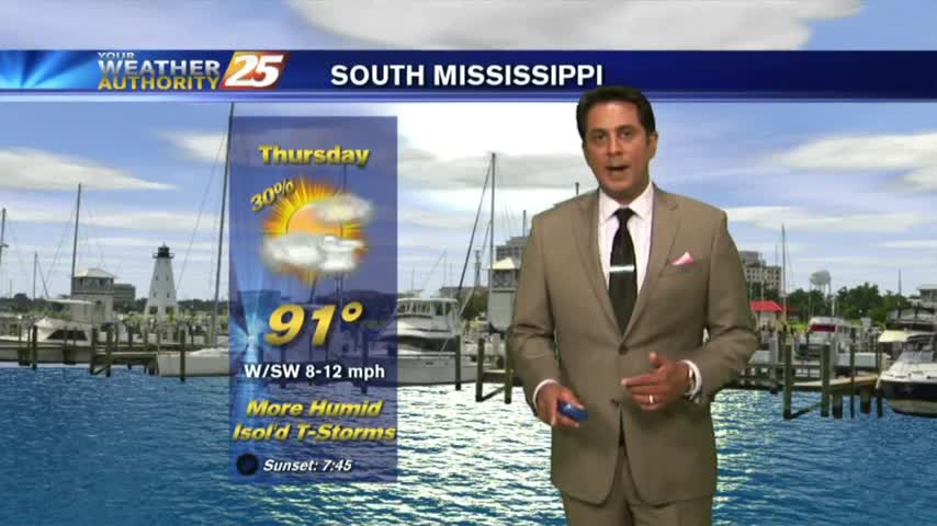
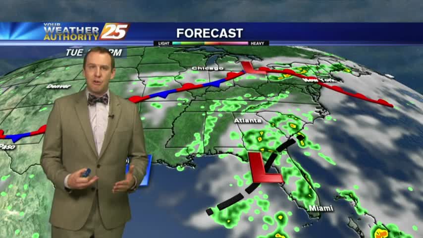
Afternoon showers and thunderstorms, and we are keeping an eye on the tropics.
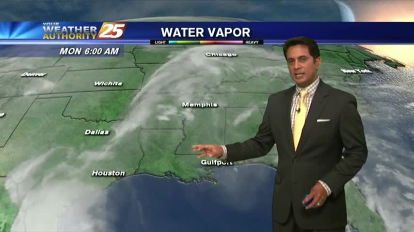
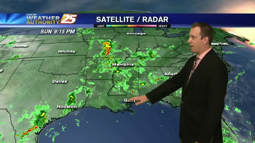
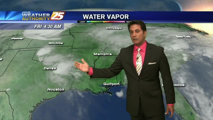
Overnight showers/t-storms continue to move in from the GOM...along with areas of patchy fog...
Last week was exceptionally hot and sunny with a few afternoon thunderstorms, and this week will be more of the same but with more cloud cover and rain....
It was drier today as expected and that will continue through the weekend, but more hot and humid days with afternoon will return next week.

Today had fewer showers as expected which is what we'll see through the rest of the weekend, but higher chances of rain return next week....
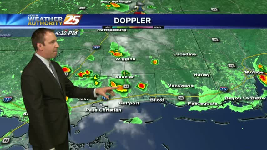
Isolated activity beginning to pop as temps warm into the upper 80s...
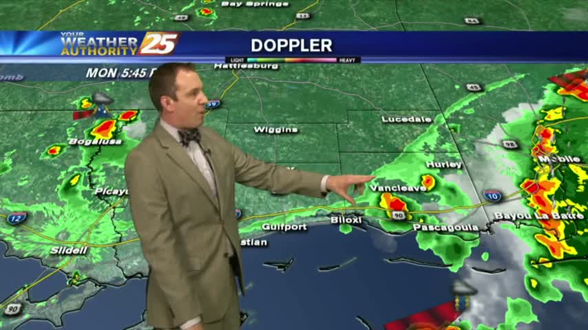
Overnight t-storms over the sound continue to move south, away from he area as drier air moves in...
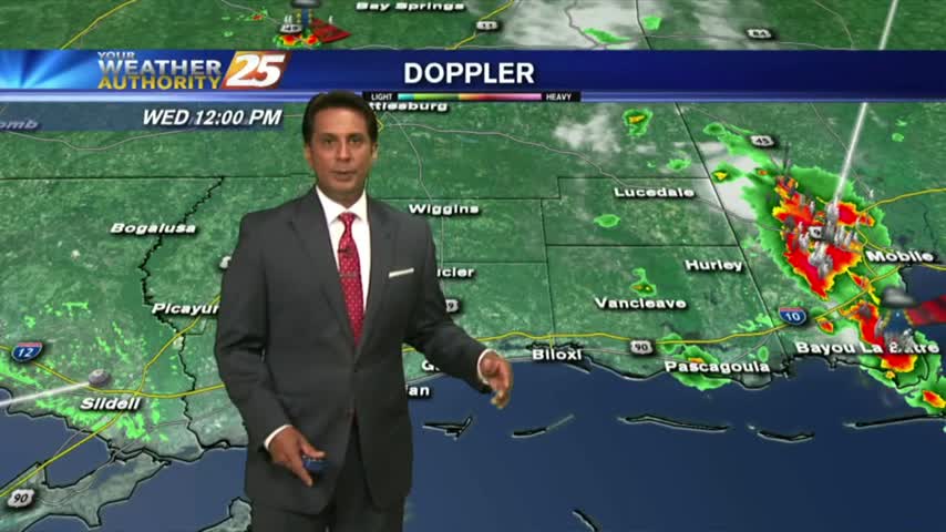
Afternoon storms brought some severe weather an lingered into the evening, but I'm expecting less of those each day through the weekend....
Another hot and humid day, another afternoon of showers and thunderstorms with severe weather traits. Expect similar days ahead....
Showers and t-storms beginning to pop in the local area due to intense daytime heating...
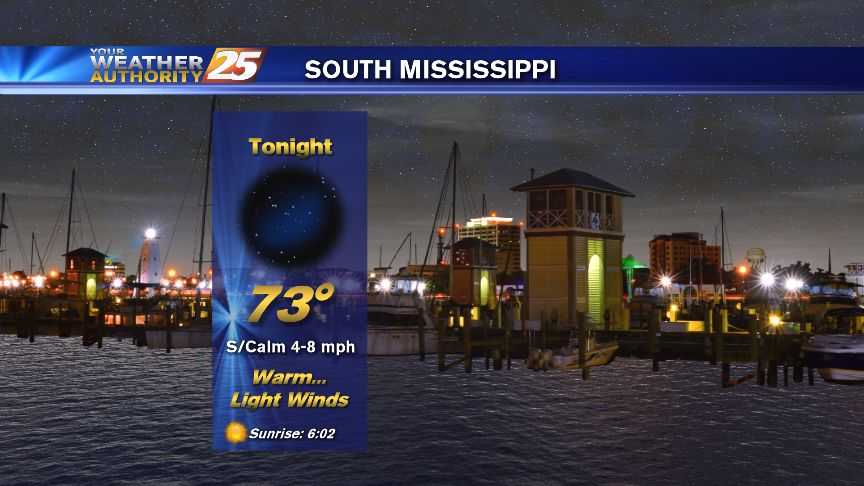
Another HUMID start after showers/t-storms yesterday afternoon/evening. Areas of patchy fog is along the Southern 6...
Today's record breaking temperature brought another afternoon of showers and thunderstorms, and I'm expecting very little change for the rest of the week....

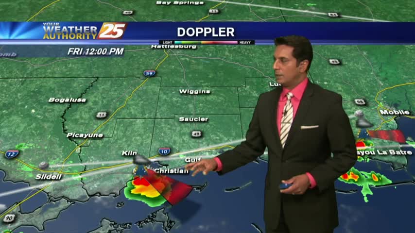
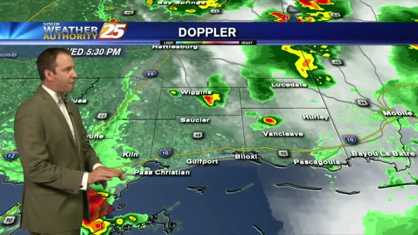
It hasn't been officially confirmed yet, but we received a report of hail in one of the afternoon storms near Perkinston, MS. Expect more showers, t-storms, and hot afternoons ahead....
After a warm start, it's getting hot and humid with isolated showers/t-storms developing...
Isolated overnight activity continues to linger with areas of light patchy fog...
With another day of record breaking temperatures behind us we'll see some slight cooling through the rest of the week, but only into the upper 80s....
Having a few problems with the video capture service, but can't let you go without your forecast!
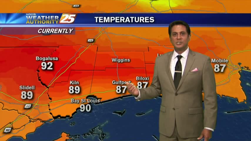
More record heat today, but some relief is on the way.

After record breaking temps yesterday afternoon, it's a very warm start for your Tuesday morning...
Today was the hottest day in May in history and while it will cool slightly going forward, don't expect very much relief....
Today blew the record high temperature away by several degrees, and was the hottest day we've seen so far this year. It does cool slightly going forward though....