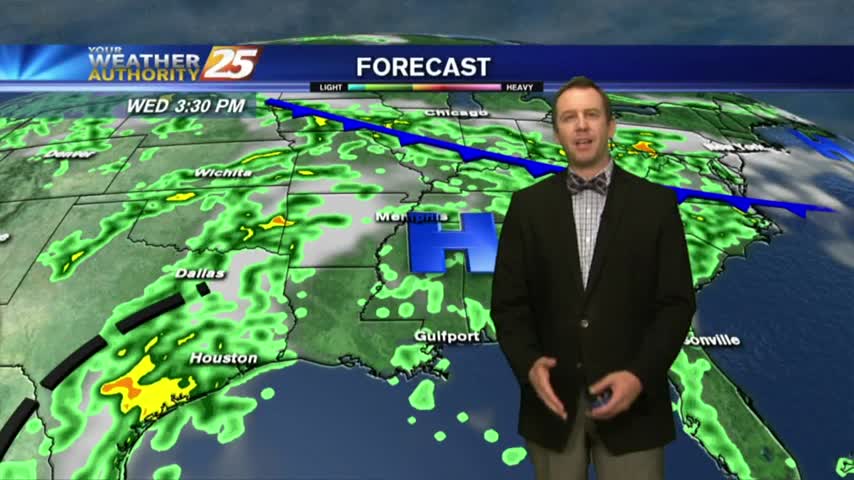
6/22 - Payton's Friday Night Forecast
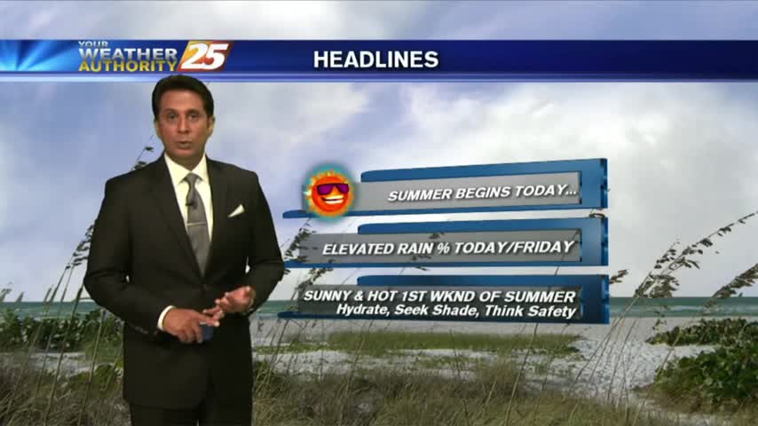
Very hot & humid for the first weekend of the Summer.

Very hot & humid for the first weekend of the Summer.
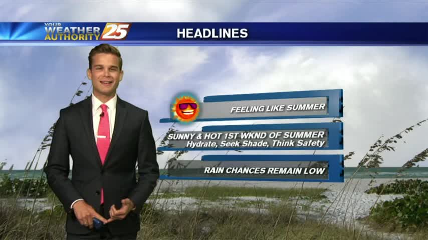
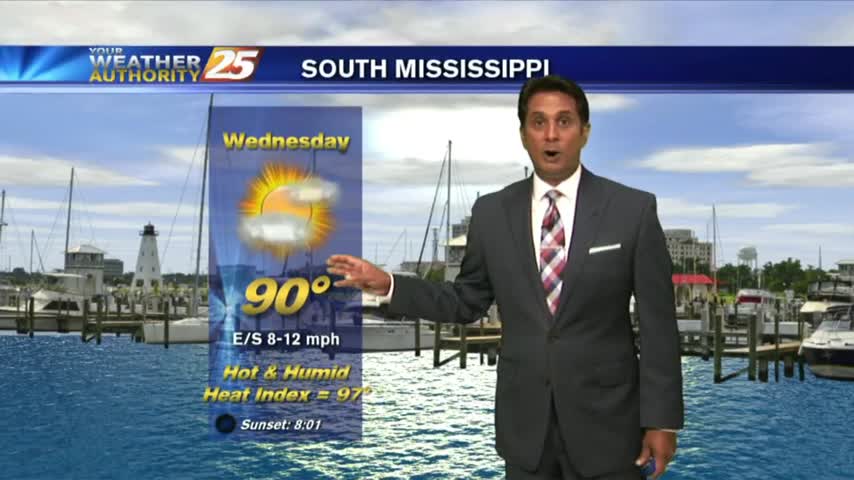
If you like today's heat...you will love the weekend forecast.
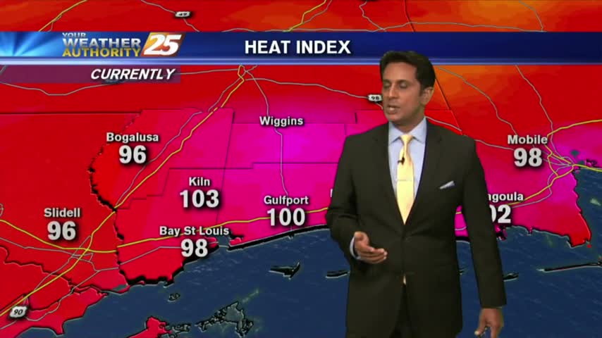
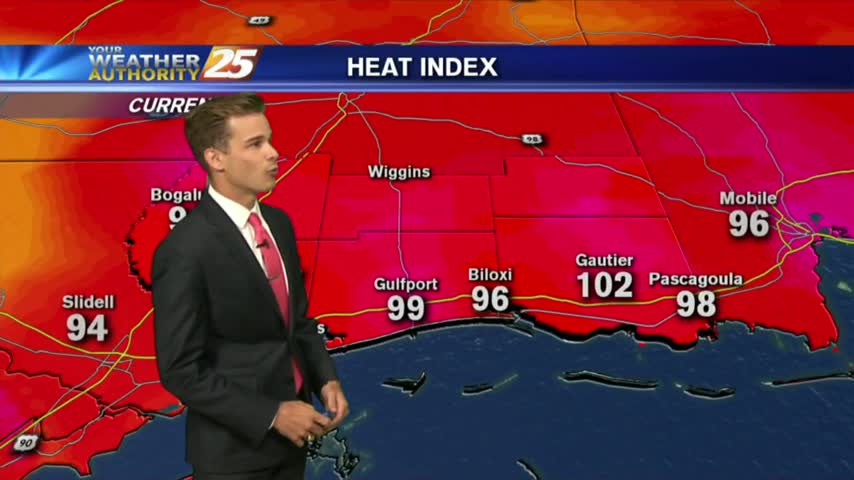
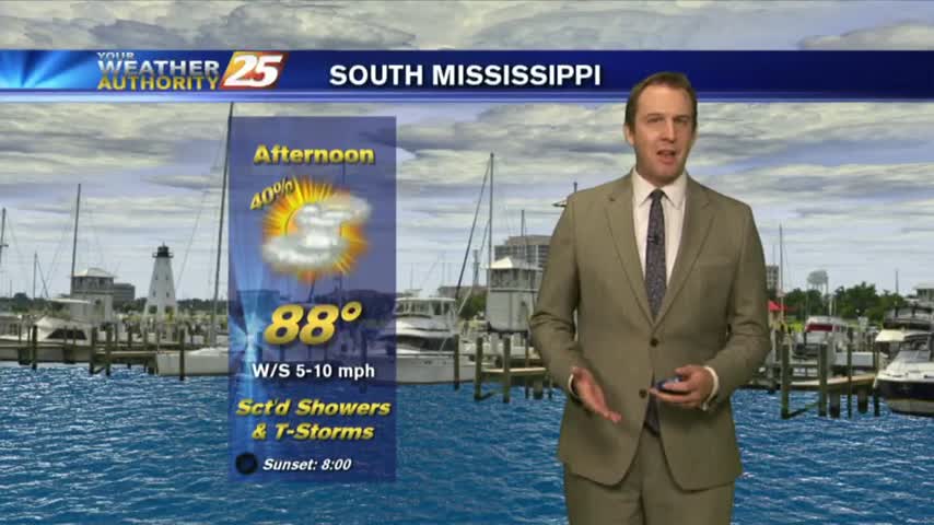
Things are getting HOT out there as the HEAT INDEX is now pushing 100 degrees...

Summer is definitely in the air as morning low temps are in the upper 70s to low 80s...
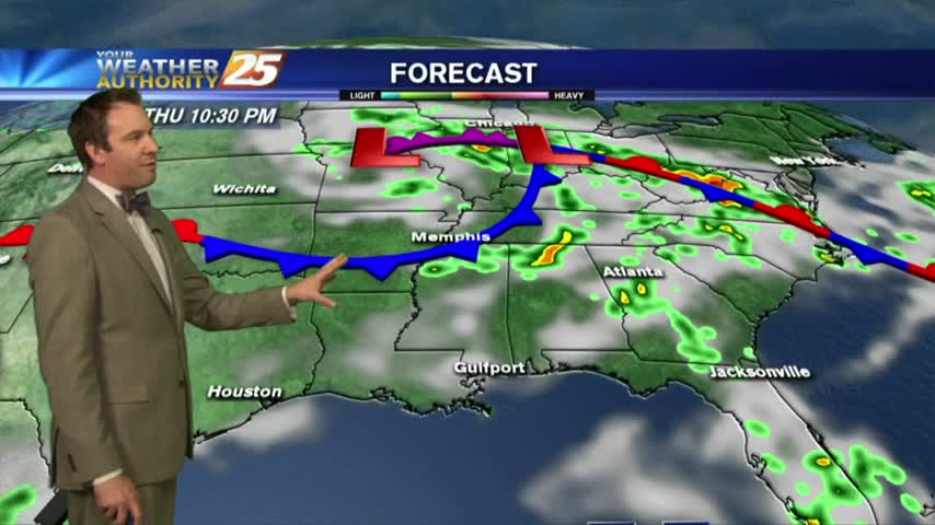
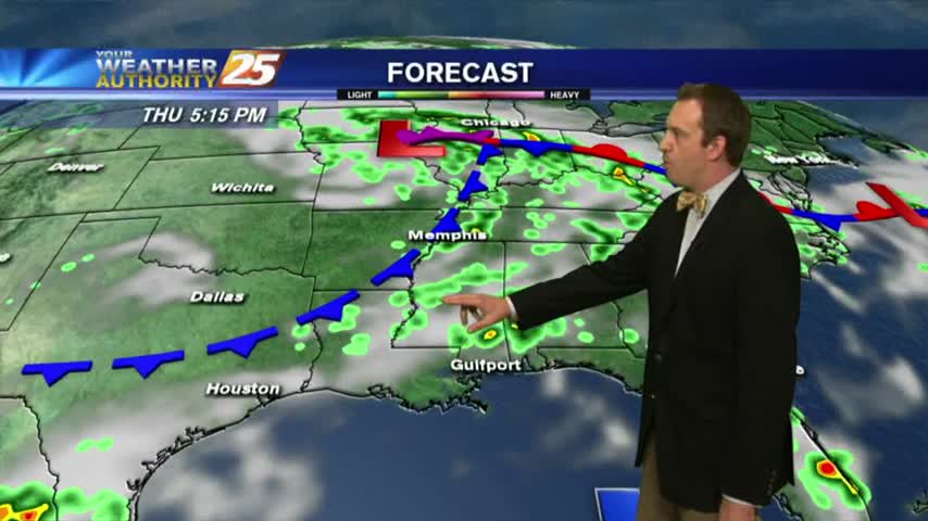
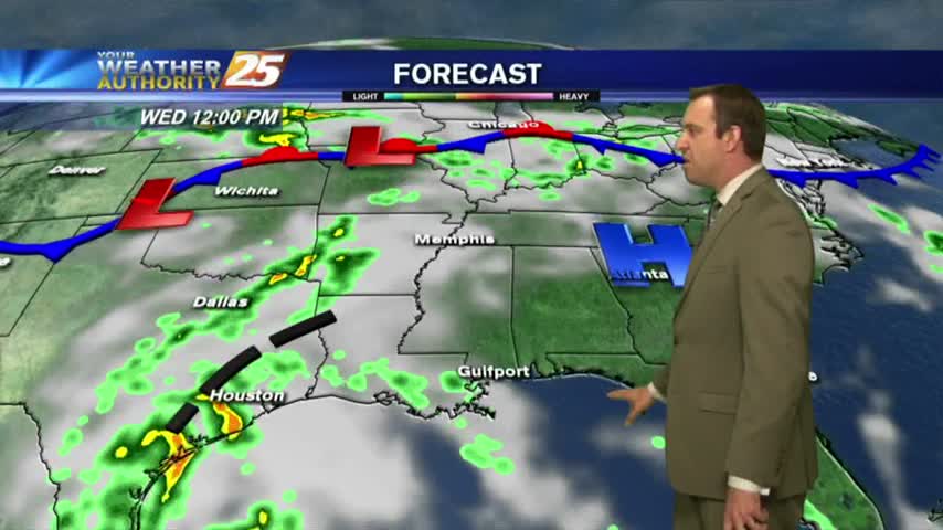
We saw rain earlier today as expected, but drier (and hotter) days move in quickly....
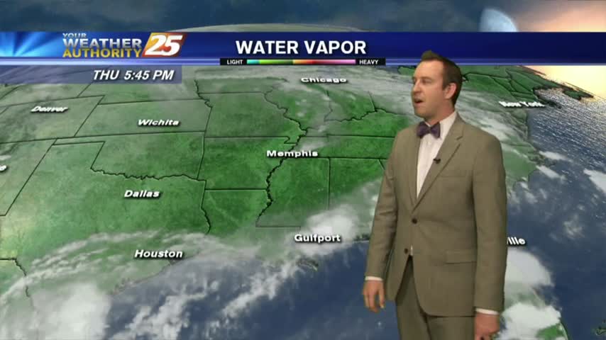
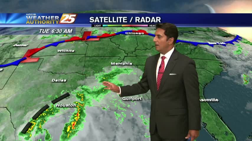
There was a little rain to the north this afternoon, but most of the area remained dry. Expect more dry days through the weekend and some high heat indices....
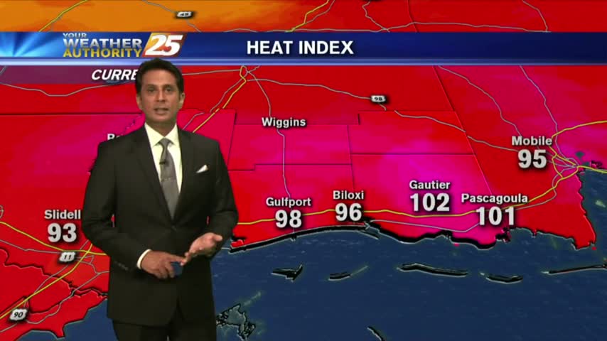
A VERY HOT 1st day of Summer with the HEAT INDICES pushing the triple digit mark...
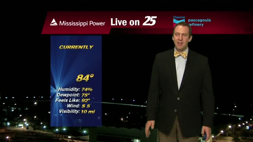
A VERY WARM start to the new season as several locations are in the low 80s this morning...
Not as much rain today as expected, but we'll absolutely see some tomorrow with hotter and more humid days ahead....
Another sunny and dry day in South MS today, but we'll see a bit of rain moving in soon....

The final day of Spring is shaping up nicely with much more sunshine and HOT conditions...
A rain-free start to this final day of Spring with areas of light patchy fog...
Even though we still saw one shower pop up in the afternoon, today was still the driest day we'll see all week....
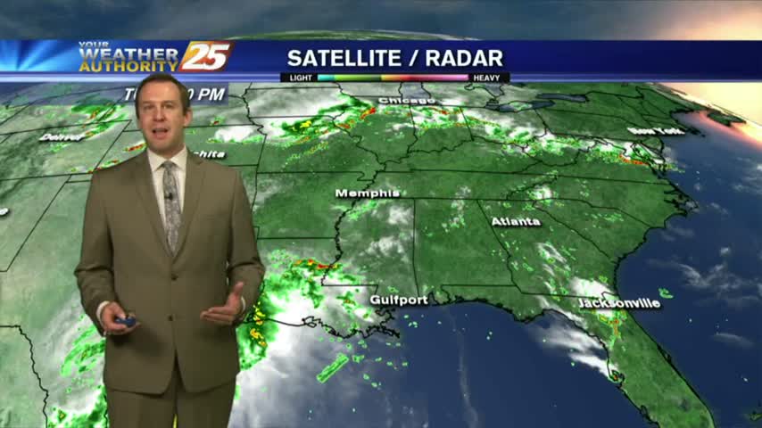
Much drier today even though we still saw at least one shower; expect more of the same ahead....
Hot and humid again, and the first day of Summer is just days away.
A tropical wave has moved ashore E'tern Texas with warm & humid conditions along S. Mississippi...
It was cloudy, rainy, and humid today, but will be much drier for the next few days....
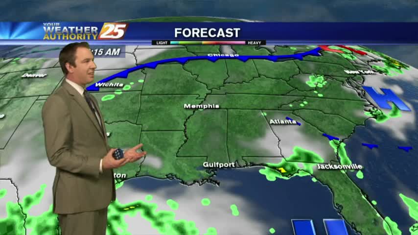
A disturbance has brought tropical moisture home causing cloudiness and a few showers, but it'll be a much drier this week than last....
Cloudy this afternoon with tropical moisture streaming into the area.

With a tropical wave in the NW'ter Gulf of Mexico, cloud coverage continues to move in from the south...
It was much drier today, something I expect to see a lot of through this week, but there will still be a little rain mixed in....
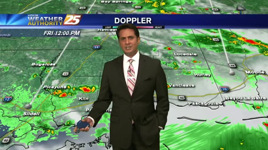
We're continuing our afternoon thunderstorm trend into the weekend, but clearer and dryer days are finally showing up....
We're heading into Father's Day weekend, and sadly expecting more afternoon showers and thunderstorms....
Temperatures continue to warm as the HEAT INDICES are in the mid-90s, with t-storms developing...