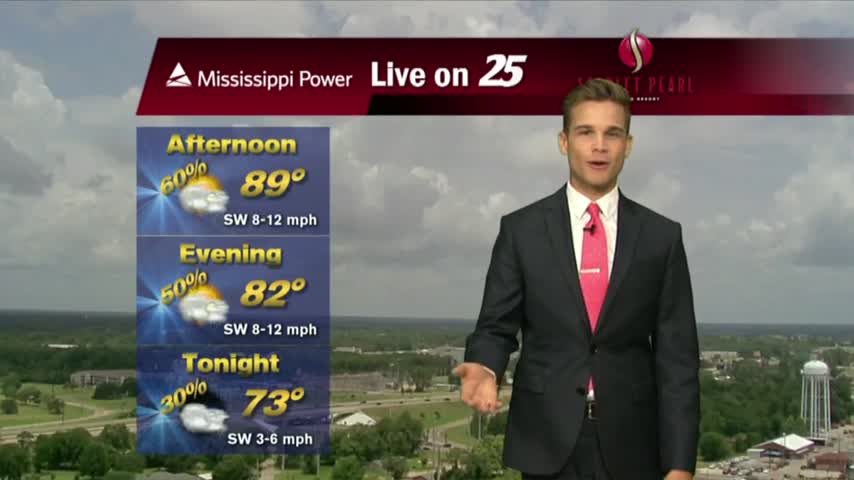
6/15 - Rob Knight's "Father's Day Weekend" Forecast
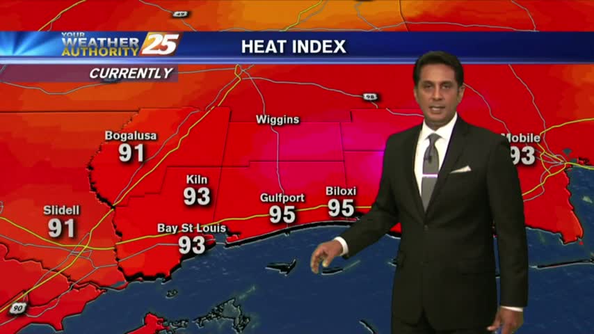
Temperatures continue to warm as the HEAT INDICES are in the mid-90s, with t-storms developing...
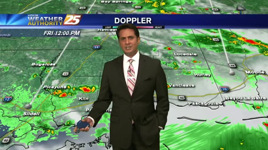
Temperatures continue to warm as the HEAT INDICES are in the mid-90s, with t-storms developing...
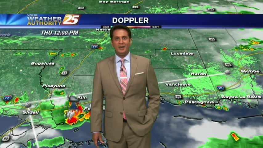
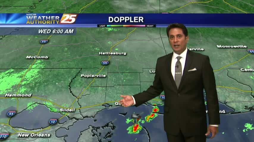
As the very saturated environment continues, activity is already in the area before sunrise...
This afternoon's showers dissipated rather quickly, but we'll see more showers and thunderstorms as we head into tomorrow afternoon....
We'll see another calmer night after yet another stormy afternoon, with another round of more of the same tomorrow....
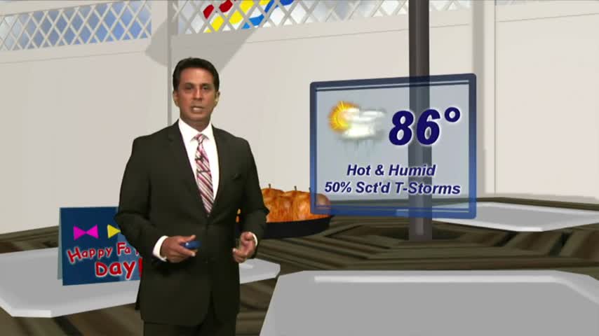
HOT & HUMID with showers and t-storms beginning to pop along the Southern 6 and the region...
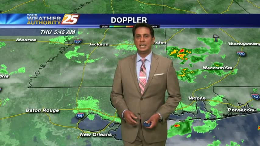
Another HUMID start to the day with isolated activity in the vicinity...
It was another day of showers and thunderstorms, but we'll see another round of them as we head into tomorrow....
It was much less active today as expected, but that won't last as the showers and t-storms come right back tomorrow....
The activity is taking a bit longer to fire off but will begin heading into early afternoon...
After HEAVY RAINFALL yesterday afternoon, only a few light sprinkles exist this morning...
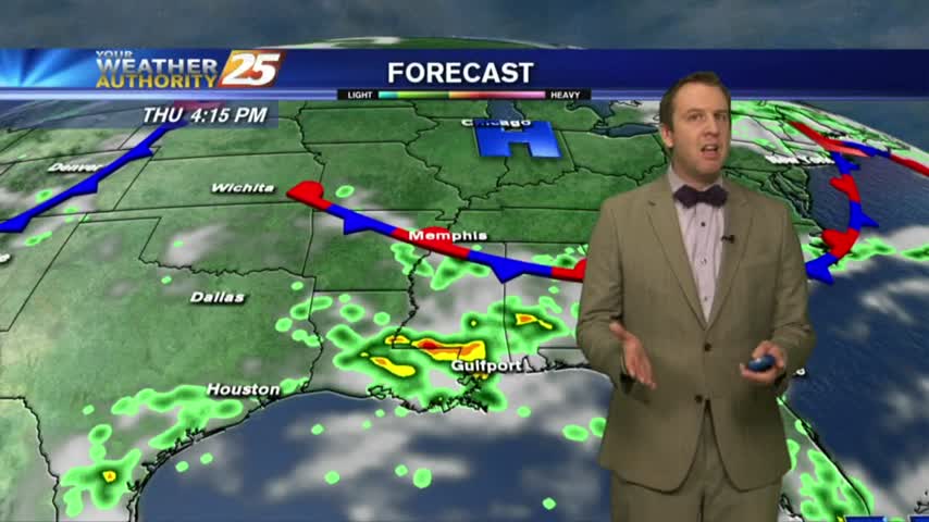
If you enjoyed today's showers and thunderstorms, you're in luck for the rest of the week! If not, well....
This afternoon brought another round of showers and thunderstorms with at least one becoming severe warned. Expect more ahead....
Showers and thunderstorms going up, and the tropics are heating up.
Overnight activity has dissipated but activity will redevelop this morning and then again this afternoon...
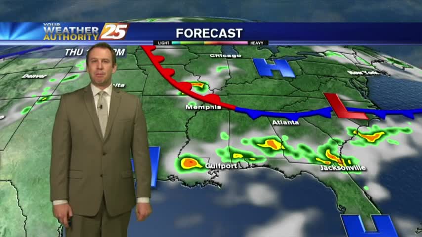
Expect many rainy days ahead as we return to our typical "summertime" pattern....
The weekend was relatively drier, but we're in for a rainy week ahead....
Mores showers and thunderstorms this afternoon, and an update on the tropics.
A warm/humid start with cloud coverage developing and moving in from the west...
A summer like week with showers thunderstorms in the forecast and the latest on the tropics.
More nice, dry weather today, but expect to see more and more showers as we head through the weekend and into next week....
It was another beautiful day with reasonable humidity and plenty of sun, but higher humidity and rain chances are on the way....
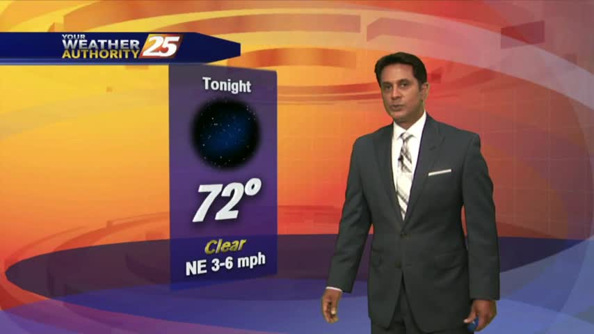
A nice start to the day/weekend as clear skies prevail with a north wind and temps in the upper 60s/low 70s...
We'll see more beautiful days like today ahead, but rain isn't far away....
Today was hot and sunny with moderate humidity, a far cry from the oppressive humidity we saw this time last week....