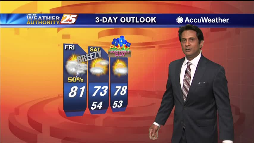
05/08 Ryan's "Stormy" Friday Evening Forecast
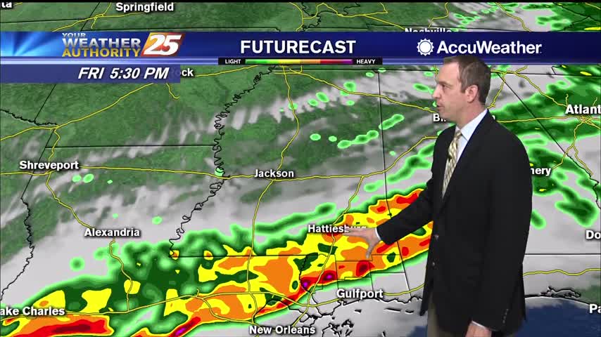
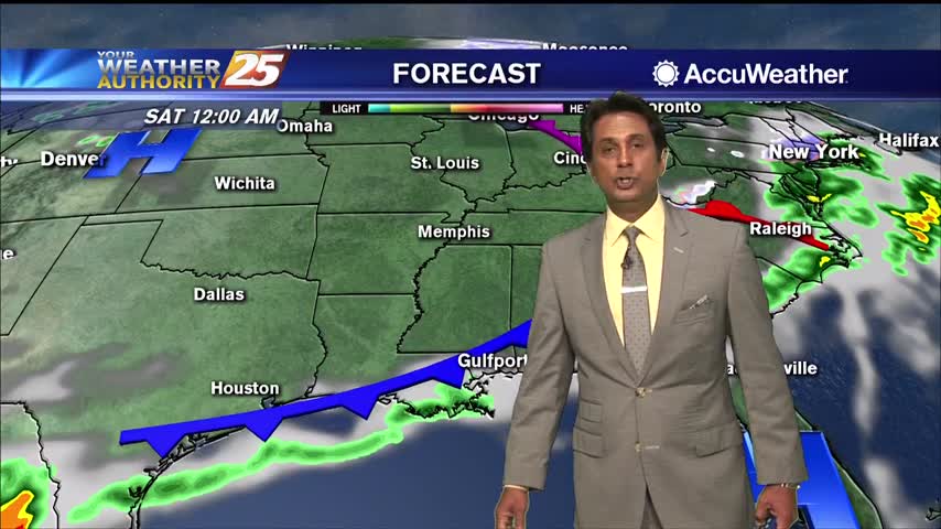
A cold front is bringing a line of storms for the evening, but expect to see clearing through the early morning hours.
A cold front is bringing a line of storms for the evening, but expect to see clearing through the early morning hours.
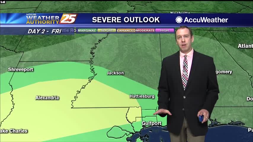
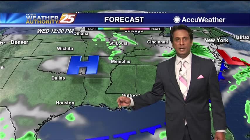
An approaching cold front will push showers/t-storms west of the area into south Mississippi...

A warm and humid start to the day in advance of an approaching cold front...
Still clear and dry tonight, but clouds, rain, and higher humidity move in quickly tomorrow afternoon!
Dry air remains in place, but we'll see rapid changes to that and even potential thunderstorms moving in tomorrow.

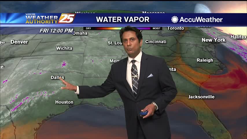
Dry conditions will continue for at least one more day before some much needed rain arrives. Humidity levels are still low, but gradually increasing across the Gulf Coast with mild temperatures in the mid 70s. This afternoon, winds will switch…
A CHILLY start this morning as very low humidity continues to affect the area...

Hot, dry conditions aren't helping the multiple fires in the South MS area, but showers are on the way...just not immediately.

It's been quite hot over the last few days and still was today, but cooler air is on the way.
After a hot day yesterday, temperatures will be cooler today topping out only in the lower 80s this afternoon. Dry conditions are expected with very low humidity and gusty winds up to 25 miles per hour. Tonight, temperatures drop to…

This morning will bring clearing skies as the cold front to the south continues to move away from south Mississippi. A tightening gradient will bring windy conditions from the north at times gusting into the upper teen to low 20…

Today was one of the hottest we've seen so far, but some slight relief is on the way.
Much hotter today, but some slight relief is on the way as a front moves through.
Highs today will get up to the mid 80s under mostly clear skies. Overnight, cloud coverage will increase slightly as temperatures stay mild, only dropping to the mid 60s on the coast and lower 60s for inland areas. Rain chances…
The disturbance diving through the southern Great Lakes States will push a cold front through the area this evening. Expect isolated to scattered t-storms to develop in advance of the front. The majority of activity in our region will be…
The weather will remain nice, but heats up tomorrow before a slight cool-down and some end of week rain.
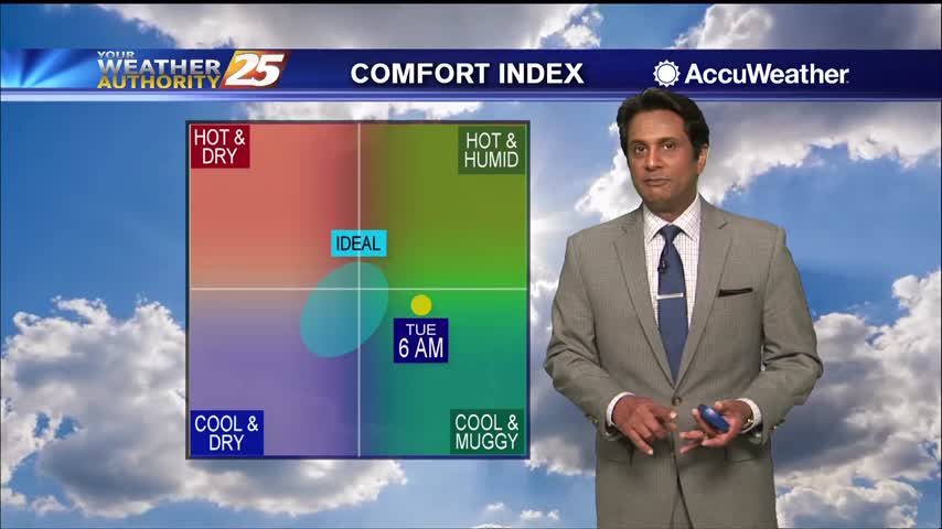
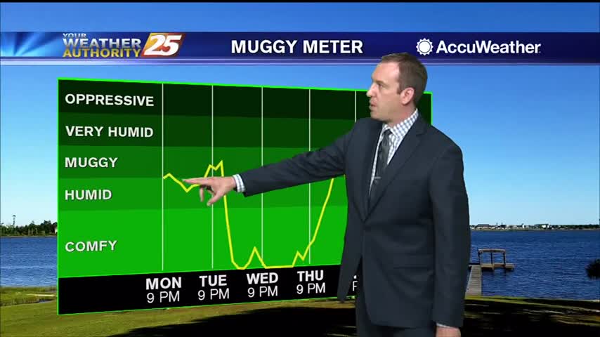
The humidity and temperature have been slowly rising through the weekend, but will rise sharply tomorrow before a slight cool-down.
After a beautiful weekend here on the Gulf Coast, the sunny, dry stretch continues. Highs today will get up to the mid 80s under mostly clear skies. Overnight, cloud coverage will increase slightly as temperatures stay mild, only dropping to…
A nice mild start to the day with areas of light patchy fog...

Overnight lows will be in the upper 50s on the coast under clear skies. Monday’s highs lift to a range from 85 to 90 north of I-10 while the more southerly flow over the coast favors keeping highs along the…
Dry air will linger a little longer before things get humid on us again, just before another front moves though.
Happy first of May everyone! The beautiful weather is in no hurry to leave, so be sure to enjoy it before those muggy conditions return.
A FANTASTIC afternoon ahead with mild temperatures and very low humidity values...

Another chilly morning along the Mississippi Gulf Coast heading into the 1st weekend of May...