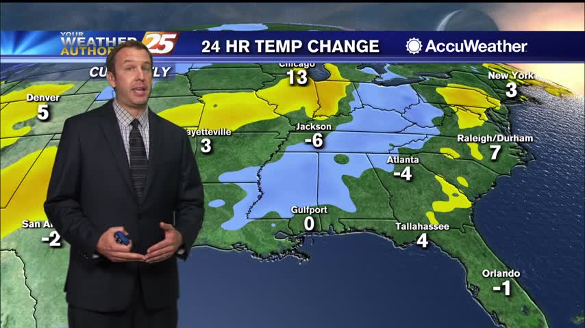
10/13 Ryan's "Better" Tuesday Evening Forecast
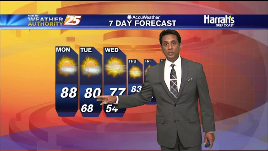
Forecast is improving for the next few days after this morning's front, but we'll see another few cool downs this week.
Forecast is improving for the next few days after this morning's front, but we'll see another few cool downs this week.
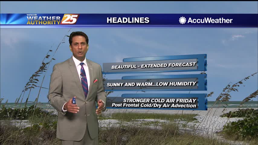
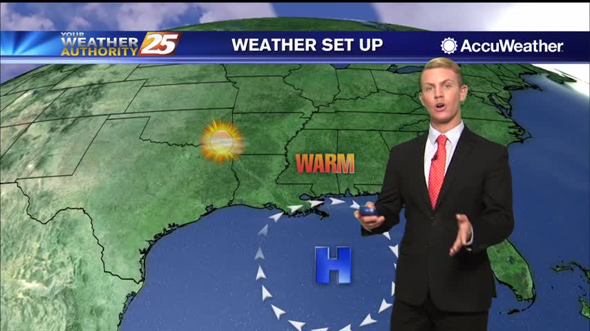
Post frontal passage will continue to bring a less humid air mass into south Mississippi...
A nice start to the day as a weak dry front overhead is pushing SE...
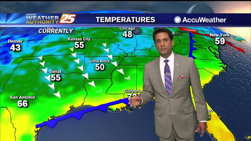
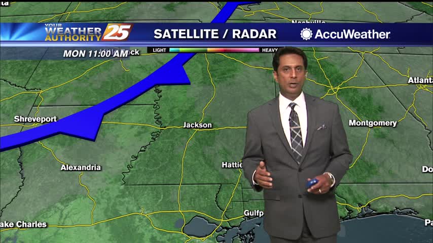
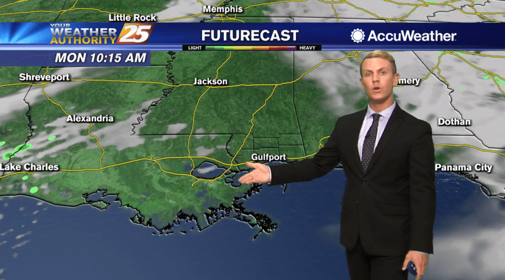
We continue to track a relatively weak cold front swinging through the area today. Behind the front, dew points are already beginning to fall pretty steadily. Most cloud activity ahead of the front along and south of I-10 is near…
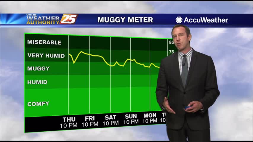
Been a little warmer and more humid than average, but a few fronts will keep it much more fall like this week.
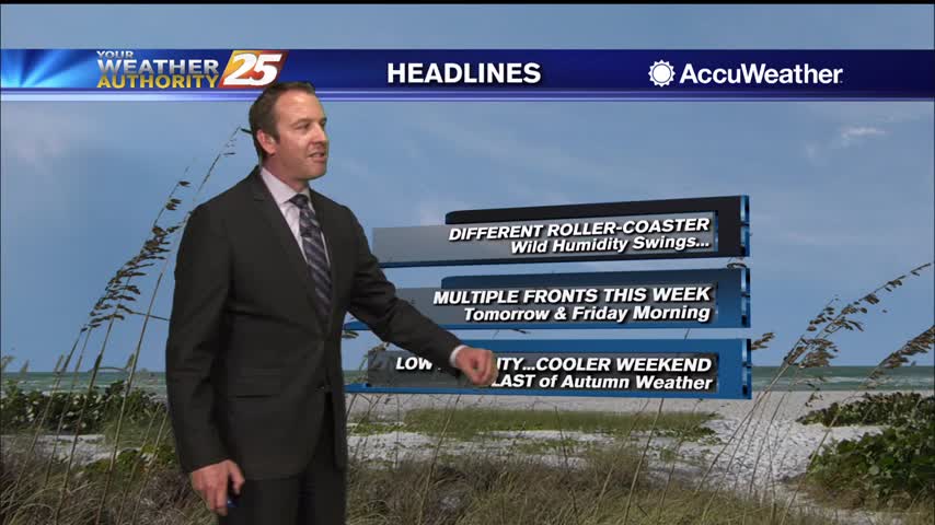
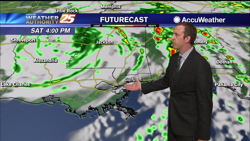
Delta is gone though the tropical moisture lingered, just to be pushed out by our first of two fronts this week tomorrow morning.
Plenty of sunshine and HOT temperatures heading into this afternoon...
A warm and humid start with areas of DENSE FOG for your morning commute...
After a foggy start to the day for some, expect things to be warm, humid, and mostly sunny across the Gulf Coast. High temperatures should top out in the mid to upper 80s this afternoon, which is about 5-8 degrees…
Generally high pressure at the surface will maintain the dry conditions over the central Gulf Coast region and surrounding areas. The higher dewpoints tonight along with strong cooling with nearly calm winds and mostly clear skies will lead to areas…
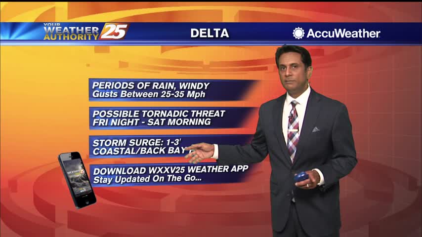
Delta had made landfall and continues to push inland, largely missing South MS.
Delta is land falling in Southwest Louisiana, missing us but bringing at least a few issues to the South MS area.
A warm and humid start to the day as we continue to track Hurricane Delta....

Cloud coverage and spotty rain is moving in from the SW associated with Hurricane Delta
Cloud coverage and spotty rain is moving in from the SW associated with Hurricane Delta
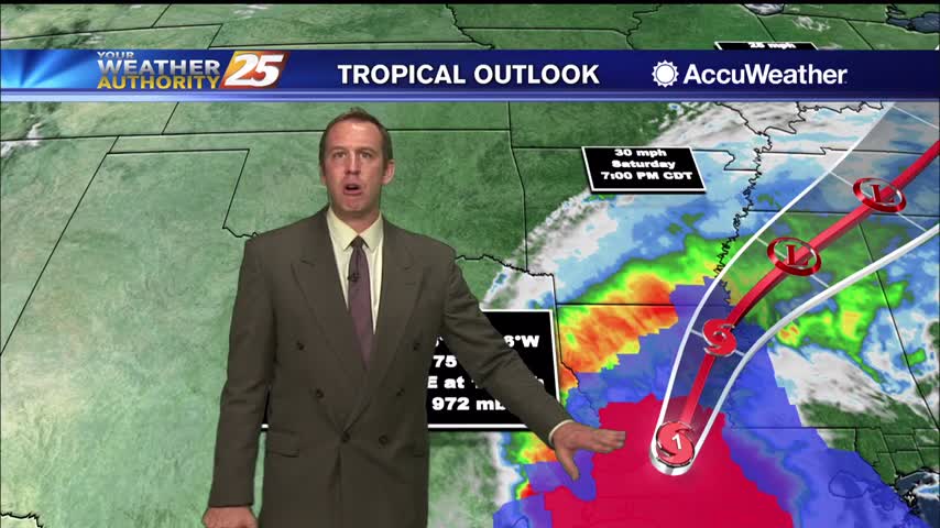
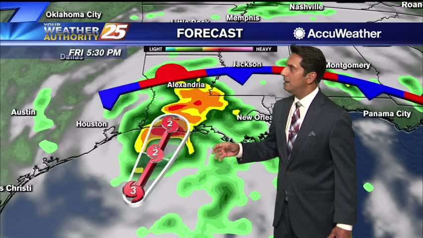
Delta still moving in looking to landfall in west/central LA. South MS get ready for a few wet, windy days.
Delta is still far away, but active weather brought possible tornadoes to the area this afternoon.
Upper clouds continues to move across the area stemming from Hurricane Delta in the West Central GOM...
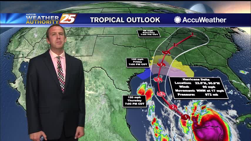
Hurricane Delta should start making its turn today to head more northward causing conditions to become worse with time mainly during the day Friday and mainly along and west of the Mississippi River. Delta is expected to move inland Friday…
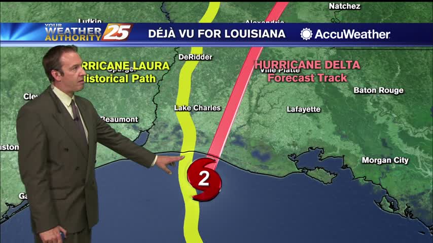
Last few updates on Delta have been "good" news for South MS, as it continues to slide westward....
Hurricane Delta's updates continue to improve regarding South MS, but there's a lot that can change between now and Friday.
A lovely afternoon for the Cruisers here in south Mississippi....
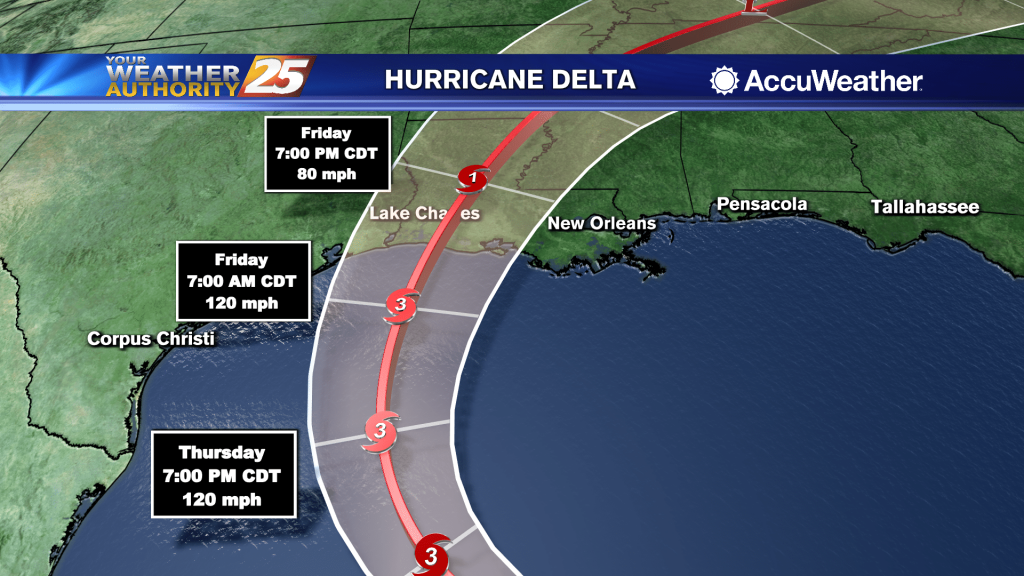
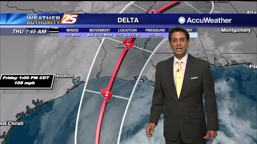
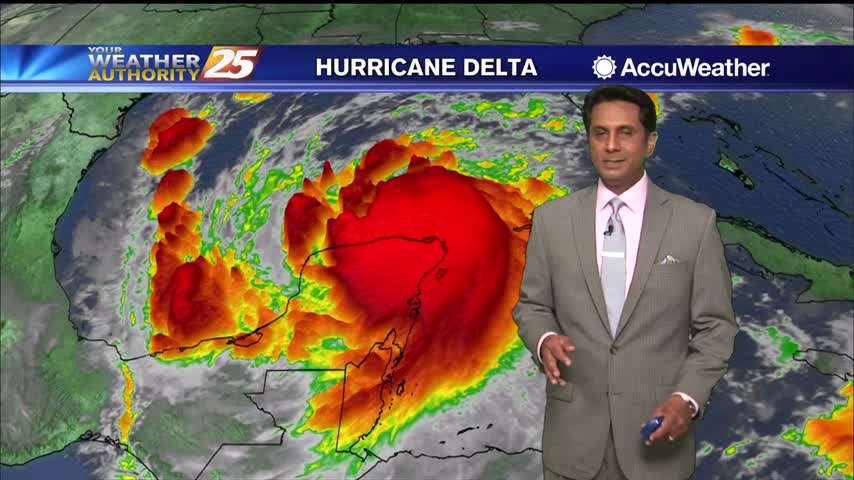
(WXXV) — Hurricane Delta is now a Category 2 with maximum sustained winds at 105 mph with higher gusts. Re-strengthening is forecast when the hurricane moves over the southern and central Gulf of Mexico through Thursday, and Delta is expected…

(WXXV) — With Delta forecast to make landfall as a strong hurricane, forecasters say coastal flooding can be expected across the Gulf Coast. Authorities throughout South Mississippi are preparing now by setting up several self-serve sandbag sites. Self-serve sandbags are…