04/12 Ryan's "Last Clear" Monday Night Forecast
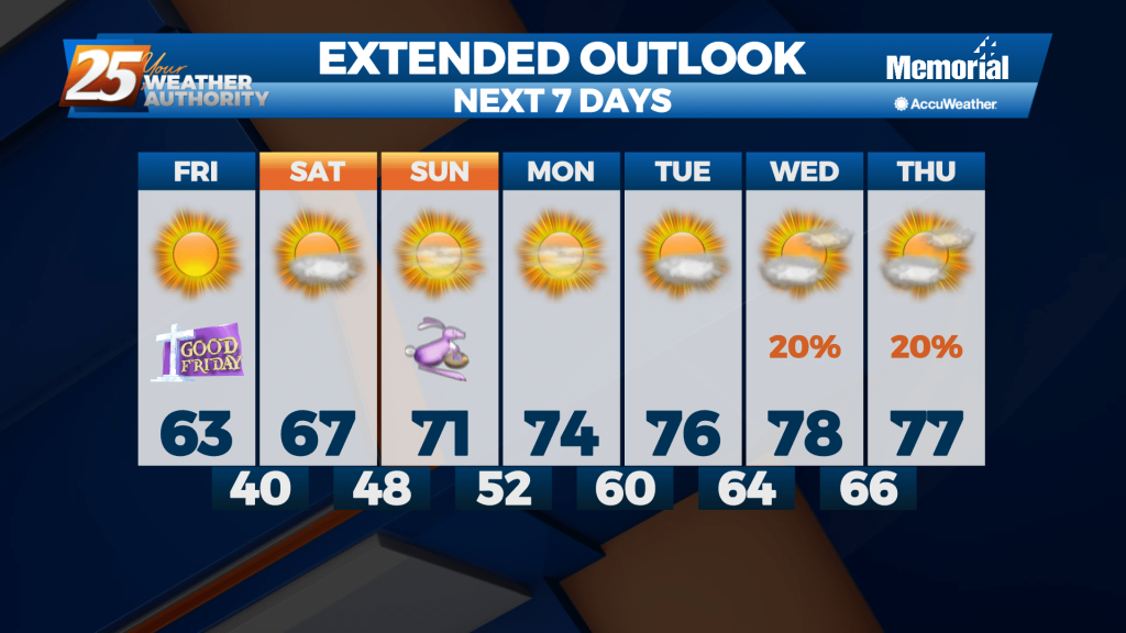
Expect to have seen the last clear skies for most of the week as clouds and rain move in, but they'll be on their way out by the weekend.
Expect to have seen the last clear skies for most of the week as clouds and rain move in, but they'll be on their way out by the weekend.
A most excellent Monday afternoon ahead with warm temperatures and sunny skies...
High pressure will dominate the forecast, giving us clear skies and calm conditions today and tonight. Sunny skies, dry and warm conditions, and light southerly winds are expected across our forecast area for Monday, and highs should warm in the…
Nice today after a wild start to the weekend yesterday, but the clouds and rain won't stay gone for much longer....

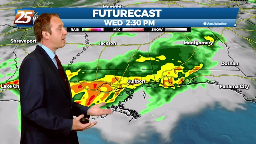
We have a "moderate" (level 4 of 5) severe threat inching into South MS during the overnight hours, leading to a stormy start to another day this week.
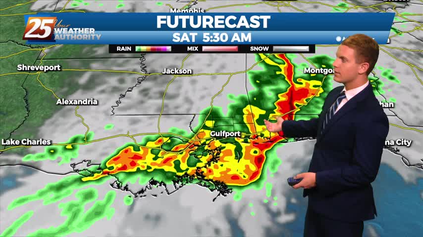
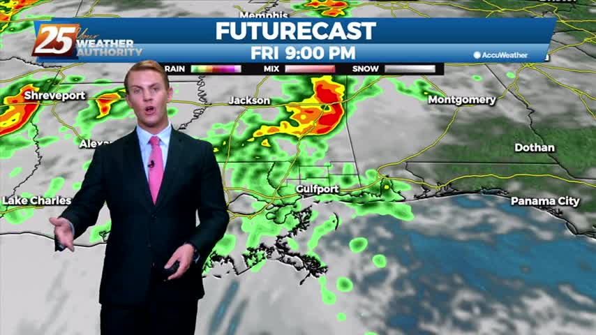
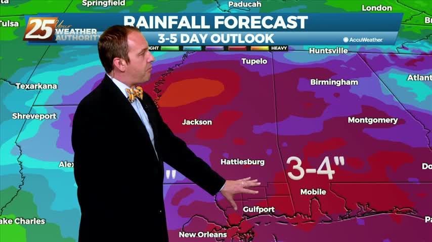
Scattered thunderstorms will be possible across the area through much of the day today, with the best chances along the coast. An active weather period is expected, culminating in a strong squall line sweeping through the area late Friday night…
Scattered thunderstorms will be possible across the area through much of the day today, with the best chances along the coast. An active weather period is expected, culminating in a strong squall line sweeping through the area late Friday night…
Quite a wild turn-around today as we began with tornadoes and lightning, but ended calm and sunny with another quick turn-around on the way.
Early this morning, a line of storms prompted several severe thunderstorm warnings and a few tornado warnings issued as well. Now things are a lot quieter with that system quickly moving off to the east. With the line of thunderstorms…
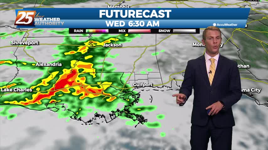
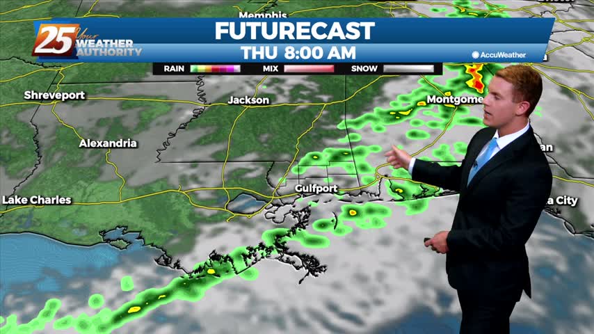
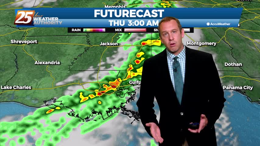
It has been several days since our last round of active weather, but that changes now as showers and storms move in quickly overnight.
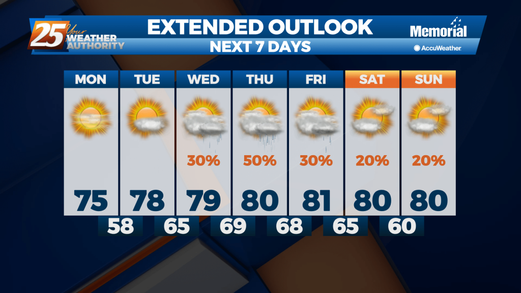
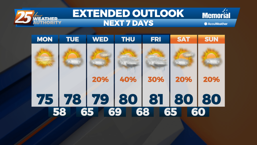
Highs today and Thursday will be in the upper 70s to lower 80s, with mid 70s at the beaches. Lows tonight will be mild due to increased moisture, ranging from the lower 60s inland to the mid 60s at the…
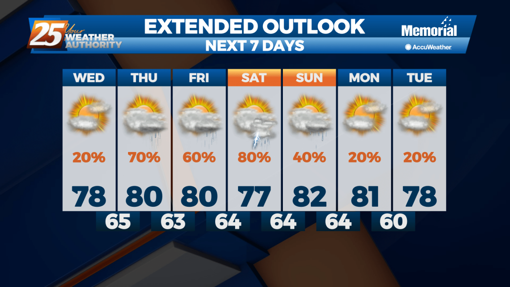
Highs today and Thursday will be in the upper 70s to lower 80s, with mid 70s at the beaches. Lows tonight will be mild due to increased moisture, ranging from the lower 60s inland to the mid 60s at the…
The humidity and temperature continue to rise, but we're rapidly approaching the limit as thunderstorms begin to build....
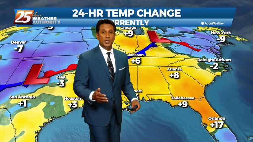
The high pressure that has been sitting over the Gulf Coast region for the last few days has begun to shift to the east, now being stretched from the northeastern Gulf over the southwestern Atlantic and as far north as…

The high pressure that has been sitting over the Gulf Coast region for the last few days has begun to shift to the east, now being stretched from the northeastern Gulf over the southwestern Atlantic and as far north as the Carolinas. A few showers may manage to develop over interior portions of South Mississippi […]
The weekend was sunny, dry, and mild, though it has continued to get warmer and more humid each day....
A large high pressure system is currently centered across the southeastern United States, giving us clear skies and dry conditions. This will result in cool nighttime temperatures and warm daytime temperatures. Highs on Monday will be in the mid and…
A large high pressure system is currently centered across the southeastern United States, giving us clear skies and dry conditions. This will result in cool nighttime temperatures and warm daytime temperatures. Highs on Monday will be in the mid and…
Cold front brought a chilly night last night and we're in for more of the same tonight, but then a significant warm-up begins.
Today will be slightly warmer than yesterday and temperatures will range from the upper 50s well inland to the lower 60s along the coast. After Friday, high pressure will continue to build in and stall over us, giving us dry…

Drastically different from the last few nights as cold, dry air moves in and frost is likely later tonight....
Much colder and drier air continues to flow into the region during the period in the wake of a cold front. Dry conditions continue through Friday as a large dome of cool high pressure builds into the eastern states. A…

A front has finally moved in and and will push through, bringing cooler and drier air...an event we haven't seen much of over the last few weeks.
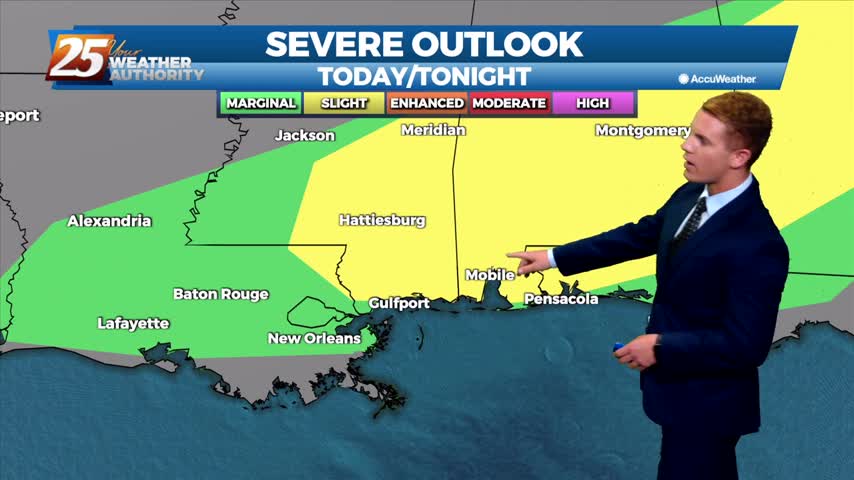
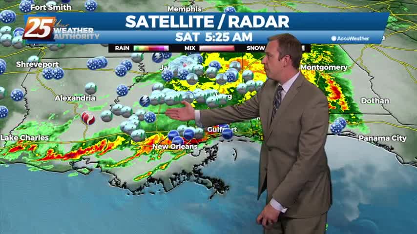
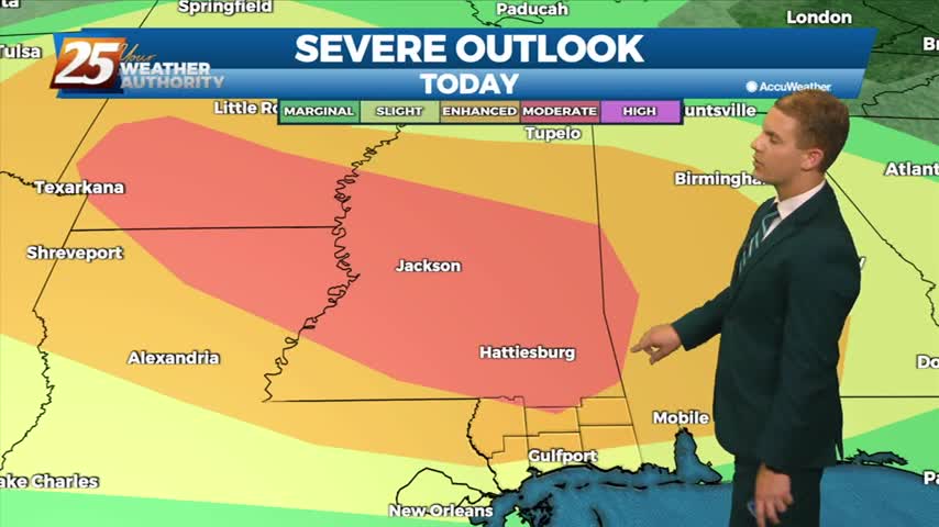
The latest Storm Prediction Center outlook has our area at a Slight Risk for most Southeast Louisiana parishes and Mississippi coastal counties. There is a Marginal Risk for all other locations in our viewing area for severe weather today. The…