10/11 Ryan's "Still Humid" Monday Night Forecast
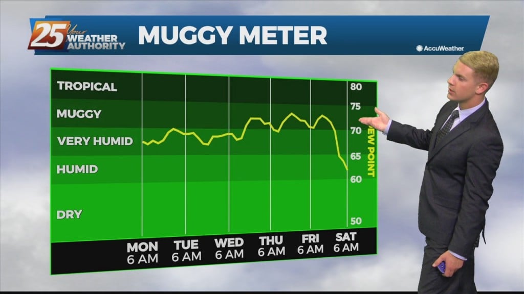
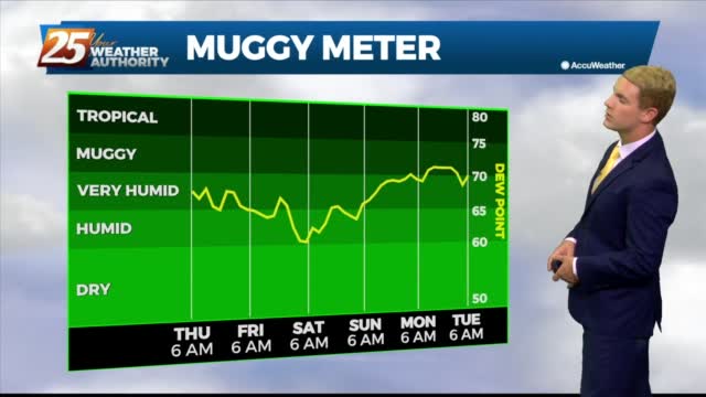
Last weekend ended on a slightly less humid note, but more muggy air is on the way. Like the increase over the weekend though it'll be a slow…
Last weekend ended on a slightly less humid note, but more muggy air is on the way. Like the increase over the weekend though it'll be a slow…
Last weekend ended on a slightly less humid note, but more muggy air is on the way. Like the increase over the weekend though it'll be a slow build,…
High-pressure is expect to pretty much remain in place through the short range portion of the forecast. An approaching cold front to the NW will slowly move E/NE and ride north of the Hattiesburg area. By late Tuesday through Wednesday…
Upper level high-pressure is expect to pretty much remain in place through the short range portion of the forecast. An approaching cold front to the NW will slowly move E/NE and ride north of the Hattiesburg area. By late Tuesday…
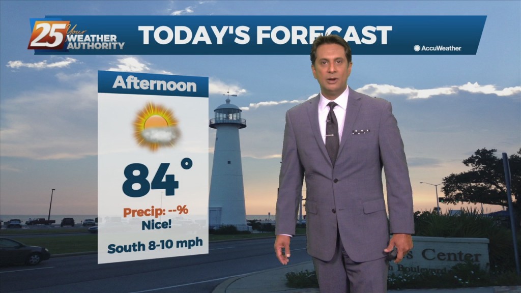
Highs Monday afternoon will then be similar to today, in the mid to upper 80s. Overall, enjoy the mostly clear skies and dry weather. A dry airmass underneath high pressure will allow for a continued dry forecast Tuesday and Wednesday…
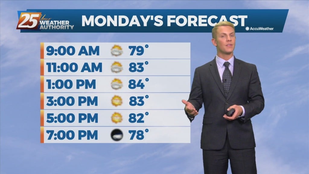
Highs Monday afternoon will then be similar to today, in the mid to upper 80s. Overall, enjoy the mostly clear skies and dry weather. A dry airmass underneath high pressure will allow for a continued dry forecast Tuesday and Wednesday…
Expect another sunny day tomorrow afternoon, but also our coolest start of the week as well. Otherwise, don’t expect any big changes, and tomorrow afternoon will likely even warm…

Expect peak sun content tomorrow afternoon, but things will finally start cooling off soon. Don't expect any big changes, and tomorrow afternoon will likely even warm a degree…

High-pressure NW will slowly move SE into the region this weekend. This will keep dry weather and lower humidity over the forecast area, although humidity levels/dew-points will be coming up slightly on Sunday to more muggy readings. Diurnal temperatures…
The persistent mid/upper low-pressure over the mid-Mississippi Valley will finally lift northeast to the Great Lakes region through tonight. This will be replaced by an upper level high-pressure building in from the southern plains into the Gulf Coast region. Surface…

Pretty hot today but it didn't feel too bad thanks to slightly drier air. Only in the short term though. Drier, warmer air from the Southwest is moving…
Feels pretty hot out there for October already, and even hotter days are on the way. Only in the short term though. Drier, warmer air from the Southwest is…
Dry, sunny weather has finally arrived! High pressure will quickly replace the loitering low that has plagued us for the better part of this week. Dry northwesterly flow will filter in much drier air into the area allowing for rain…
High-pressure moving into the region along with a much drier air mass will dominate the forecast through the weekend. This will bring skies clear, and winds on the light side. A change from yesterday with model guidance now showing the disturbance…
Dry, sunny weather has finally arrived! High pressure will quickly replace the loitering low that has plagued us for the better part of this week. Dry northwesterly flow will filter in much drier air into the area allowing for rain…
We saw more blue skies today and will see even more in the days ahead, but we're still going to be in for more morning fog. This air…
We saw more blue skies today and will see even more in the days ahead as drier air takes hold. This air won't be much drier at the…
As we fall back into a drier regime, a more October like pattern should show itself. But with no good cold fronts moving through at least through Friday, conditions won't change much but also shouldn't be too uncomfortable. As the…
Moisture flow will continue to fall off over the next few days. As we fall back into a drier regime, a more October like pattern should show itself. But with no good cold fronts moving through at least through Friday,…
Temperatures will not change much over the next few days while this low pressure system moves out of the area. There will be plenty of sunshine for most of our area, so high temperatures will still be in the mid-…

We’ll see only the slightest dip in the humidity in the days ahead, but much drier, more sunny days are coming. We saw some of that as…

We'll see only the slightest dip in the humidity in the days ahead, but much drier, more sunny days are coming. We saw some of that as early…
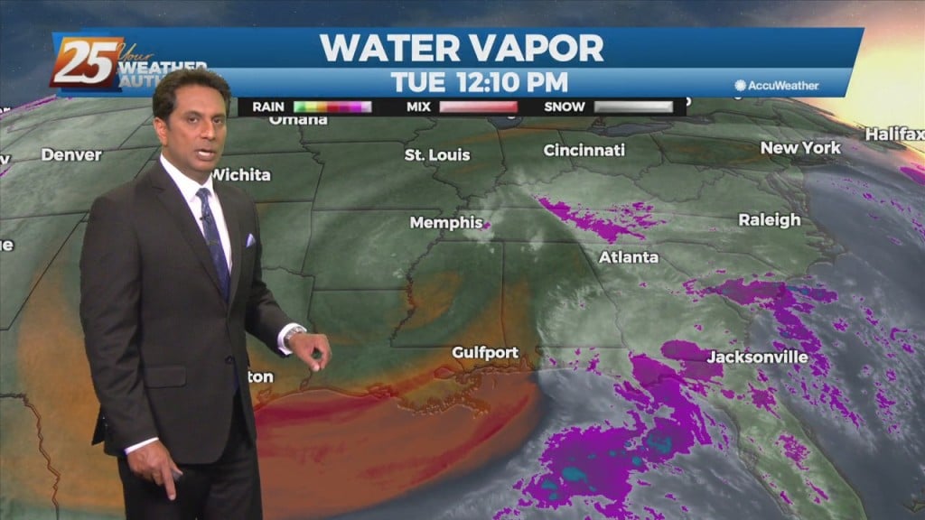
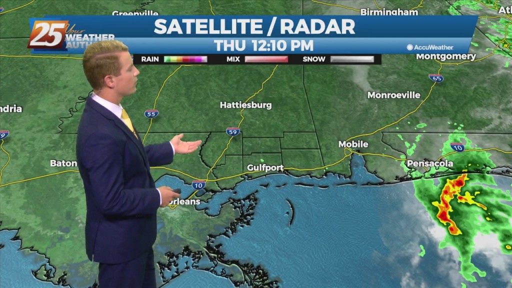
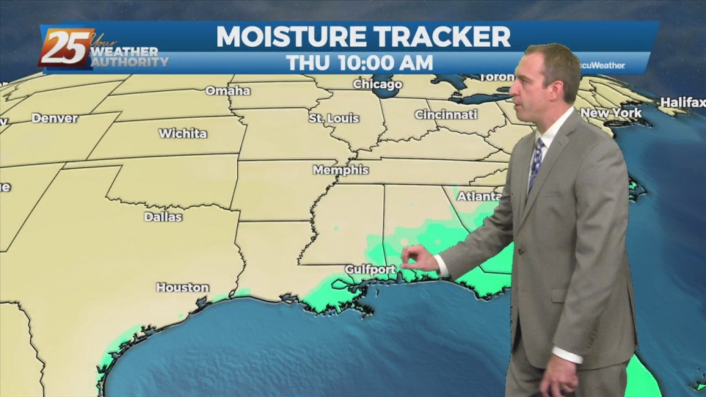
There is a marginal risk for excessive rainfall for the best chances of getting rainfall this afternoon over coastal Mississippi. This is all being brought about from an upper disturbance that extends from northern LA up into the northeast. The…
The main focus will be more toward rainfall rates and not as much on totals area wide. Rates could be around 2 to 3 inches per hour today and isolated areas could see 2 to 4 inches in a short…