5/24 - Rob Knight's "Wet Pattern Continues" Tuesday Morning Forecast
An upper level High-pressure remains off the Atlantic Coast with southwesterly upper flow across much of the southeast. Scattered showers and t-storms will taper off this…
An upper level High-pressure remains off the Atlantic Coast with southwesterly upper flow across much of the southeast. Scattered showers and t-storms will taper off this…
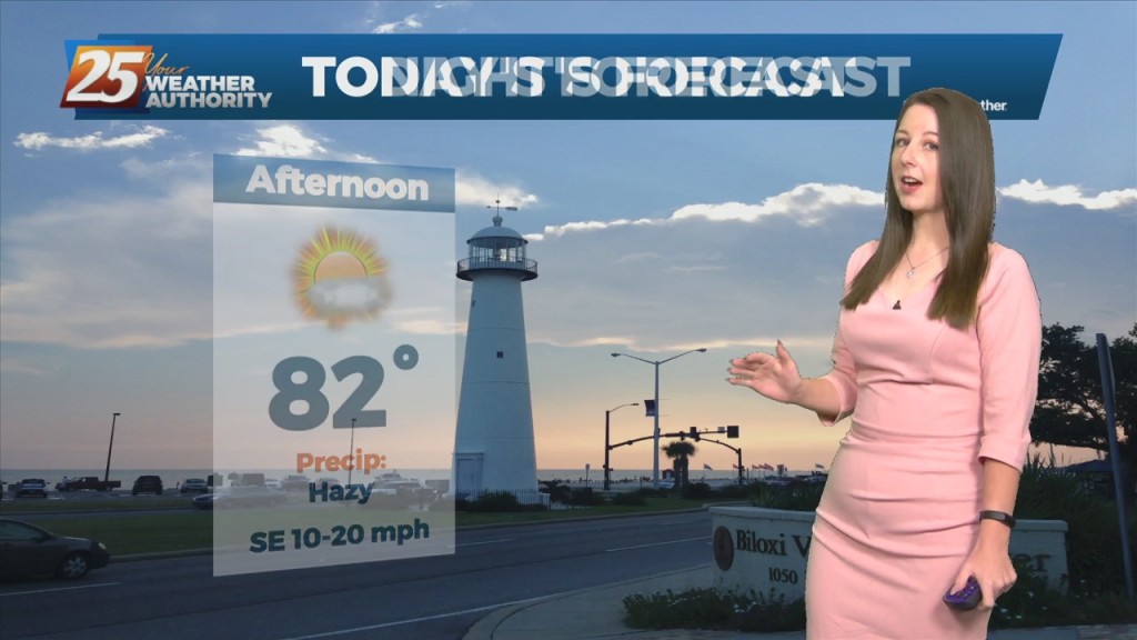
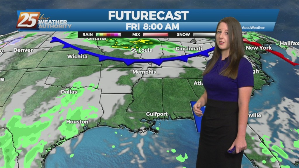
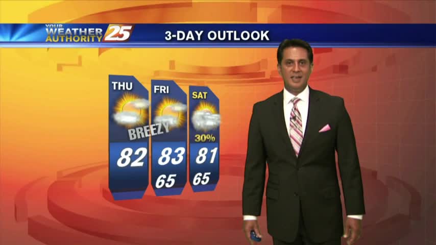
Today will be quiet, humid, and warm with HI readings mostly in the mid to upper 90s and a few 100s. Saturday the chance for rain will increase. Southwest…
An upper level ridge is building in and across the southeastern CONUS with the center passing across the CWA today. As a result, onshore flow becomes well established and…
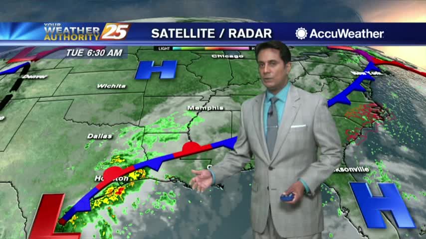
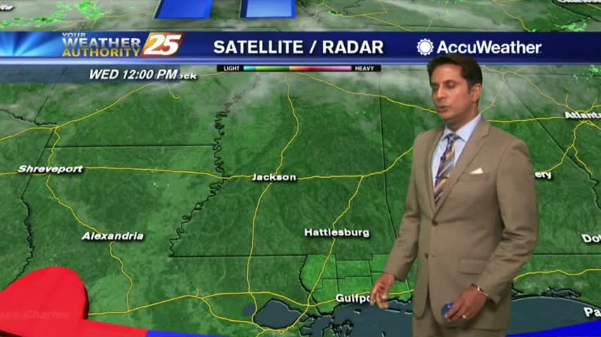
The disturbance that tried to bring showers to the region yesterday is quickly moving farther away from the area. As it does so, an upper level high-pressure will begin building in and across the southeastern CONUS today through Saturday. As…
Post front airmass continues to push in today as upper level high-pressure to the NW shapes the short term forecast. This will bring another below normal temperature day with…

Since February 2006, Bobby Edwards has been at the helm of WXXV as General Manager. Today, our staff bids farewell to the man who lead the way for…

Kevin Cuttill with Crusader For Veterans joined us in studio this afternoon to talk about his latest fundraiser for our neighbors in SE Louisiana hard hit by hurricane Ida. The group is taking donations Wednesday at the Juke Joint in…

Late Monday night a portion of Hwy 26 in George county collapsed leaving 2 dead, 10 injured with 3 dealing with life threatening injuries. Authorities are speculating the torrential rainfall from Hurricane Ida was to blame for the erosion that…
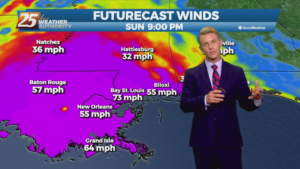
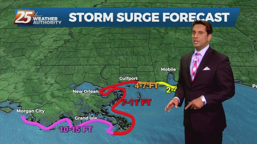
The NWS Doppler radar imagery and data from an Air Force Reserve Hurricane Hunter aircraft showed that Ida made landfall around 1655 UTC along the southeastern coast of Louisiana near Port Fourchon with estimated maximum winds of 130 kt and…
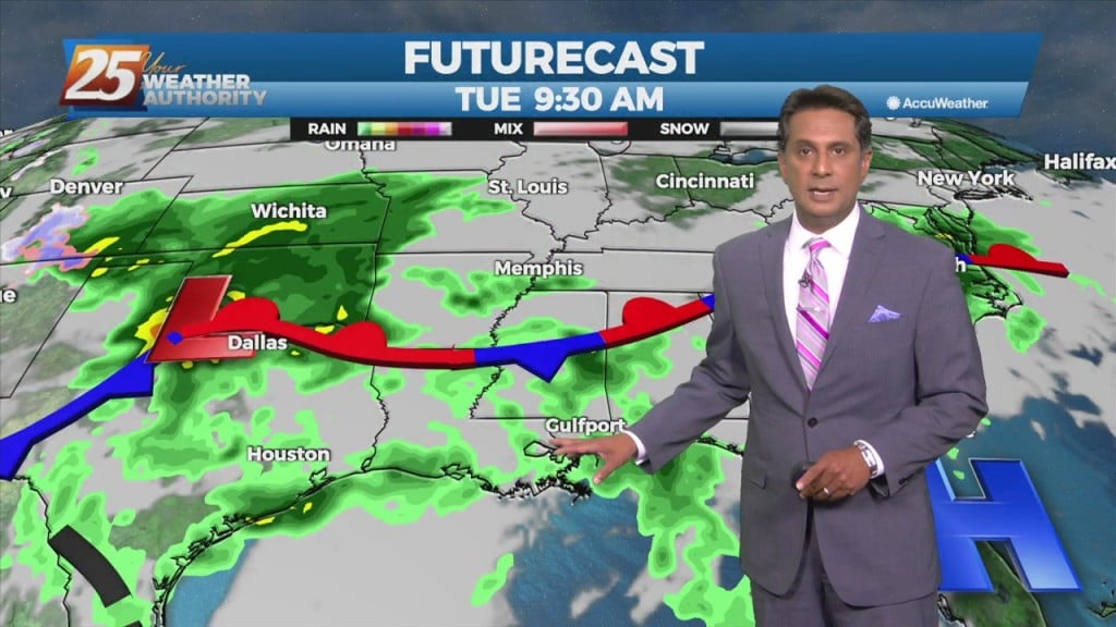
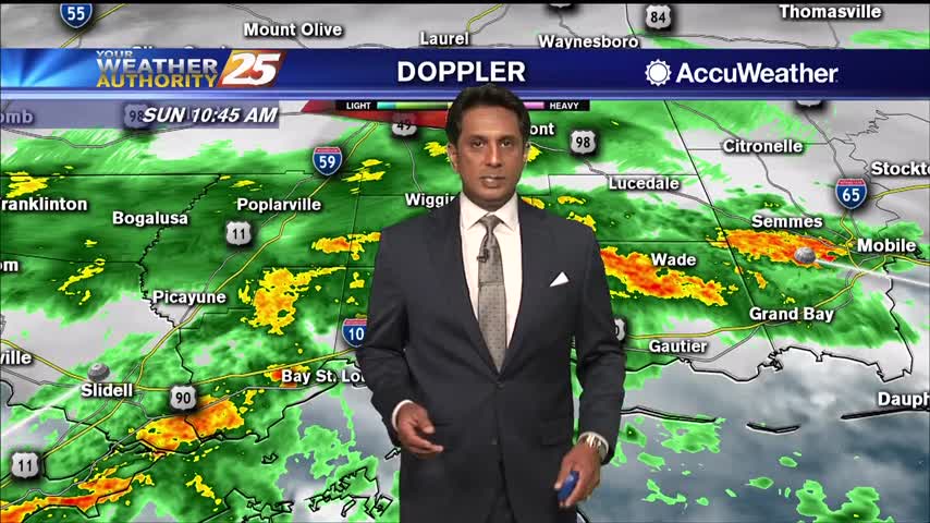
Periods of HEAVY RAIN and STRONG WINDS continue to move into the area...
Numerous areas in South Mississippi dealing with flash flooding and flooding along Hwy 90...
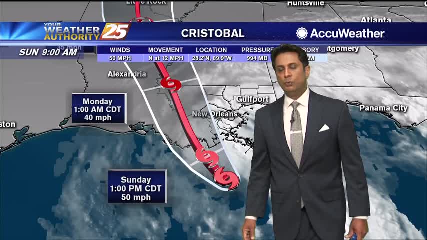
TS Cristobal continues to move closer to the SE Louisiana coast with landfall a bit earlier than projected...
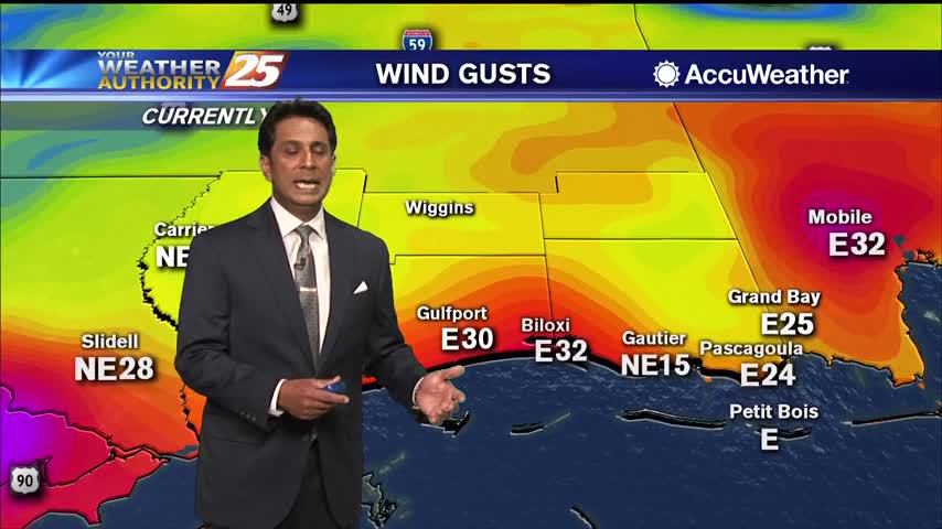
Feeder bands moving across south Mississippi bringing heavy rains and strong winds...
The weekend's storm system is well to the east with areas of patchy fog lingering along south Mississippi...
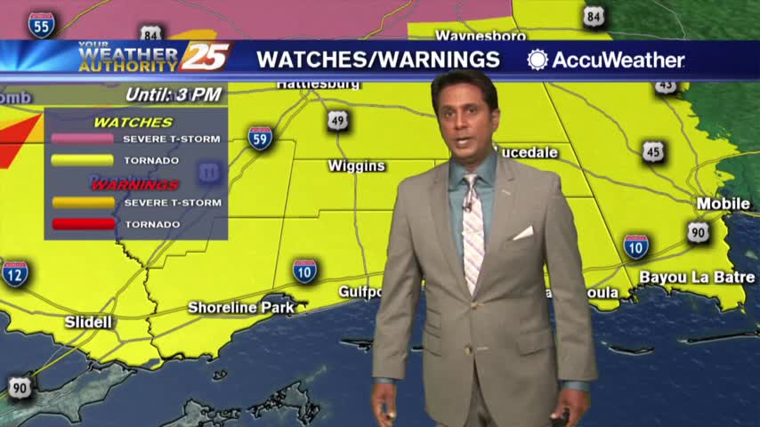
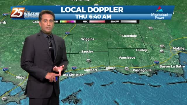
Isolated rain is now in the area as a TORNADO WATCH has been issued until 6 PM...
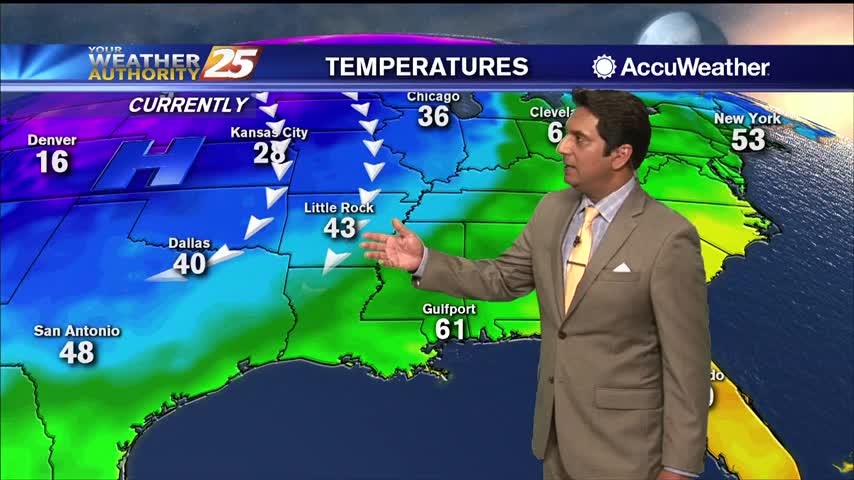
Major changes this morning with a colder/drier air mass moving into the region in the wake of yesterday's cold front...
Above seasonal temperatures continue with the mercury climbing into the 90s this afternoon...
Another wet start to the day with a line of showers and t-storms moving in from the Gulf...
In the wake of the cold front, mostly clear skies continue as drier air is moving into the region...

With a tropical wave in the NW'ter Gulf of Mexico, cloud coverage continues to move in from the south...
Upper level non-rain producing clouds continue to move across the region as temperatures warm into the 80s...
It's a COLD start with pleasant conditions ahead...FANTASTIC conditions for the parades this weekend...