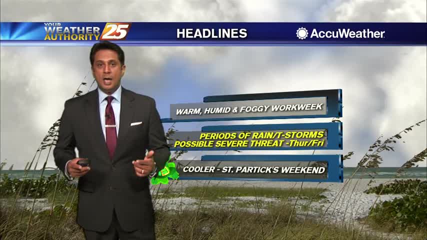
3/27 - Rob Knight's "Hump Day" Morning Forecast
Another cold start to the day with clear skies and a dry wind coming from the north...
Another cold start to the day with clear skies and a dry wind coming from the north...
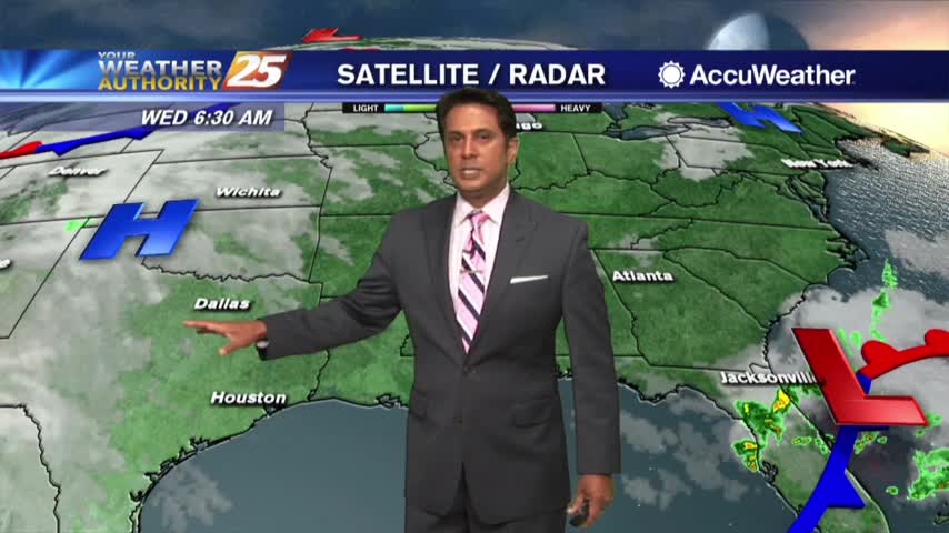
In the wake of lat night's cold front, it's a drier start to the day under clear skies...
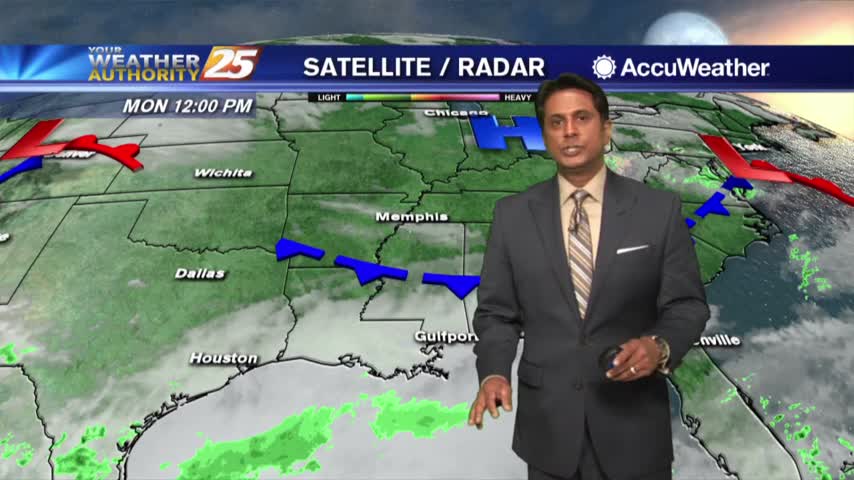
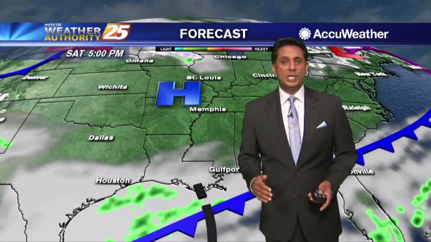
With a cold front NW of the area, it's a warmer and humid start to the workweek...
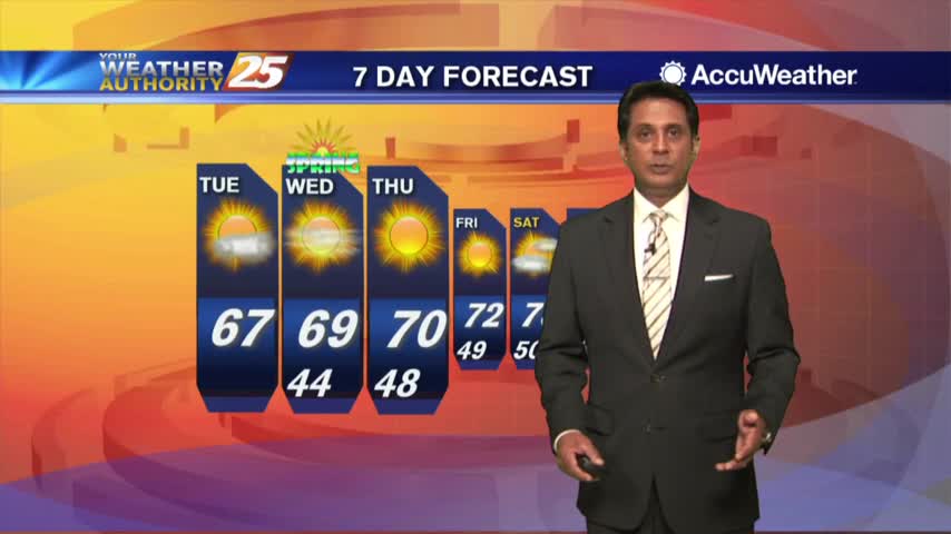
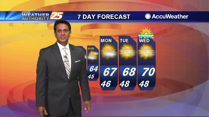
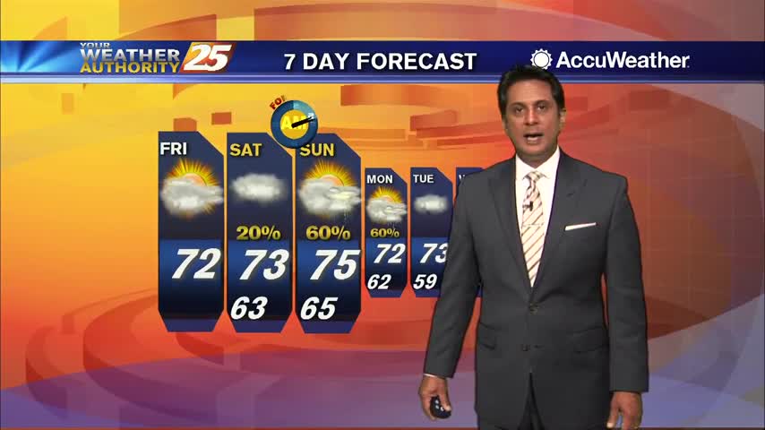
A lovely start to the day with cool temperatures and clear skies heading into the 1st weekend of Spring...
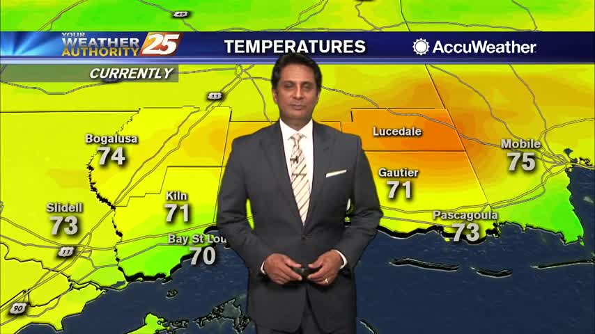
A few hours of a south wind yesterday afternoon is providing warmer temperatures this morning...
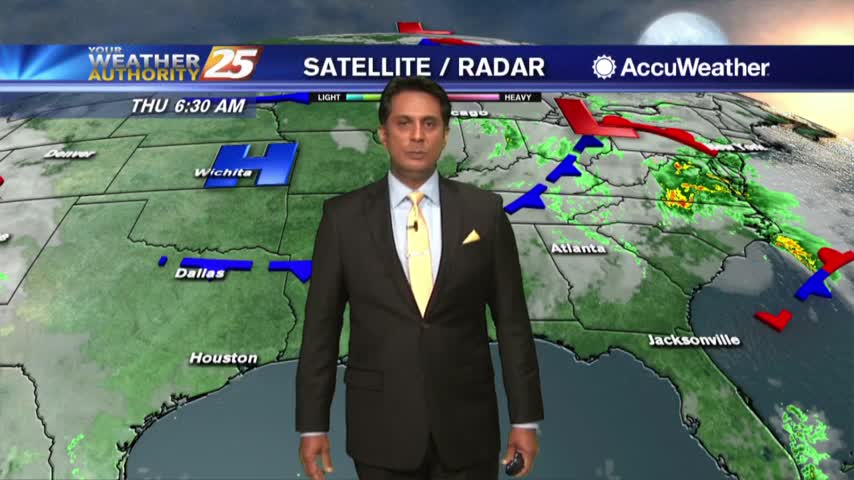
A cold and clear start to the final morning of winter with an area of high-pressure to our west...
A DRY front moved through last night with very low humidity and chilly temps through the state this morning...
Upper-level cloud continue as temperatures are slow to warm this afternoon...
A CHILLY start to the day with upper-level clouds from the SW moving into the area...
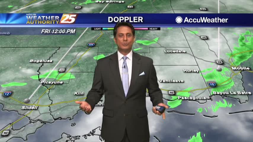
Rainfall from this morning has cleared the area to the east as clouds continue...
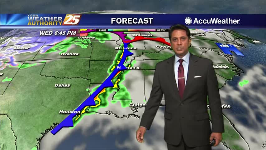
Isolated rain is moving across the area as the cold front is now to our east...
Winds tapered-off last night but still in the mid teens as the cold front has slowed down to our west...
Warm and humid conditions continue as we head into the afternoon along with a few showers on-tap...
A warmer start to the day with areas of light patchy fog as a warm front to our SW moves closer...
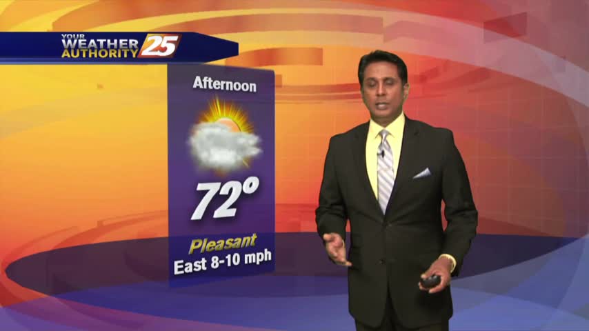
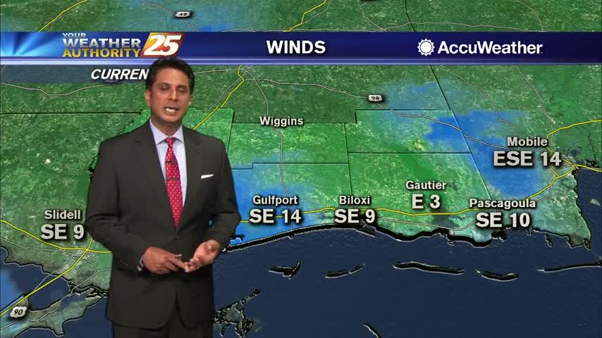
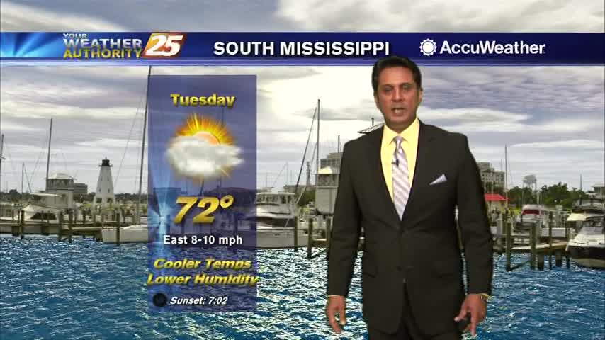
A mixture of sun and clouds will continue through this afternoon with a fairly dry easterly wind...
A MUCH better start to the day with a cooler/drier air mass in place...
DENSE FOG from earlier this morning continues to affect a few areas along the coastal counties...
A very warm and humid start to the day with spotty rain and DENSE FOG...
A southerly flow has a warm and humid air mass moving in from the Gulf...
A warm and humid start to the day with an area of high-pressure to our east...
Another CHILLY start to the day but the warm-up will begin later this afternoon...
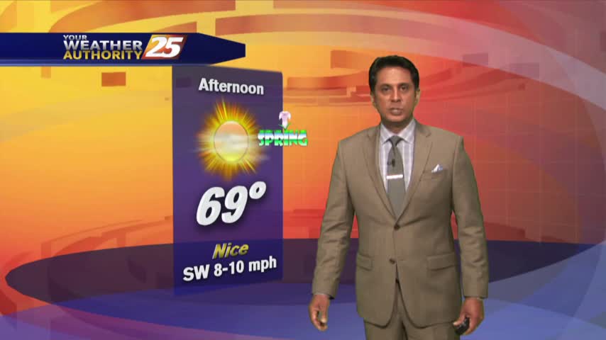
It has turned out to be a BEAUTIFUL afternoon...
With an area of high-pressure closer to the area, a north wind continues to bring frigid temperatures to start off the day...
With an area of high-pressure to our NW...a cold dry winds has FRIGID temperatures to start off Mardi Gras...