7/12 - Rob's Friday Morning "TS BARRY" Update Forecast
A warm, humid and cloudy start with isolated showers moving in from the SW...
A warm, humid and cloudy start with isolated showers moving in from the SW...
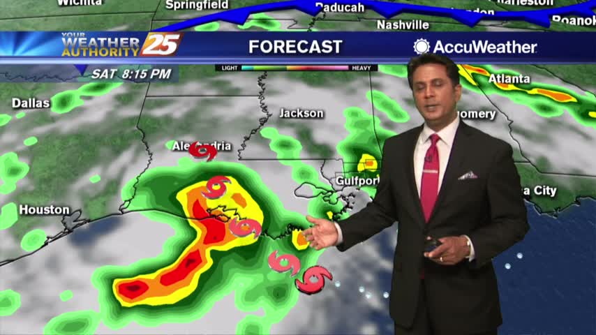
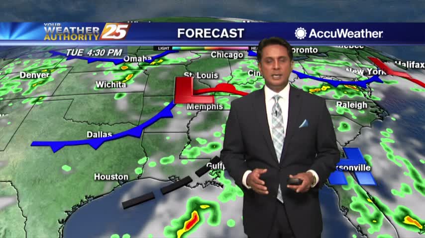
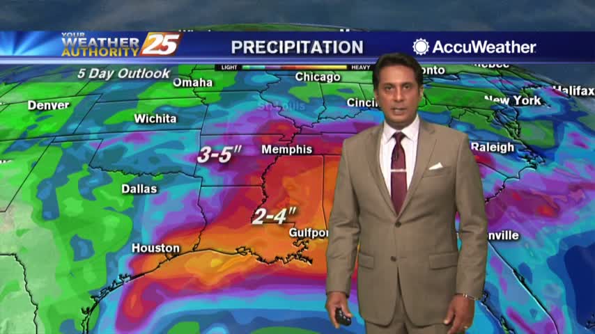
As of 10 a.m. this morning, the area of low pressure in the north-central Gulf of Mexico has been upgraded to TROPICAL STORM BARRY...

A cloudy start to the day as potential tropical cyclone #2 continues to develop roughly 200 miles south of Mobile bay...
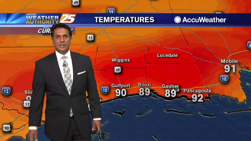
The mercury continues to rise as the heat index has surpassed the century mark...

A very warn start to the day with hot temperatures this weekend as the heat index will be between 103-115 degrees...

A very warm start to the day with a few upper-level clouds moving in from the west...
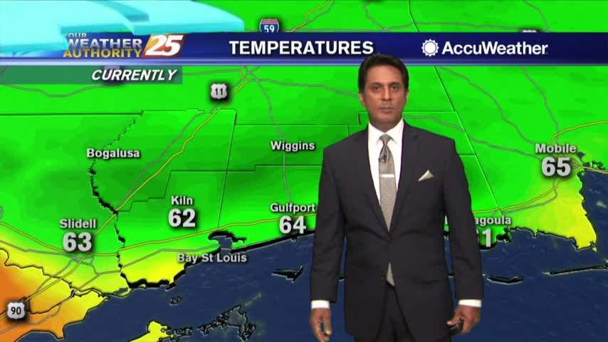
A north wind this morning has bough very pleasant conditions to south Mississippi under sunny skies...

A slightly cooler start to the day due to yesterday afternoon/evening t-storm activity...

High-pressure closer to the area is providing much more sunshine and HOTTER temperatures...
After a warm and humid start under cloudy skies, the sun is beginning to shine through...

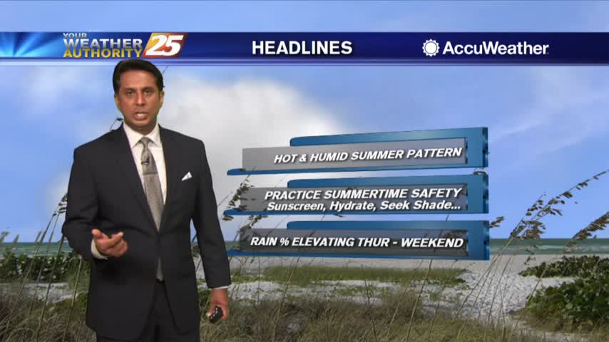
A VERY HOT & HUMID start to Summer with a HEAT ADVISORY in effect...
The low humidity from last week is out of the area as a typical Summertime pattern returns...
A beautiful start again with low humidity and cooler air, but changes will occur...
Another amazing morning with lower humidity as a reinforcing cold front is now to our east...
Upper-level clouds moving across the area will thin over the next few hours...
Cool temperatures and lower humidity as you head out the door this morning...

A pleasant start to the day with a cold front east and a less humid air mass through the viewing area...

A warm start to the day with a rare late spring cold front approaching from the west...

A rain-free start to the day under cloud coverage, but the activity will increase later today...
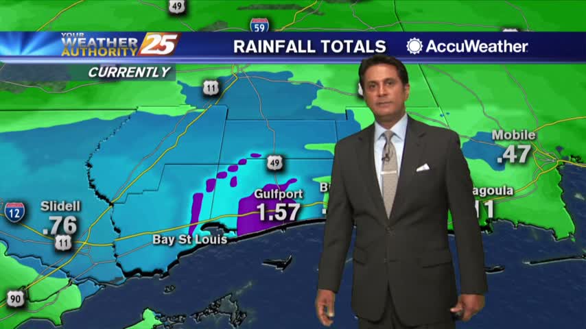
Another wet start to the day with HEAVIER RAIN expected later today...
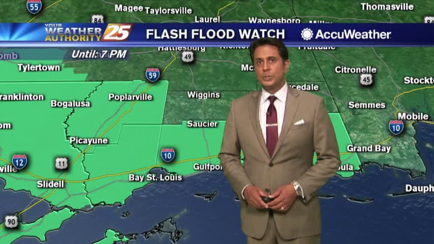
Showers/T-Storms continue to develop and move in from the SW, A FLASH FLOOD Watch is in effect...
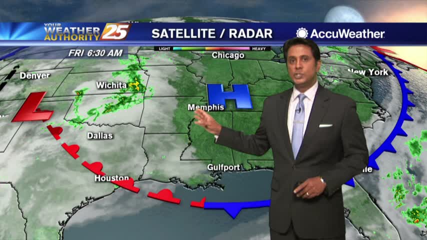
Major changes have occurred with the pattern and this morning rain is moving in from the SW...

Another warm and humid start to the day with thin upper-level clouds moving across the area...

A very warm start to the day with a weak/dry cold front to our north...