6/17 – Rob Knight’s “”Summer Pattern” Morning Forecast
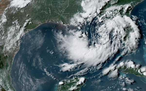
Surface high-pressure will remain in control of the weather today as a minor disturbance will move from west-east across the region Tuesday. A short wave near the Texas/Louisiana border has provided enough focus for convection across the west/central Louisiana…with the activity moving into the NW’tern Gulf of Mexico.
The stronger disturbance should move through early Tuesday. Residual moisture will linger and additional minor bits of energy may move through and interact with moisture. We will maintain a good chance of convection over the region Tuesday and Wednesday. Cannot rule out gusty winds and heavy downpours will again be possible on Tuesday. Temps should be at least a degree or two cooler for the highs on Monday and Tuesday with the increase in convection. Daytime hating and moisture flow will bring a typical summertime pattern to the area as afternoon sea-breeze interaction will flare up showers & t-storms along the coast moving inland.


Leave a Reply