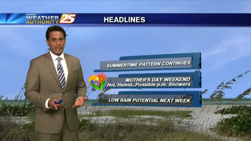
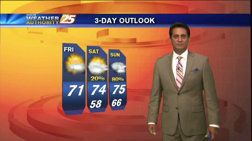
5/18 - Rob's Friday Afternoon/Weekend Forecast
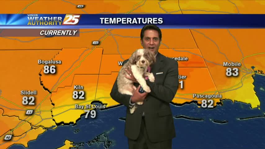
Isolated activity beginning to pop as temps warm into the upper 80s...
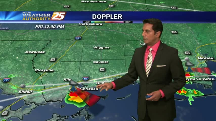
Isolated activity beginning to pop as temps warm into the upper 80s...
Overnight t-storms over the sound continue to move south, away from he area as drier air moves in...
Showers and t-storms beginning to pop in the local area due to intense daytime heating...
Another HUMID start after showers/t-storms yesterday afternoon/evening. Areas of patchy fog is along the Southern 6...
After a warm start, it's getting hot and humid with isolated showers/t-storms developing...
Isolated overnight activity continues to linger with areas of light patchy fog...

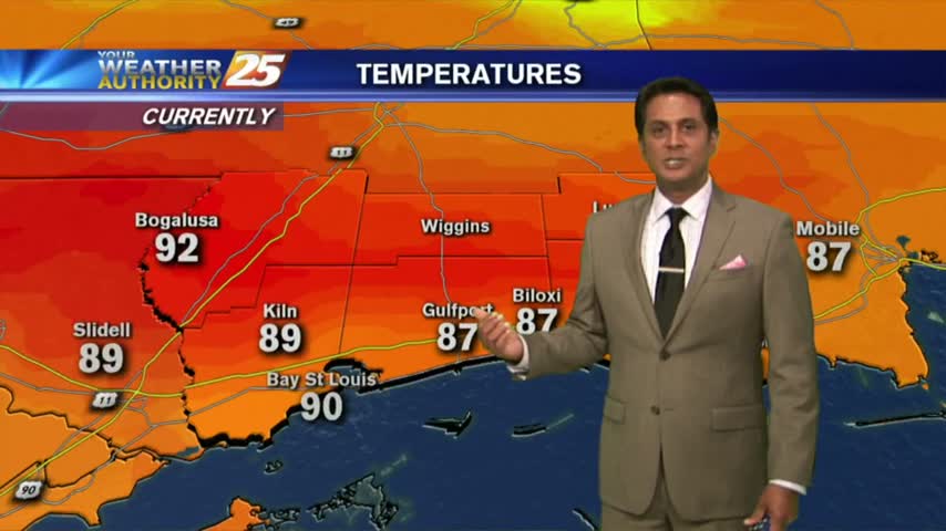
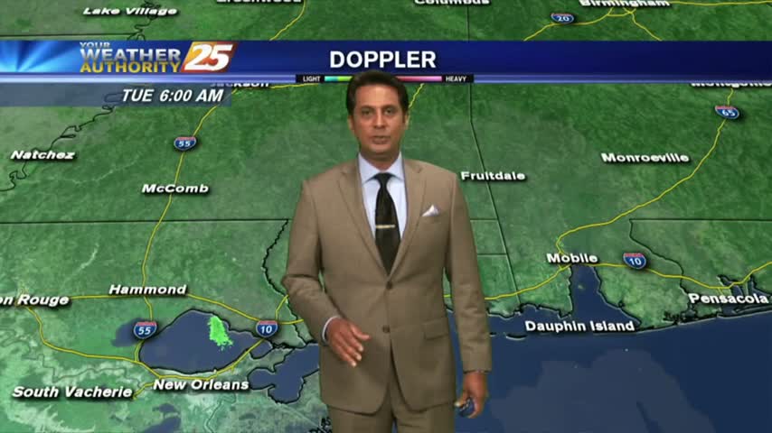
After record breaking temps yesterday afternoon, it's a very warm start for your Tuesday morning...
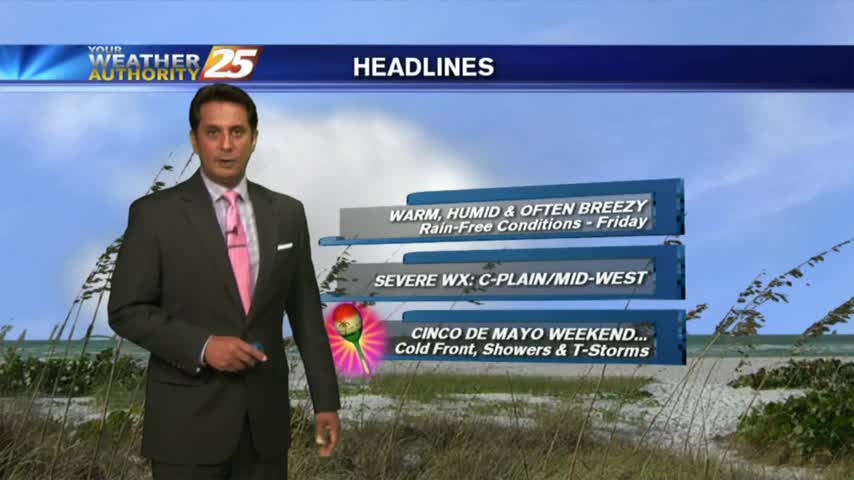
Heading into the weekend, temperatures warming into the mid/upper 80s feels HOTTER with the elevated humidity...
A HUMID start with areas of patchy fog east of Hwy 49...as we head into the Mother's Day weekend...
After a mild start to the day, the mercury is rising into the 80s along with elevating humidity...
Another warm start with the humidity poised to get very high as the return-flow from the GOM begins...
A mild start to the day as areas of light patchy fog is beginning to lift...

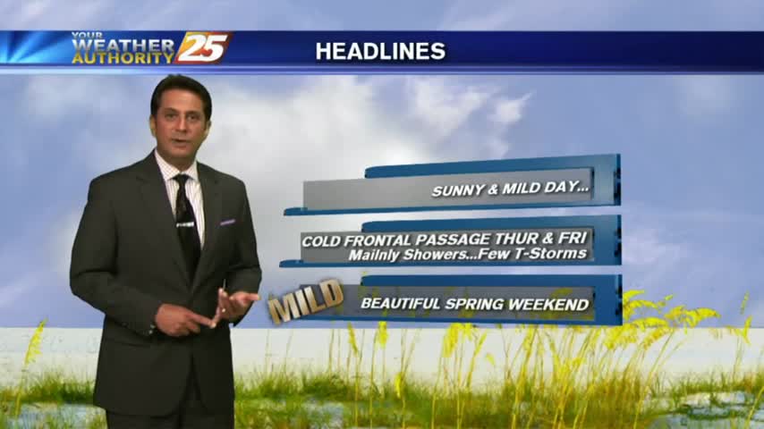
A dry start to the workweek with a cold front north poised to move through the area this evening...
Another mild and humid start with areas of patchy fog along the Southern 6 counties...
After a mild start to the day, temps continue to climb into the 80s with winds gusting into the 20 mph range...
A much warmer start to the day as an area of high-pressure continues to block the pattern...
Cloud coverage is moving in from the south and lowering in height, along with areas of patchy fog...
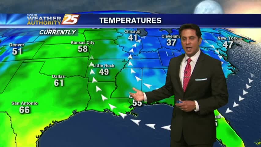
In the wake of Saturday night's dry cold front...its a cool start to your Monday with decreased humidity...
A chilly stat with a few clouds moving into the area along with another cold front...
After a clear start to the day, a few clouds are in the area along with temperatures warming nicely...
A clear & cool start to the day with changes ahead with an approaching cold front...
A cool start to the day with very shallow ground fog, the fog will be much worse tonight...
After a RAINY Sunday, an area of low-pressure in W'tern Tennessee will keep clouds in the area...
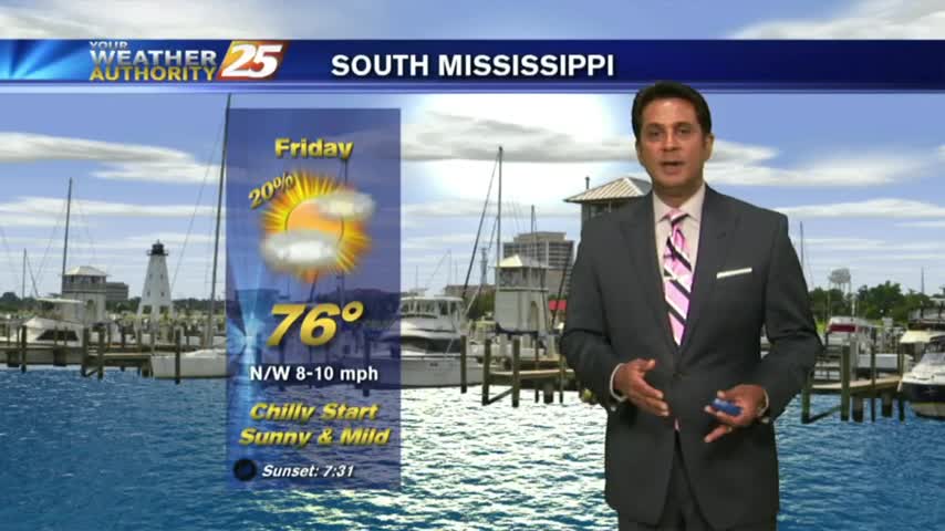
After a chilly morning, temperatures will top out around 70 degrees this afternoon...