8/31 - Rob Knight's "Hot & Humid" Midday News Forecast
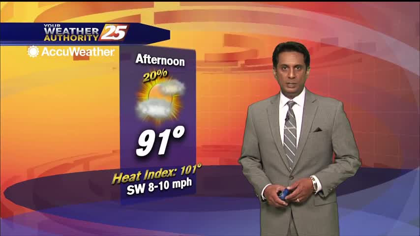
Hot temperatures heading into the final afternoon of August...
Hot temperatures heading into the final afternoon of August...
A mild start this morning with a rare summer cold front over the area...
A warm, and much more humid start to the day...
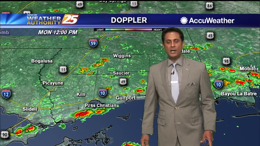
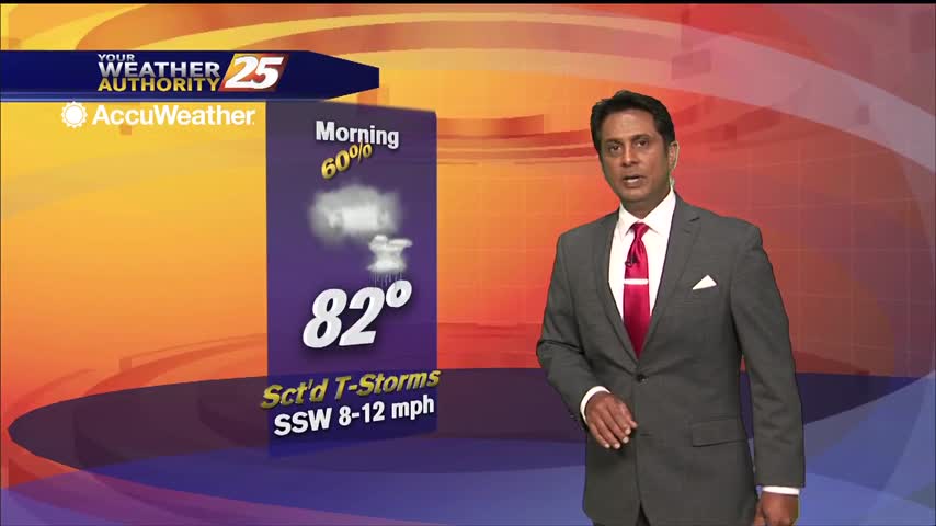
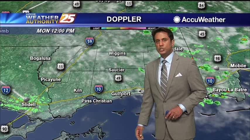
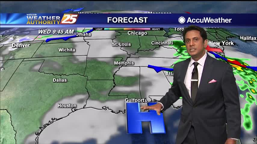
A wet start to the workweek with rain moving in from the SSE...
A warm and humid start with a few showers moving in from the S/SE...
A warm and muggy start with a few overnight showers/t-storms moving SE across the area...
A very humid start to the day with areas of patchy fog north of the interstate...
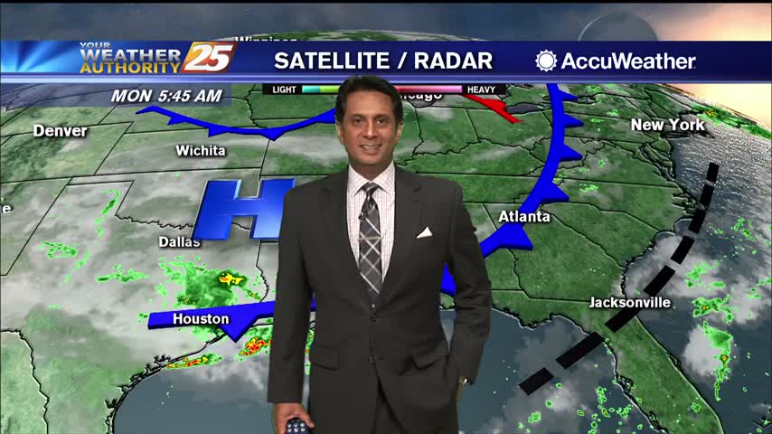
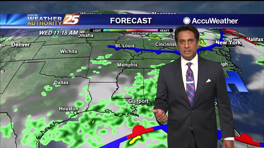
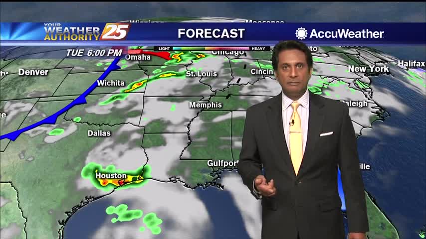
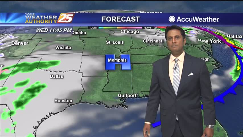
Rainfall is already moving into the area from the SW, with a wet pattern ahead...
A mild start under clear skies with areas of patchy fog inland...
A warm start to the day with slight lower overnight humidity than what we typically find...
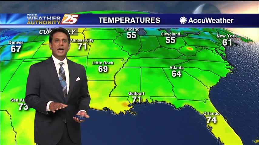
Rainfall has moved east with skies partially clearing this afternoon...
A nice mild start to the day with areas of light patchy fog...
After a lovely weekend, it's a chilly start with morning low temperatures in the /40s50s...
If you're commuting this morning, head up for areas of patchy fog especially inland...
After clearing skies yesterday afternoon, clouds have returned to the region...
A warm and humid start with areas of patchy fog affecting south Mississippi...
A cool start under mostly cloudy skies as winds begin to elevate...
A cloudy start this morning with spotty light rain moving NE...
A cloudy and mild Presidents' Day afternoon...
A cold start with a few upper clouds moving across south Mississippi and areas of light patchy fog inland...
After a CHILLY start to the day, the mercury is warming nicely into the 60s...

A mild start this morning with a warm front moving north through the N'tern Gulf of Mexico...
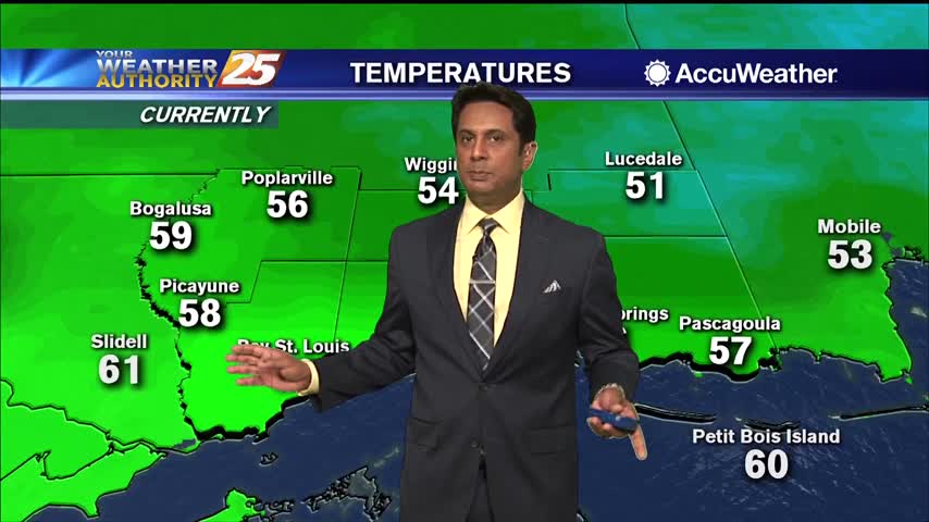
It's a humid start to the day with areas of patchy fog for your Monday morning commute...
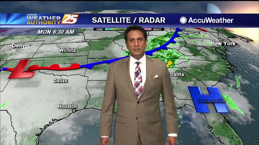
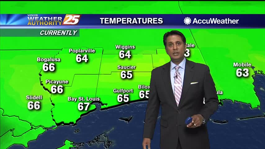
A nice start to the workweek with morning low temperatures in the mid/upper 60s heading out the door...