5/8 - The Chief's "Heat Indices In The 90s" Wednesday Afternoon Forecast
HOT...HUMID & BREEZY afternoon ahead... On Thursday a strong upper level disturbance will help send a cold front southward toward the region. During the…
HOT...HUMID & BREEZY afternoon ahead... On Thursday a strong upper level disturbance will help send a cold front southward toward the region. During the…
Now that the most violent weather has moved east, we will now work with the back side of the surface low-pressure that still wants to hang…
Anticipate multiple potential hazards in the first 24 hours of the forecast before the weather quiets down for a while. Low pressure over western Kansas this…
All eyes continue to focus upstream at the nontropical low pressure system across the western Gulf of Mexico. This feature will begin to strengthen as it…
Some weak convection has developed over the MS Sound and near the Pearl River this afternoon. This is likely in response to steel low level lapse rates/enhanced…
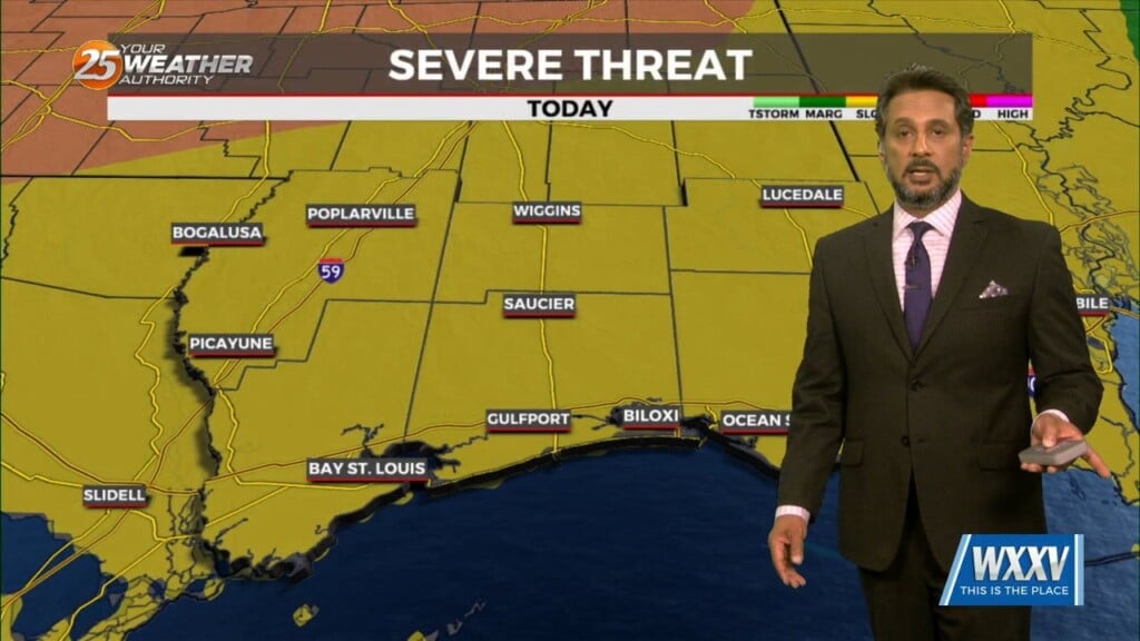
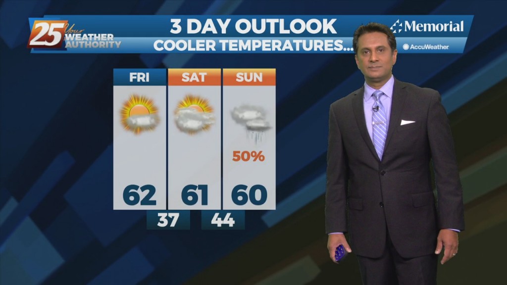
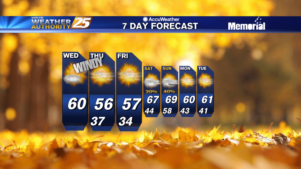
Today will bring clearing skies early this morning with windy conditions through today as high pressure settles in from the north. The biggest concern for the weekend…
Main forecast problem is rain chances tonight and then morning lows Saturday morning. Today was just another dreary day across much of the area thanks to the stalled boundary…
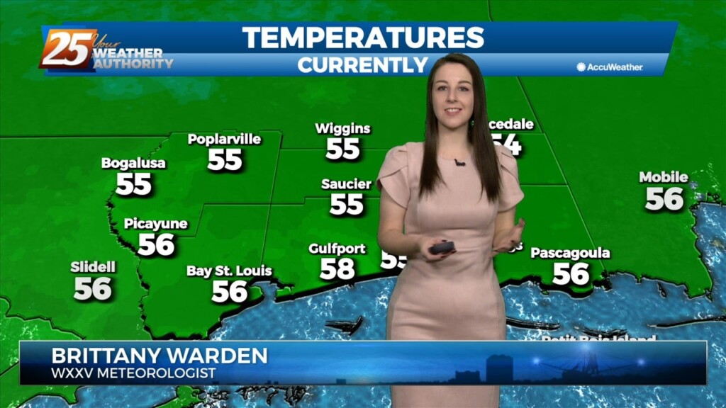
As the cold front exits stage right, we will see temps begin to fall this morning into the 40s and 50s by mid-morning. With strong…
This is the time frame that will be looked at the most. A warm front will lift out of the gulf and move over the area around noon…
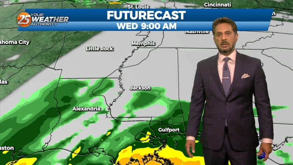
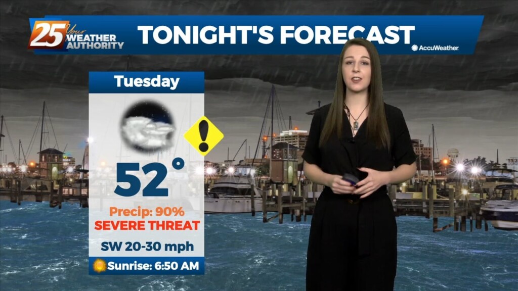
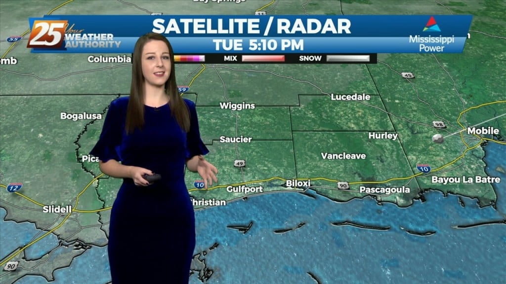
Bottom line up front...main concern for this forecast package will be with the storm system expected to impact the Gulf Coast Tuesday into Wednesday morning, with the…
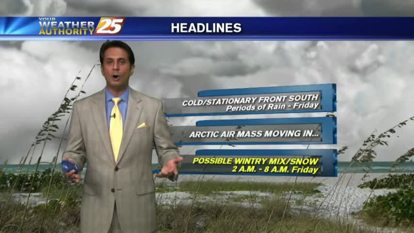
Strong high pressure will build into the region and usher in quite cold air for this time of year. Highs and lows will be 15+…
Weak cold front will blasts through the area this afternoon and evening, but the airmass is too dry to produce precipitation. Not anticipating any weather systems in…
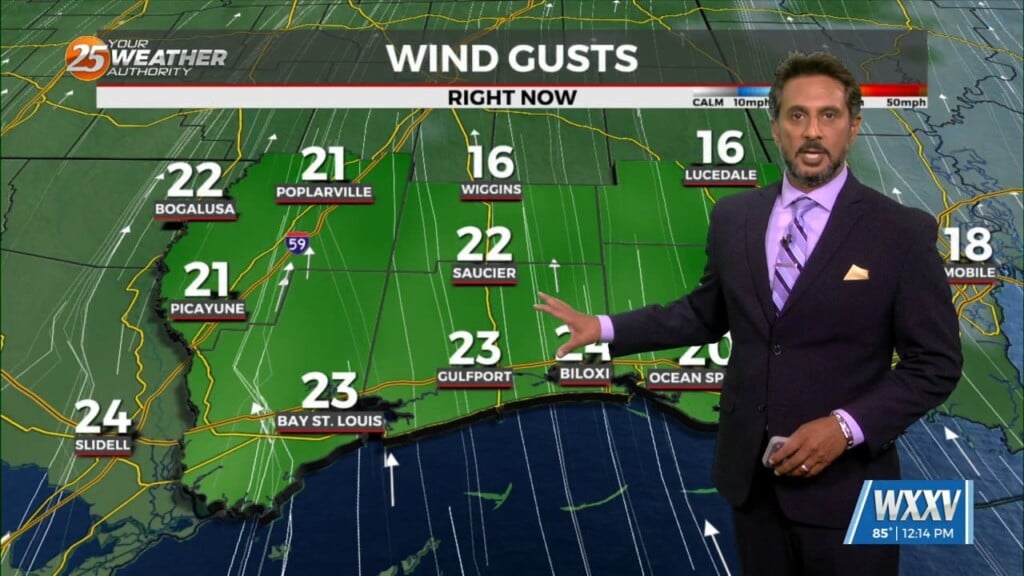
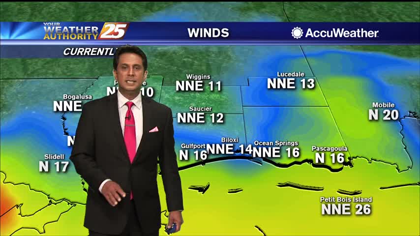
Winds are gusting to around 20 mph and will continue to stay elevated through this evening. The story for tonight will be the near freezing temperatures for areas…
As high-pressure begins to move in from the NW, skies will gradually clear...

SALLY continues to slowly move towards the Mississippi/Alabama coastline...
Skies have cleared as strong winds continue to affect the area...

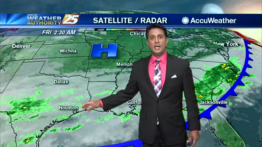
Rain with patchy dense fog continues through the area and much of the region...

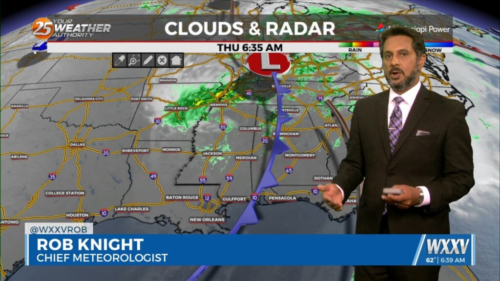
A swath or rain in central Mississippi is beginning to drift south into the area...
A cool, cloudy and windy start to the day in the wake of last nights cold front...
As the first batch of rainfall move to the NE, VERY WINDY CONDITIONS continue to affect the viewing area...
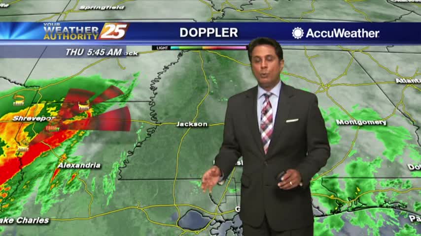
Light rainfall has been moving in from the SW, with heavier activity expected later this afternoon...
After a cloudy morning with light rain, the heavier activity is beginning to move in from our SW...
Rain has ended as the cold front is now to the east of our area, with improving sky conditions expected through today...
The HEAVIER activity has moved east with light rain linger through the viewing area...along with COLD TEMPS and WINDY CONDITIONS...