9/6 - Rob Knight's Friday Morning "HOT" Forecast
A warm start to the day under clear skies with slightly lower humidity...
A warm start to the day under clear skies with slightly lower humidity...

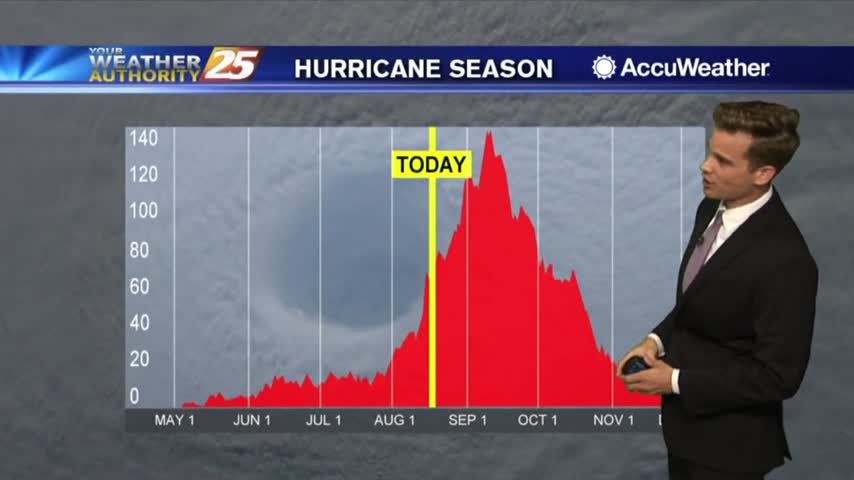
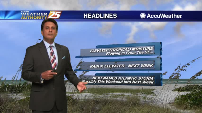
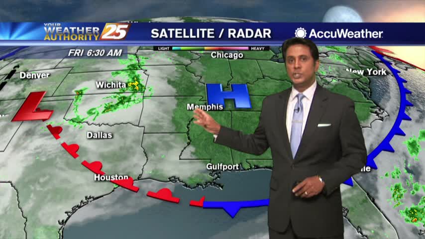
Hurricane Dorian is currently a CAT2 hurricane located about 260 miles ENE of the SE/tern Bahamas...
Another warm and humid start to the day under partly/mostly cloudy skies as showers/t-storms moving in from the SW...

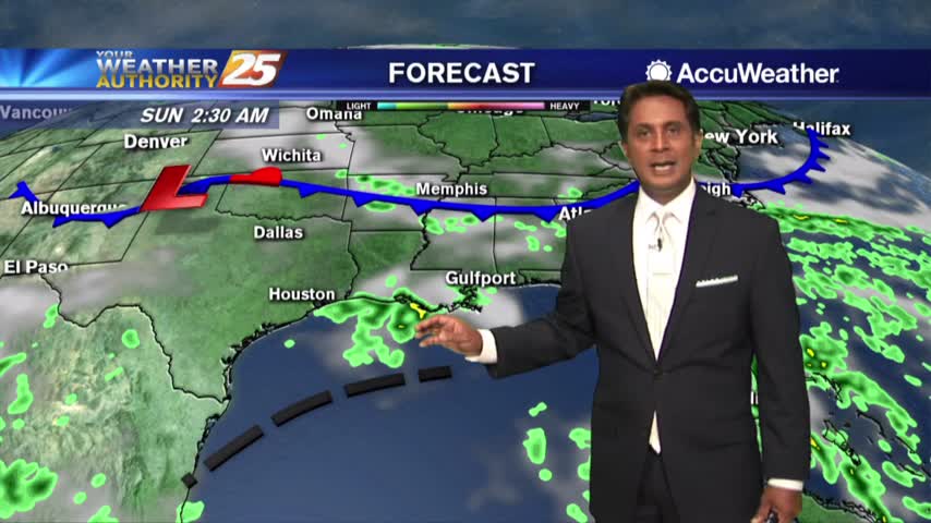
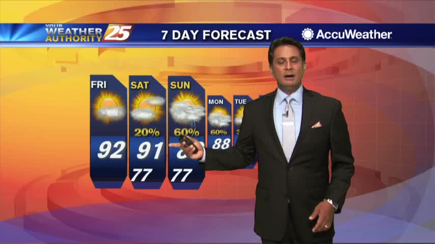
Rain chances still look likely as we head into the weekend as tropical moisture heads our way
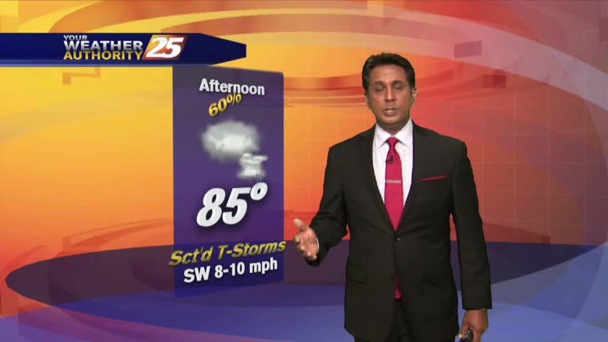
More downpours this afternoon and into the weekend
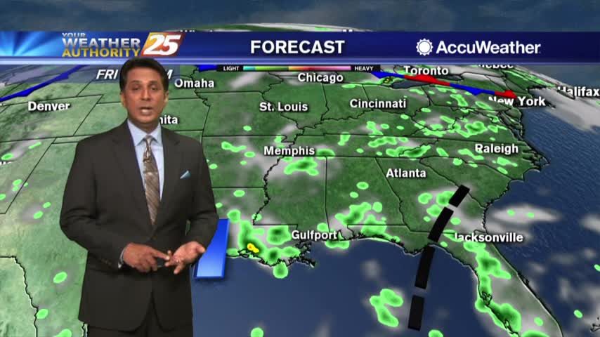
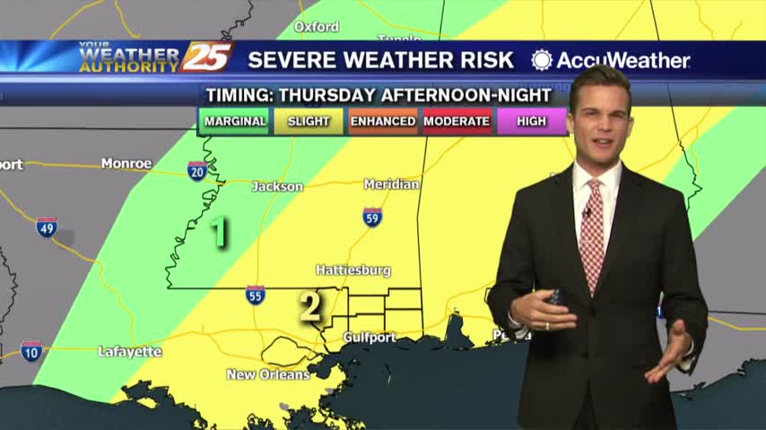
Rain chances on the rise this weekend and the latest on the tropics
After a clear start to the day, a few clouds have developed along with VERY HIGH heat index values...
A rain-free start to the day with warm and humid conditions heading out the door...
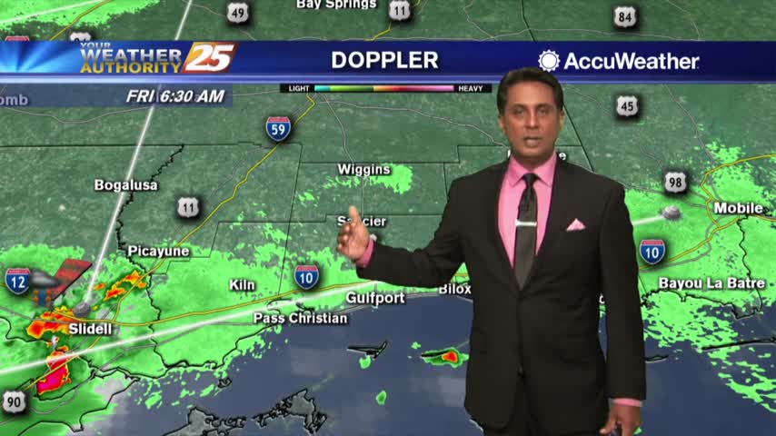
A HUMID start to the day with spotty rain/t-storms develop along the coast and south...
Warming temperatures with isolated showers/t-storms beginning to pop across the viewing area...
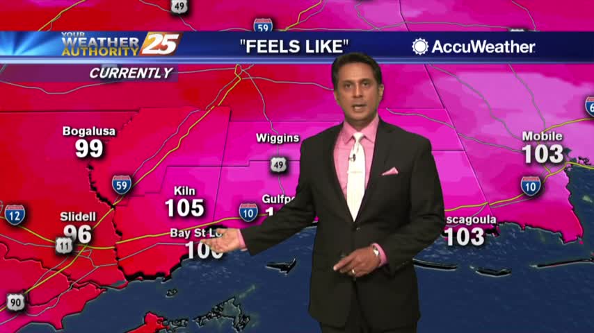
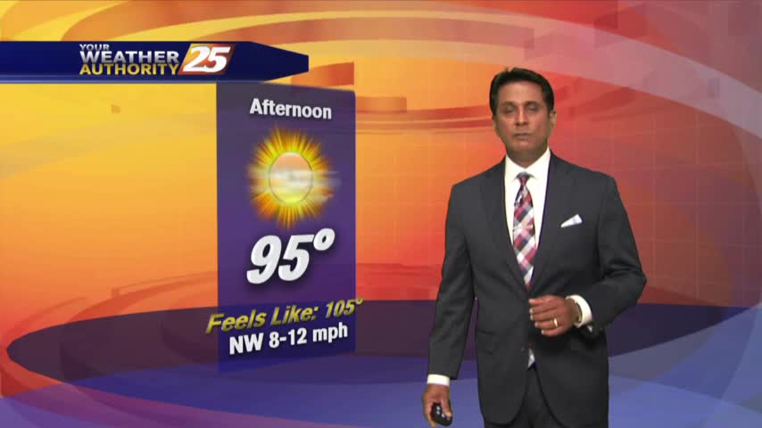
HOT temperatures this afternoon as the HEAT INDEX will average 104 degrees, please be safe...
The mercury continues to rise as the heat index has surpassed the century mark...
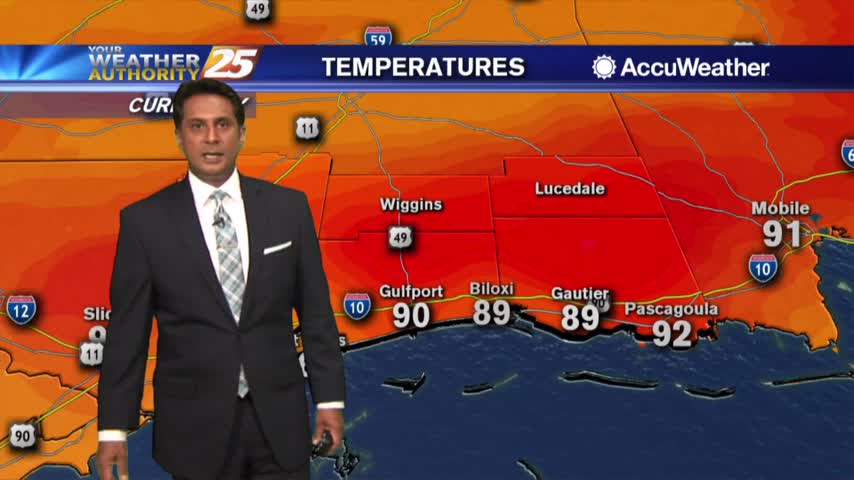
Temperatures are soaring into the low/mid 90s but the HEAT INDEX is making it feel like the low 100s...
A north wind this morning has bough very pleasant conditions to south Mississippi under sunny skies...
A slightly cooler start to the day due to yesterday afternoon/evening t-storm activity...
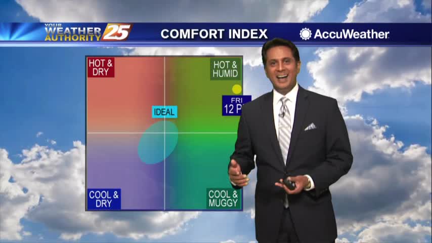
Subsidence was quite strong yesterday and will likely keep convection from becoming numerous today…but rain potential will be slightly higher.

6/14 - Rob's Father's Day Weekend Forecast
A beautiful start again with low humidity and cooler air, but changes will occur...
It's getting VERY HOT as we head into the afternoon...
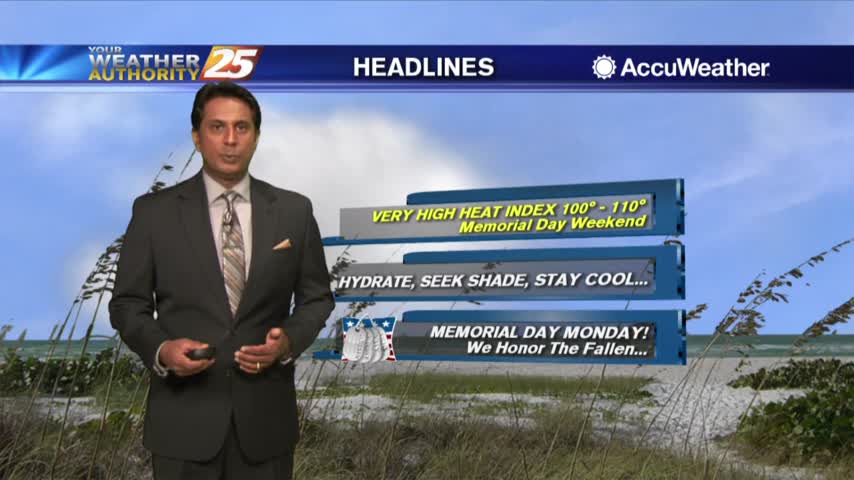
A warm & humid start heading into the Memorial Day weekend, with areas of patchy fog...
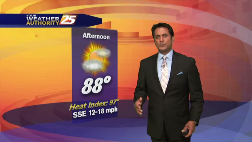
Temps continue to climb into the mid/upper 80s as the HEAT INDICES are in the 90s...
Soak up the sunshine! Rain chances this weekend.
Rain possible this weekend...90s next week?
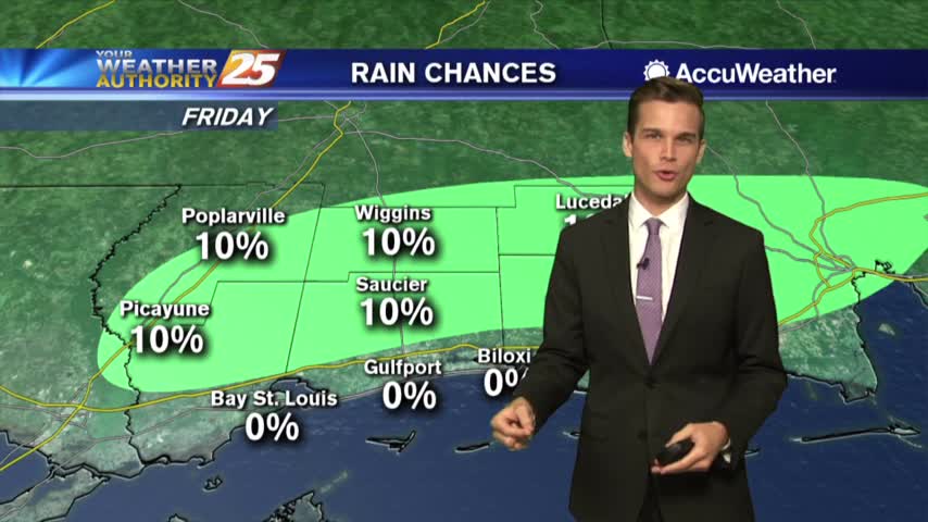
Mainly dry Friday, but t-storms possible on Saturday.