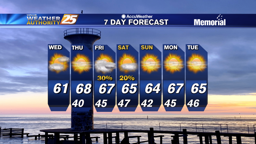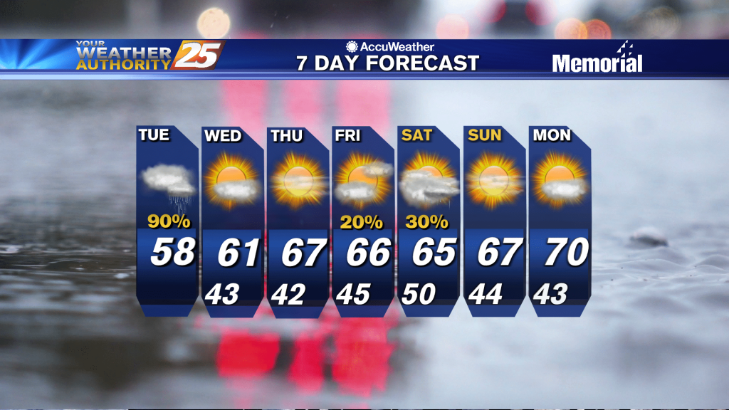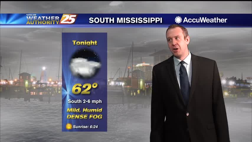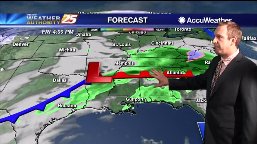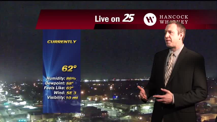
03/14 – Brantly's "Cloudy and Humid" Sunday Night Forecast
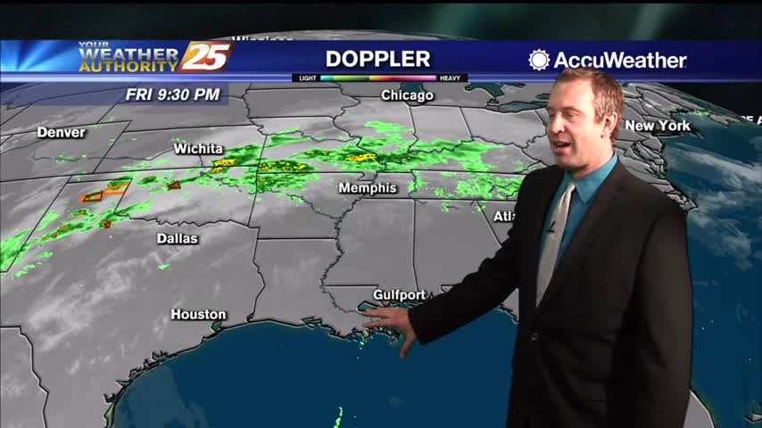
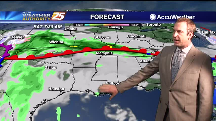
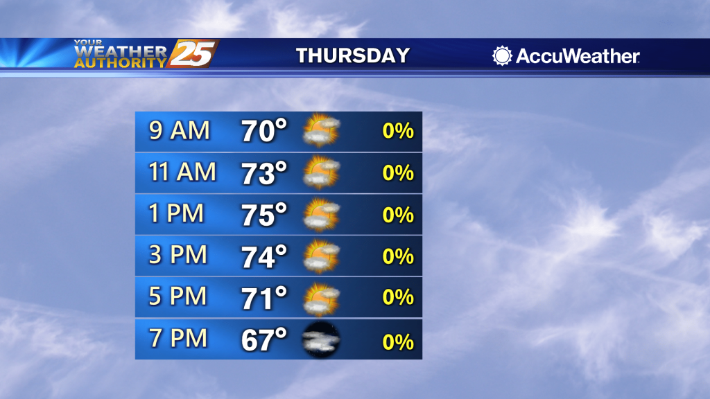
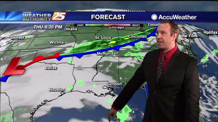
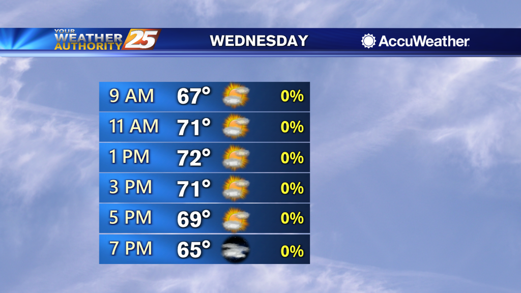
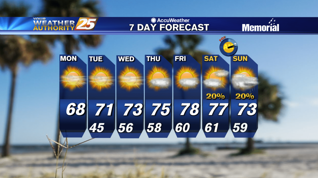
Cloudy skies will continue for the next few days as we enter an unsettled weather pattern. High temperatures stay warm in the upper 70s through Wednesday and rain chances will gradually rise from 40% Monday to about 70% Wednesday as…