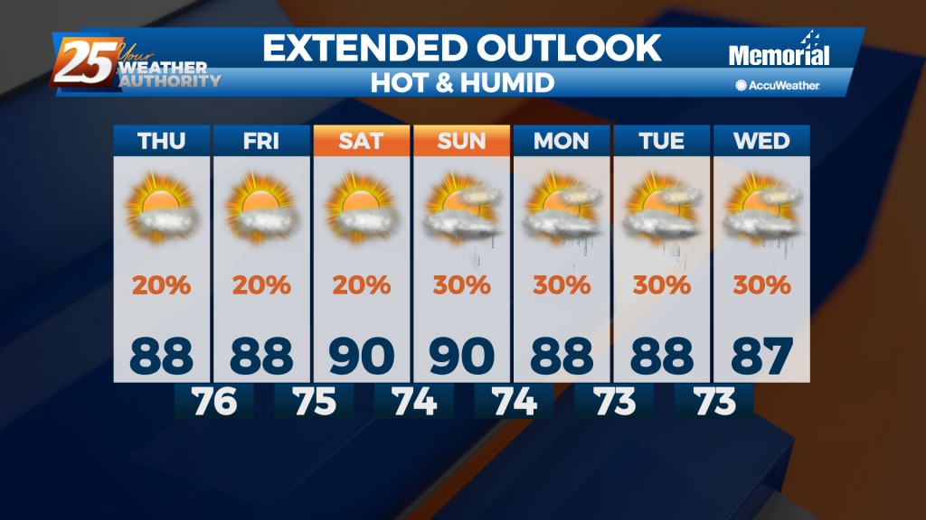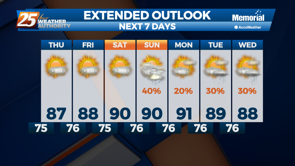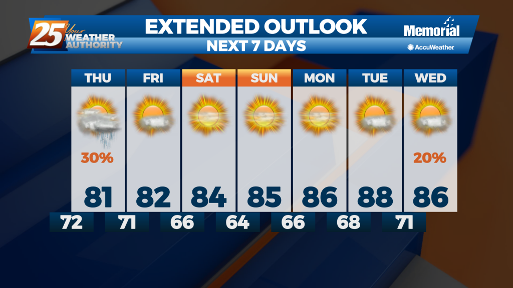
06/10 Ryan's "Quite Humid" Thursday Night Forecast
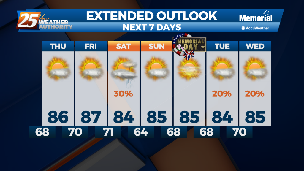
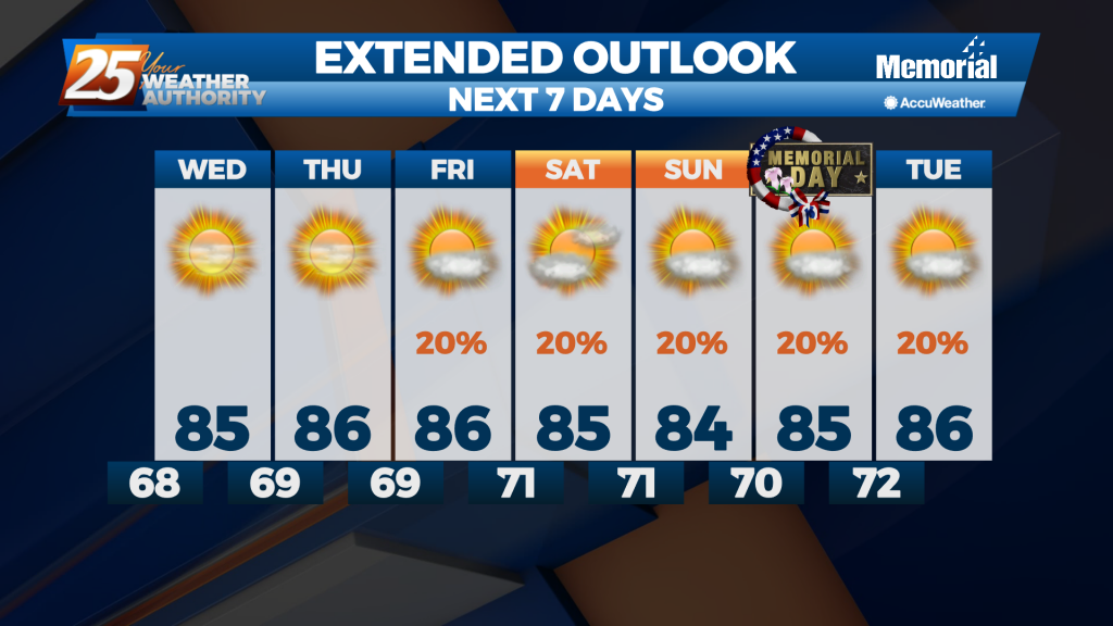
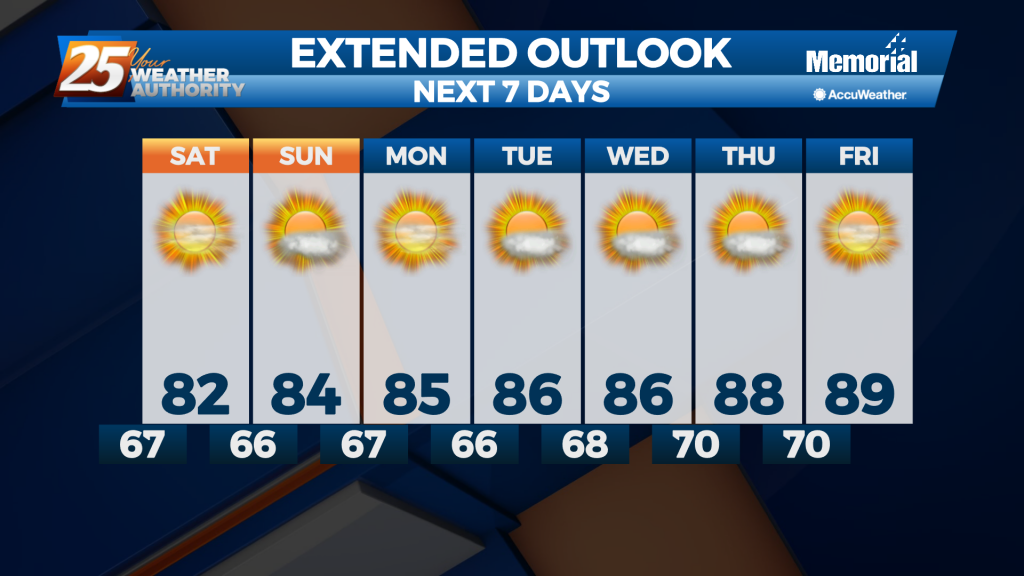
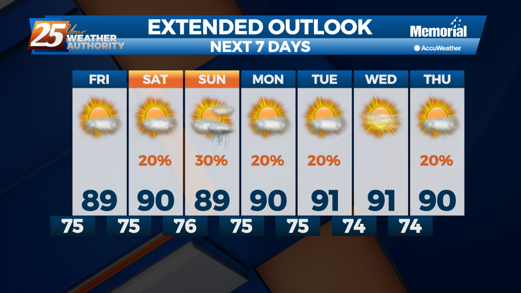
Another hot and quite humid afternoon is now behind us, but we'll see many more in the days ahead. Tonight's low will remain in the mid 70s once again, with light-to-patchy fog and southerly winds. Tomorrow continues the gradual warming…