Weather Authority

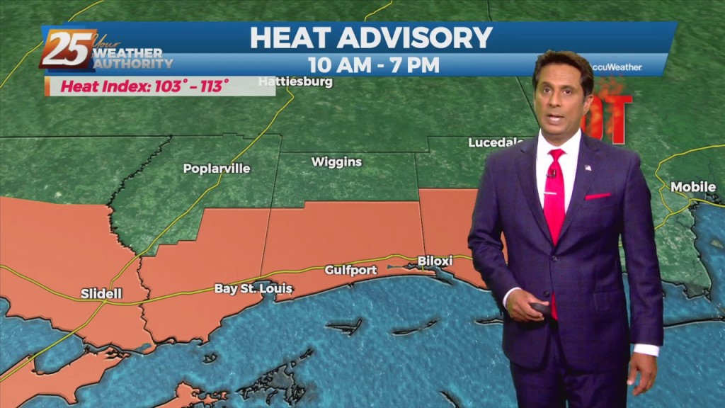
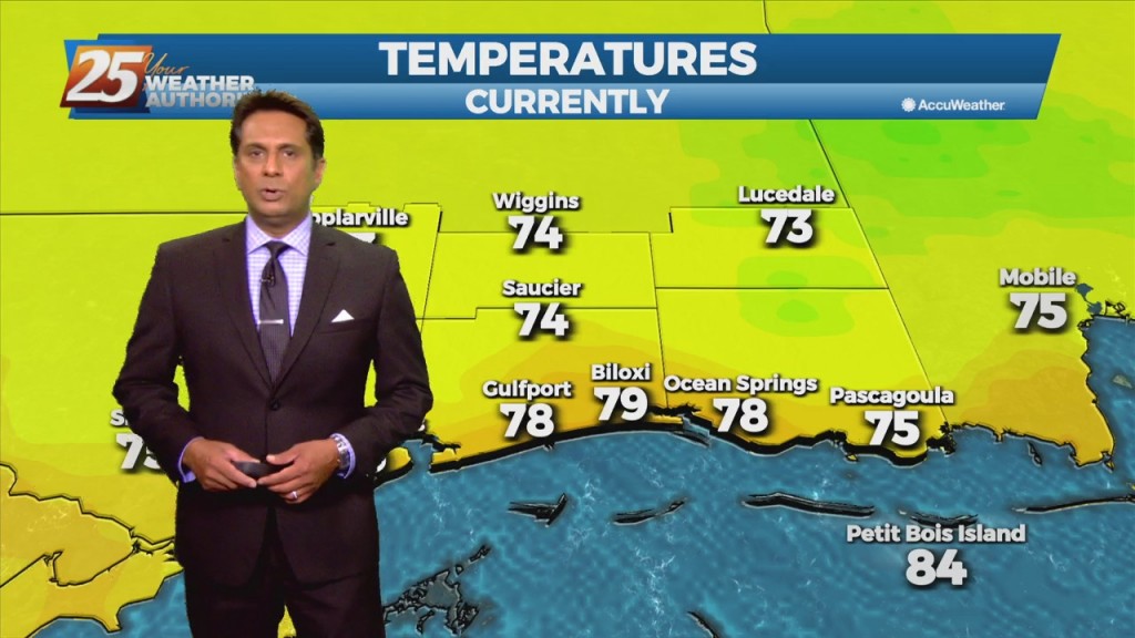
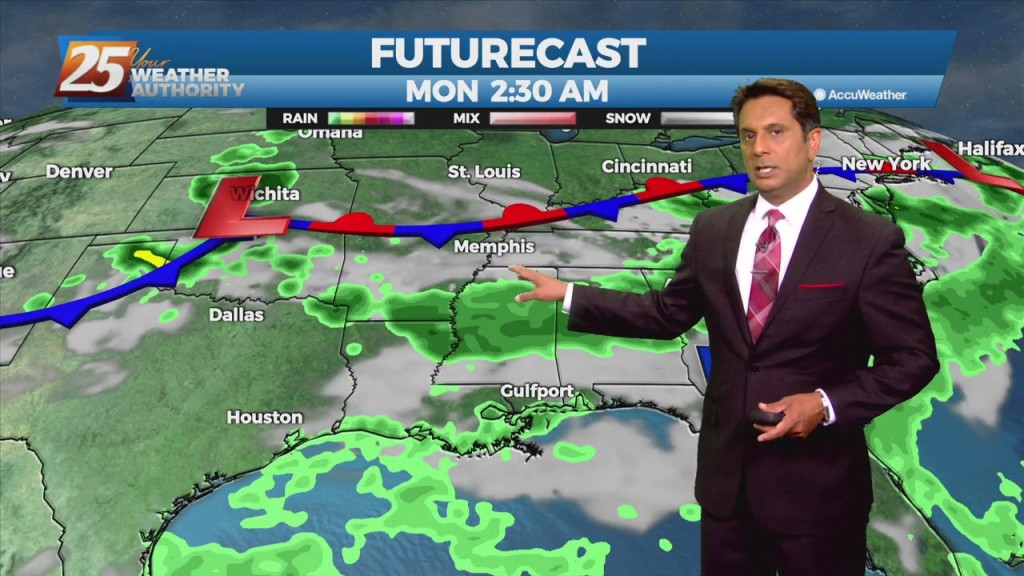
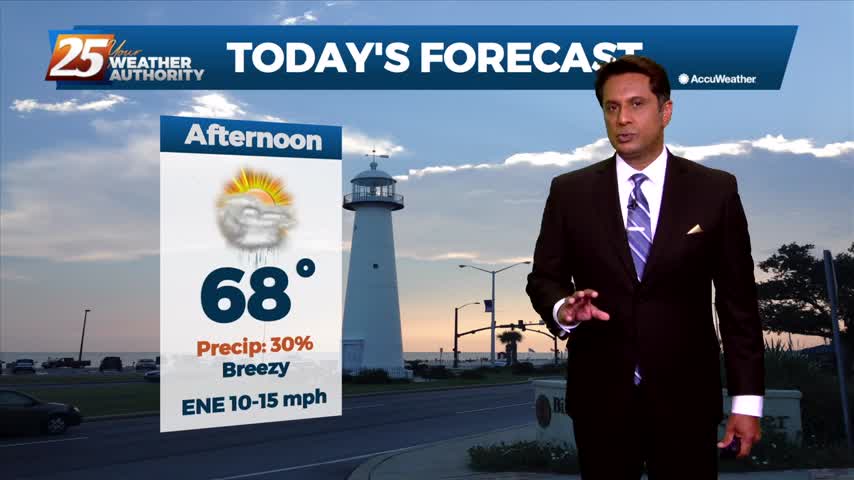
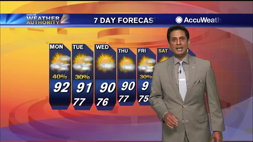
10/1 - Rob's 1st Day of October Forecast

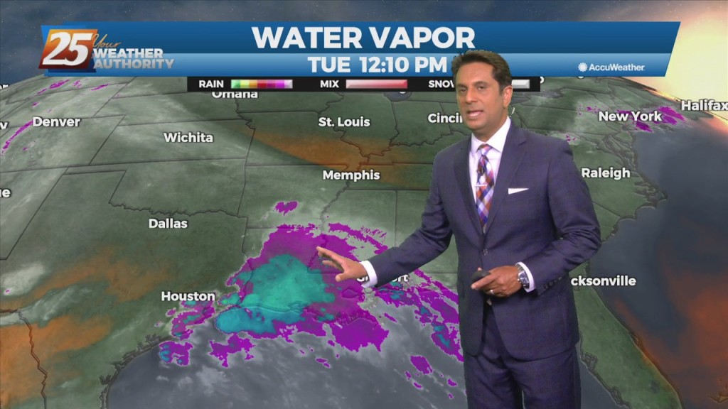
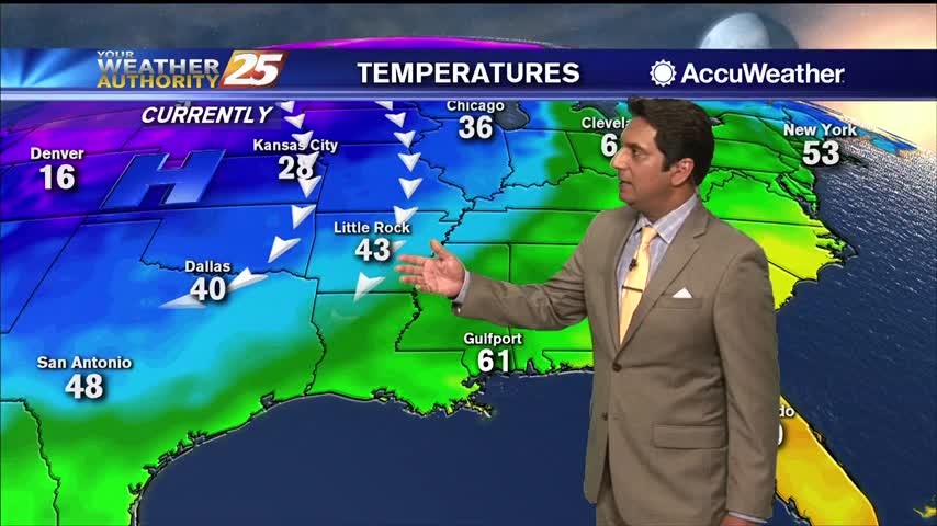
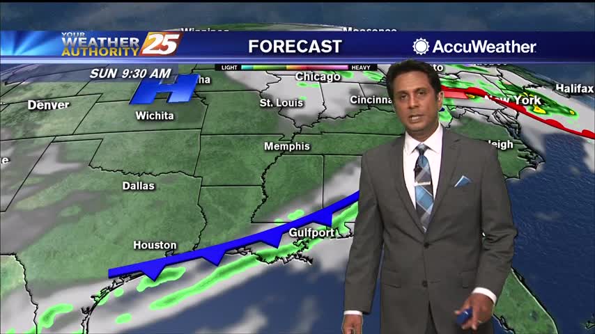
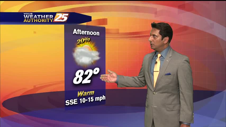
Closing out the workweek into the weekend will bring lower rain chances. Pulses of weak Energy from the west are expected to continue to aid a wet environment favorable for more isolated showers and thunderstorms. Isolated showers and thunderstorms may…

9/28 - Rob's "Warm & Humid" Afternoon Forecast

An upper level high-pressure is developing along the Mississippi Valley from Canada to the Gulf of Mexico. The moisture recovery has occurred since yesterday evening. A disturbance in the NW'tern GOM will continue to slowly move to the NW towards…

8/11 - Rob Knight's "Tracking The Tropics" Morning Forecast

Another day of afternoon shower and thunderstorm activity is on tap with precipitation chances a good deal higher overall than they were yesterday, mainly during the peak heating of the afternoon hours. This should in turn help to keep temperatures…

8/9 - Rob's "Hot & Humid" Monday Afternoon Forecast

With high-pressure shaping the forecast, daily high temperatures generally in the 90 to 95 range and afternoon dew-points in the lower and mid 70s will make for somewhat uncomfortable conditions. Moisture flow south of the interstate will be more abundant than…

7/27 - Rob's "Heat Continues" Tuesday Morning Forecast

Humid air, warm temperatures, and light winds will keep the current heat advisory posted through today. The main hope for cooling will be any thunderstorm development which will be embedded in a deep easterly flow. Afternoon seabreeze should provide a…

7/20 - Rob's "Gray & Gloomy" Tuesday Afternoon Forecast

An area of upper level weakness over New England will be in place through the early part of the week with a massive high-pressure system sitting over the western third of the country. A frontal boundary will continue to slowly…

7/20 - Rob's "Wet Tuesday" Morning Forecast

This stubborn active summertime pattern will continue throughout the middle of the workweek before a gradual drying trend expected by the end of the week. There's an area of upper level weakness over New England in place through the early…

7/12 - Rob's "Hot & Humid" Afternoon Forecast...

With daytime heating, afternoon showers/t-storms will affect the area with the activity diminishing around sunset. By Tuesday, the upper-level dynamics supporting showers/t-storms upstream of the zonal deep-layer flow exits towards our north, as we settle into overall weaker moisture flow.…