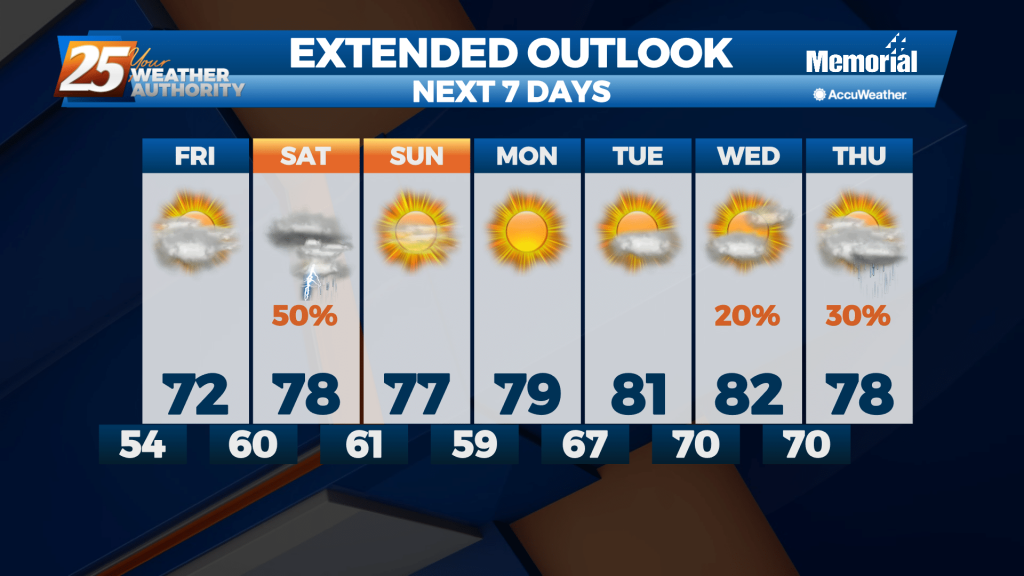
12/13 - Sam Parker's "Cloud Covered" Friday Morning Forecast
Had a warmer morning than yesterday mainly stay in the 40s but a north easterly breeze made the wind chill down in the 30s. We will…
Had a warmer morning than yesterday mainly stay in the 40s but a north easterly breeze made the wind chill down in the 30s. We will…
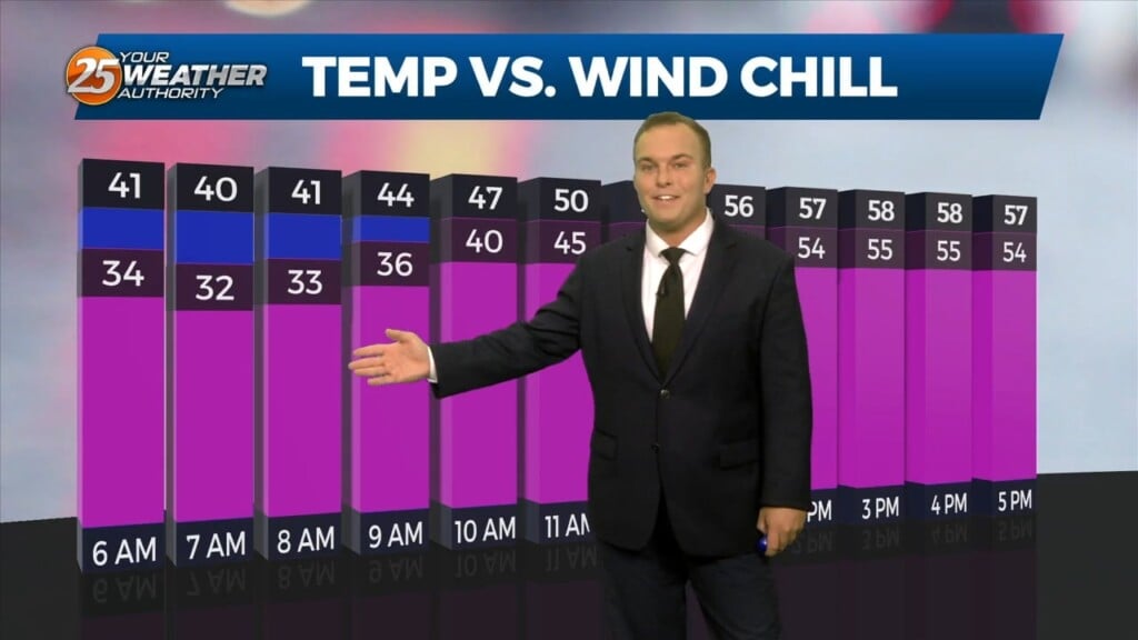
Temperatures will be very cold tonight under mainly clear skies. Winds will also remain in place and the north wind will make it feel like the 20s out the…
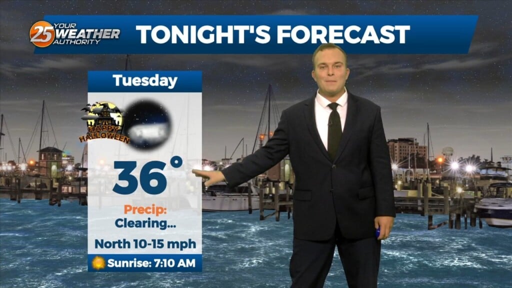
Skies do end up clearing out this evening but the chill is only just beginning. Temperatures plummet tonight and winds will remain elevated. Be sure to secure…
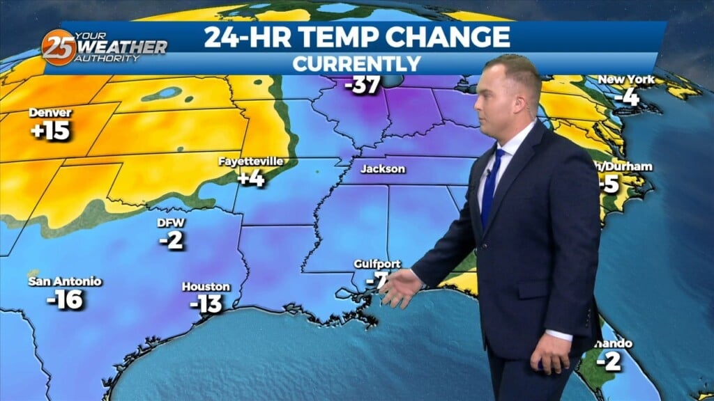
There is a surface boundary running northwest to Southeast across the area. We are seeing temperatures this afternoon 3-5 degrees warmer than yesterday at this time. Considering today and yesterday are very similar, we still…
Cloud coverage of the mid-level and upper-level variety has moved in thanks to a disturbance to our west. Clouds and increasing moisture via southerly flow will help…
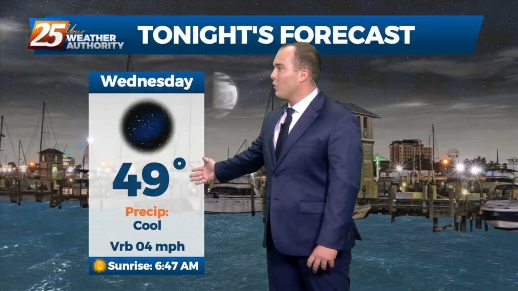
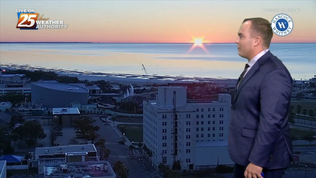
It’s cool, but pleasant this evening. Clear skies and calm-to-light winds will allow for efficient radiative cooling overnight. Temperatures around daybreak will be in the upper-40s to low-50s…
After a rainy first part of this weekend, the cold front swept through bringing clearer skies with it. Northwesterly winds behind it will continue until high pressure…
A disturbance to the west of our area is providing for increased cloud coverage. High pressure will help weaken it through the rest of today.…
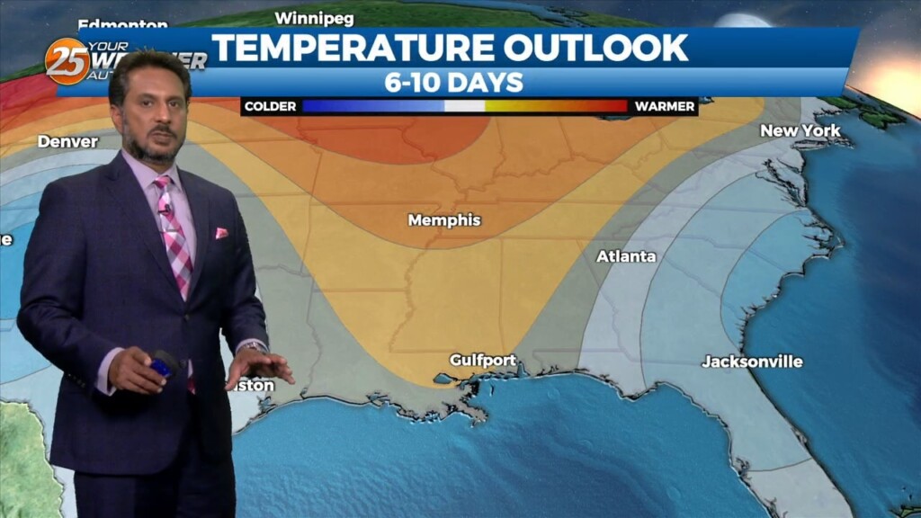
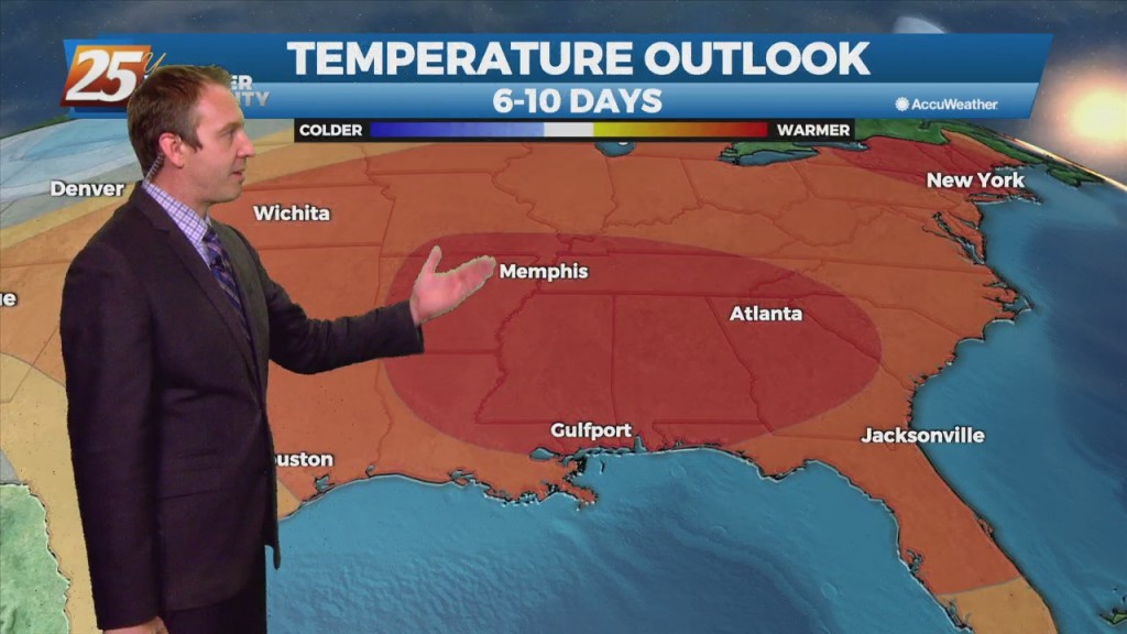
Spring begins later today, but first, Mother Nature has one last grip of winter on us. Temperatures will max out 15 or so degrees below seasonal averages this…
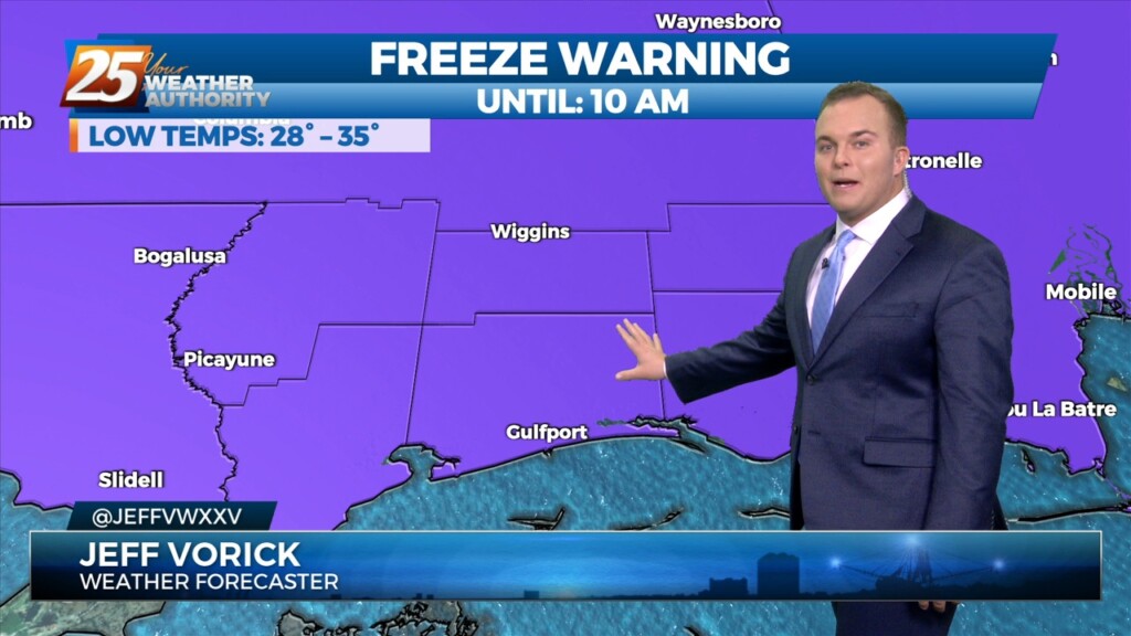
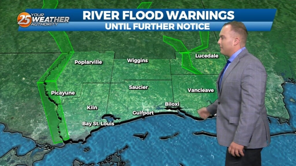
The late season chill will stick around for a little longer across South Mississippi. A Freeze Warning is in effect for all of the Southern Six…
Cool conditions will remain today under abundant sunshine. Winds will be shifting to an easterly, and then southeasterly direction as high pressure moves farther east. Thanks to southerly…
Cool conditions continue today with high temperatures only maxing out in the low 60s. Clouds will be on the increase into this evening as a minor disturbance moves…
The cold front has made it through our area bringing with it clearing skies, gusty winds out of the north, and colder temperatures. Clouds will…
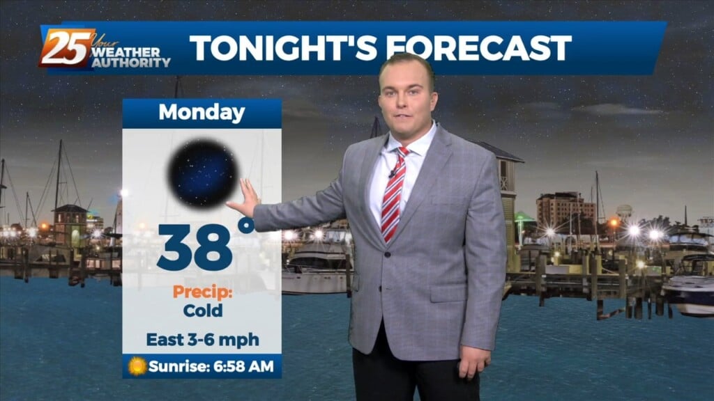
It’s a cold one to start off this Monday. However, abundant sunshine will eventually prevail later with temperatures climbing to seasonal values. The colder airmass that we…
As the colder airmass continues to slide east, an upper level high pressure will move in behind it. Temperatures will continue to moderate today as high temperatures…
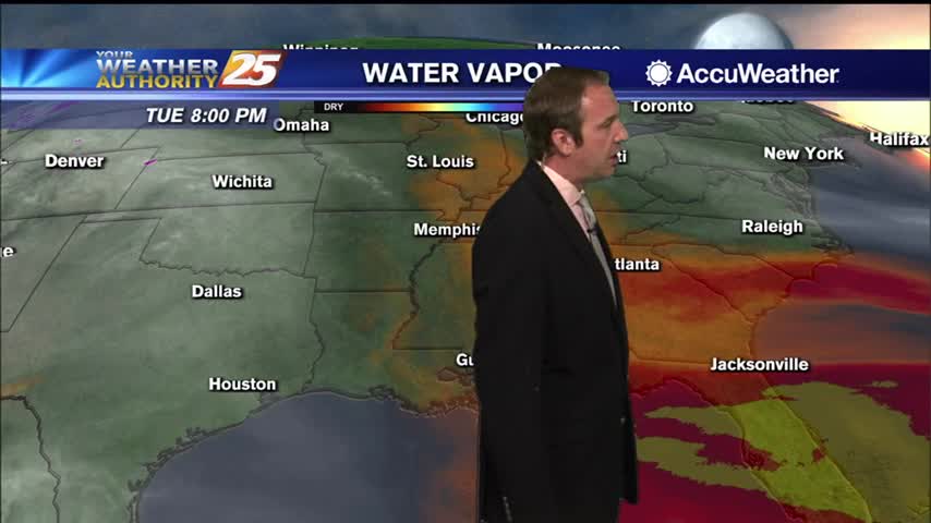
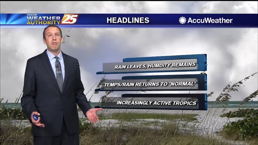
After a close call with Tropical Storm Fred it seems it's just getting hotter and more humid in South MS. The humidity at least will be a short-lived…
Another foggy night ahead as a slow moving front piles up moisture in the South MS area, with little change until the weekend.
Today was the last of the week we'll see clear, blue skies, but our cloudy, stormy weather won't last too long into the weekend.
Today was a beautiful start to the week after cooler, drier weekend, but heavy rain will return to the Gulf Coast sooner rather than later....
Another chilly one lies ahead, but it will begin quickly warming ahead of our next frontal system....
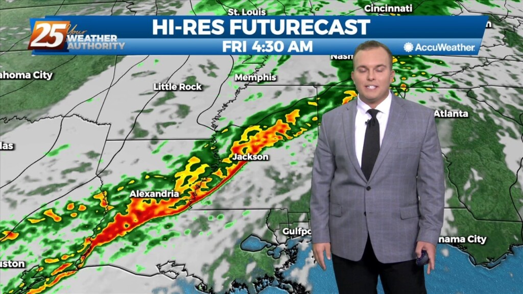
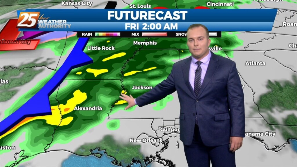
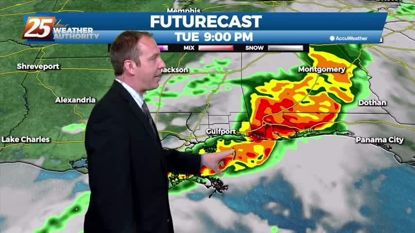
Our next front is closing in and active, potentially stormy weather will be moving in during the wee hours of the morning....
Last night was the coldest we've seen in a while, but we're warming rapidly into the weekend as a front closes in....
Cooler, drier air remains, but we will continue to warm steadily through the week.
It's been pretty wet since the end of last week, but a drier trend is finally beginning which will take us through the weekend.