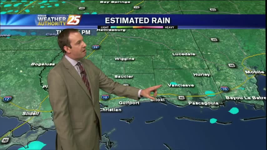
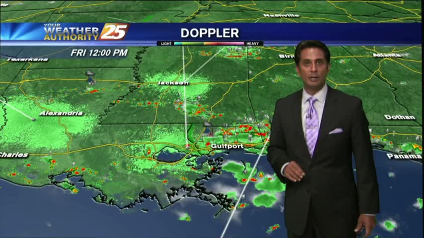
08/17 Ryan's "Finally Dry" Thursday Forecast
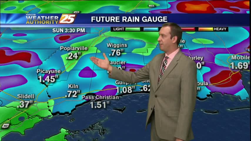
The drier conditions we promised arrived as expected and brought a beautiful day. Tomorrow will be nice as well, but the afternoon showers return. Details within.
The drier conditions we promised arrived as expected and brought a beautiful day. Tomorrow will be nice as well, but the afternoon showers return. Details within.
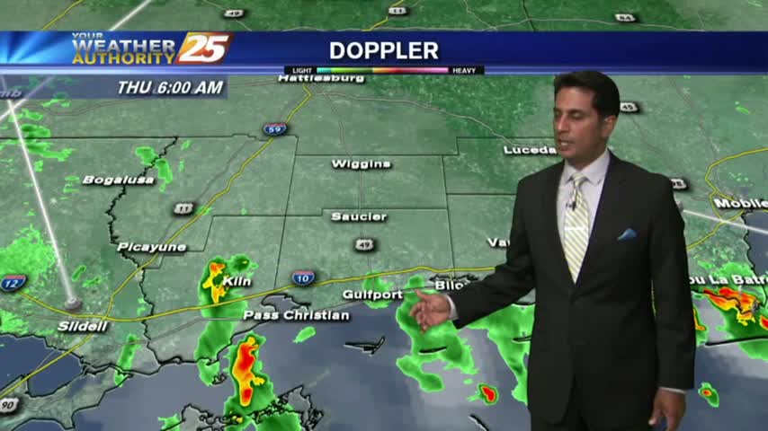
A HUMID start to the day with areas of light patchy fog and isolated showers/t-storms moving in from the south...
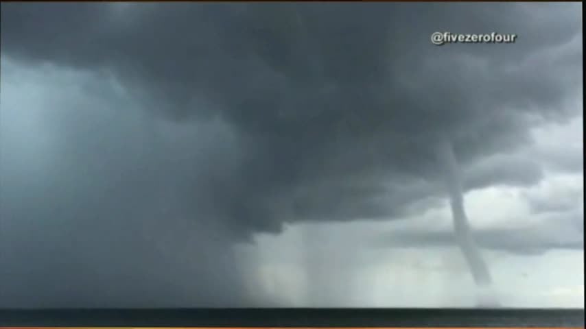
Showers and storms were a bit more active today (including this waterspout in Louisiana), but relatively drier conditions are expected before the weekend. Watch the full forecast for details.
After another day of predictable afternoon showers and storms, we'll see more of the same as we head into tomorrow. Click the forecast link for more details.
While last night was the exception, we're again seeing our earlier showers & t-storms dissipating and and even some slight sky clearing. Rain returns quickly though, so watch the full forecast for details.
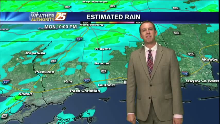
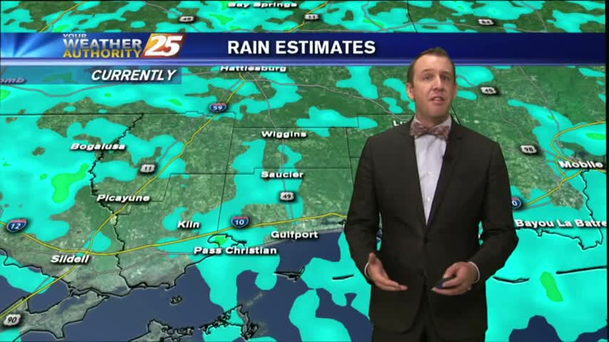
Not much rain earlier, but the rain started to move in late this evening and will continue each afternoon for the next few days. Watch the full forecast for details.
A more humid start to the day with partly/mostly cloudy skies moving in from the west...
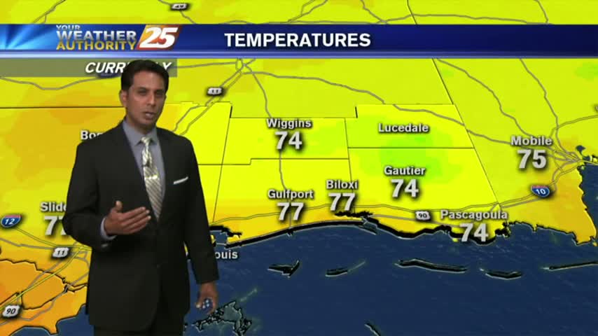
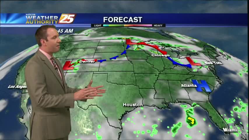
Slow moving showers and thunderstorms dominated the afternoon, but the next few days will be drier! Watch the full forecast for more.
Another warm/humid start to the day with overnight showers/t-storms over the n'tern GOM/Sound moving north into the Southern 6...
Our warm and humid afternoons are leading to sea breeze showers and thunderstorms, but we aren't seeing much rain after sundown. Expect more of the same for tomorrow, full forecast details inside.
Our afternoon showers have now all but disappeared, but at least a few clouds will remain. Be ready for more showers all the way through the weekend. Click link for details.
Our afternoon showers have finally cleared, but the rain will return each afternoon into the weekend. Watch the full forecast for more.
After overnight and early morning activity over the sound, showers/t-storms continue to flare-up along the viewing area...
The fireworks went off without any issues from mother nature last night, but the pattern will begin to change...
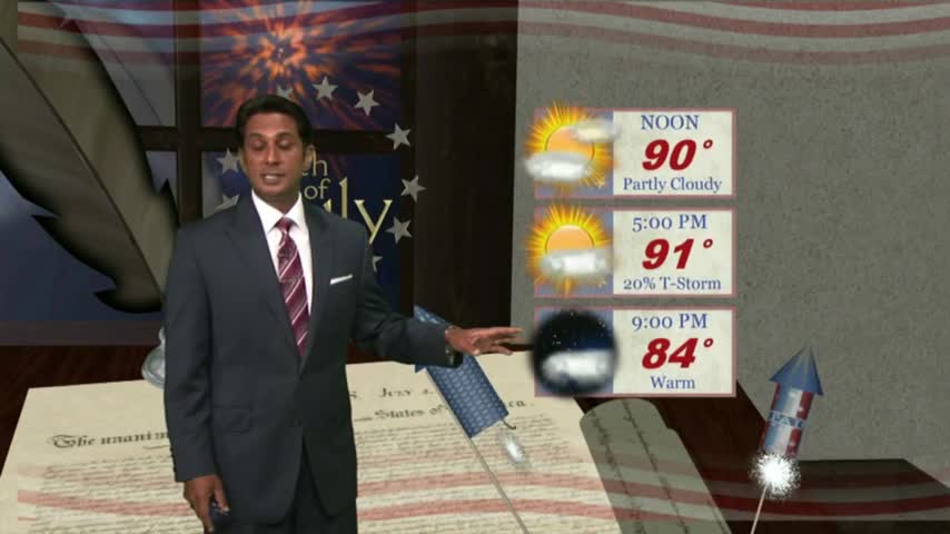
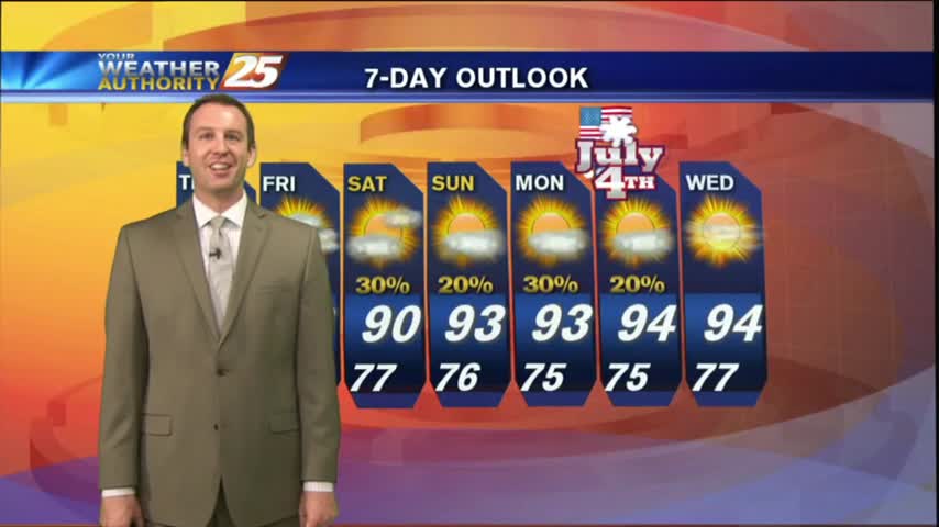
Another warm/humid start to the day (Independence Day) with VERY HOT conditions on-tap through the region...
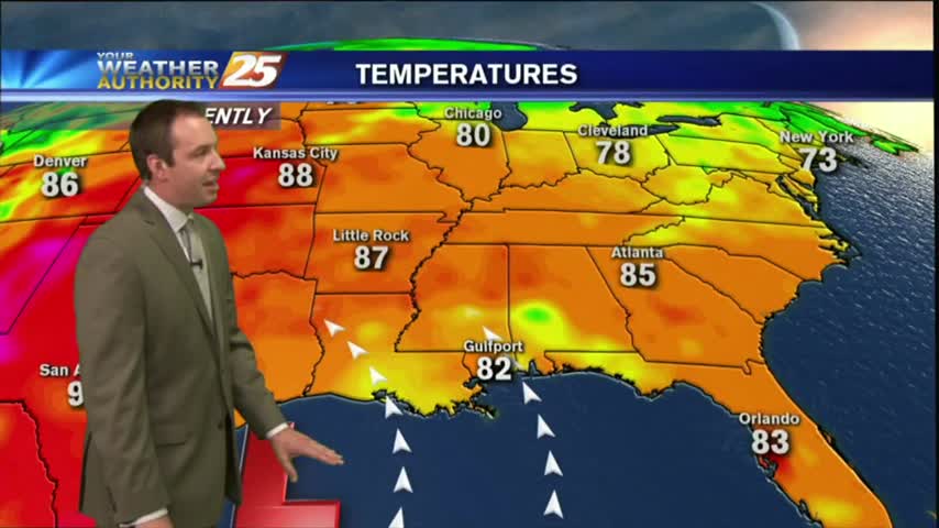
A warm/humid start to the day/workweek with DANGEROUS HEAT INDICES to affect the Mississippi Gulf coast...

After a rain-free start to the day, minimal activity has been popping up along the Southern 6/northern Gulf of Mexico...
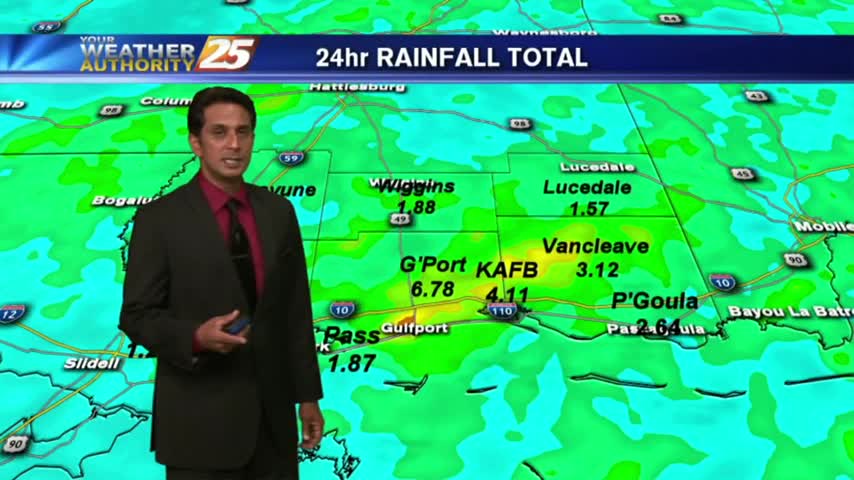
After torrential rainfall yesterday with as much as 6" of accumulation, it's a drier (rain-free) start to the final day of June. ..
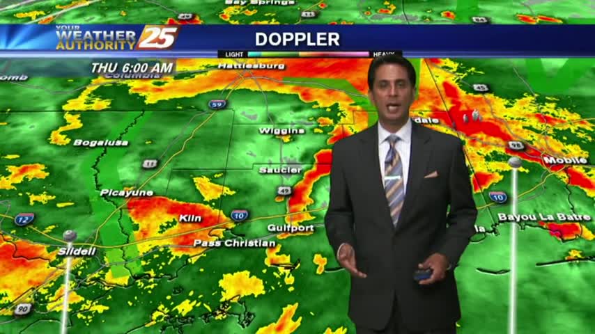
A gray/gloomy start to the day as an area of low-pressure west of Lake Pontchartrain is bringing HEAVY RAIN into the area...
Storms moved in earlier today, but will wait until the early morning overnight hours before bringing in round 2. Best to get it out of the way now, leading to a sunny holiday! Details inside.
Today brought the first significant rain since Cindy left, and even a few Tornado Warnings this morning! Expect it to continue for a few days, but dry & hot weather is ahead. Click for details.
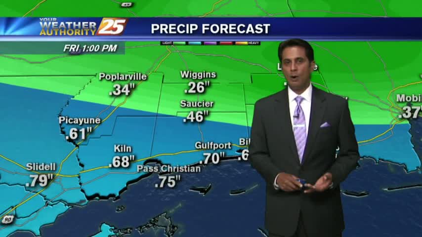
I hope you enjoyed our last few dry days because the rain is set to move in as early as tomorrow. Please watch the full forecast for more details.
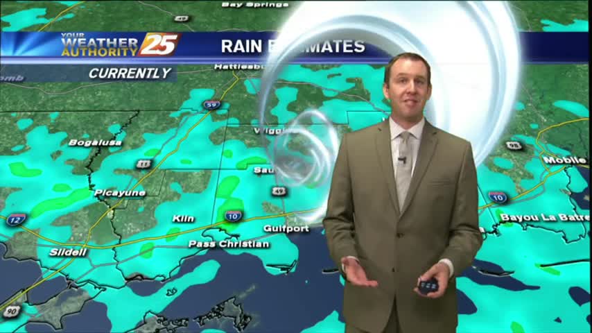
It's still considerably drier tonight than it was all of last week, but we will see more humid days & showers later this week. Click the forecast link for details.
Last weekend's forecasts called for the Sun returning on Monday, and so far everything is moving along as we expected. The dry & sunny days won't last forever though, details within.