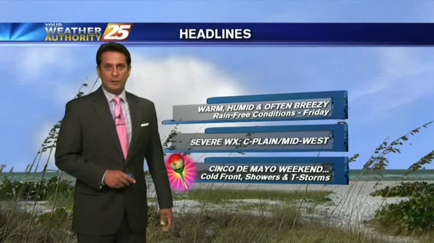
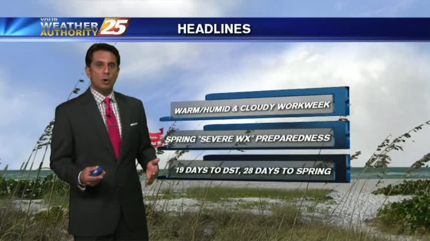
5/21 - Rob's Warm & Wet Workweek Forecast
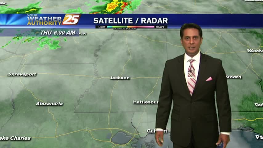
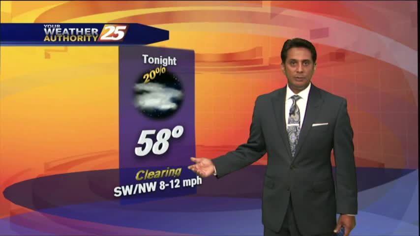
Overnight showers/t-storms continue to move in from the GOM...along with areas of patchy fog...
Overnight showers/t-storms continue to move in from the GOM...along with areas of patchy fog...
A HUMID start with areas of patchy fog east of Hwy 49...as we head into the Mother's Day weekend...
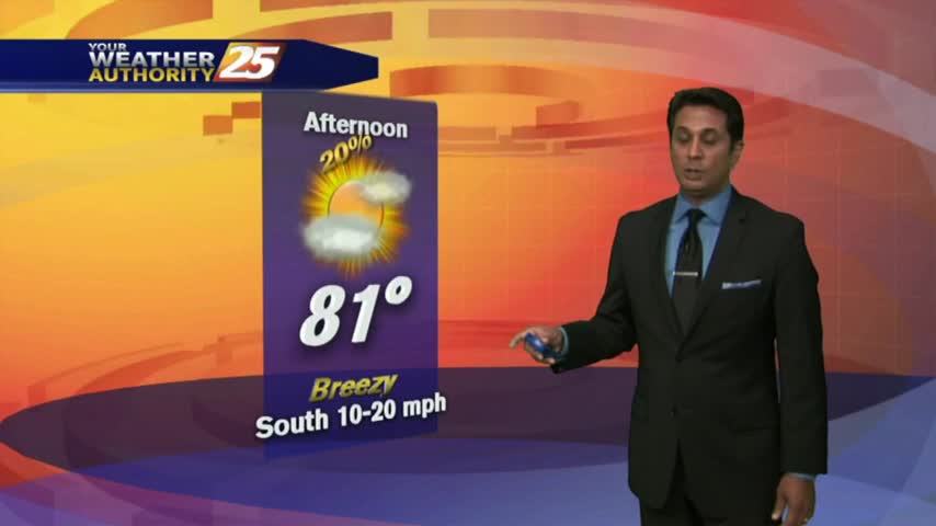
Another WARM & HUMID afternoon as cloud coverage continues to move through in advance of an approaching cold front...
Upper level non-rain producing clouds continue to move across the region as temperatures warm into the 80s...
A mild start to the day as a SE wind continues to elevate humidity and produce areas of patchy fog...
A much warmer start to the day as an area of high-pressure continues to block the pattern...

A warmer start to the day as a humid air mass moves in from the GOM in advance of an approaching cold front...

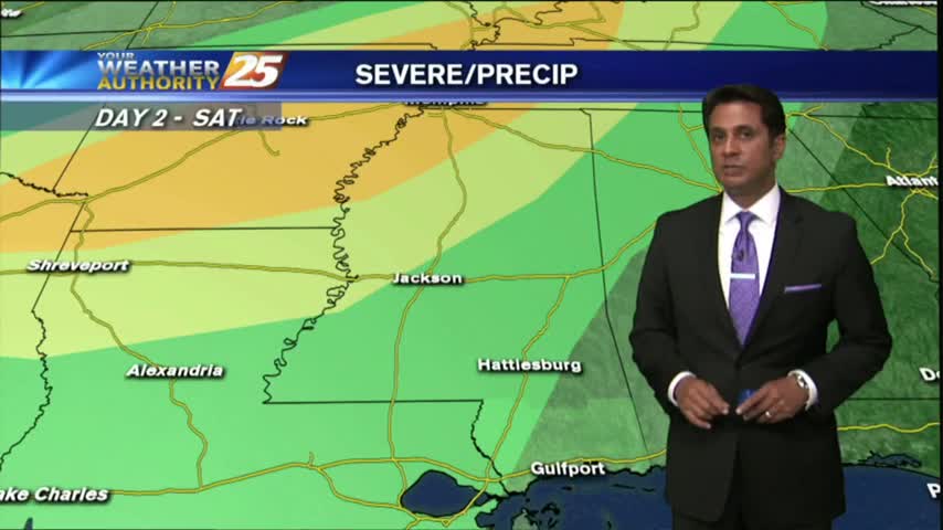
A warm/humid and windy start to the day with a POTENTIALLY SEVERE cold front approaching from the west...
Another warm, humid and breezy start to the day with a cold front approaching from the west...
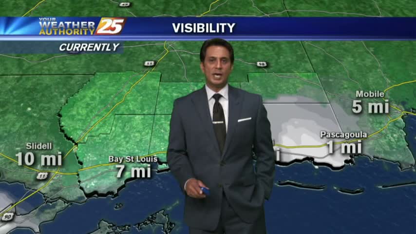
After a warm weekend, elevated humidity has areas of patchy DENSE FOG in the area...
After a FOGGY start to the day, cloudy skies continue along with isolated showers developing...
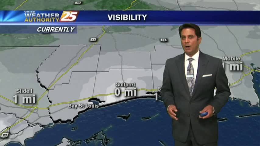
A warm/humid start to the day with DENSE FOG through the viewing area. A DENSE FOG ADVISORY is in effect...
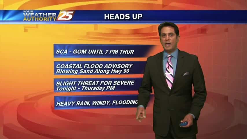
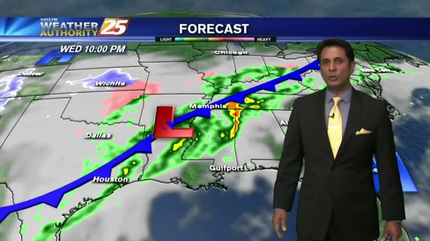
A warm/humid and very breezy afternoon is ahead in advance of an approaching cold front...
It's a warmer start to the day with isolated showers moving across the viewing area...
Isolated showers have been moving into the area with a few t-storms on-tap this afternoon...
With a stalled cold front to our NW, the warm & muggy conditions continue with areas of patchy fog this morning...

After a HUMID start to the day with areas of PATCHY FOG, warm & humid conditions continue...
A WARM/HUMID start to the day with PATCHY FOG ahead of an approaching cold front...
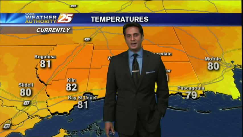
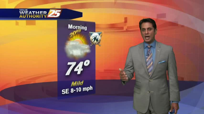
A WARM start to the day with several locations already in the low 70s...
A VERY WARM and humid start to the workweek, with minimal fog through the viewing area...

After a FOGGY morning, the fog has lifted into a low-level cloud deck as temps continue to warm into the mid-upper 70s...
Another morning with areas of DENSE FOG...a DENSE FOG ADVISORY continue through 10 A.M...
A warm/humid start to the day with WIDESPREAD FOG, a DENSE FOG ADVISORY is in effect through late morning...
After a FREEZING start yesterday morning, temps are a good 20 degrees warmer under cloudy skies...