10/20 - The Chief's "Beautiful Seasonal Weekend Ahead" Friday Afternoon Forecast
A very weak front just north of the area will continue to move toward the Atlantic Coast today and Saturday with upper high pressure beginning…
A very weak front just north of the area will continue to move toward the Atlantic Coast today and Saturday with upper high pressure beginning…
A closed mid-level low pressure system over TX is more of a double barrel low as the eastern portion of the low led to all of…
A very warm start to the day with another warm day expected across the region and no sign of a change at least in the…
A warm front moving north this morning over south shore locations could bring enough vertical depth to get some showers out of it today…otherwise just…
Continued unseasonably warm conditions will persist for the next few days as the surface high over the Bahamas causes southerly surface flow into…
Aloft, our region will be within the northwest periphery of the strong high pressure parked over south Florida leading to southwesterly flow. Today will mostly be a…
Today our area will reside between a strong upper level high pressure over the western Caribbean and southwest Atlantic and a strong upper level…
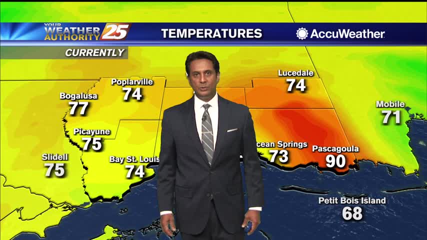
Additional cloud cover expected today across the region as low level winds continue to advect a very rich airmass over the region. High pressure will continue…
High pressure centered over Florida this morning, with an upper level disturbance to the west with an associated surface cold front. Light southeast winds continued…
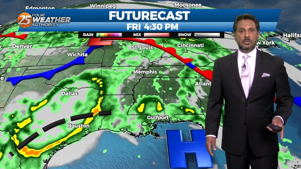
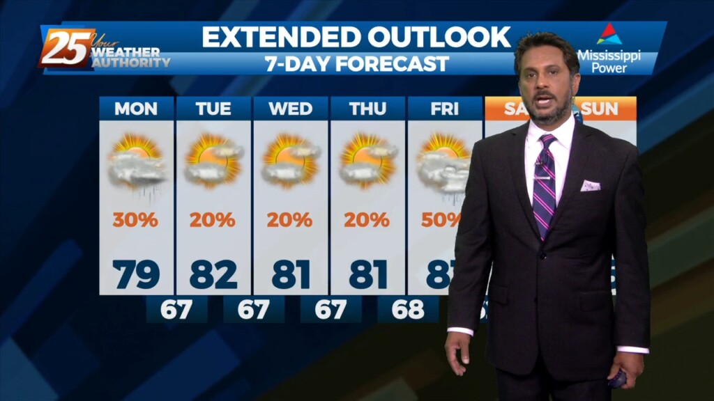
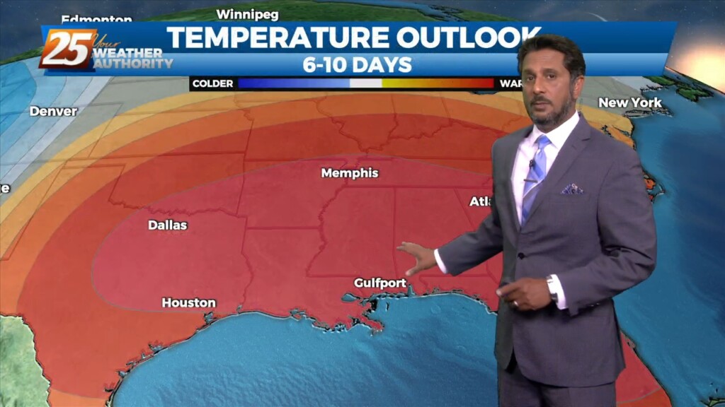
After today we will be heading into a much more active pattern. A Major disturbance will be digging down through the Central and Southern Plains…
The warm front yesterday retreated quickly and even by this morning was already north of the area and we are now in a warm air regime. This could set the…
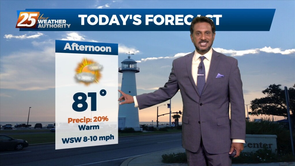
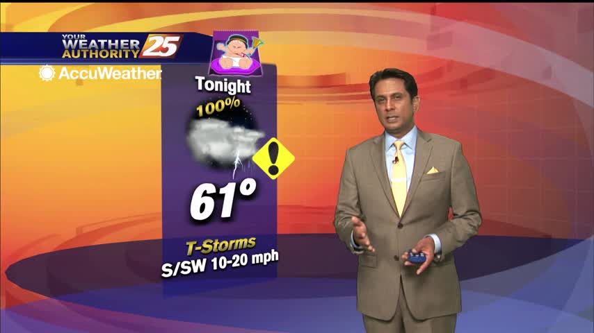
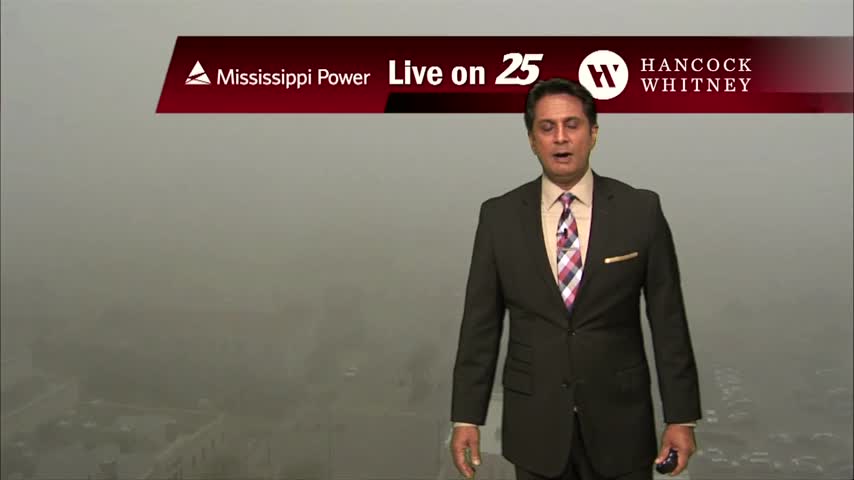
The primary story this Friday morning is visibility concerns. Widespread fog, some dense has developed generally along and north of the I10/12 corridor east of…
A weak boundary still forecast to sink southward and stall near the coast for today and tomorrow. While widespread showers and storms are not expected, the boundary should…
Above seasonal average temperatures will continue until a cold front makes its way through our area early tomorrow morning. The warmer temperatures coupled with high relative humidity…
Today will continue the trend of quiet conditions as high pressure located just east of our area remains dominant over the forecast. High temperatures today are…
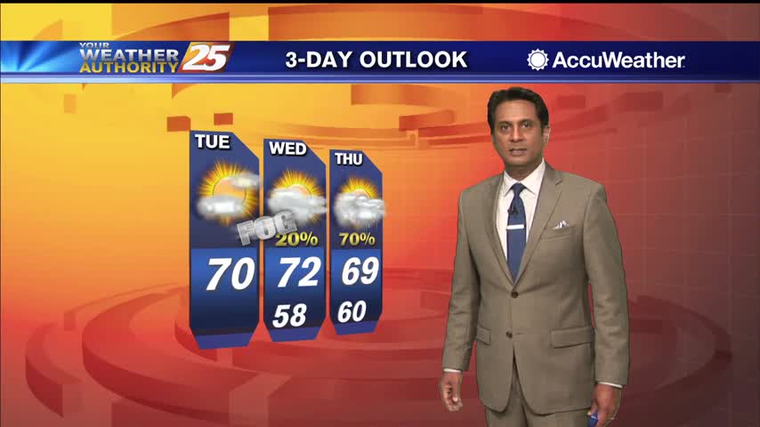
Cloudy skies continue with patchy fog as more rain begins to move in...
A warm start to this final day of the year with patchy fog and light rain moving in from the south...
A very nice afternoon ahead with high temperatures way above seasonal norms...
Another very warm late December afternoon...
Fog is still in the area and we could see RECORD HIGH temperatures this afternoon...