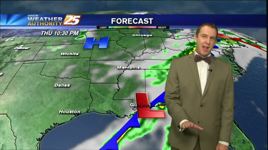
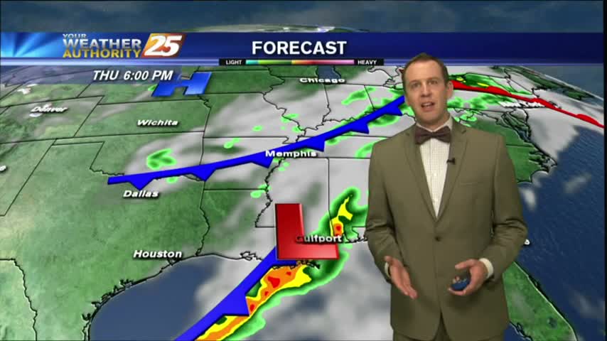
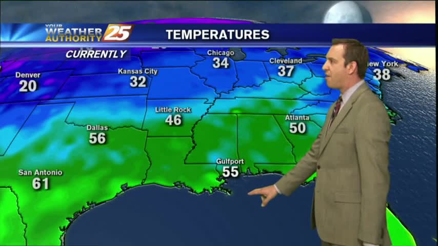
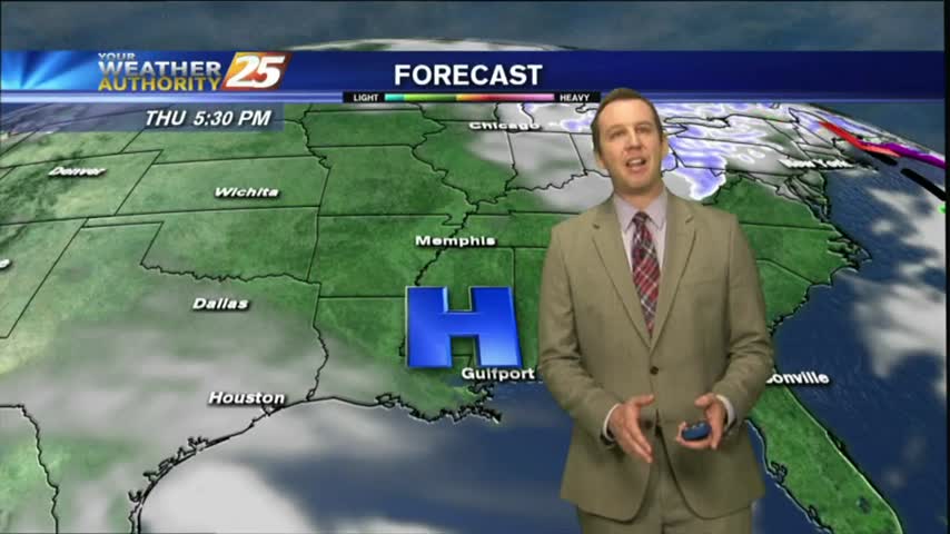
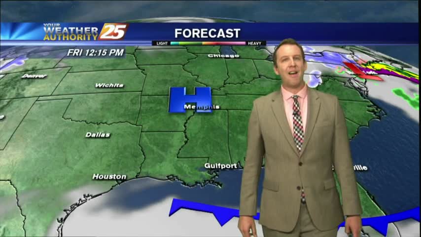
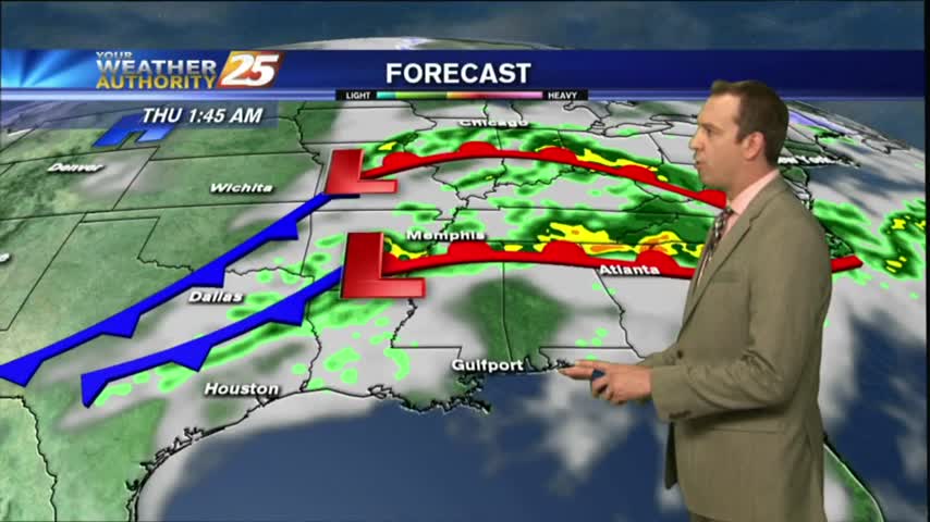
04/03 Ryan "Slight Severe" Tuesday Evening Forecast
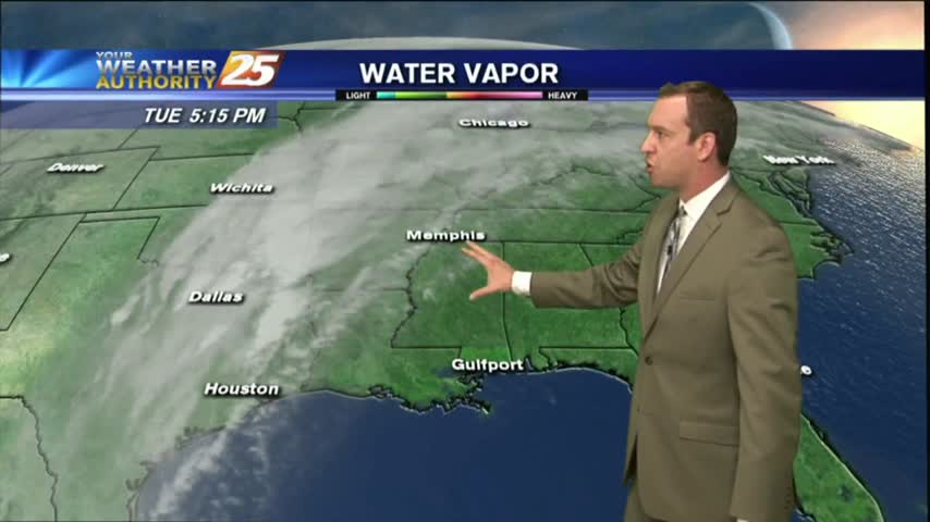
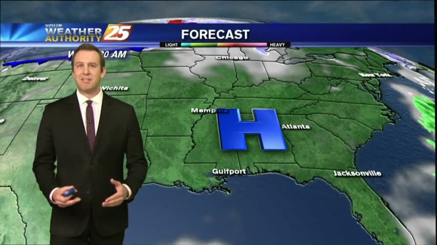
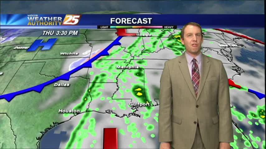
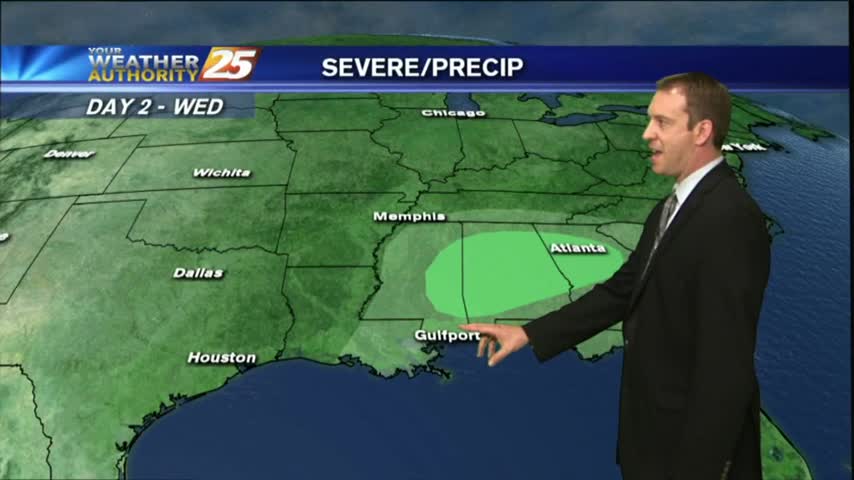
It's much more cloudy today, but will clear quickly tomorrow after overnight storms which bring a slight risk of severe weather to the Coast....

It's much more cloudy today, but will clear quickly tomorrow after overnight storms which bring a slight risk of severe weather to the Coast....
Another warm and humid day down with a few more to go before a sunny and drier Easter weekend....
The humidity and clouds just keep coming for the next few days, but the holiday weekend is looking much clearer....
Another clear and chilly night is moving in, and we'll see some patchy inland frost forming tonight, but it'll warm considerably soon....
Another gorgeous day in South MS, with at least two more on tap before things start to warm up....
There's still a little cloud cover near the coastline, but by tomorrow we'll see cloudless skies which will linger for a few days.
As the front moved through this morning it brought rain, but is now bringing much cooler and drier air.
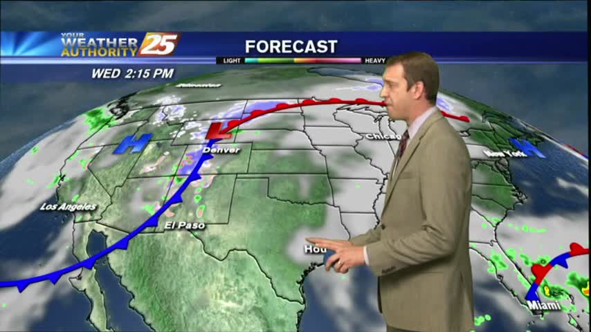
A few sprinkles of drizzle and one light shower have already passed through Gulfport tonight, and the warm front is still on the way. Watch the full forecast for details.
Cooler today as expected, but an approaching warm front will bring much higher humidity and temperatures tomorrow. Watch the full forecast for details.

We've tied or broken temperature records every day, with the exception of last Sunday, since last Friday; a trend I expect to continue through the rest of this week and the weekend. Watch the full forecast for details.
Another day down, and another high temperature record tied or exceeded. Expecting more of the same ahead with a little rain mixed in, so watch the full forecast for the details.
After last night's chilly conditions we're in for a few days of warm and humid weather and mild, foggy nights. Watch the full forecast for details.
It was a much nicer day than expected this afternoon, but clouds will move in through the night and the humidity remains high. Watch the full forecast for details.
Rare astronomical phenomenon will occur tonight as we'll experience a "Super Blue Blood" Moon during the overnight hours in the very early morning. Watch the full forecast for details.
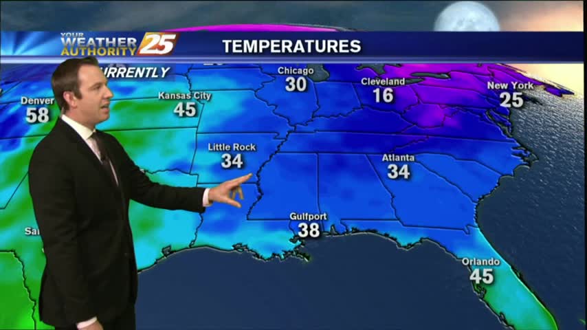
It was much cooler this afternoon than it was the day before, but expect it to be only slightly colder tonight. We'll see rapid changes from tomorrow through the weekend though, so watch the full forecast for the details.
Northerly winds continue bringing colder and drier air into South Mississippi, setting us up for a few beautifully dry and sunny afternoons. Still in for a few chilly nights though; click here for the details.
Yesterday's forecast for today was right on! It was slightly cooler, considerably drier, and these conditions will last through the end of the week. Click here for the full forecast with Meteorologist Ryan Mahan.
Another round of rare winter weather has moved into South MS bringing inches of snow to the Jackson and Hattiesburg areas, but so far not much more than sleet for us. Watch the full forecast for details.
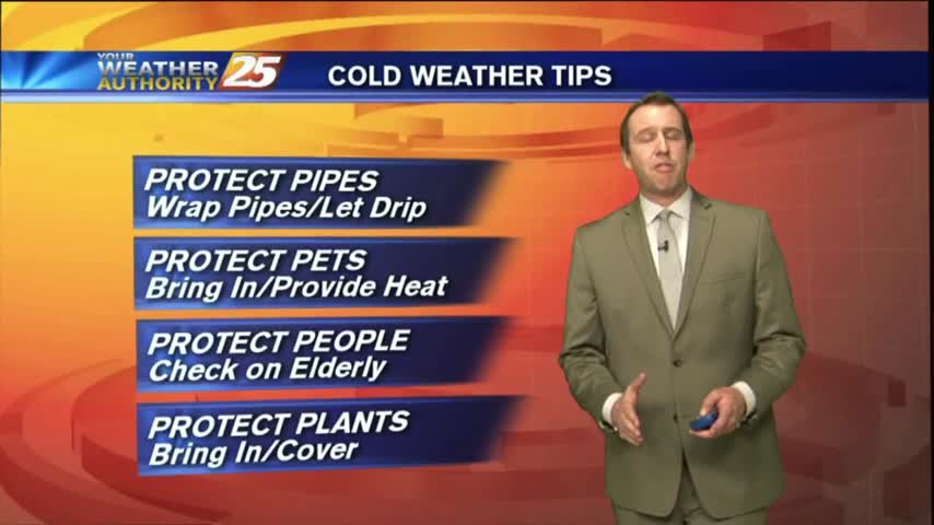
Most of South MS will see some form of winter weather tonight, but even colder and more brutal temperatures are moving in over the next day and a half. Watch the full forecast for details.
Fog is developing quickly to the North of us near Hattiesburg, but Dense Fog Advisories have now been issued for all coastal counties and the Mississippi Sound. Click here for the full forecast.
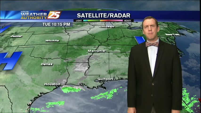
It was a gloomy day in South MS as our high humidity lead to a misty light fog and low pressure lead to cloudy skies. Expect little change in the short term, but you'll have to click the forecast link fore the details.
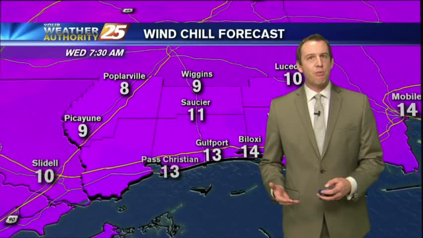
More dangerously cold nights ahead, but our afternoons will begin warming soon. Be on the lookout for some non-accumulating snow flurries late tonight/early Wednesday. Full forecast within.
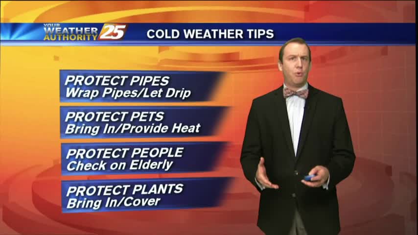
More sub-freezing temperatures ahead for the next few nights, but we're already seeing some slight warming which will continue gradually through the week. Click the forecast link for details.
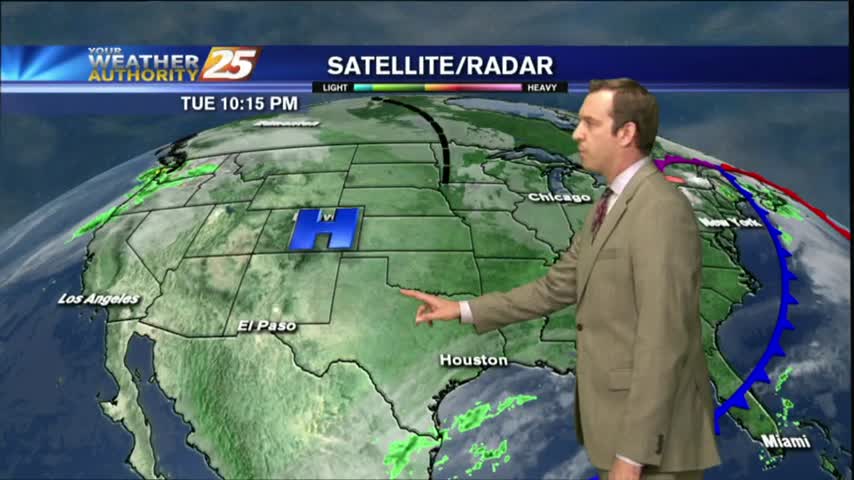
Dense fog advisories remain in place for all six coastal counties and the surrounding area, but after tonight's frontal passage we shouldn't see those again for a few days. Rain will return before the weekend though, details within.