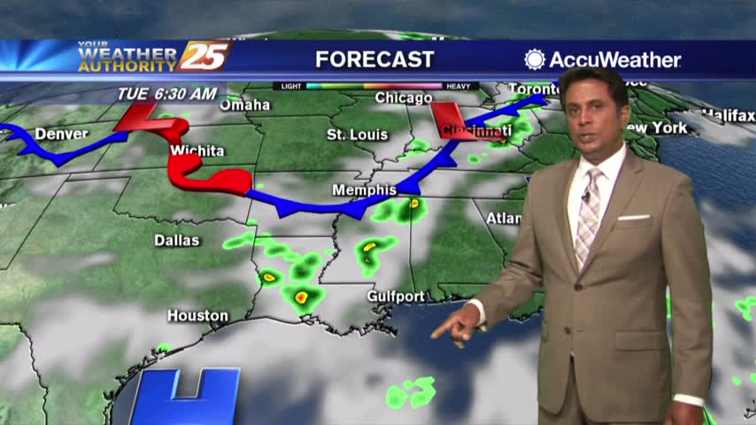
7/30 - Rob's Tuesday Morning Forecast
A few showers and t-storms possible this afternoon.
A few showers and t-storms possible this afternoon.
Cold front brings rain then drier air...could also stir up the tropics later this week. More details here.
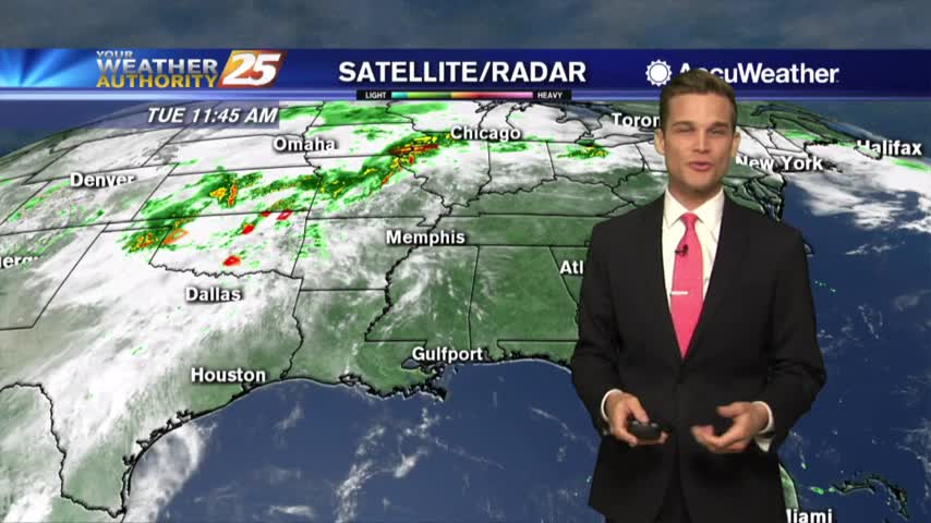
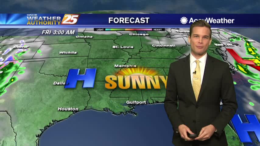
Heavy rain Tuesday afternoon...drier and sunny by Wednesday.
The sunshine is back and it's hot and humid
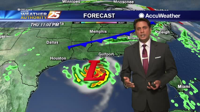
Another hot one and a tropical system will likely form in the Gulf of Mexico...the latest here.
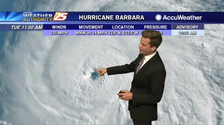
Hot and humid here...A major hurricane in the the Pacific.

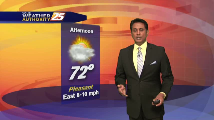
Heat index values may reach over 110 as we head into the weekend.
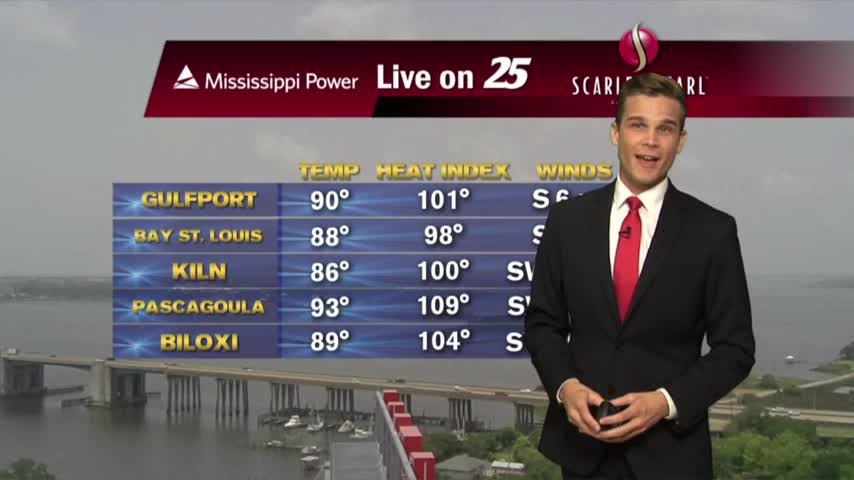
Heat indices over 110 in some location this afternoon...if you're lucky you might see some rain.
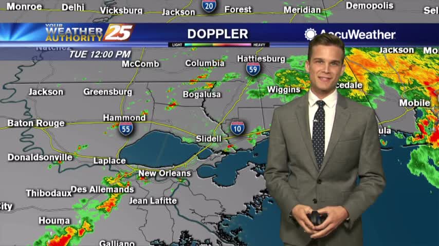
A few t-storms this afternoon could produce gusty winds and small hail.
Keep the rain gear nearby today...a little drying later this week.
Tuesday: Hot, Humid & Stormy At Times

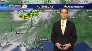
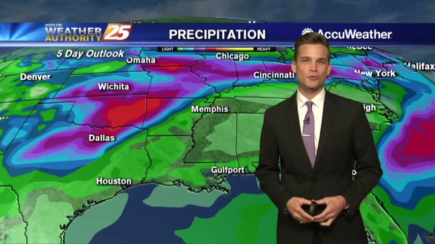
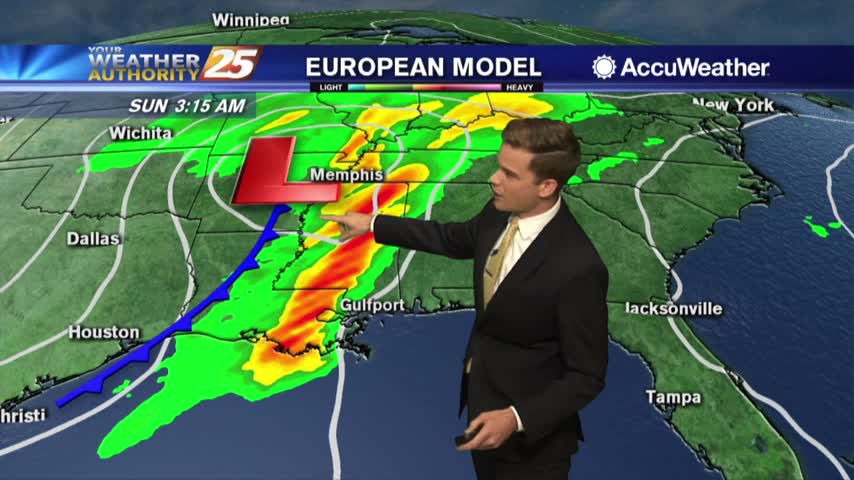
Heavy Rainfall likely from Tropical Disturbance in the Gulf.
Heat and humidity continue...
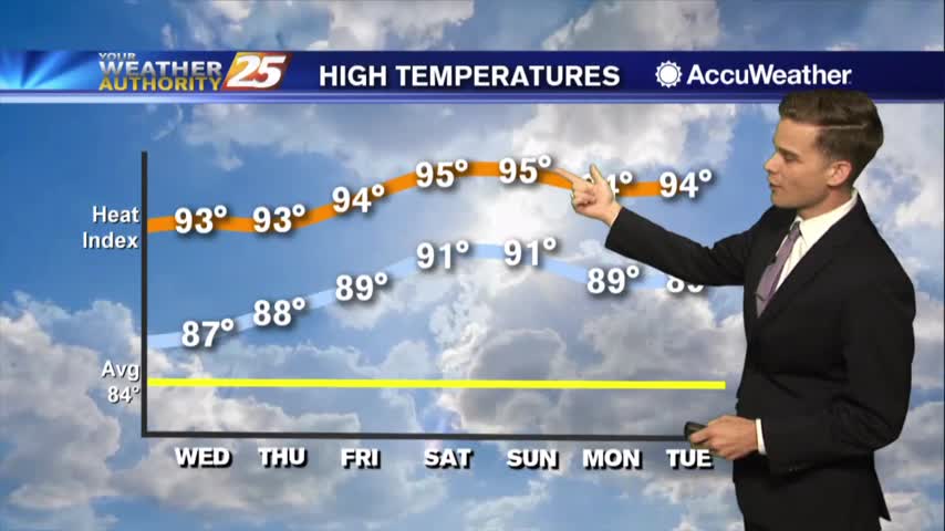
Heat & humidity are here to stay
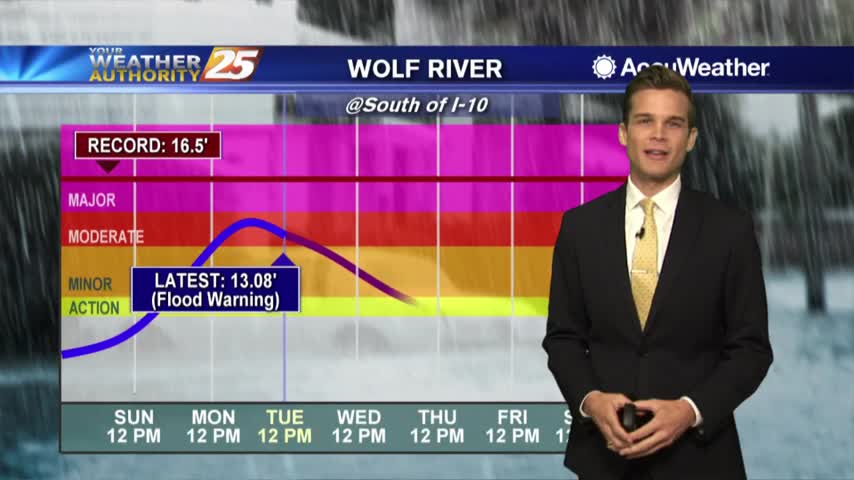
Another beautiful day, but some rivers remain high.
Last day of nice weather...rain later this week.
Humidity building in...rain chances aren't far off.
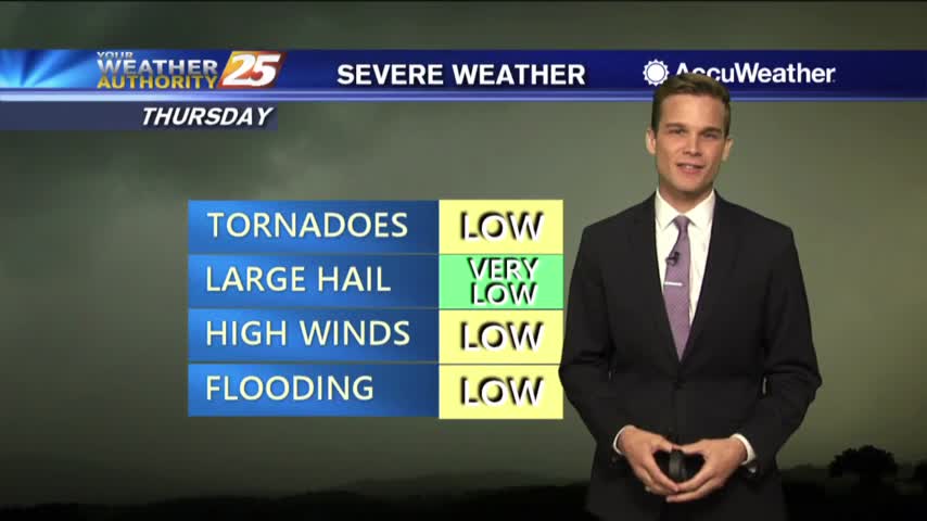
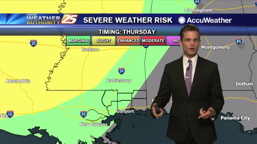
Clouds moving in. Strong T-Storms Possible by Thursday.
Sunshine tomorrow...possibly t-storms this weekend.

Passing showers today...sunshine tomorrow.
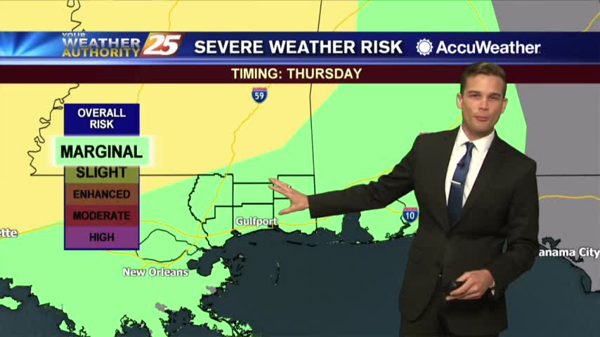
Sunny again....Severe T-Storms By Thursday? Your Full Forecast Right Here
Sunshine for your Tuesday!
A mixture of sun and clouds will continue through this afternoon with a fairly dry easterly wind...

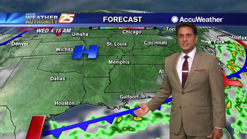
A MUCH better start to the day with a cooler/drier air mass in place...