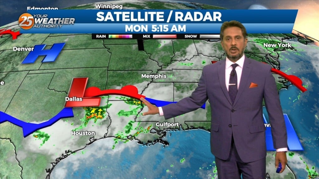
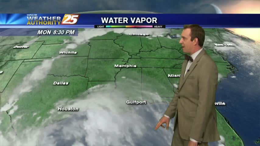
9/25 - The Chief's "Elevated Rain Chances Ahead" Monday Morning Forecast
The upper level pattern across the country remains complex, with an area of high pressure extending from northern Mexico to the Great Lakes and low…
The upper level pattern across the country remains complex, with an area of high pressure extending from northern Mexico to the Great Lakes and low…
Mississippi is still under the influence of upper level troughing which is slowly moving east while further west has a large ridge with a cutoff low. This trough…
A strong and persistent meso-low currently over the Arklatex region and broader and weaker shortwave trough in the upper levels will continue to work in conjunction to produce…
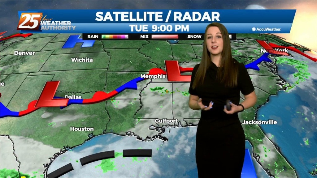
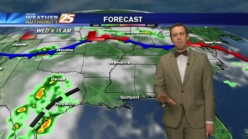
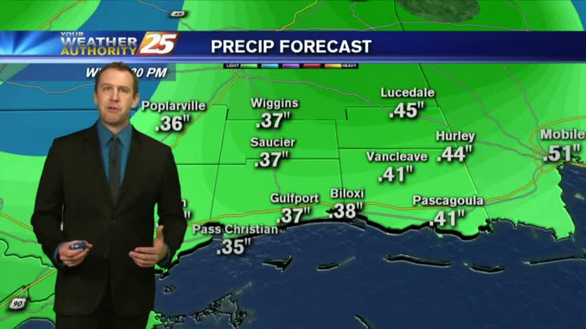
Tonight through Wednesday Night, little change in the ongoing pattern is expected through Wednesday night as a broadly diffluent westerly upper level pattern, a weak shortwave trough, and favorable…
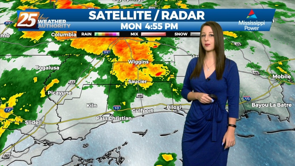
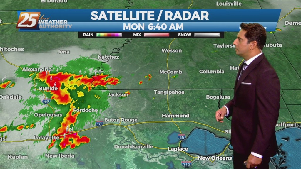
The overall current pattern is fairly interesting across the Lower Mississippi River Valley. A surface "frontal" boundary resides generally along and north of the I20 corridor. As the…
In a near carbon copy of last week, rain chances will once again continue to be high through the period. High pressure over the western Atlantic will keep…
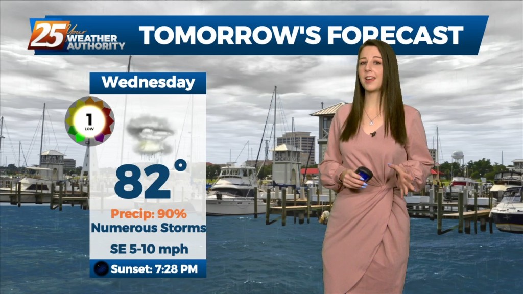
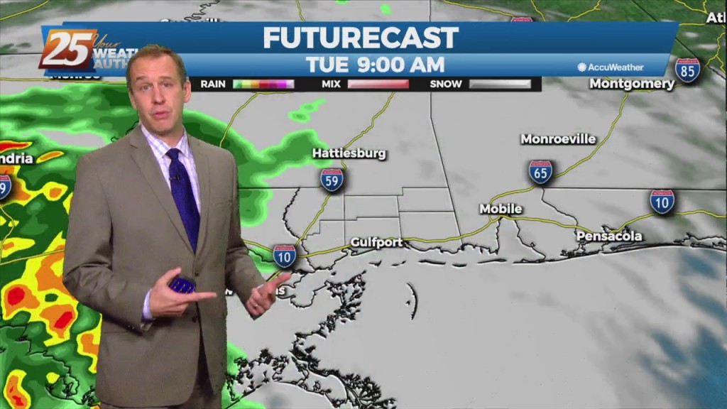
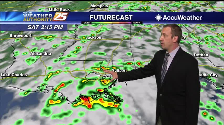
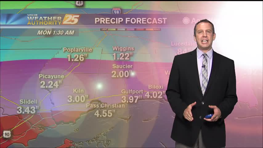
If we thought we had a lot of rain and coverage today it looks like things will ramp up over the next 3 days. We start tomorrow…
There is little change in thinking from the previous forecast concerning the overall trend of gradually increasing moisture, lift, and rain chances through Wednesday. The overall…
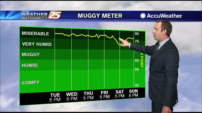
The end of last week was sunny and dry, but muggy air and grey skies have moved in. This was bound to happen eventually, but has been enhanced…
The upper level high-pressure centered along the northern Gulf Coast will continue to move south and weaken. An upper level trough digging across the Mississippi Valley and an associated surface cold front will drop southeast into the forecast area. Showers/T-Storms along…
The last couple of days have been nice and relatively drier, but tropical moisture is rushing back to South MS. It's already moving in actually, and the cloud cover and rain chances will continue to climb through tomorrow night. That…
Today was the last and wettest day of the week, with much more rain expected over the weekend and into next week.

Today was sunny and dry, but more and more clouds will arrive as we head through the weekend.
Another great day in South MS, but it'll be the last day without rain we'll see for a while....

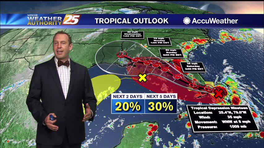
It's going to miss to the left, but Hurricane Laura is on its way and will bring us a few rainy days....
Hurricane Laura will miss us to the west, but we're still in for a few days of disturbed weather.
Marco is weakening rapidly, so we won't see much of a significant impact as it passes to the south, but Laura is slowly strengthening....

Tropical moisture remains in place, so widespread shower activity lingers for at least one more day before changes move in.
Slightly more rain today than yesterday, but much more lies ahead for the rest of the week!
Sowers and t-storms earlier this morning will flare back up this afternoon...
A warm start to the day with scattered showers and t-storms in the N'tern Gulf of Mexico...
It was cloudy, rainy, and humid today, but will be much drier for the next few days....
A disturbance has brought tropical moisture home causing cloudiness and a few showers, but it'll be a much drier this week than last....
We're in for a wet week ahead as we'll see several days like today with late morning/afternoon showers and partly sunny skies. Weekend outlook not looking good....