2/20 - The Chief's "Warming Trend begins" Tuesday Morning Forecast
An area of upper level high-pressure extends from western Mexico northward through the Rockies. At the surface, high pressure extended from New England to the Louisiana…
An area of upper level high-pressure extends from western Mexico northward through the Rockies. At the surface, high pressure extended from New England to the Louisiana…
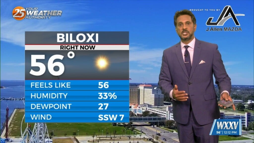
Very nice comfortable/dry conditions ahead today as highs top out in the mid-60s for most. Cool tonight, but no freezing temps expected. The nice continues into…
A lovely day is ahead with mild temperatures and sunny skies. A few upper level non-rain producing clouds will move through from time…
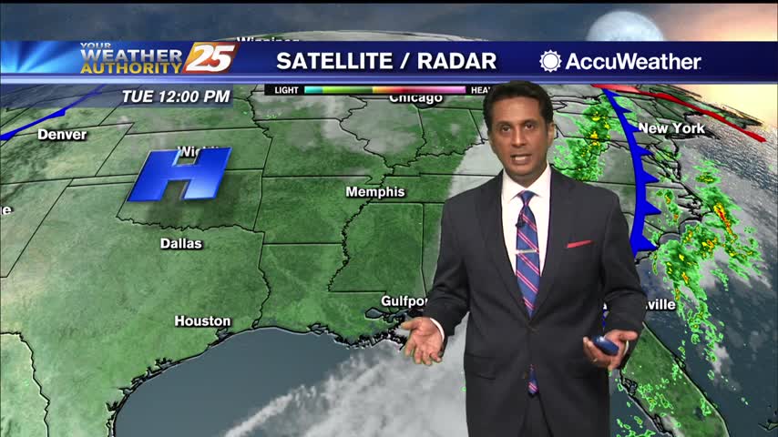
The upper level pattern is transitioning just slightly with a weak disturbance moving into the central Gulf States today. The best uptick in cloud…
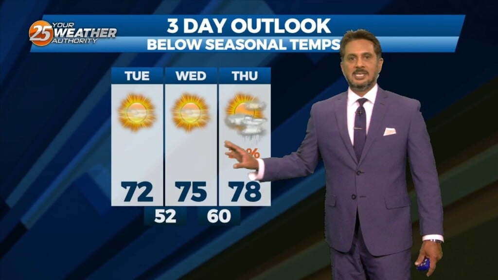
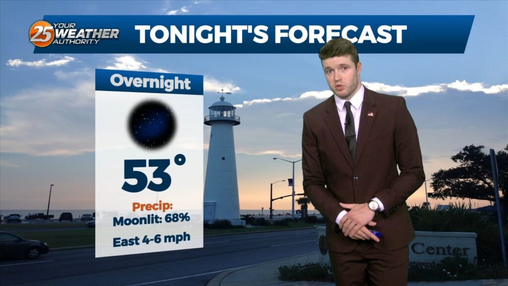
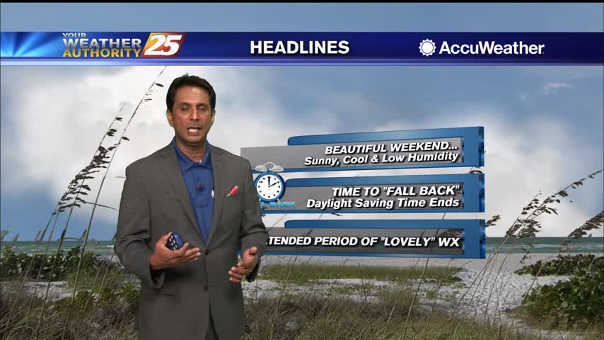
Lovely…but below seasonal temperatures will continue this afternoon as high pressure slides eastward to the Atlantic Coast by Wednesday afternoon, eventually turning low level flow onshore…
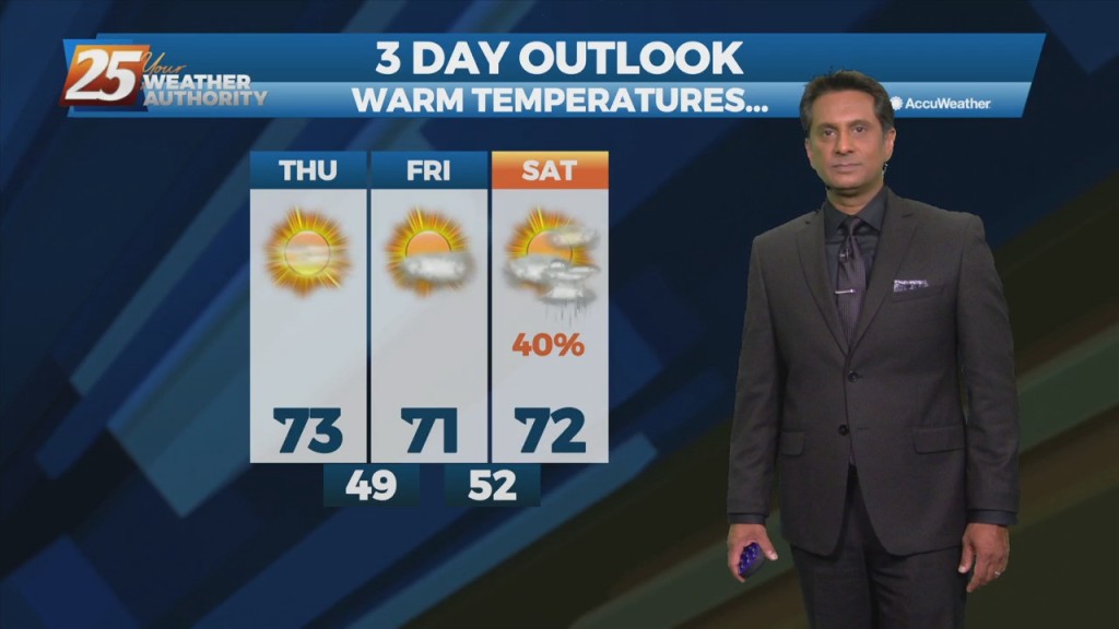
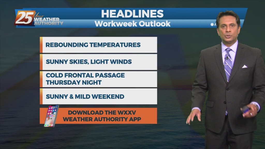
High pressure to the NW will continue to move in and shape the forecast into the weekend. With insolation during the afternoon hours, expect temperatures to…
This afternoon will remain mostly quiet outside of a couple possible showers over the coastal waters. We see our first real warm-up day of the warming…
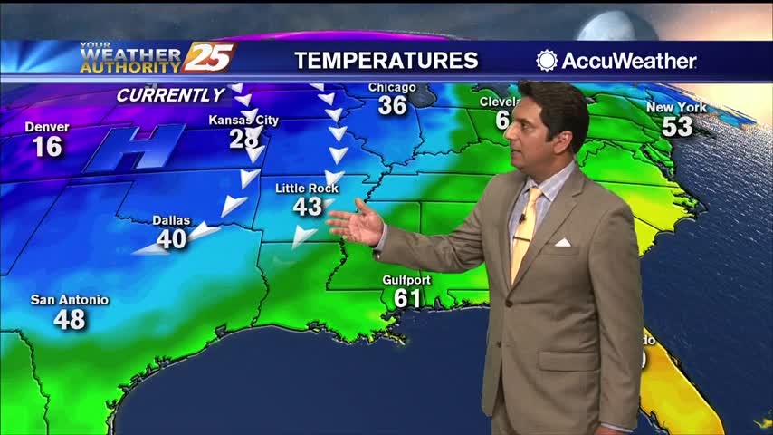
Post front airmass continues to push in today as upper level high-pressure to the NW shapes the short term forecast. This will bring another below normal temperature…
High-pressure will begin moving in from the NW, ushering a colder/drier air mass. Pleasant condition will continue through Friday before high-pressure moves SE allowing for the next system…
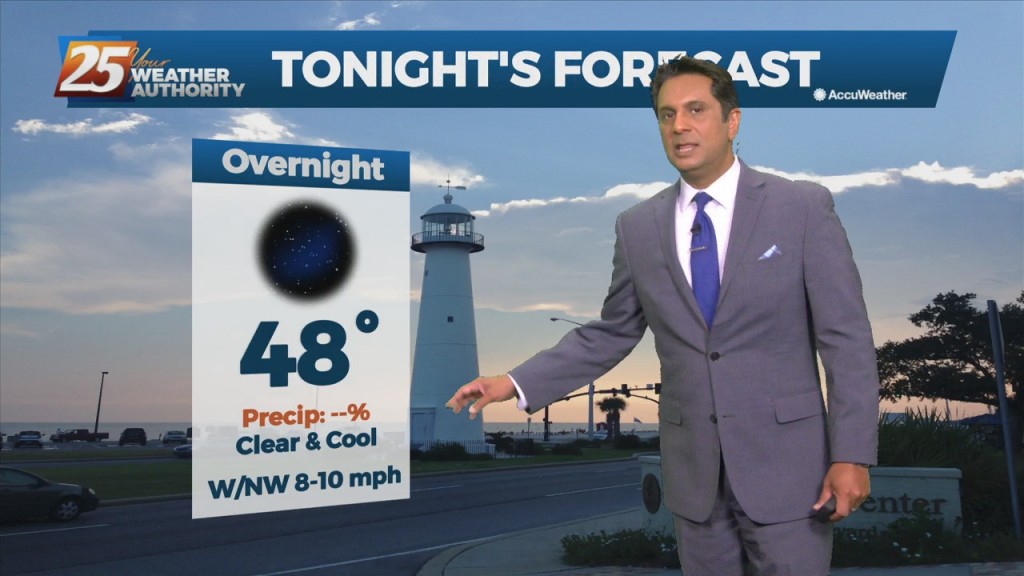
High pressure will remain over the area bringing dry conditions with mild days and clear cool nights. A west-northwestly flow will remain in place through the…
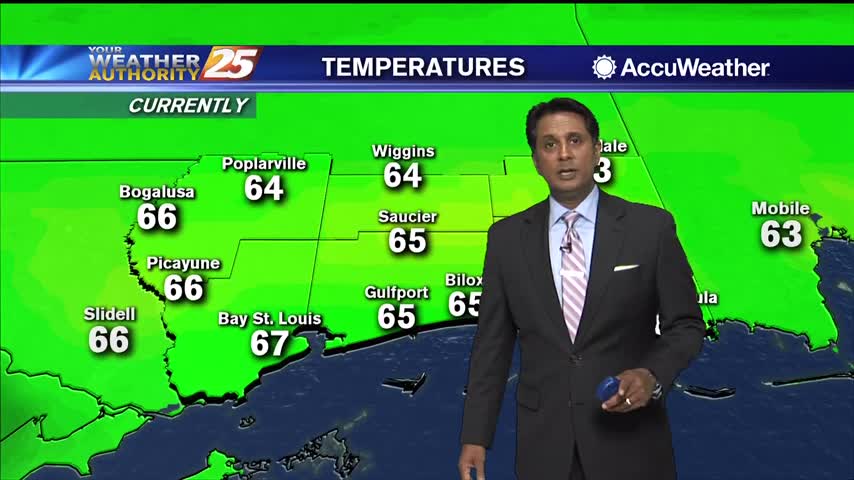
Under the influence of the high pressure, today and Tuesday will bring sunny skies and light winds as highs/lows each day becoming a few degrees warmer than…
A large upper level low-pressure will continue to spin over the western Great Lakes through Saturday. Another upper-level disturbance to the NW will move through tonight…
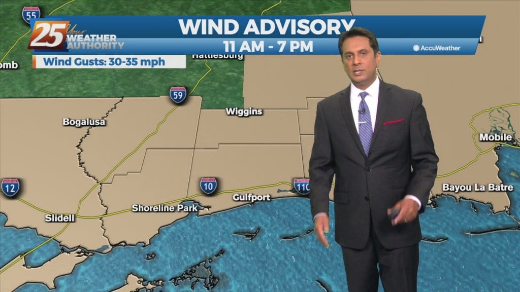
With the severe weather behind us the rest of the forecast will be focused on temperatures and winds. Windy conditions will remain in place today with winds…
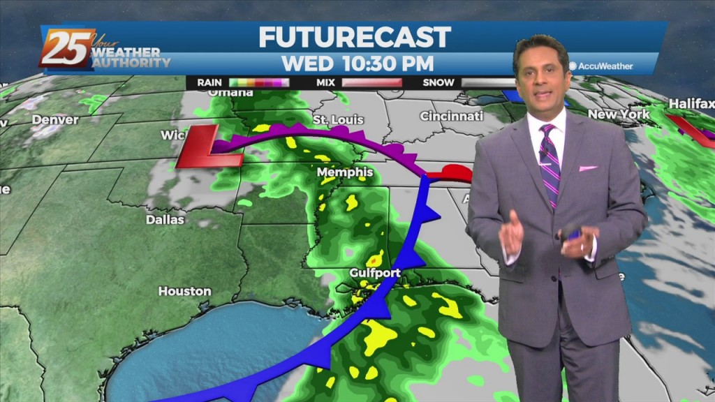
We continue to see a severe weather/heavy rain threat Wednesday afternoon and Wednesday night with much cooler weather to follow. An approaching cold front Wednesday will bring the…
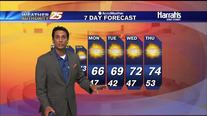
A lovely afternoon ahead with sunshine and seasonal high temperatures...
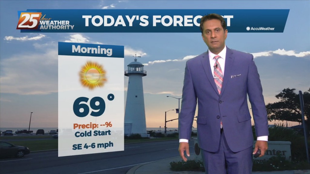
After a CHILLY start, temperatures are warming nicely into the upper 60s...
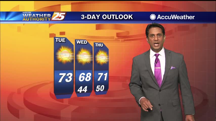
Temperatures have warmed nicely with a lovely autumn afternoon ahead.
A lovely afternoon ahead with sunshine and the winds relaxing...
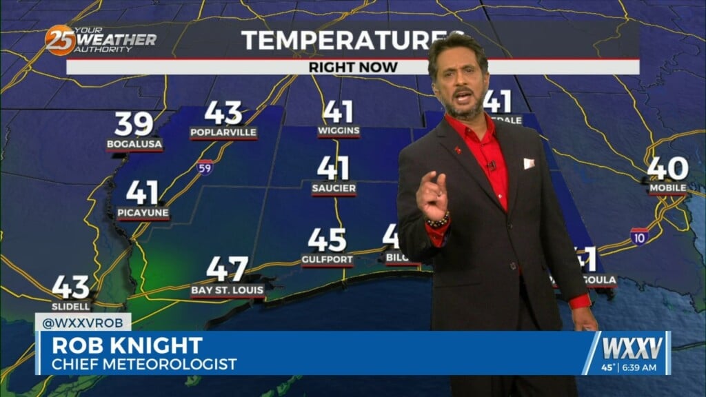
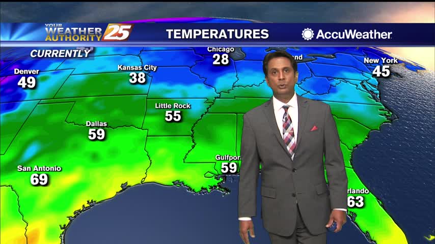
A chilly start to the day with temperatures in the upper 40s/low 50s...

A few mid/upper level clouds linger with winds gusting into the 20 mph range...
A dry front moved through the area overnight providing for a reinforcing shot of cooler drier air this morning...
Sunshine and nice temperatures with breezy conditions heading into this afternoon...
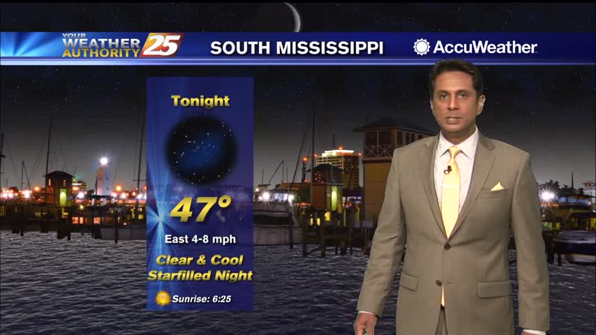
The weekend's storm system is well to the east with areas of patchy fog lingering along south Mississippi...
After a CHILLY start to the day, the mercury is warming nicely into the 60s...