4/26 - Jeff's "Severe Weather Threat" Wednesday Night Forecast
Cloud coverage will increase tonight ahead of a complex of thunderstorms that will move in. Expect rain to move in around daybreak tomorrow and persist through much…
Cloud coverage will increase tonight ahead of a complex of thunderstorms that will move in. Expect rain to move in around daybreak tomorrow and persist through much…
Surface high pressure and an upper level ridge are sliding to the east primarily bringing a shift in wind direction through southeasterly and ending up southerly and…
Surface high pressure and an upper level ridge are sliding to the east primarily bringing a shift in wind direction through southeasterly and ending up southerly and around 10…
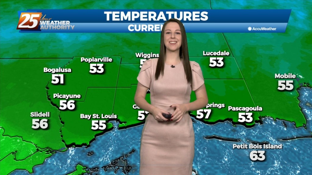
We've officially had a cold front make it's way through our area and can expect colder and drier conditions behind the front for a brief period of time.…
Warm and moist air advection continues as we stay ahead of the trough over southern Colorado. The advection as well as isentropic lift has created some showers…
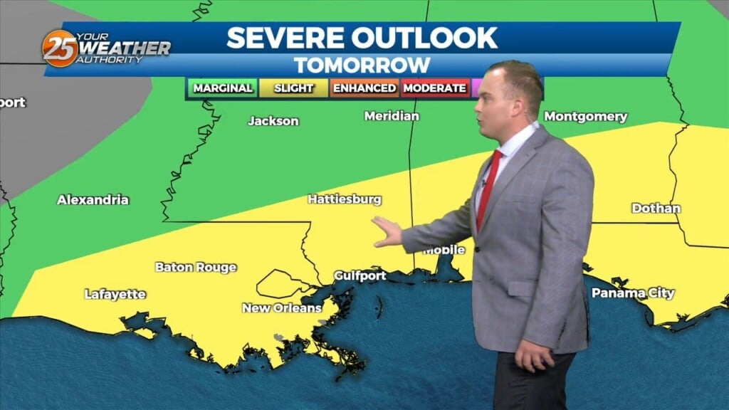
The biggest concern in the short term is the potential for severe through the remainder of this afternoon and overnight tonight ahead of an approaching cold front.…
The biggest concern in the short term is the potential for severe through the remainder of this afternoon and overnight tonight ahead of an approaching cold front. Already…
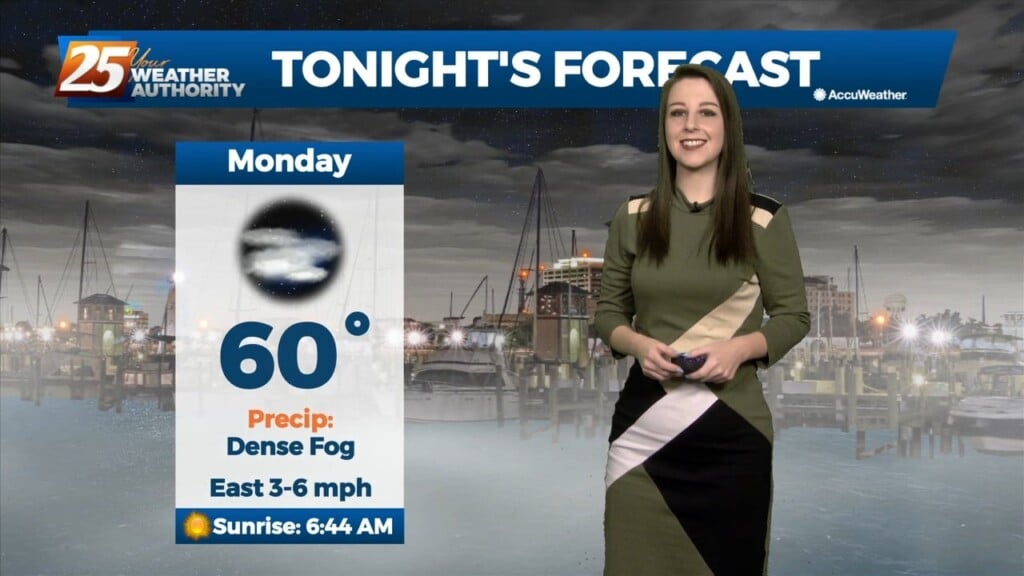
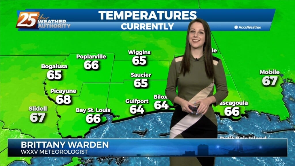
We're on tap for yet another cool and muggy evening. Temperatures will bottom out to the low 60's this evening and once again, we'll have fog in…
Tonight, we can expect cool temperatures and foggy conditions yet again. Heading into tomorrow though, we'll see the potential for severe weather in our area.…
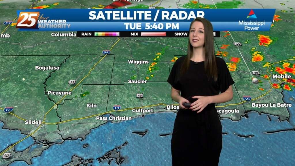
The main focus of the forecast will be the activity we'll see tonight. Tonight will hold a 90-100% chance for showers and thunderstorms in advance of an approaching…
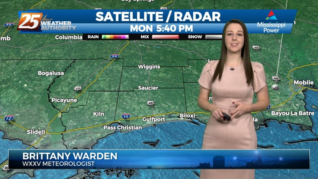
We're on tap for a quiet but chilly evening. Temperatures will bottom out towards the mid 50's and we'll see a gradual increase in cloud…
Pleasant weather with seasonable temperatures have been observed throughout the day today on the backside of a shortwave trough lifting into mid-atlantic CONUS as height rises and stable air…
The upper low to our west will move eastward across Texas this afternoon and evening, and be located near Shreveport by early Saturday morning. Beyond that point,…
Upper ridging forecast to drift slowly westward over the next few days to be centered over Kansas/Oklahoma by Friday. Main forecast question is whether ridging is far enough…
The risk for severe weather today will be greater than what we saw yesterday, with the main risks being damaging straight line winds around or > than 60mph, large…

Aside from a normal start to summer and high temps well above normal values, we will throw several thunderstorms on the pile for Thursday night into Friday…