2/11 - Sam Parker's "Severe Storm Threat" Tuesday Night Forecast
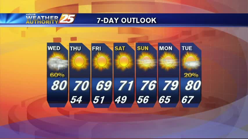
Possible chance to see severe storms Wednesday afternoon and night. Smaller rain showers continue over night for some of the area. Wednesday will be another warm…
Possible chance to see severe storms Wednesday afternoon and night. Smaller rain showers continue over night for some of the area. Wednesday will be another warm…
Cloud cover will be dominant this afternoon with humidity continuing to increase. There will also be a 30-40% chance of isolated showers with an embedded rumble…
Today starts off with cool-to-mild conditions that will change through the day. Southerly winds will help increase moisture, especially this afternoon. This all happens ahead of…
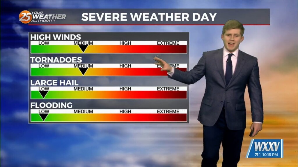
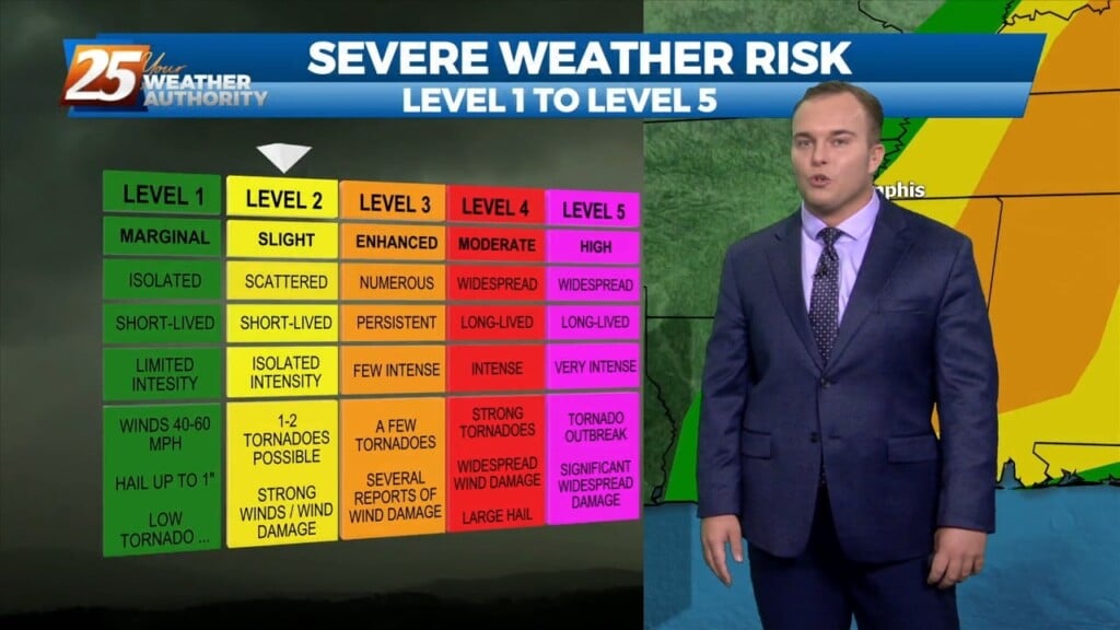
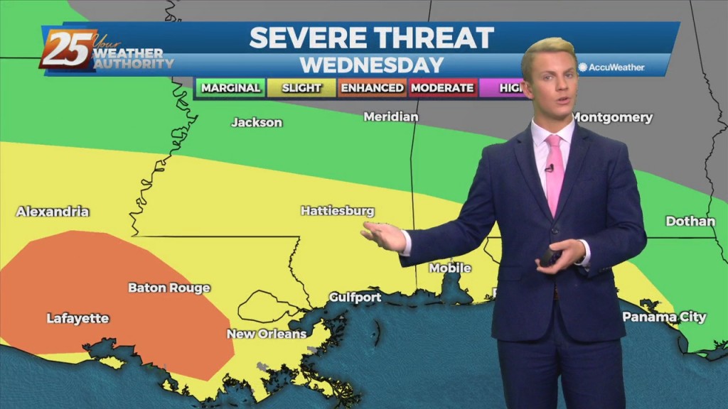
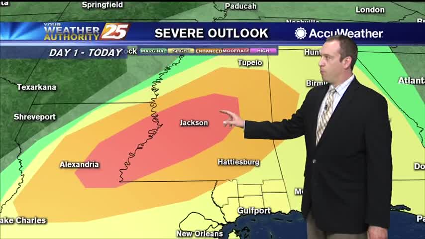
A Severe Thunderstorm Watch is in effect for our area until 1 AM. Thunderstorms bring the potential of strong winds and small hail with the…
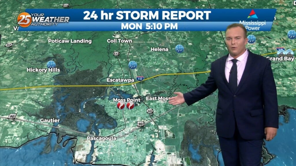
The threat for strong to severe thunderstorms will continue through a portion of this evening. Thunderstorms have the potential of producing damaging winds, small hail, and…
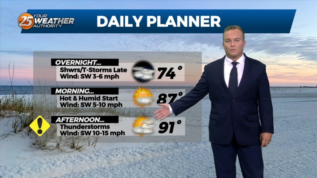
Winds have primarily become a southerly flow which is taking the humidity up another notch. Overnight, there is the possibility for showers and thunderstorms after midnight.…
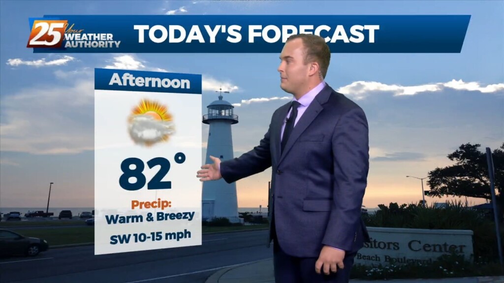
Skies have cleared some since this morning. Temperatures will be in the 80s for a lot of the area again today. Winds will become breezy this afternoon,…
Warm and moist air advection continues as we stay ahead of the trough over southern Colorado. The advection as well as isentropic lift has created some showers across the…
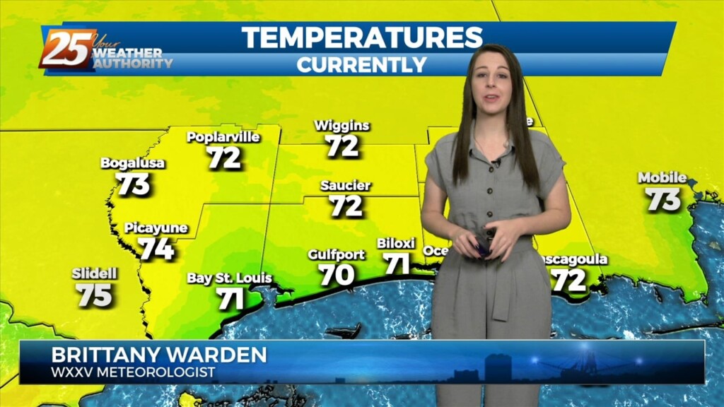
The warm and humid pattern continues across South Mississippi. Temperatures will be in the 70s this afternoon under predominantly cloudy skies, with breaks in the clouds…
Mostly cloudy skies, warm temperatures, and a 50% coverage of scattered showers and thunderstorms are expected this afternoon. A line of showers and thunderstorms that will…
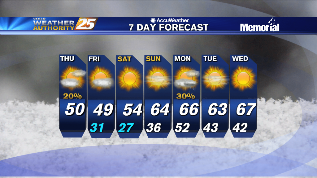
Clear skies will be in place tonight following the gloomy weekend. Temperatures will be colder tomorrow morning as a colder airmass will settle in tonight. Tomorrow will be…
With the calm-to-light winds and high moisture content, there is the potential for fog tomorrow morning. Monday will have mostly cloudy to overcast skies across South…
Upper ridging forecast to drift slowly westward over the next few days to be centered over Kansas/Oklahoma by Friday. Main forecast question is whether ridging is far enough…
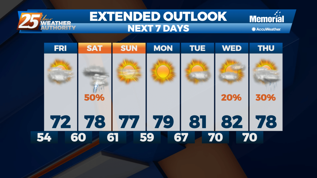
Quiet conditions through St. Patrick’s day with linger cloud coverage and mild temperatures In the 70s. The forecast gets active again Thursday night and early Friday. Our next disturbance is…
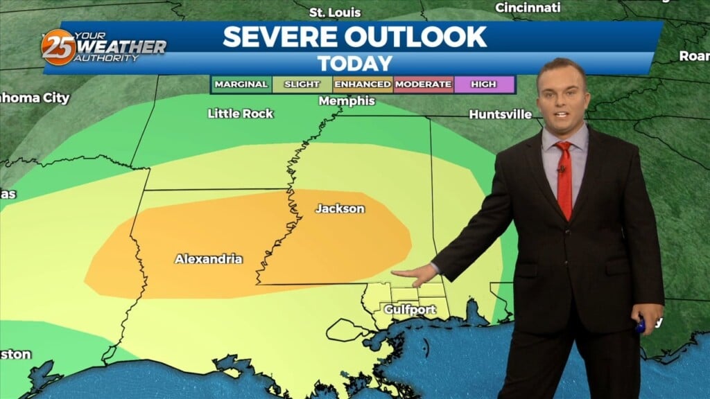
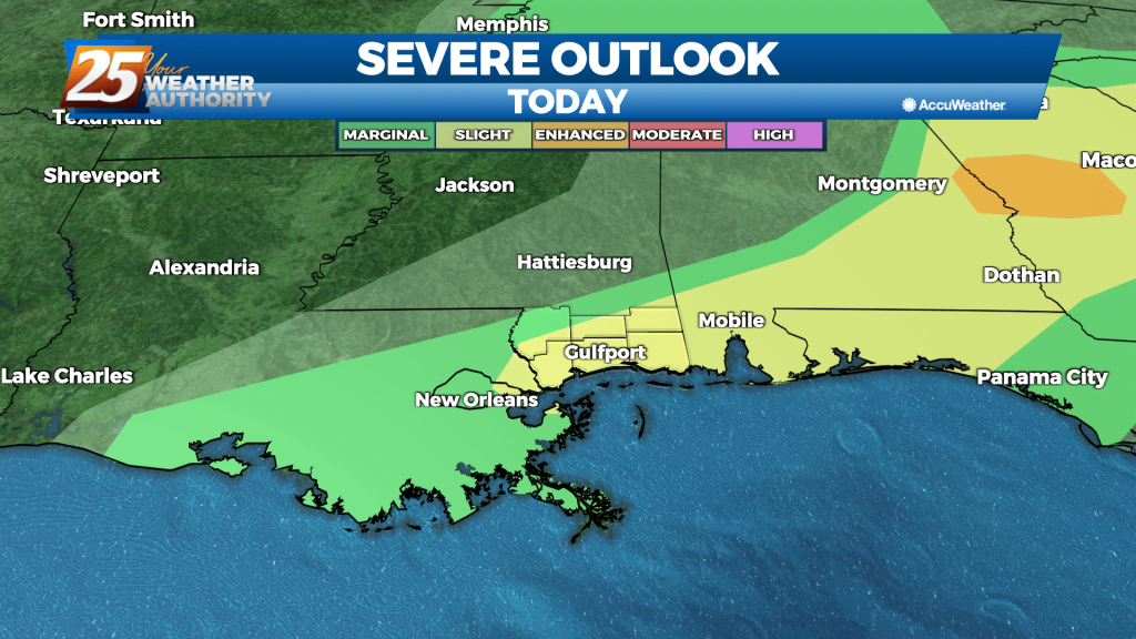
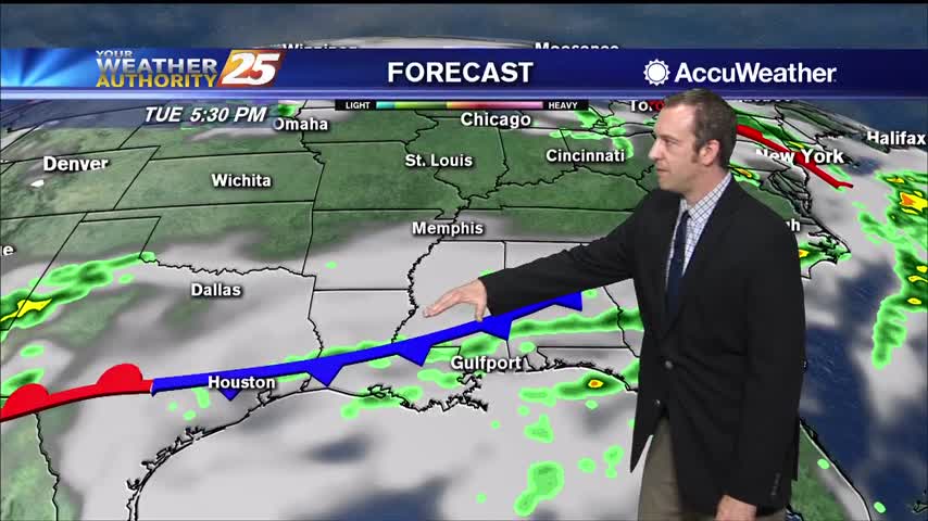
Rapidly changing weather conditions will be the rule over the next 18 to 24 hours, with the threat of severe weather and heavy rainfall continuing to be…
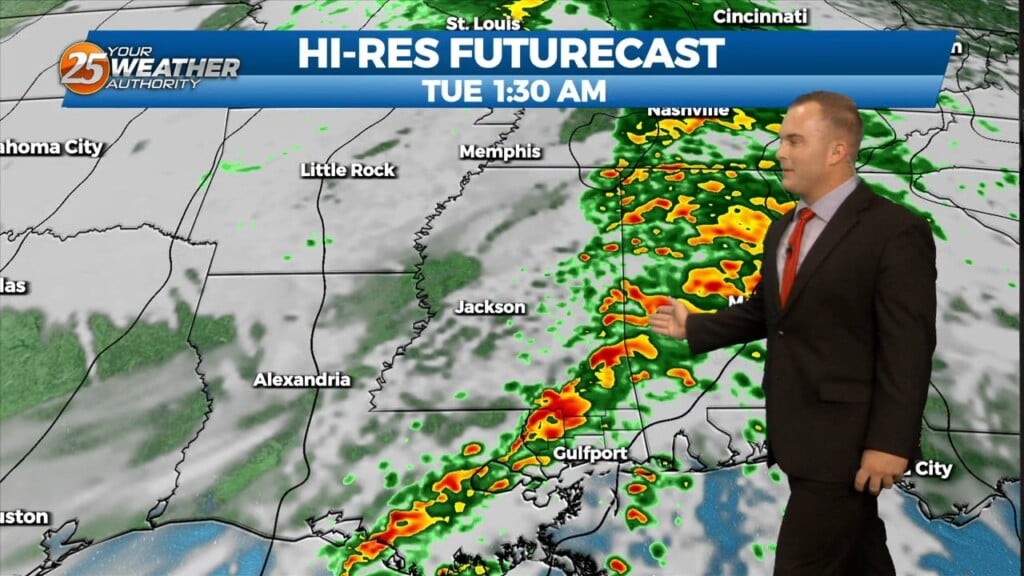
First line of storms passed through without any severe weather and the threat has diminished, but we'll still see at least a few thunderstorms through the night.
Today was the last of the week we'll see clear, blue skies, but our cloudy, stormy weather won't last too long into the weekend.
It has been several days since our last round of active weather, but that changes now as showers and storms move in quickly overnight.
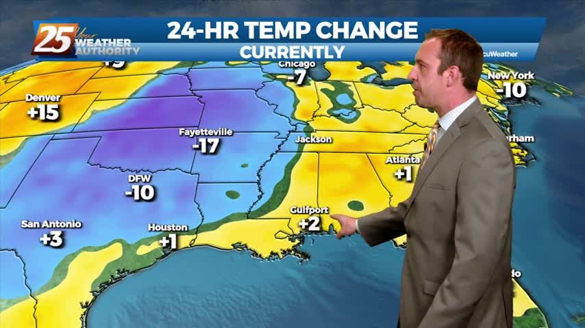
Showers and storms are streaming through for the rest of the night, bringing another round of colder, drier air for the end of the week.
Nasty, grey looking weather remains, but very little rain has fallen. That will change heading into tomorrow.
A cold front is moving in and strong thunderstorms are likely overnight before nicer weather moves in.

The storms have finally arrived and we'll see some form of active weather form now until the beginning of next week....
Tonight's storms will be the last we'll see for several days, but their "slight" risk of severe weather is worrying. Watch the forecast for storm details and the upcoming week's forecast.