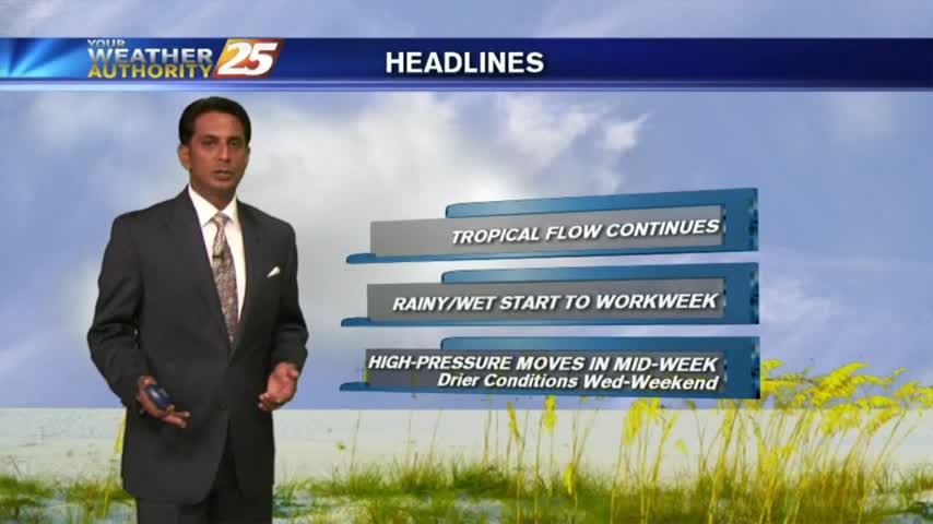
6/5 - Rob's Midday News "Wet Pattern" Forecast
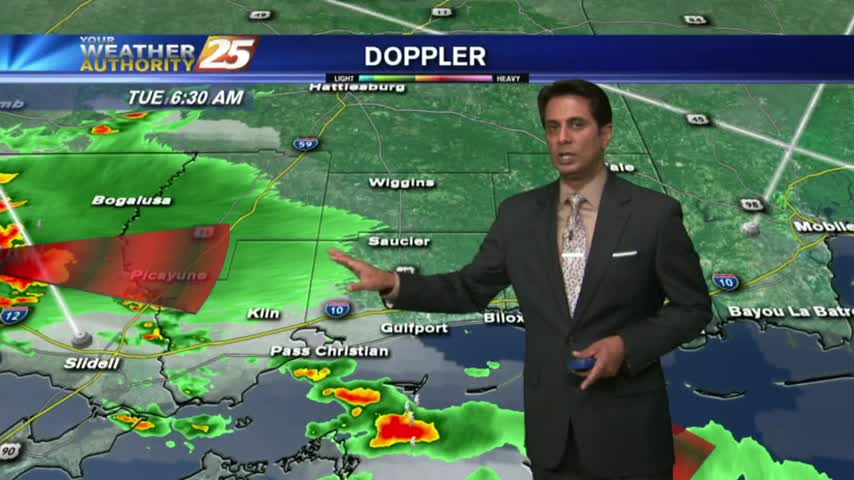
Showers/T-Storms continue to develop and move in from the SW, A FLASH FLOOD Watch is in effect...
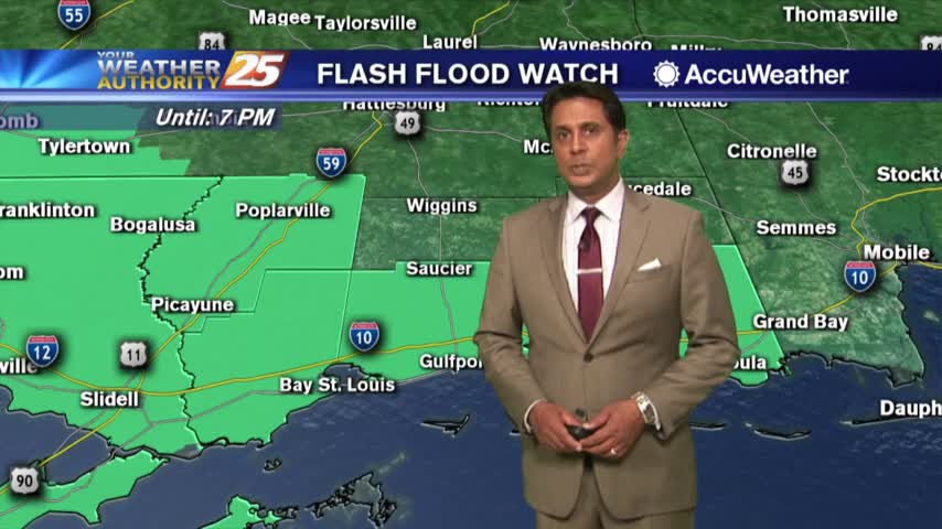
Showers/T-Storms continue to develop and move in from the SW, A FLASH FLOOD Watch is in effect...

A foggy and wet start to the day as a cold front is moving into the area from the west...
Another wet start to the day with a line of showers and t-storms moving in from the Gulf...

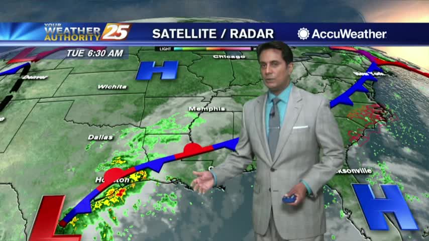
This morning we have isolated activity south, moving into the viewing area...

A warm/humid start with isolated showers & t-storms already affecting the area...

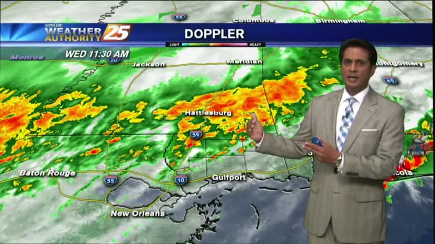
Temperatures continue to warm as the HEAT INDICES are in the mid-90s, with t-storms developing...
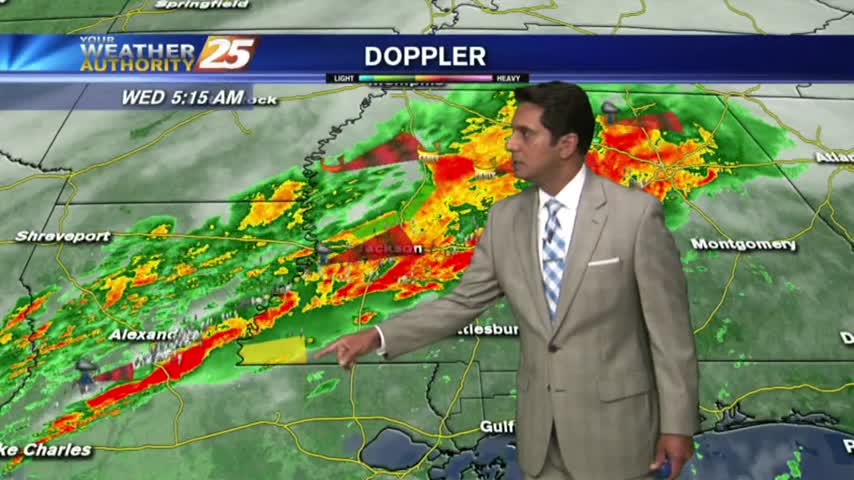
The cold front continues to slowly move through the area...with the energy beginning to fizzle out.
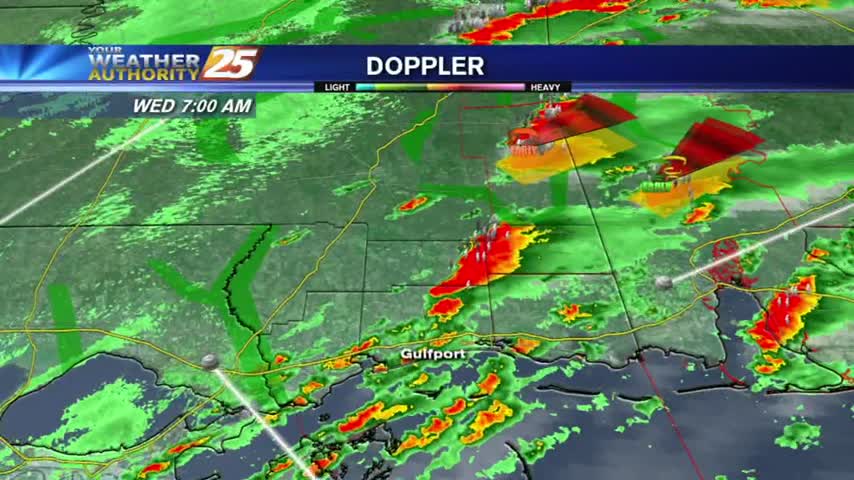
A disruptive start to the day with showers/t-storms and areas of DENSE FOG varying in intensity and location. PLEASE use care with your morning commute...
A cool and humid start to the day with showers/t-storms already developing to our SW, moving NE...

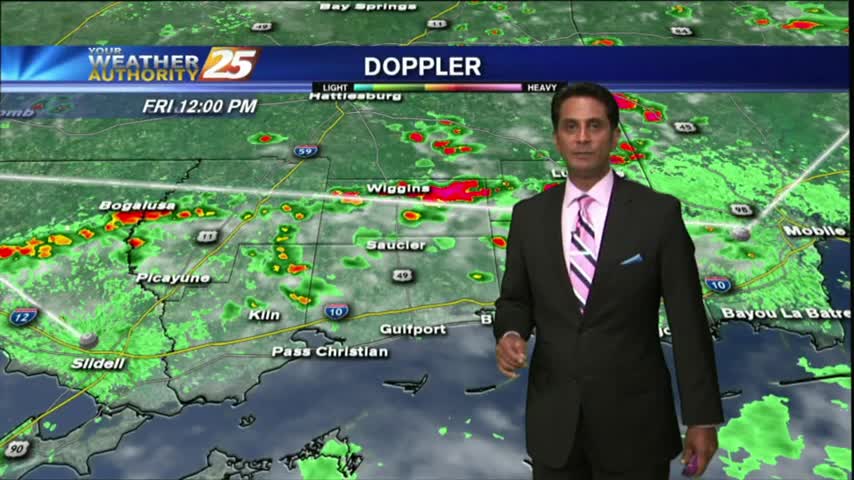
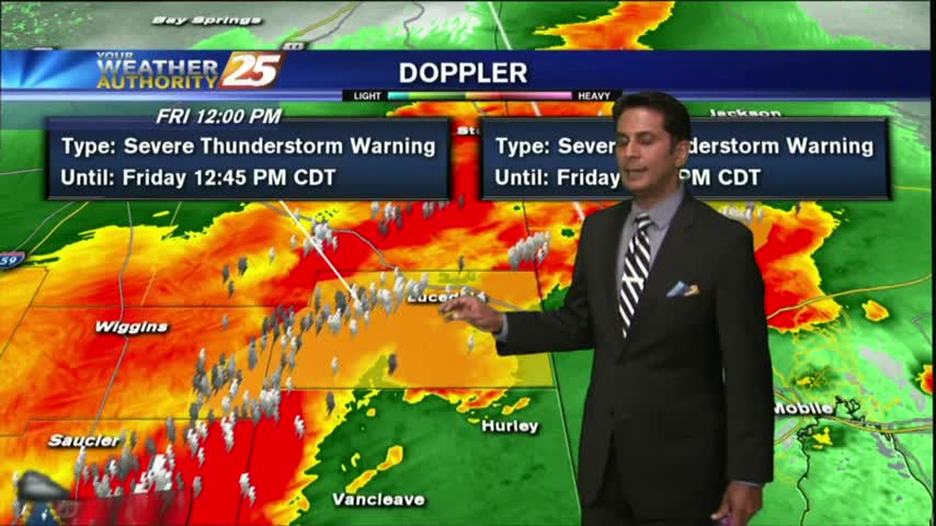
The humidity and temperature will continue to rise into tomorrow ahead of our next cold front, which could bring some damaging weather overnight Friday. Watch the full forecast for details.

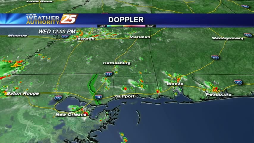
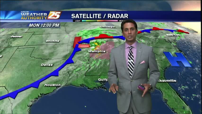
A mild start to the 1st full week of autumn...with showers/t-storms moving into the area from the SE...
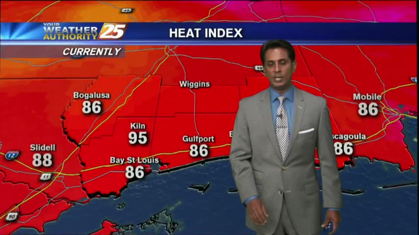
It's a HOT late summer afternoon as temperatures area climbing into the upper 80s...BUT, the HEAT INDEX is much higher...
After a rain-free start to the day, showers and t-storms are moving into and developing along the viewing area...

A clear start to the day has changed as clouds have moved in from the west and SW...along with isolated showers/t-storms...
Another morning with showers/t-storms over the sound/northern Gulf of Mexico moving into the Southern 6...

Overnight showers/t-storms have made their way into the sound and along the immediate beach. More activity to come through today...
After a brief period of sunny skies and low humidity, a very TROPICAL AIR MASS is back in the region with showers/t-storms moving in
After a rain-free start to the day under partly cloudy skies....the clouds and activity has moved back into the viewing area...

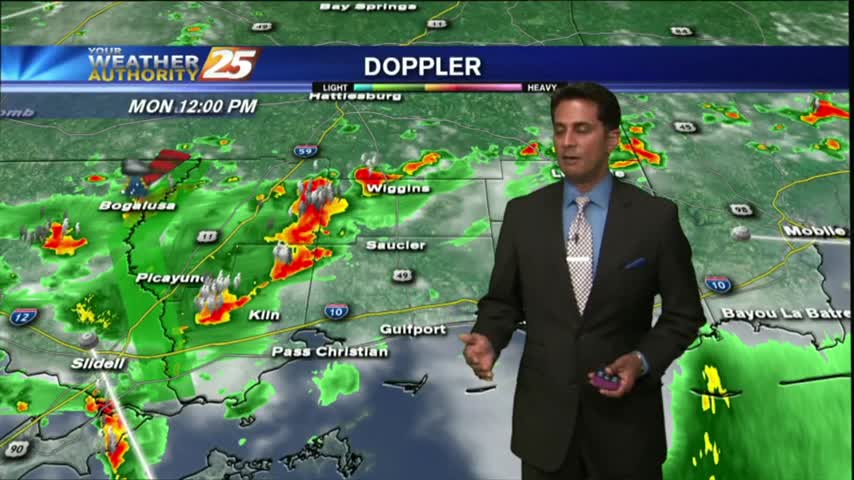
It's a gloomy start to the workweek/Memorial Day with showers/T-Storms, which continue from last night...

With a stationary front over head, showers/t-storms continues with areas of patchy fog along the Southern 6...
A line of T-Storms moving into the area in advance of an approaching cold front...
Showers & t-storms moving into and developing along the Southern 6 with a TORNADO WATCH in effect...
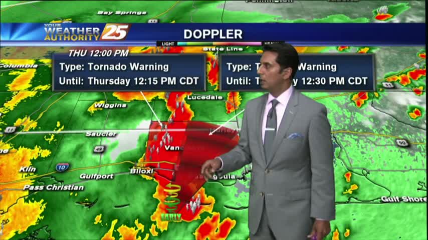
SEVERE WEATHER continues to move across the Southern 6...
After a cloudy, warm/humid start to the day...showers & t-storms continue to develop and move into the area...