3/24 - Rob Knight's "Heavy Rain Continues" Afternoon Forecast
Another round of HEAVY RAIN will move into the area this afternoon/evening...

Another round of HEAVY RAIN will move into the area this afternoon/evening...

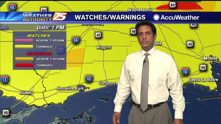
The threat for SEVERE WEATHER will be in the area this afternoon though mid-evening...

Areas of DENSE fog this morning, then the possibility for SEVERE WEATHER this afternoon/evening...
Areas of DENSE fog this morning, then the possibility for SEVERE WEATHER this afternoon/evening...

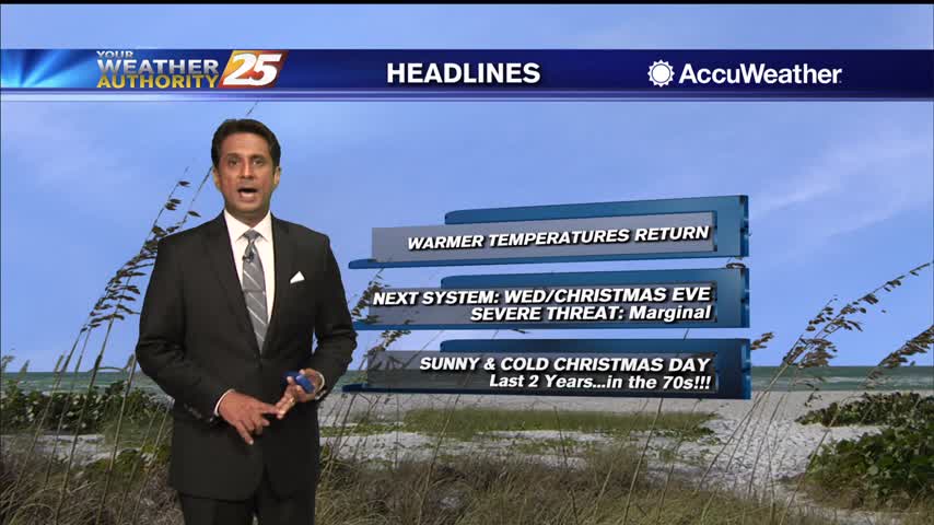
Even warmer temperatures this afternoon with a cold front draped across N'tern Mississippi...

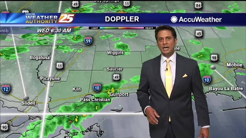
Areas of DENSE FOG this morning with isolated rain ahead...
A cold afternoon ahead as temperature will struggle to make it into the upper 30s...

A warm start to this final day of the year with patchy fog and light rain moving in from the south...
A very nice afternoon ahead with high temperatures way above seasonal norms...
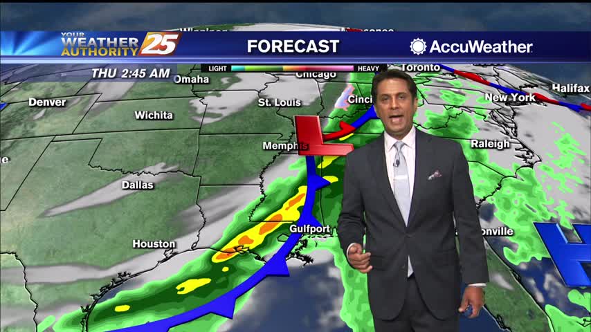
An initial surge of warm air and moisture has led to some areas of light rain showers already, but a line of stronger storms is expected to roll through after midnight. The combination of a squall line of widespread showers…
There is a MARGINAL/SLIGHT risk for severe thunderstorms this evening for south Mississippi.
A warmer start this morning as a vigorous weather system will move through tonight...
A lovely afternoon ahead with seasonal temperatures and sunshine...

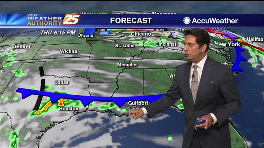
Showers and t-storms from the SW will continue to move NE into south Mississippi...
A lovely start to the day with clear skies and slight cooler temperatures...
An approaching cold front will push showers/t-storms west of the area into south Mississippi...

A warm and humid start to the day in advance of an approaching cold front...
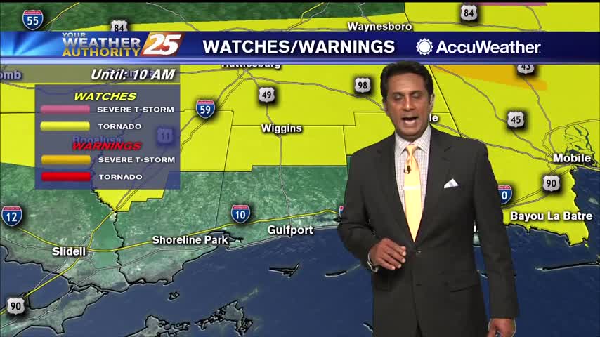
A very windy start to the day with multiple watches in effect as a vigorous system approaches...
A weak cold front moving south will push through the area this afternoon. Scattered rain will move in post-frontal overnight into Friday morning. At this time, it seems like the front will begin a slow push back to the north…
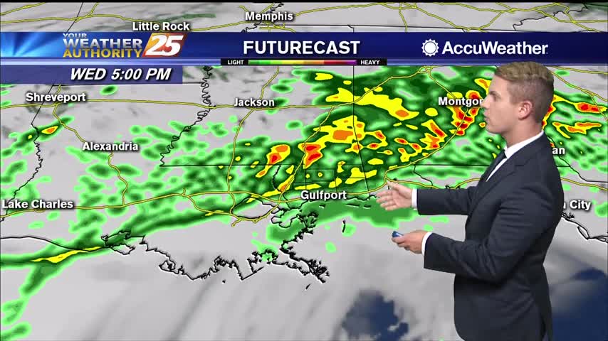
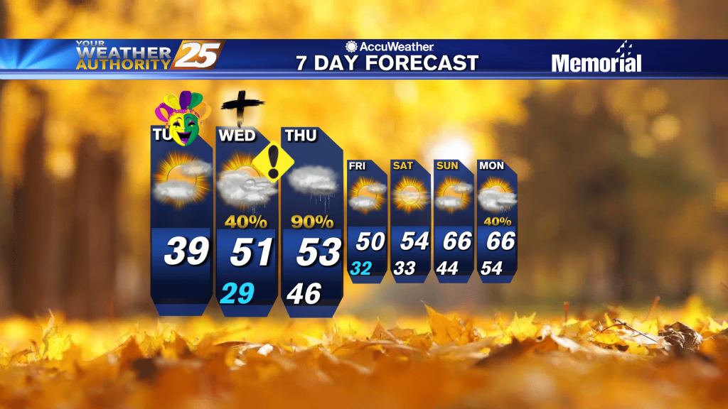
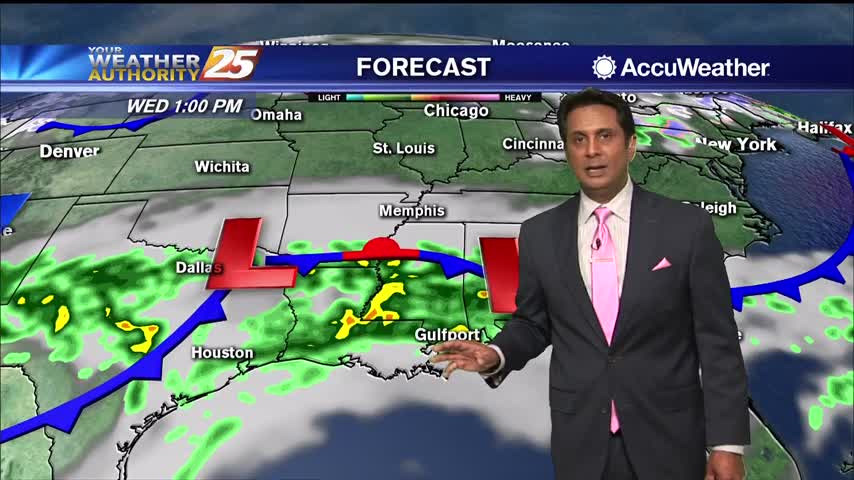
Wednesday afternoon and evening, everyone in South Mississippi will likely see showers and thunderstorms. Some thunderstorms may produce heavy rainfall, gusty winds, and an isolated tornado or two. The most likely time of arrival for any strong to severe storms…
What will likely be the most impactful weather of the week is expected take place over the next 24 hours. An upper-level low pressure system is currently tracking across northern Mexico. A frontal boundary that moved into the region yesterday…
The current upper level pattern shows a weakness extending across the upper Mississippi Valley and a close low near Baja California. The disturbance that brought rain the local area yesterday is quickly racing east while the disturbance to the north…
A mild and humid start with isolated rain and areas of patchy fog...

A windy and humid start to the day with isolated rain moving in from the south...