2/8 - Rob Knight's "Midday News" Forecast
After a cloudy start...more in the way of sunshine this afternoon along with cool temperatures in the upper 50s to low 60s...
After a cloudy start...more in the way of sunshine this afternoon along with cool temperatures in the upper 50s to low 60s...
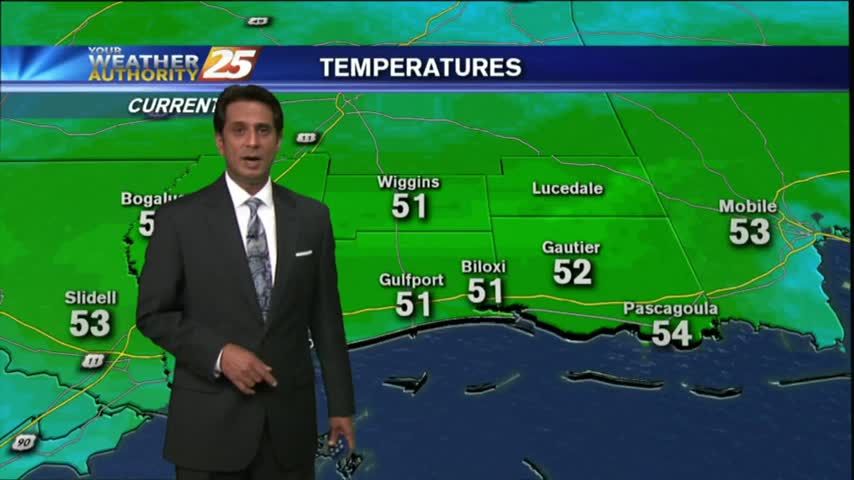
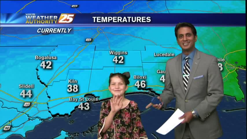
A MUCH BETTER start to the day with extensive cloud coverage and cooler temperatures, about 20-25 degrees colder than yesterday morning...
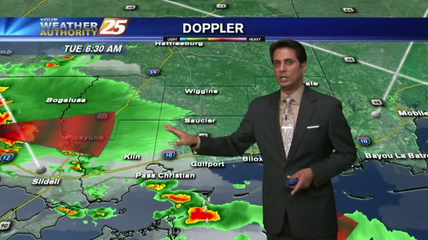
A disruptive start to the day with showers/t-storms and areas of DENSE FOG varying in intensity and location. PLEASE use care with your morning commute...
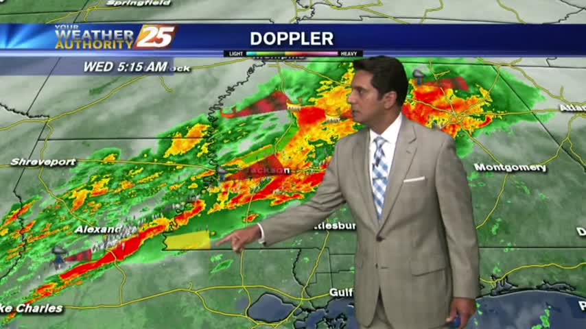
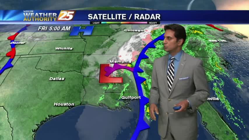
A cool and humid start to the day with showers/t-storms already developing to our SW, moving NE...
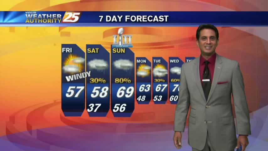
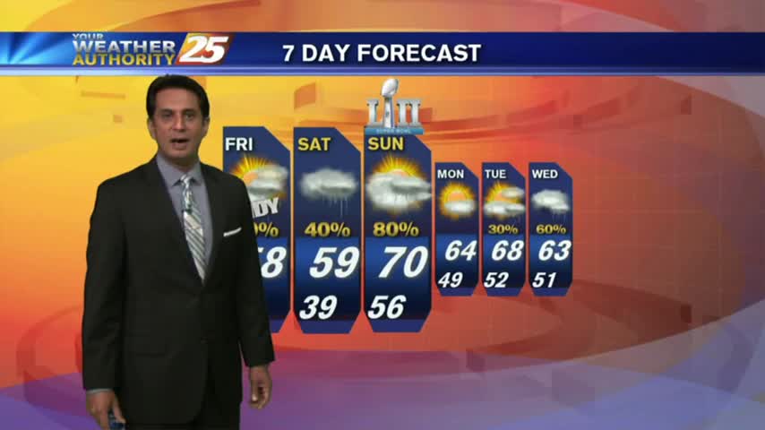
As the cold front has moved to the south of our area, cloud coverage will continue along with VERY WINDY conditions from the north...
After a MUCH WARMER start to the day, the mercury continues to climb into the 70s, under cloudy skies...
After a FREEZING start yesterday morning, temps are a good 20 degrees warmer under cloudy skies...
After a FRIGID start, major changes will occur as an area of high-pressure to our east brings the return flow back to the region...

A chilly/frigid start to the day with continued breezy conditions from last night...
After a RAINY weekend, the weather is east as clouds are clearing from the NW to the SE...

This morning brings MUCH WARMER TEMPS along with extensive cloud coverage and windy conditions in advance of an approaching cold front...
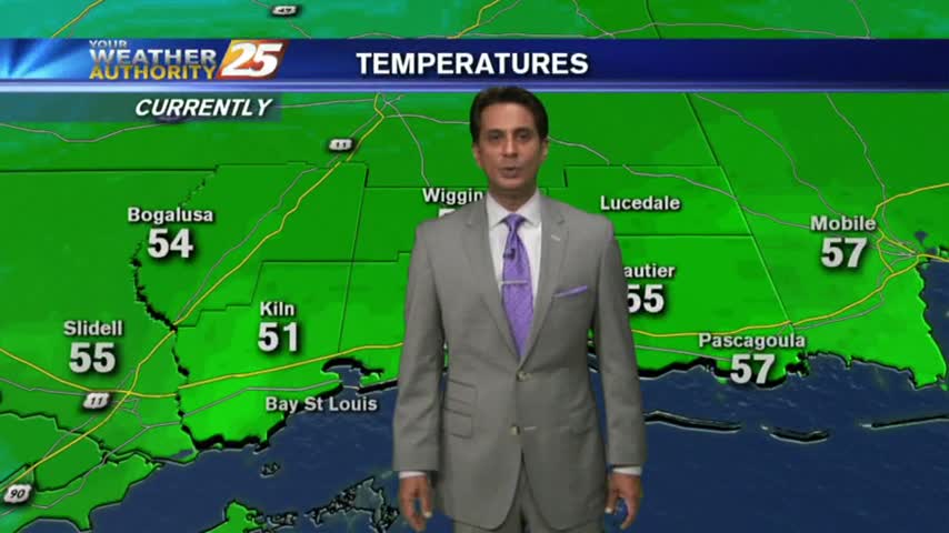
Surface high-pressure has shifted to our east and the return flow has begun to increase temperatures and humidity...
A FRIGID start to the day but warmer than what we have seen this past week. The weekend will bring seasonal conditions back to the Gulf coast...
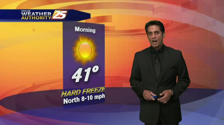
Another FRIGID start to the day with a HARD FREEZE WARNING through 11 a.m...with the warm-up beginning tomorrow...
Single digit wind chills and ice on the roads. Bundle up and drive slowly this morning.
Very dangerous roads this morning, and extremely cold conditions.
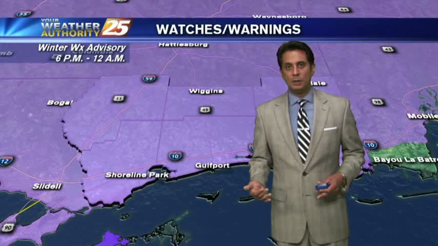
A cold start with warming temps in advance of an approaching cold front. Temps will cool this afternoon with the possibility for a few flurries late...
A FRIGID start to the day/workweek as a cold front from the central plains continues to move to the SE and into our area Tuesday...
Extensive cloud coverage continues but the clearing process will begin this afternoon with COLD and WINDY conditions...
Rain has ended as the cold front is now to the east of our area, with improving sky conditions expected through today...
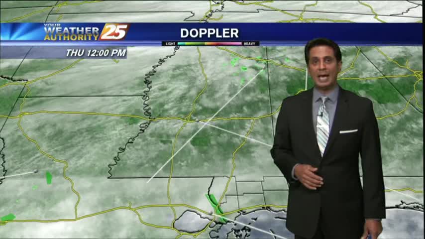
Another mild start to the day with DISRUPTIVE weather in the form of DENSE FOG developing through the viewing area and the region...
Patchy fog and low clouds are out in full force this morning through the region with light activity through our viewing area...
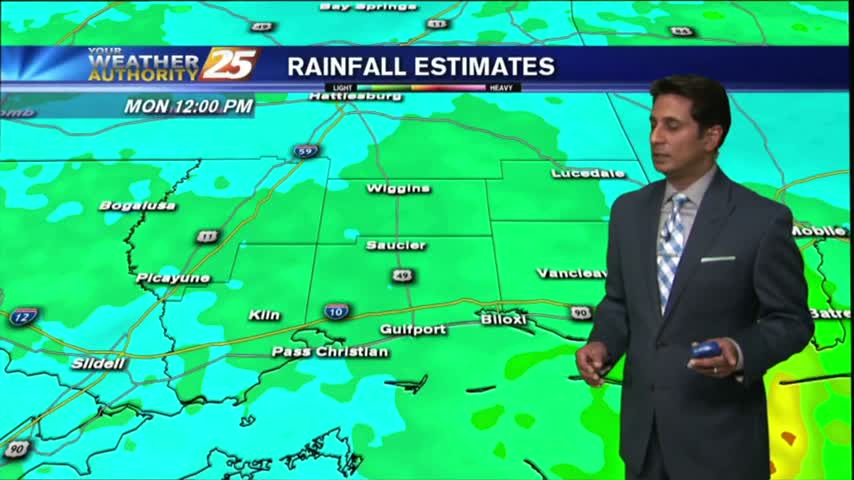
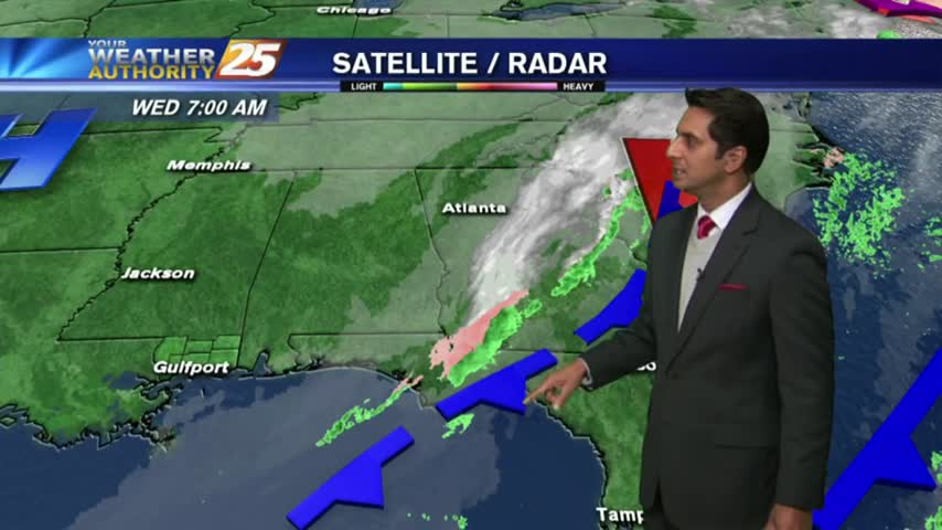
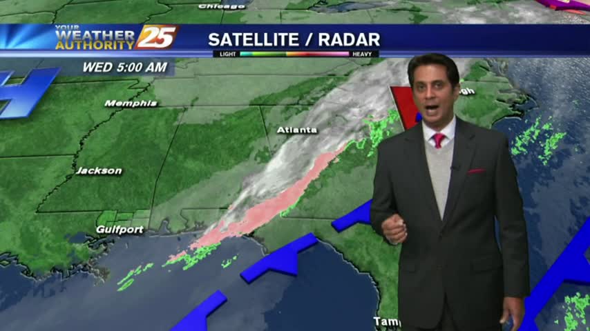
After moderate/heavy rainfall last night through this morning, the majority of the rain shield has shifted to the east with just a few showers this afternoon...
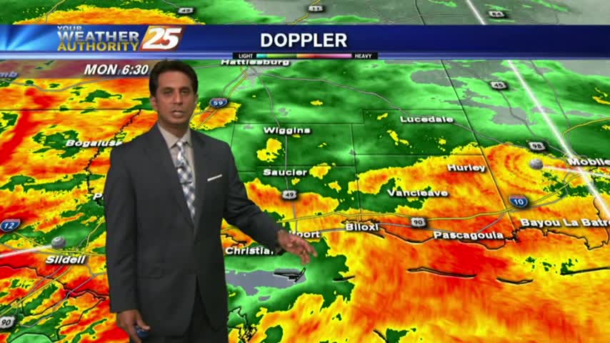
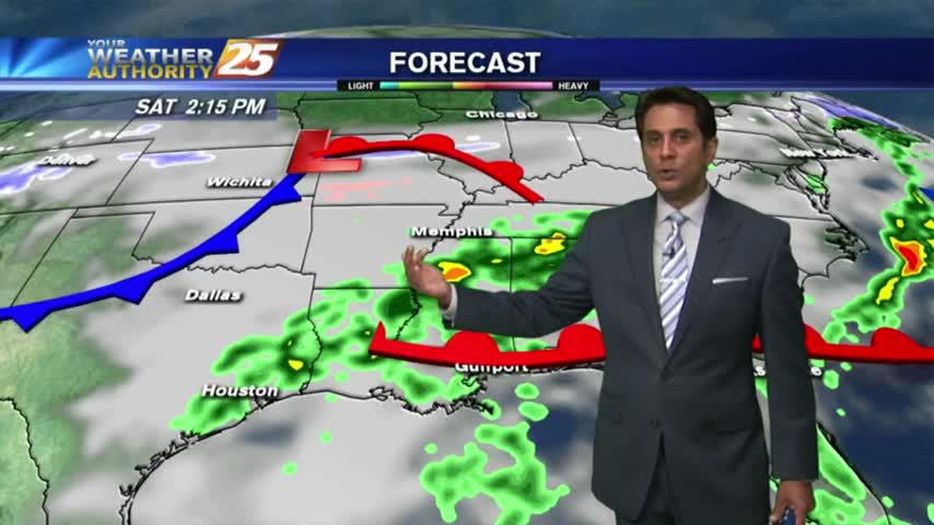
An area of low-pressure west drifting east will continue to bring rainfall to the viewing area with a FLASH FLOOD WATCH remains in effect...