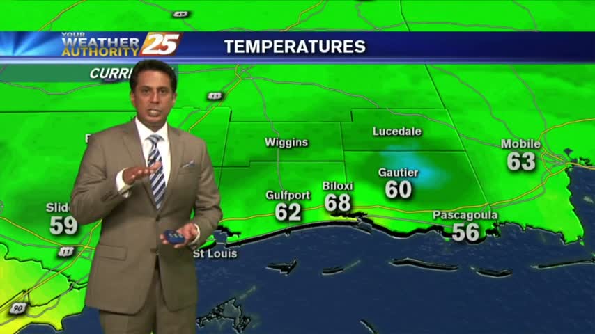
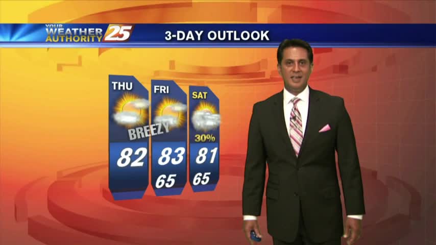
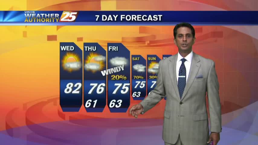
5/15 - Rob's "Potentially RECORD BREAKING Temps" Forecast
After record breaking temps yesterday afternoon, it's a very warm start for your Tuesday morning...

After record breaking temps yesterday afternoon, it's a very warm start for your Tuesday morning...
Another warm start with the humidity poised to get very high as the return-flow from the GOM begins...
Upper level non-rain producing clouds continue to move across the region as temperatures warm into the 80s...
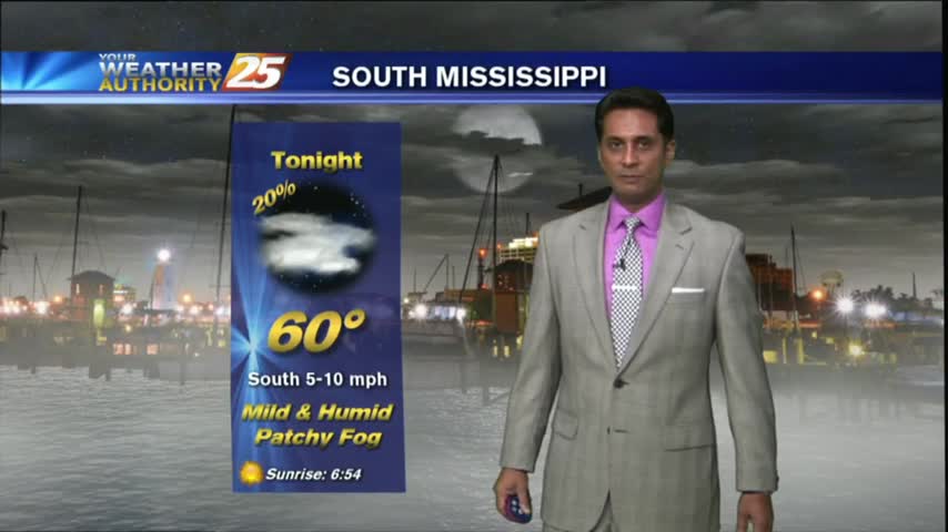
Clear skies overnight led to what is known as "Radiational Cooling", where temps dropped all the way to the dew-point. This has developed areas of PATCHY FOG...

Another warm & humid start with above seasonal conditions and areas of DENSE FOG. A DENSE FOG ADVISORY is in effect through mid-morning...
A very mild start to kick-off the weekend as drier air continues to affect the region...
Thin upper-level clouds this morning in the wake of a cold front has cleared the area. Drier air will shape our forecast at least through Friday night...

A mild and humid start to the final morning of Summer 2017. The SUMMER-LIKE temperatures will unfortunately continue...
The cold front has moved south of the area with overcast skies continuing. Major changes area ahead as a COOLER/DRIER air mass moves in...
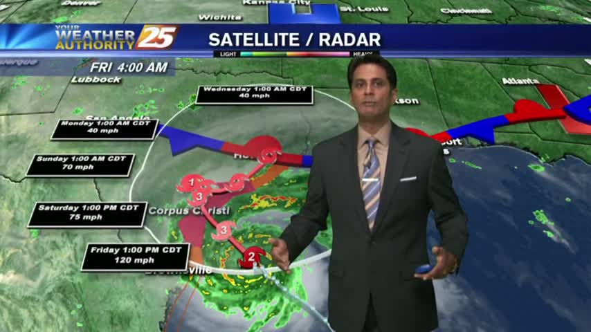
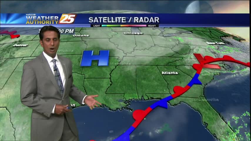
The local radar is fairly quiet this morning as most eyes are on Hurricane Harvey...
A warm/humid start to the day/workweek with DANGEROUS HEAT INDICES to affect the Mississippi Gulf coast...
After partial clearing yesterday...the clouds are back in the area along with rain developing along the Southern 6...
Another WARM/HUMID start as a weak cold front has slipped into central Mississippi. Patchy fog will continue to develop through sunrise...
After a mostly clear start with light fog this morning...clouds have increased along with WINDY conditions continuing...
As low-level humidity continues to stay very high...areas of PATCHY DENSE FOG has developed along the southern 6...
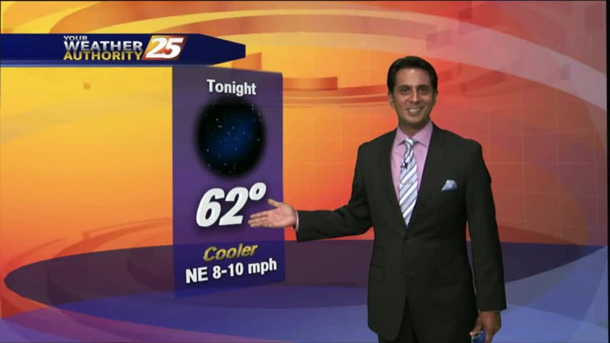
After WINDY conditions yesterday, the winds tapered-off last night with cool and dry conditions to start off the day...
After sunshine this afternoon, t-storms are beginning to pop to our SW...moving NE into the area...
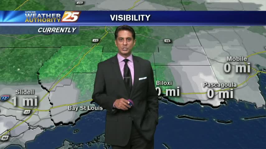
A warm/humid start with DENSE FOG and HORRIBLE VISIBILITY. Please USE CARE WITH YOUR MORNING COMMUTE.
After DENSE morning FOG; skies have cleared, temps continue to warm with a few clouds along south Mississippi...
Another morning with warm/humid conditions along with areas of DENSE FOG...an advisory is in effect through mid-morning...
After patchy dense morning fog...sunny skies have dissipated the fog with warming temps and increasing humidity...

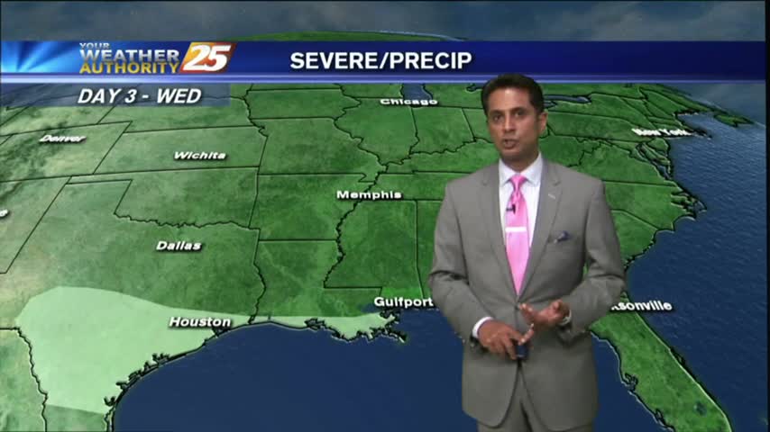
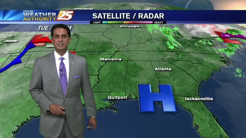
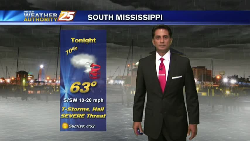
The gray/gloomy continues with rain and t-storms already in the area...and a SEVERE THREAT for this afternoon.

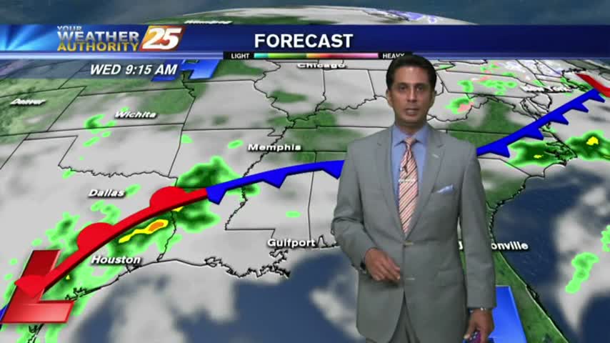
An approaching cold front in C-Mississippi will bring showers and t-storms to the area this morning...
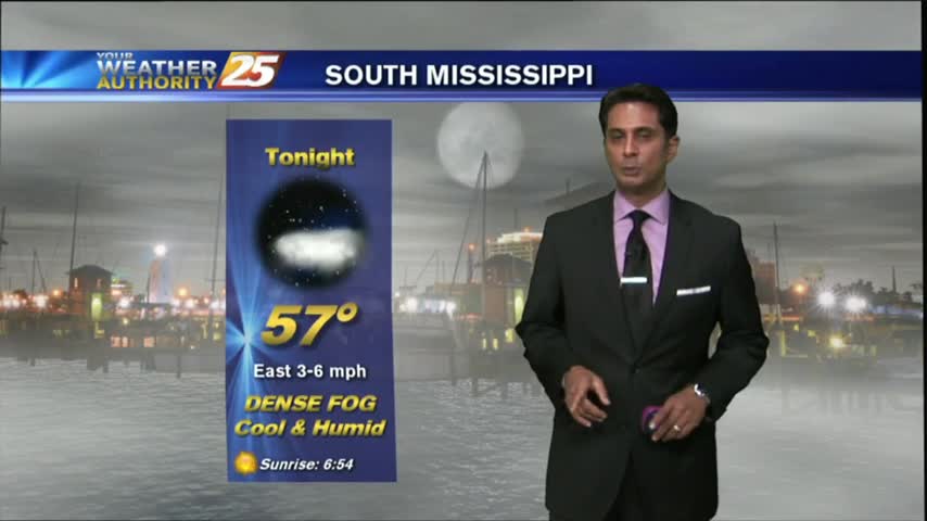
After some BUMPY weather yesterday afternoon, the cold front is now to our south as patchy fog has developed...