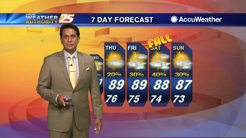
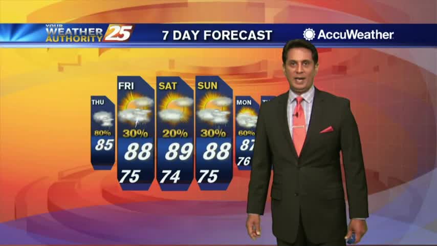
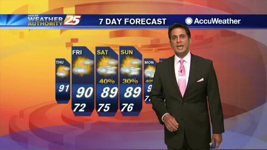
10/1 - Rob Knight's "HOT" Beginning of October Forecast
the first day of October is starting off with warm/humid conditions under mostly cloudy skies...
the first day of October is starting off with warm/humid conditions under mostly cloudy skies...

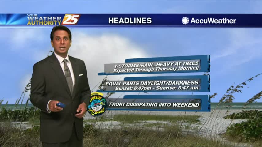
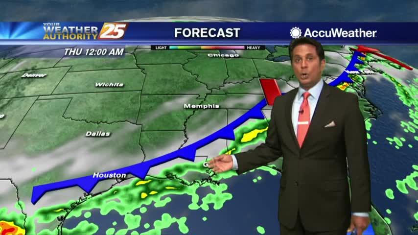
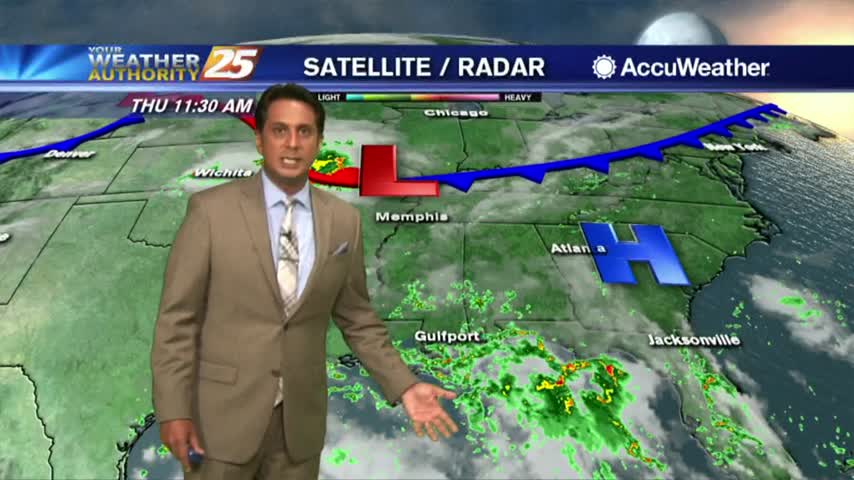
Only minimal activity this morning but widespread showers/t-storms will develop again today...
A VERY WET start to the day as a plume of moisture is bringing showers/t-storms with HEAVY RAINFALL and frequent lightning...
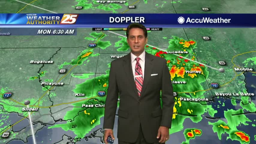
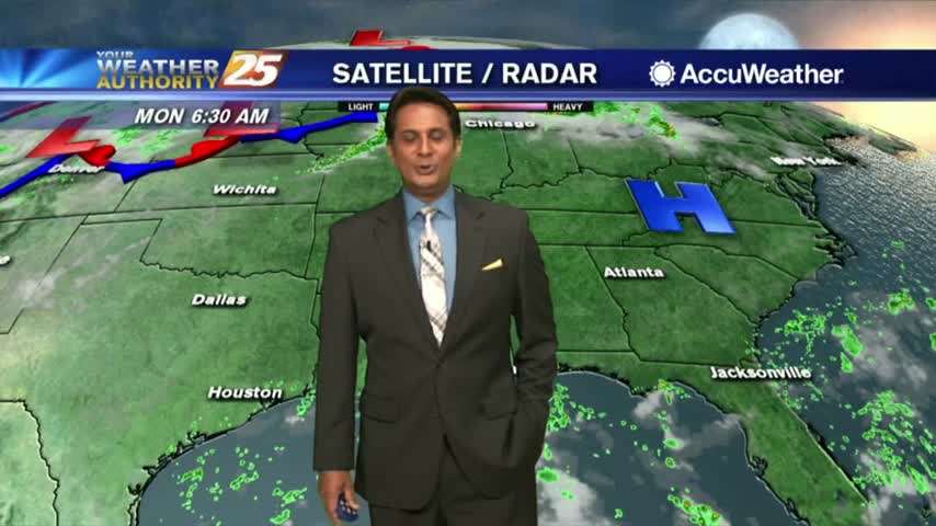
A wet start to the day/workweek with showers moving in from the Gulf of Mexico...

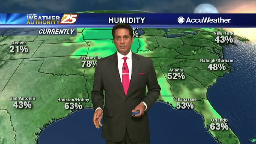
A HOT afternoon with the Heat Indies already in the low 100s as ambient temps are in the upper 80s...
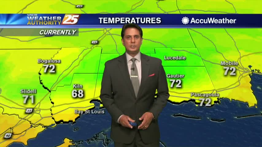
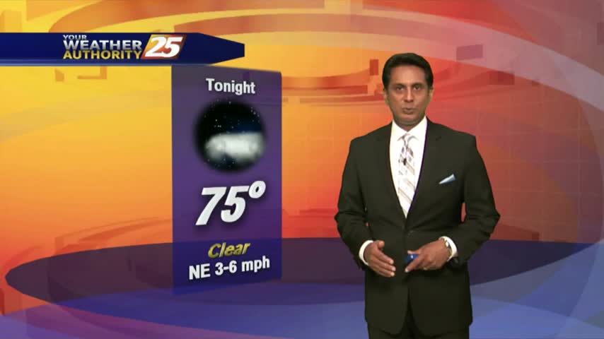
A lovely start to the workweek under clear skies and mild temperatures in the 70s...

After a beautiful start to the day, sunshine continues as only a few showers/t-storms are on-tap this afternoon...
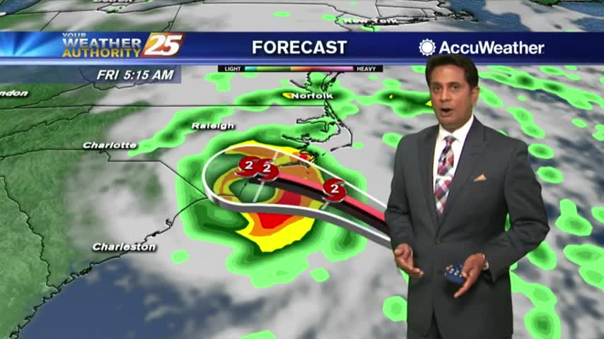
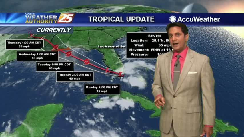
Another rain-free start to the day as we continue to watch HURRICANE FLORENCE getting closer to the Carolinas...
After a beautiful start to the day, hot temperatures will continue under partly cloudy skies...
Another wet start to the day with a line of showers and t-storms moving in from the Gulf...
Showers and t-storms moving in from the GOM, have the rain gear handy heading out the door...
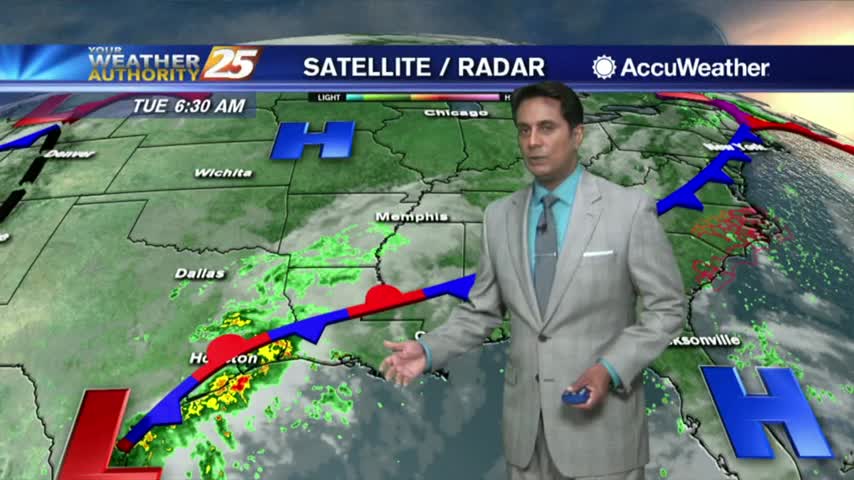
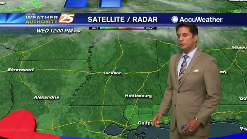
TD Gordon is well in our rear-view mirror with a few showers coming in from the Gulf of Mexico...

TS Gordon continues to move further away from the area as extensive cloud coverage remains...
An already wet start on this Labor Day morning as a TROPICAL STORM WATCH is in effect...
Another humid start to the day with isolated showers south moving north into the coastal counties...
We have only seen minimal activity thus far, but it will continue to develop this afternoon...

Activity tapered-of before midnight but a few showers are already moving in from the south...

A humid start to the day with a few showers in the area and moving in from the GOM...
A humid start to the week with light patchy fog and a few light showers moving in from the south...
After a clear start to the day and mild temps, it's going to feel hotter this afternoon with more of a humid wind flow...
A LOVELY start to the day as drier air has allowed for overnight temps to drop into the 60s...
In the wake of the cold front, mostly clear skies continue as drier air is moving into the region...
A weak cold front is overhead moving south with a drier air mass beginning to move in...
A warm/humid and rain-free start to the day, but HEAVY RAIN is on-tap this afternoon...