8/27 - Rob Knight's "Tracking Laura" Morning Forecast
A warm and steamy start to the day with gusty winds in the 20 mph range...

A warm and steamy start to the day with gusty winds in the 20 mph range...
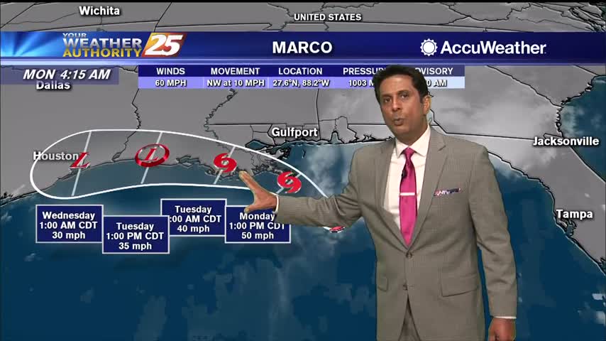
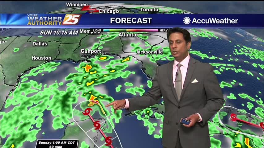
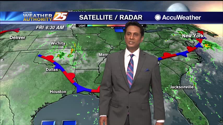
Hurricane Laura is currently in the central Gulf of Mexico currently moving northwestward. Satellite imagery does show Laura trying to have a bit more of a closed circulation and the storm has now increased to a CAT 2 hurricane. Laura…
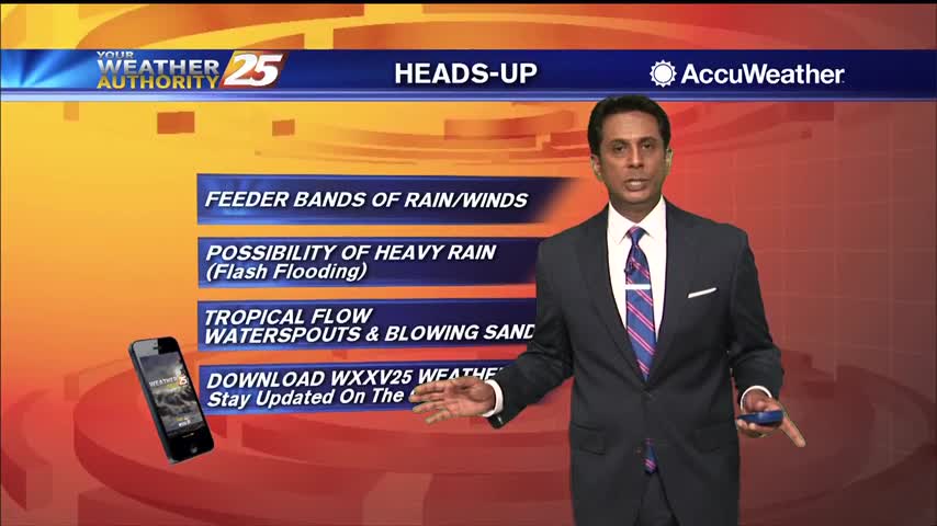
As TD Marco continues to move west along the Louisiana coast, the strong tropical flow will continue into south Mississippi. The focus will now shift to the SE'tern Gulf of Mexico as TS Laura continues to move NW. Conditions in…
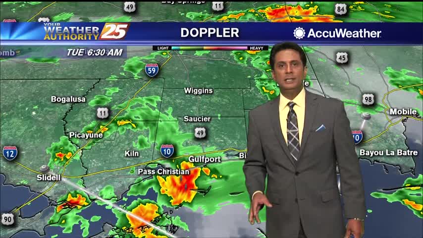
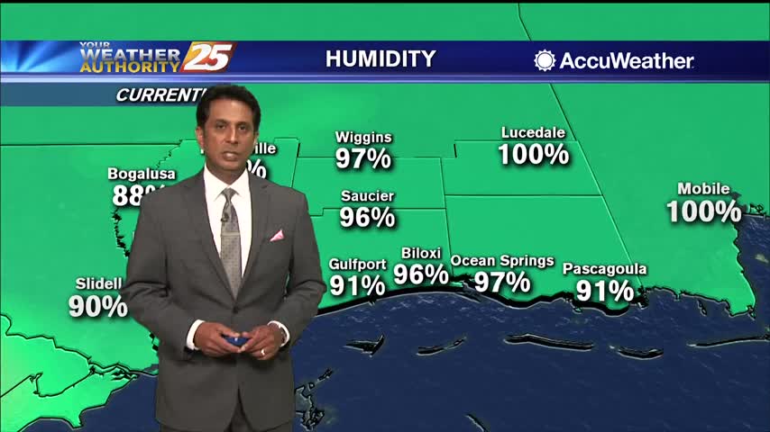
With TS Marco well south of the area, feeder bands of rain and winds are beginning to move into south Mississippi...
Hot temperatures heading into the afternoon won't feel as hot with lower humidity...
A rather pleasant start to the day as overnight t-storms have dissipated...
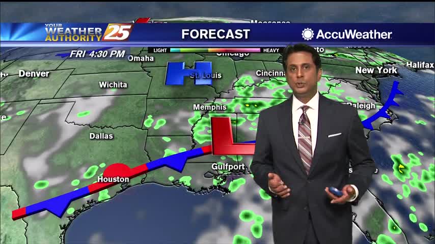
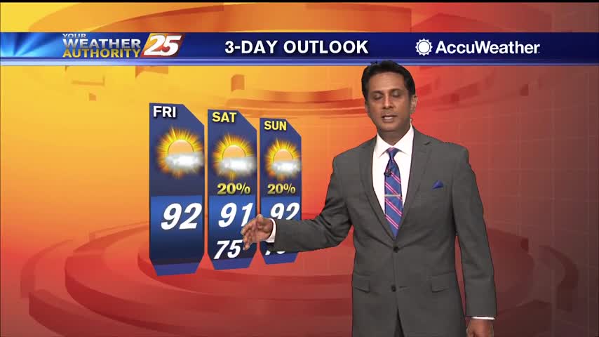
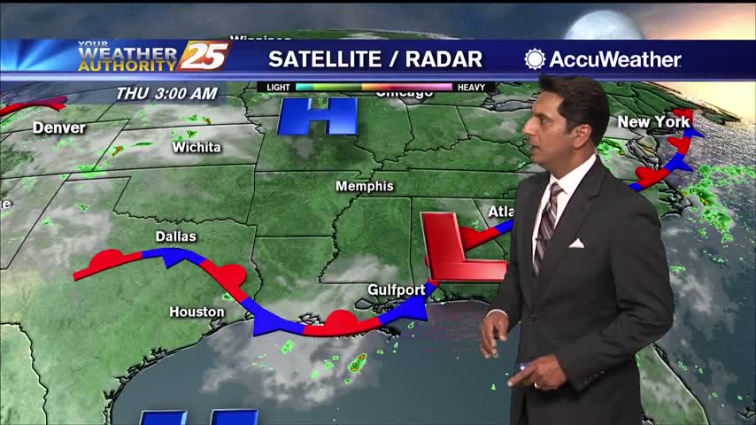
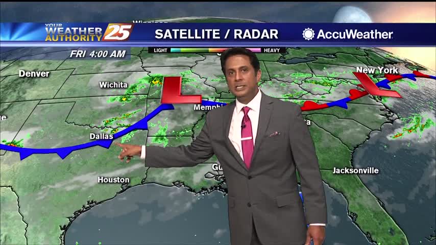
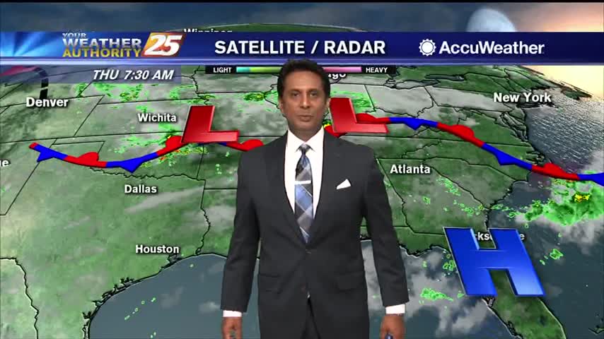
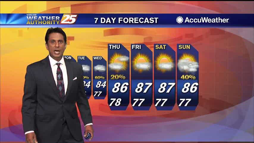
The stationary front in the area brought overnight showers/t-storms to south Mississippi will continue to be a focal point for activity through Friday. The weak upper low-pressure over Mississippi on Friday begins to shear out over the weekend. The airmass…
A stationary front will linger over the area through Thursday night. Conditions continue to look favorable for increased t-storm activity today during the late afternoon and evening hours, and have rain chances of 30 to 40 percent forecasted. There continues…
Deep layer troughing will dominate the Gulf South through Wednesday night. Strong dry air advection in the mid-levels will result in lower atmospheric moisture content and a very low risk of thunderstorm activity today. At most, an isolated shower may…
A warm and humid start with areas of very light fog and a few upper-level clouds...
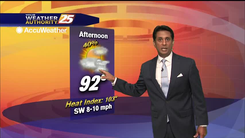
Today will bring similar conditions from yesterday, with the trend of diurnally driven summer convective pattern. Expect brief showers and thunderstorms during the afternoon hours. Max temperatures will again reach low to mid 90s with heat indices being in the…
The hot summertime pattern continues as the humid flow from the GOM dominates the region. The moisture flow will continue to saturate the atmosphere, thus leading to the sea-breeze interaction early afternoon. Isolated to scattered showers and t-storms will develop…
Hot temperatures expected this afternoon as the humidity begins to move back into the area...
Another beautiful start to the day as the lower humidity continues...
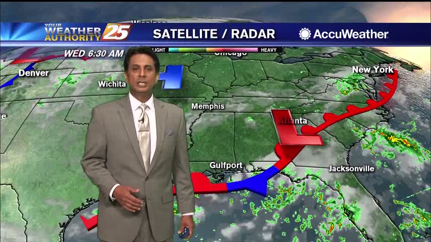
Current overview early this morning shows the same subtle, nearly stationary front parked across the northern Gulf of Mexico. Not much changing today into the weekend as a weak surface high drifts off to the east. Isolated afternoon pop-up t-storm…
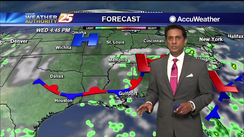
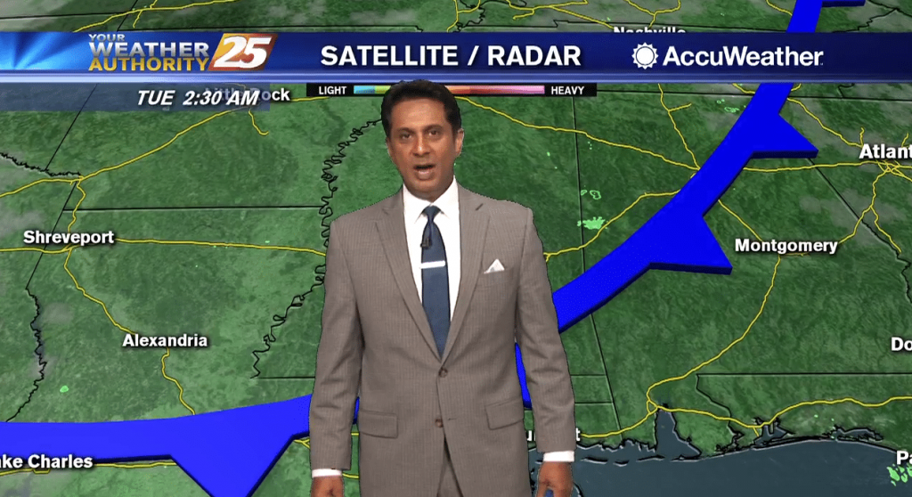
A weak cold front overhead is beginning to make the transition to a stationary front which should drift back to the NW beginning Thursday morning. This will lead to slightly more coverage in storm development heading into the weekend. Going…
A weak cold front overhead will provide for less humid air through the latter part of the work week as the mid/upper level flow from the NW will suppress activity. It is possible daytime heating could pop an isolated shower…

A warm start to the day with slightly less humid conditions compliments to a NW wind...
A very warm start to the day with areas of light patchy fog...
Weak upper level high-pressure draped across the Gulf of Mexico to the far western Atlantic Ocean will finally expand far enough north to bring rain chances down considerably across the area. While previously thought we'd be rain free, it's not…

Another day of showers with isolated t-storms before the pattern begins to change. A FLASH FLOOD WATCH is in effect through this evening as another inch or 2 of accumulation will be possible. The drier period that starts on Thursday…
A wet start to the workweek with rain moving in from the SSE...
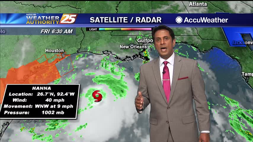
As TS Hanna moves towards the NW'tern GOM, rain continues to move in from the SE...
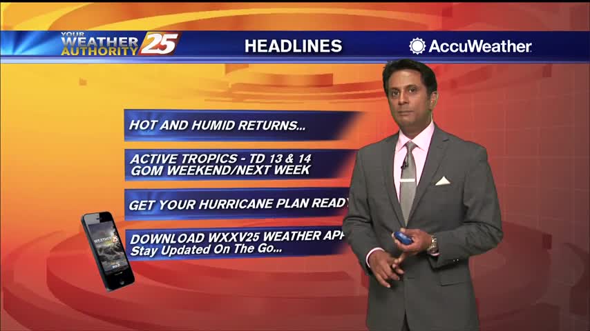
TD #8 is expected to continue westward, making landfall on the Texas coast Saturday. Main concerns here will be bands of heavy rainfall, and potential for minor coastal flooding. The moisture flow will be considerably high through Friday before diminishing…