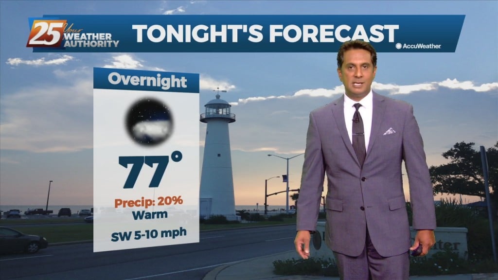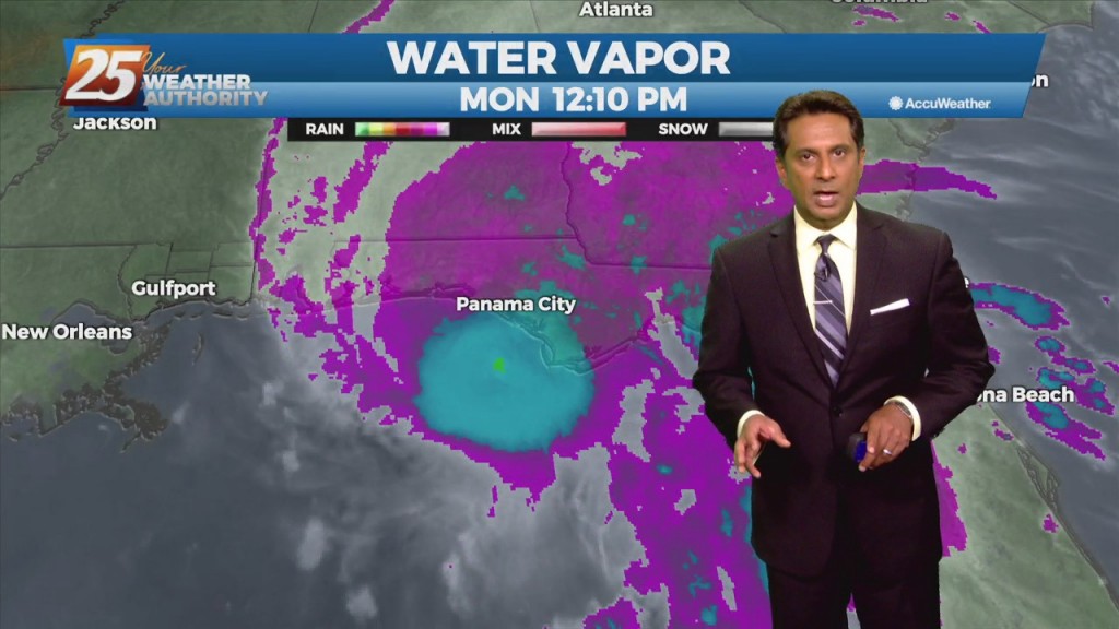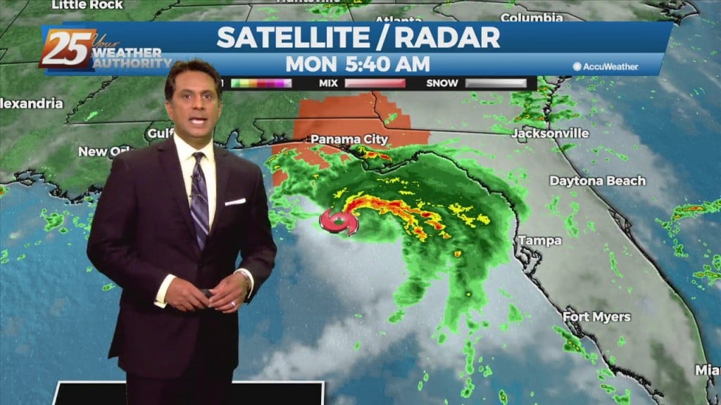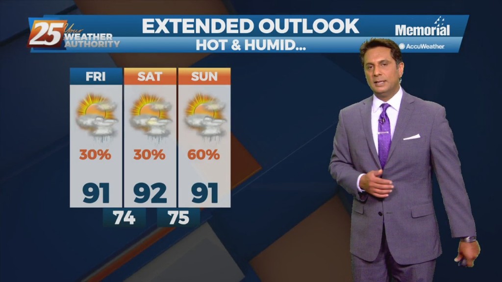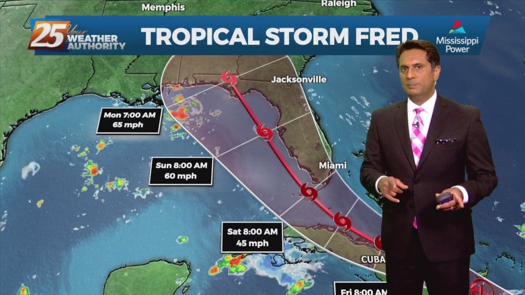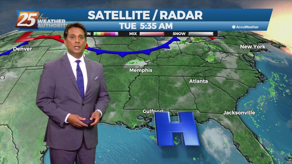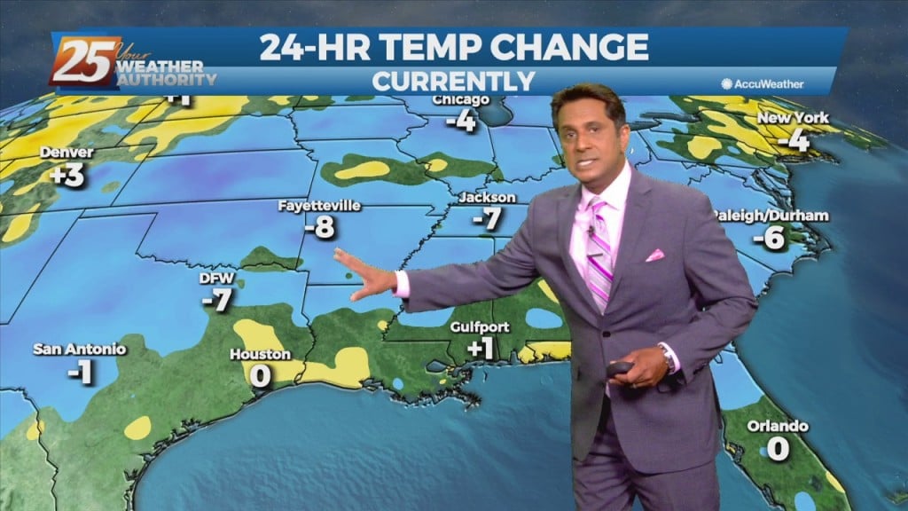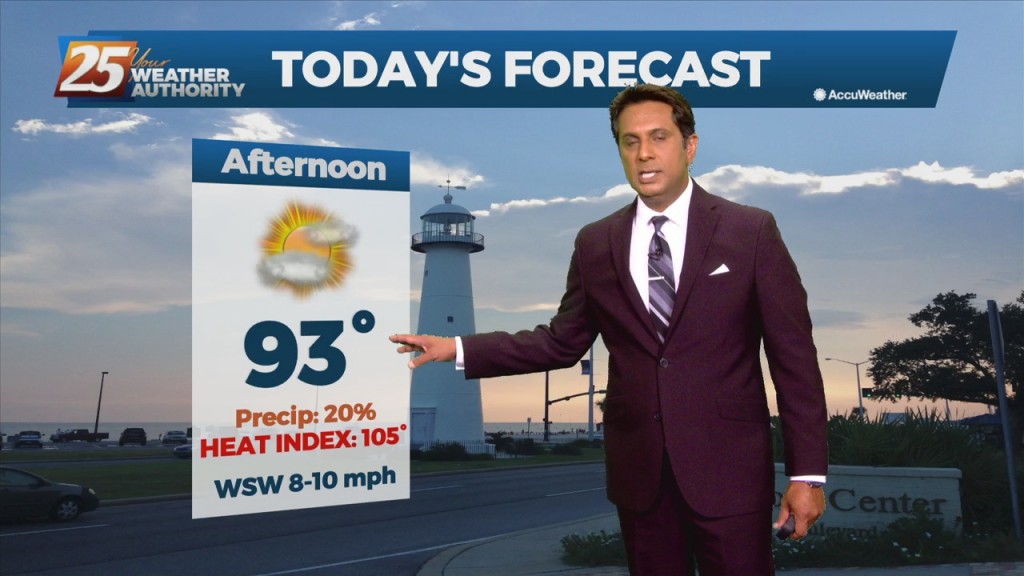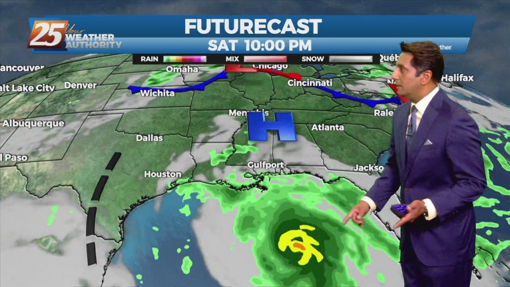
8/26 - Rob's "Elevating Rain Potential" Thursday morning Forecast
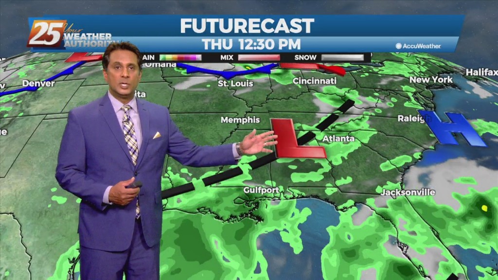
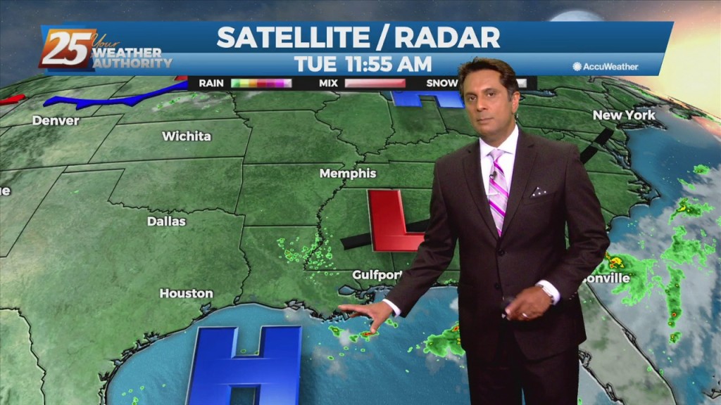
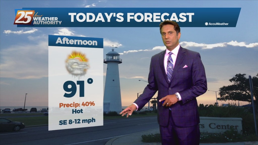
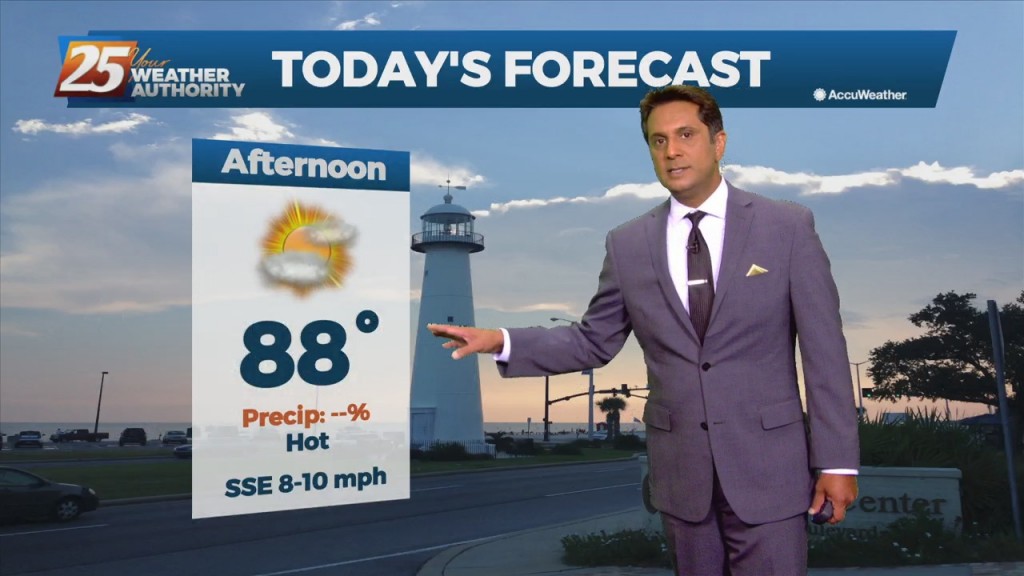
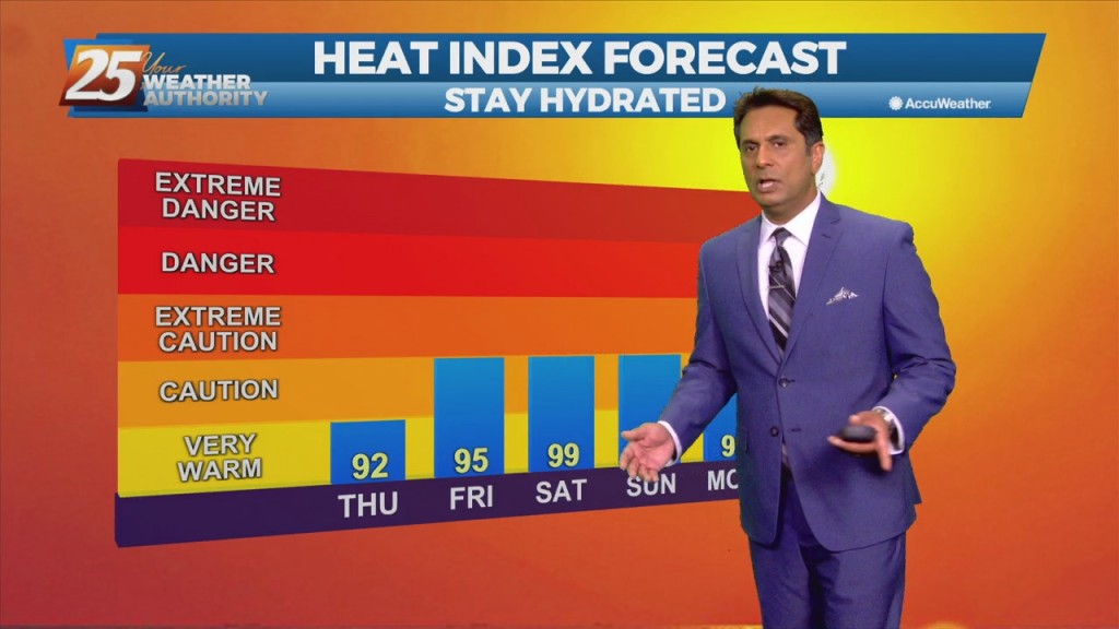
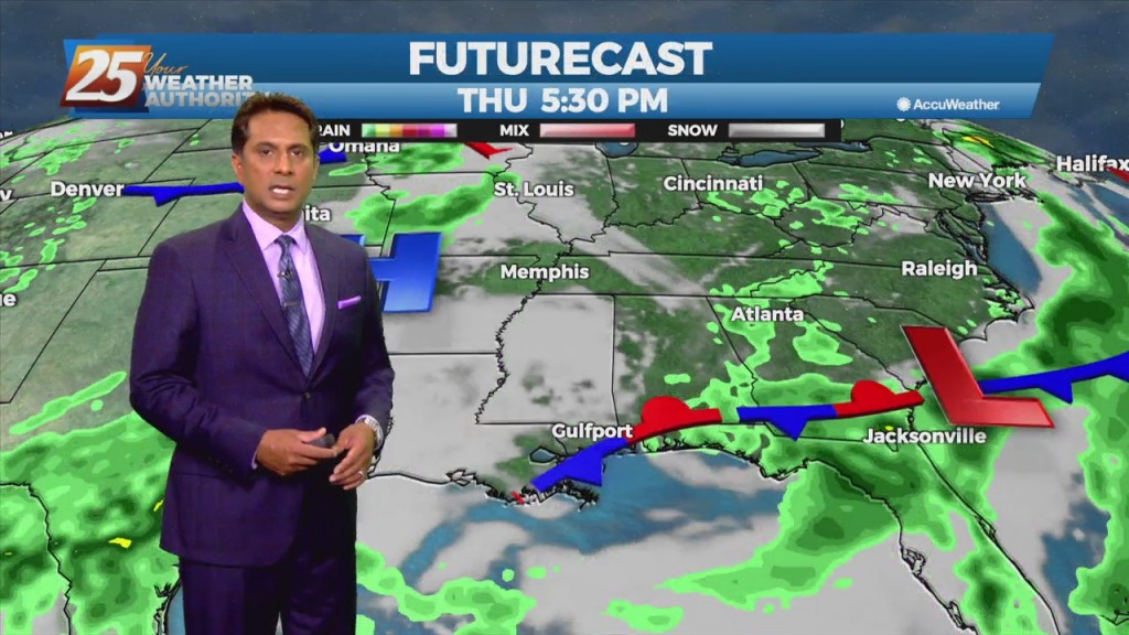
Easterly flow will continue to be a primary ingredient for increased rainfall across the area today. A strong tropical wave will move right across the area today and tomorrow bringing pretty adequate moisture to the area to assist in the…