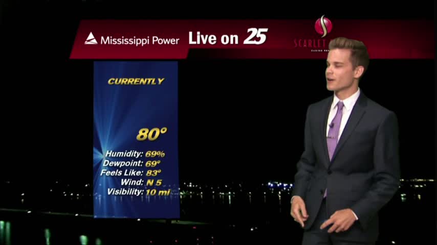
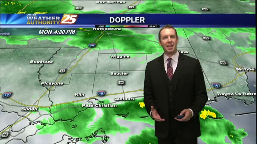
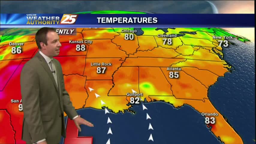
8/13 - Payton's Sunday Night Forecast
Showers and thunderstorms continue to clear out of the area. More rain is in the forecast.
Showers and thunderstorms continue to clear out of the area. More rain is in the forecast.
Didn't see much rain this morning/afternoon, but early evening thunderstorms helped light up the night sky. This will dissipate quickly, and more rain expected soon, but you'll have to watch the forecast for more.
Our earlier showers have all but cleared, though more rain is expected every afternoon through the rest of the week. Watch the full forecast for more.
An isolated shower is not out of the question tonight, but most should remain dry.
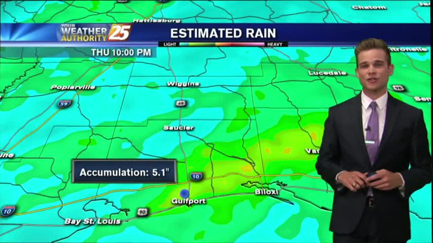
Heavy showers and thunderstorms across the area today dumped up to seven inches in some areas.
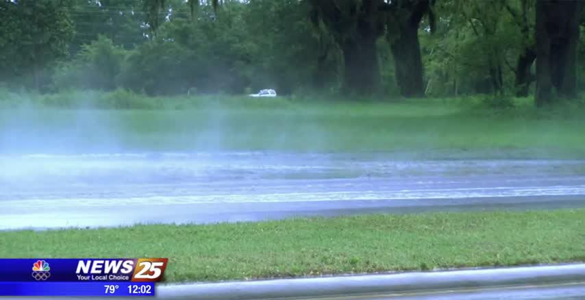
The morning showers rained on the parade of the first day back to school in Biloxi,causing some flooding on multiple roadways. According to a spokesperson from the city, residents saw flooding on Porter Avenue north of Division and as well…

The clouds have thickened as expected throughout the day, but we haven't seen many showers yet. That will change overnight, and continue through the weekend. Details inside.
A beautiful day to start August with temperatures in the upper 80s and sunny skies, but changes are on the way.
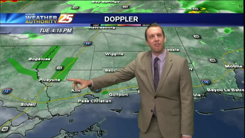
After a beautiful day yesterday to close-out the weekend, the drier air mass will continue to affect the region through Tuesday, but more rain is on the way.
The beginning of the week will be hot and dry, but with less moisture it won't feel quite as hot as it has the past couple weeks.
As expected, we saw a little more rain overnight with more showers this afternoon. Things will begin clearing up tonight, so expect some sunny & drier weather! Details within.
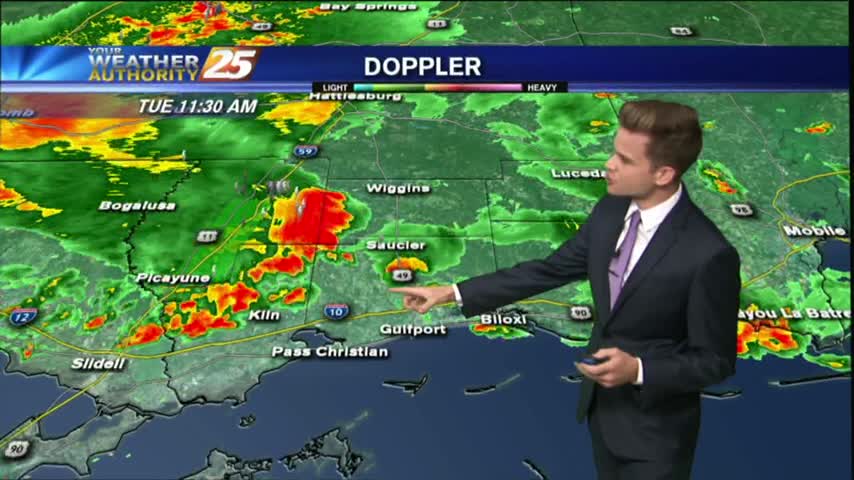
Today will bring the same scenario with the activity in the area. An additional 2-4 inches of rain is not out of the question with the strongest storms.
Our earlier showers & thunderstorms have cleared out, but I'm expecting more overnight and tomorrow afternoon. Watch the full forecast for more.
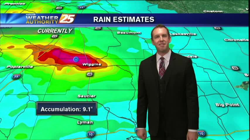
Rain was expected to begin the week, but we saw some ridiculously high rainfall totals from this afternoon's thunderstorms. Drier air moves in soon, watch the forecast for details.
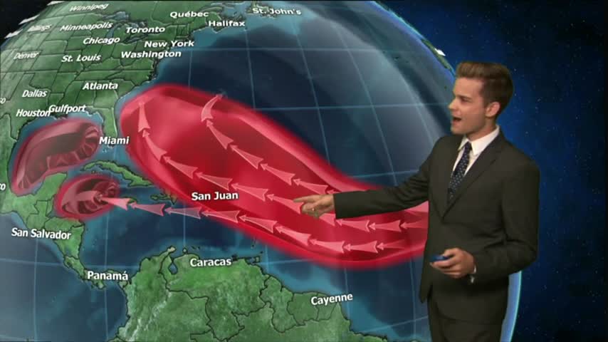
Showers and thunderstorms will continue this afternoon and into the night as strong tropical flow continues through mid week as a trough of low pressure in the upper-levels dominate much of the country.
After a humid and stormy weekend, the summertime pattern will continue this week.

Another typical July day in South Mississippi with afternoon showers and thunderstorms.
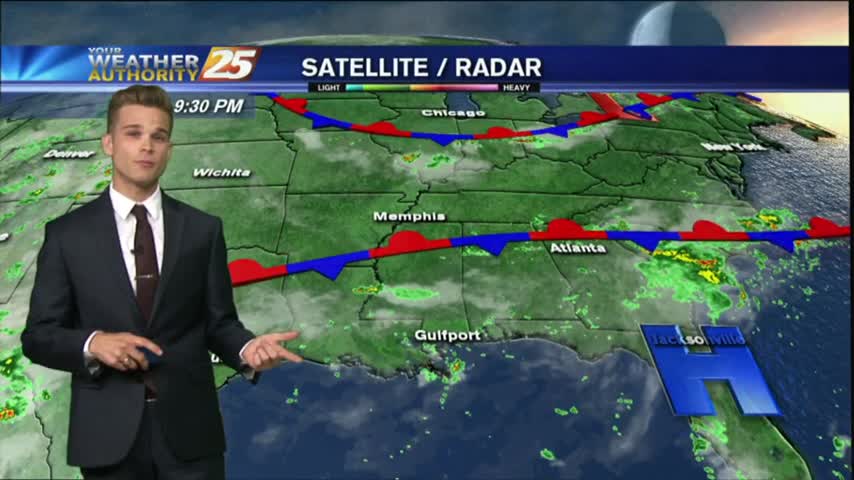
The area of high pressure that has been centered over the Gulf Coast the past few days will start to makes its way out of the area, and rain chance will start to go up toward the weekend.

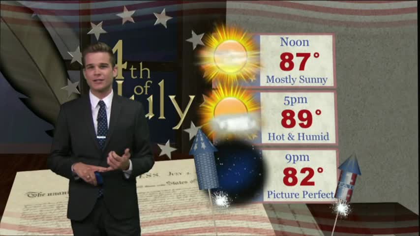
Independence Day will be another day of hot and humid conditions with heat index values running around 100 degrees.
The forecast is stuck on repeat, at least for the next few days.
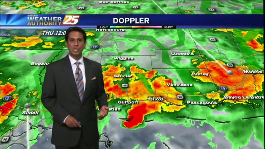
A very active day across South Mississippi as an area of low pressure sits overhead.
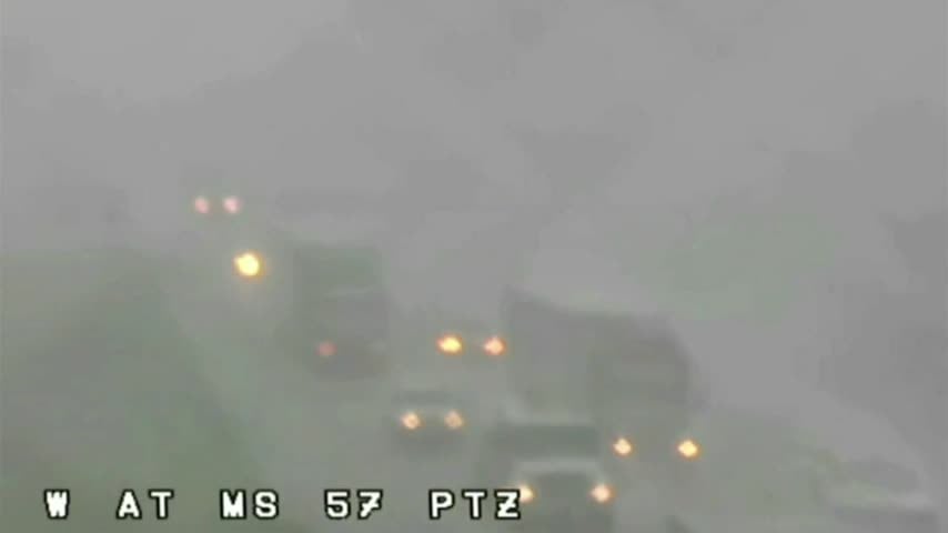
In Jackson County on Interstate 10, heavy rain brought traffic to a crawl. Here is a shot from around 3 p.m. as heavy rain and a tornado warning was impacting the Coast. This shot is near the Highway 57 exit.
HEAVY RAINFALL has been in the area since last night...and will continue though tonight as a FLASH FLOOD watch continues...
Today brought the first significant rain since Cindy left, and even a few Tornado Warnings this morning! Expect it to continue for a few days, but dry & hot weather is ahead. Click for details.