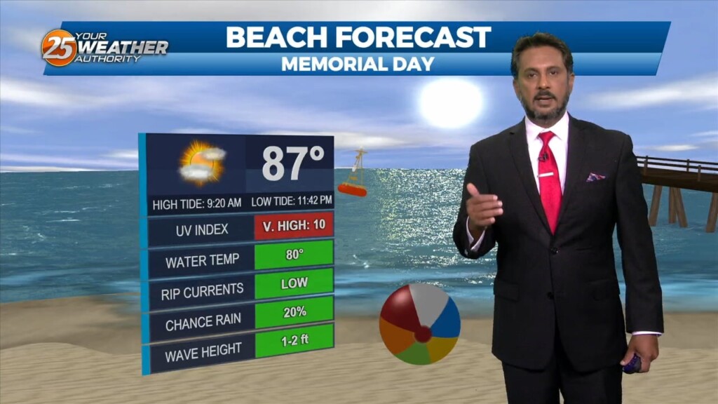
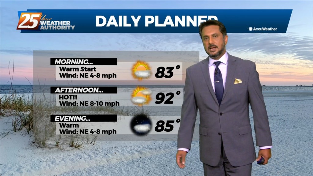
5/29 - The Chief's "Hot Memorial Day" Morning Forecast
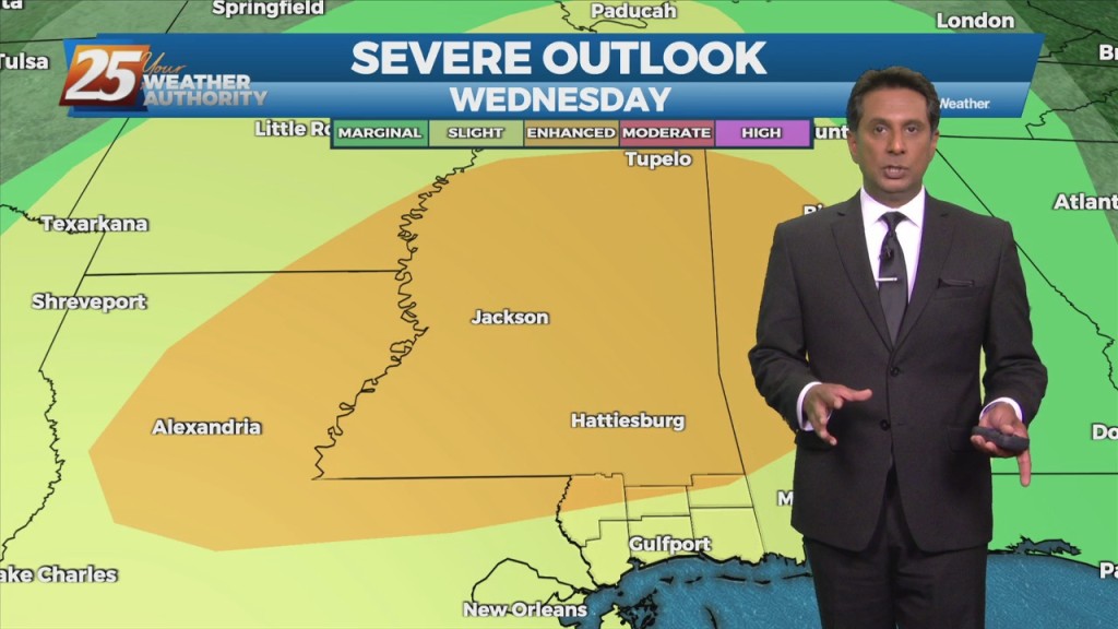
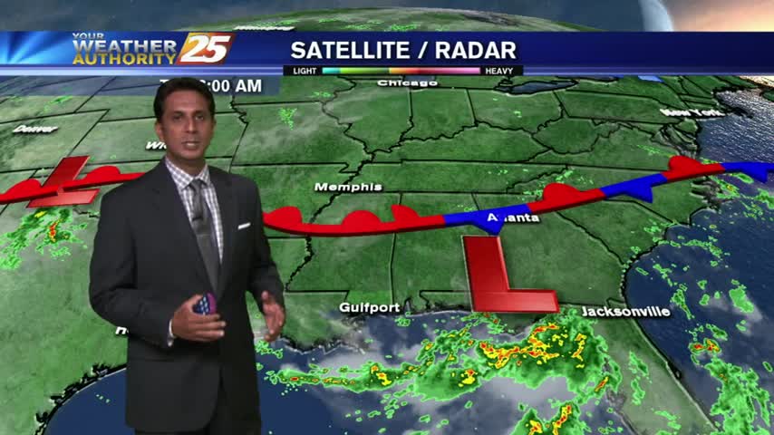
A blocking pattern remains across the eastern half of the country with an upper ridge over the Great Lakes. Yesterday’s double barreled upper low, as expected, has…
A blocking pattern remains across the eastern half of the country with an upper ridge over the Great Lakes. Yesterday’s double barreled upper low, as expected, has…

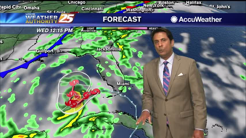
Yesterday’s frontal system will continue sliding east out of the area. Zonal flow will dominate the upper level pattern, with a northerly surface winds becoming SE…
Mid level dry air will remain in place today. This will help cap the environment, making it harder for thunderstorms to get started. There will be some…
A weak stationary front overhead will drift north with cloud coverage this morning then sunshine this afternoon. Fog will be a factor the next few morning but not in…
Cloud coverage continues to affect much of the region with mild overnight temperatures beginning to warm...

A mild start to the 1st full week of autumn...with showers/t-storms moving into the area from the SE...
A pleasant start to the day with several reporting sites in the mid/upper 60s, under clear skies...

It's a much DRIER start to the day as a weak cold front moved through the area overnight...now stalled over the sound/N'tern Gulf of Mexico.

After bumpy weather yesterday, the final Friday of March is starting out much better...

In the wake of a weak cold frontal passage last night, BREEZY conditions are beginning to move into the area...
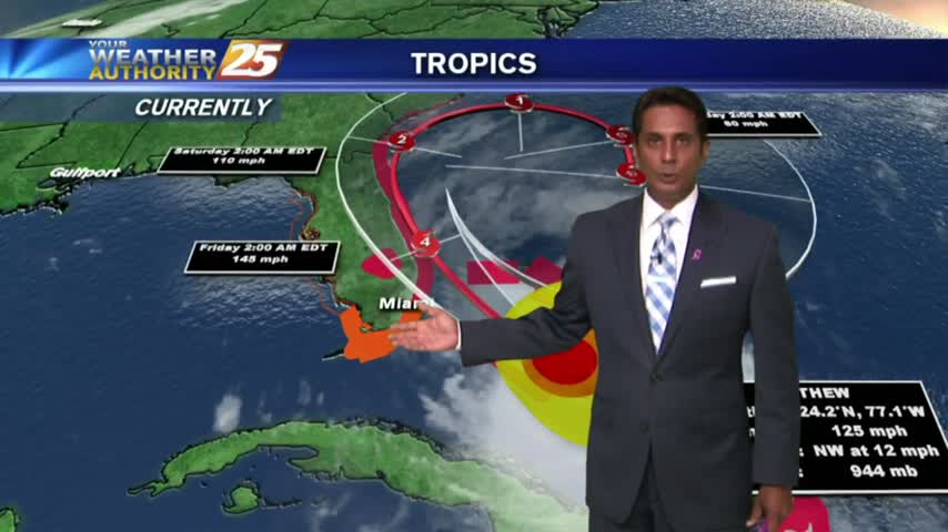
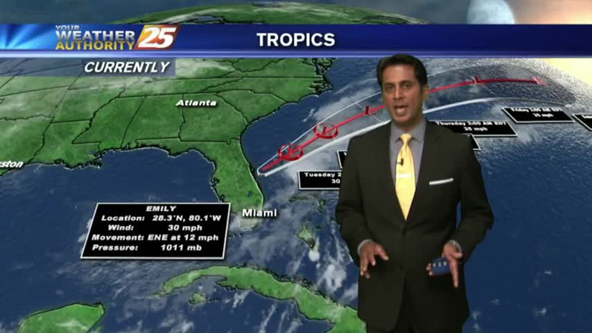
High-pressure dominance continues along the Gulf Coast as MAJOR HURRICANE MATTHEW heads towards the Florida coast...
After a BEAUTIFUL weekend, warmer and more humid conditions are in the area to kick-off the workweek...
A MUCH different start than 24 hours ago as cooler/drier air is moving into south Mississippi...
A mild start this morning with mostly cloudy skies and areas of light fog...along with isolated showers over the sound.