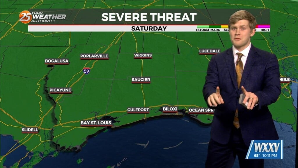
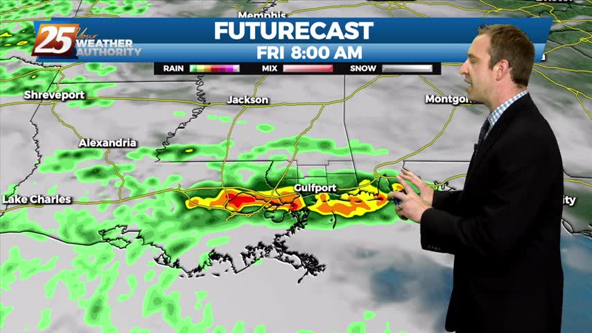
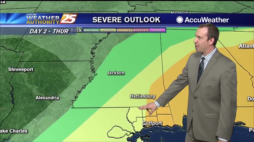
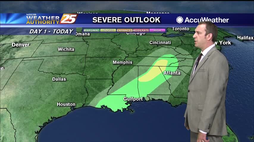
3/7 - Sam Parker's "Marginal Risk" Friday Night Forecast
On and off rain showers for most of the day on Saturday but next week seeing a warmer pattern. There is a marginal level 1 of…
On and off rain showers for most of the day on Saturday but next week seeing a warmer pattern. There is a marginal level 1 of…
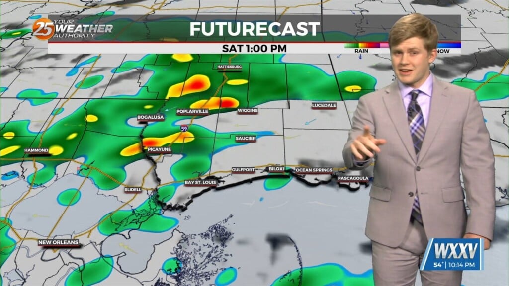
Warmer Friday and another day of storms come Saturday. A chilly night with lows in the upper 40s to low 50s and clouds moving into the…
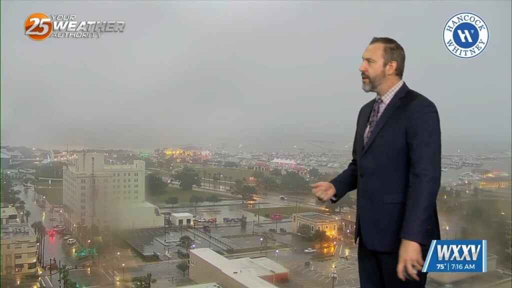
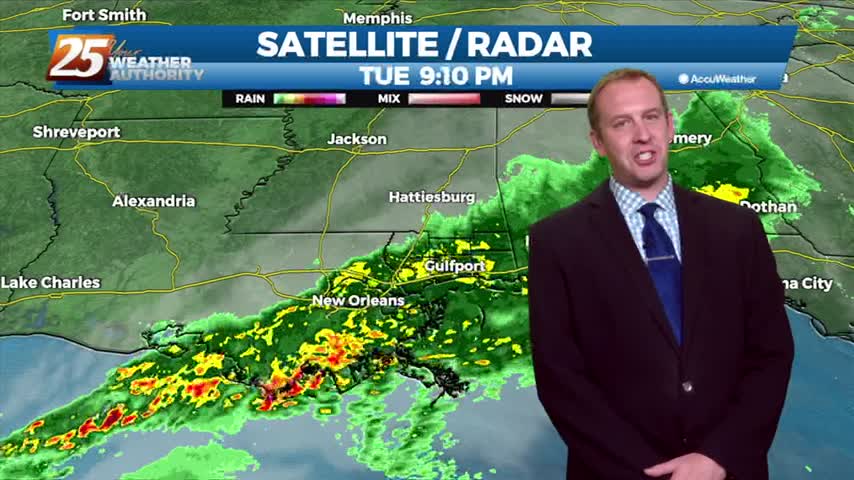
The rain started last night, but we're just now getting our heavy rain as showers and thunderstorms pop up along this morning's cold front. We're still under a level…
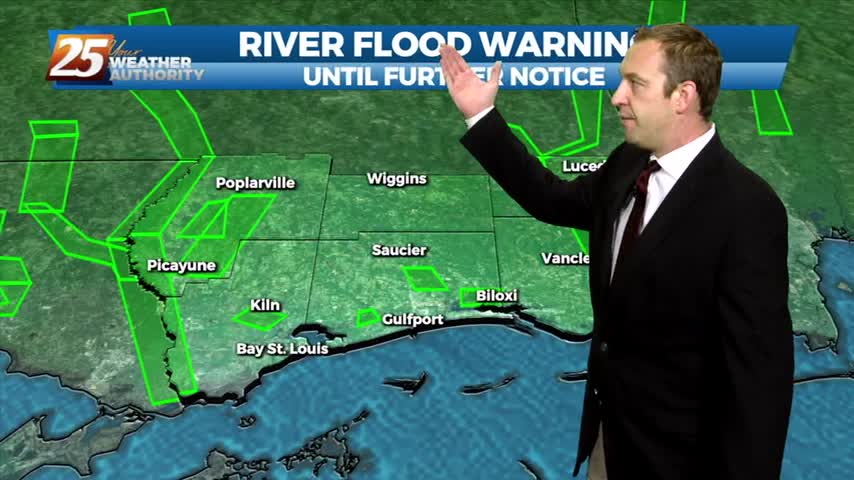
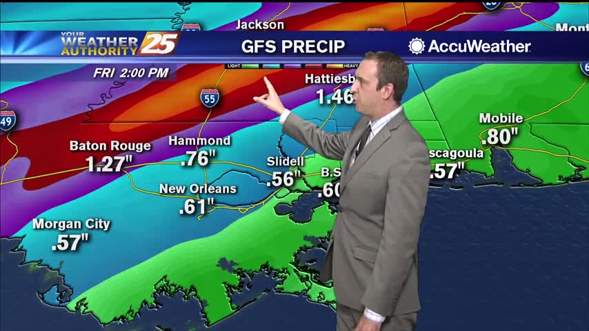
Sad to say we have a wet weekend ahead after our ridiculously wet week, but things will begin drying up quickly as we head into the next....
Finding ourselves in the midst of a familiar pattern as a lingering boundary with frequent impulses bringing rain each day. The sun will return soon though....
Today was a complete 180 after yesterday's clear skies, and the bad news is the rain isn't stopping anytime soon....
Today was a beautiful start to the week after cooler, drier weekend, but heavy rain will return to the Gulf Coast sooner rather than later....
Another hot and humid day with a warm and humid night in between, but we're seeing more afternoon shower activity.
Expect the breezy conditions to linger through the night as a front closes in and brings strong storms tomorrow afternoon.
Light southerly winds throughout the weekend have increased the humidity, so get ready for a mild and muggy evening.

Clouds will continue to build through the night, but we won't see much in the way of rain until around sunrise tomorrow.

Spring has arrived earlier than usual, and I explain why in the forecast, but cooler weather is on the way as a front moves in.

Spring begins tonight just before 11 PM, earlier than it has in nearly 125 years!
System is weakening, but rain and potentially thunderstorms are still expected overnight.
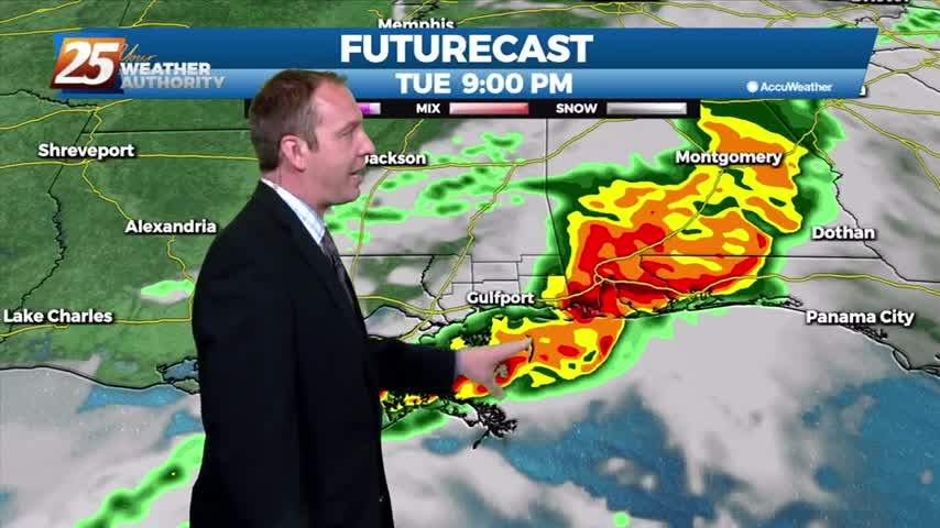
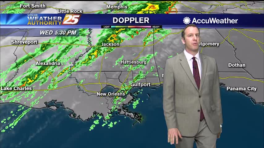
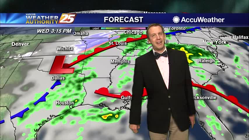
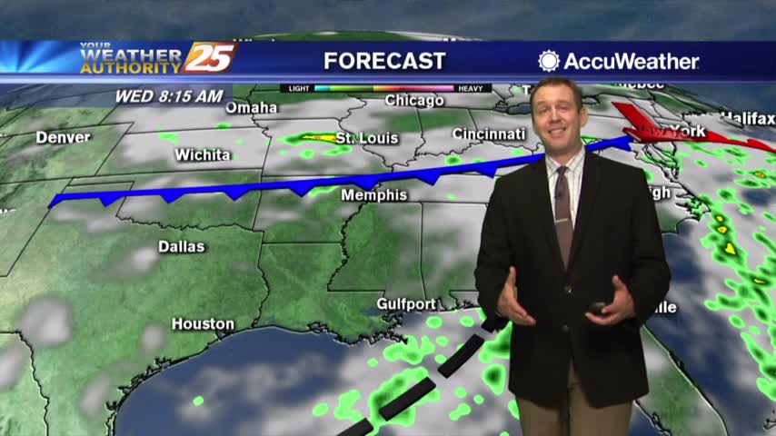
Active, potentially severe weather is moving in for all of Wednesday, but will clear quickly before the weekend.
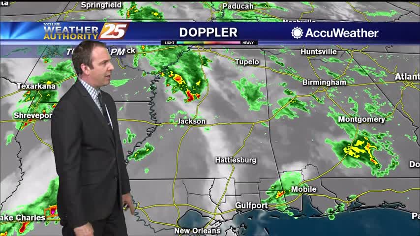
We've had a few showers throughout the day, but overall it's been hard to come by in South MS. That changes overnight, and we'll start seeing improving conditions after lunch.
The warm and humid weather hasn't been in any hurry to leave, but a cold front will force changes later tonight.
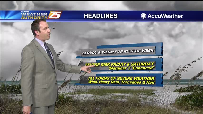
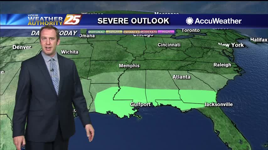
The cloudy skies have moved in and aren't leaving for the rest of the week. We're also gearing up for some potential weekend severe weather.

Still waiting on the first active weather of 2020 as a stalling front will carry rain into most of Friday.
The new year arrived rather quietly, but active, potentially severe weather moves in quickly.
Today ended a nice streak of sunny and pleasant weather, and the dreary weather will linger for a little while longer....
The clouds have moved in, rain is next, and we'll even see thunderstorms before the week ends....
Warm front in the area is going to keep skies cloudy and wet for a little longer.....
We'll see drier days ahead, but we're in for a wet start to the week....