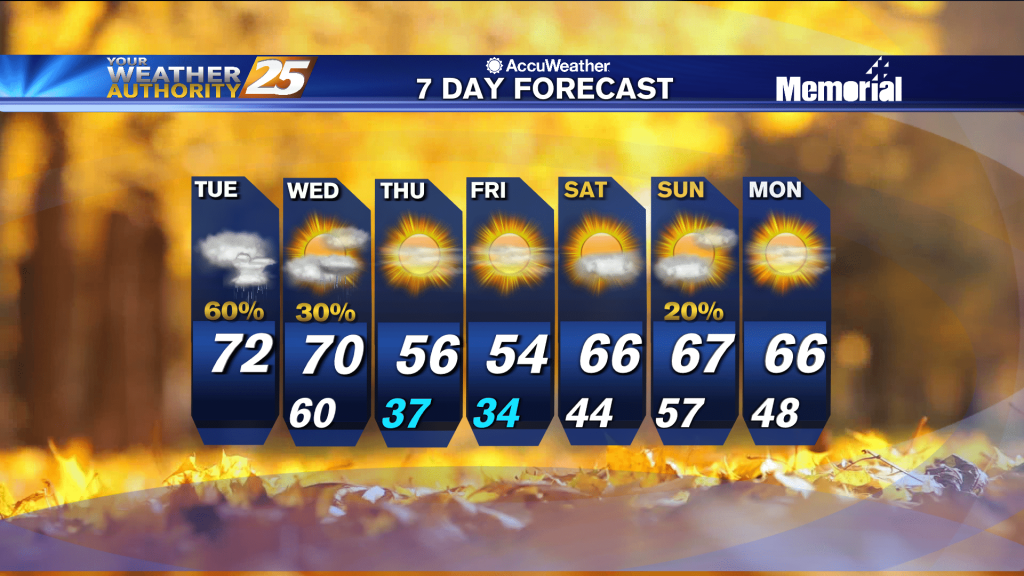
9/26 - Jeff's "Gradual Pattern Change" Tuesday Night Forecast
Skies will clear somewhat overnight and humidity will remain a factor in terms of providing a muggy feel to the air. Your Wednesday will start off with…
Skies will clear somewhat overnight and humidity will remain a factor in terms of providing a muggy feel to the air. Your Wednesday will start off with…

Partly cloudy skies and a 20% chance of a stray shower or thunderstorm will be around this evening. Skies will clear out overnight but a muggy feel…
Skies will be mainly clear the rest of tonight with warmer temperatures as compared to last night. Tomorrow will become hot and humid…
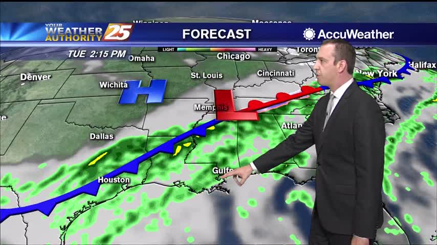
Spotty to isolated shower/thunderstorm chances will be around early this evening. Rain chances will drop off and skies will clear out tonight. Temperatures will be a…
Mild temperatures and some clouds will be around for tomorrow morning. An area of low pressure to our east will be bringing a disturbance into our area…

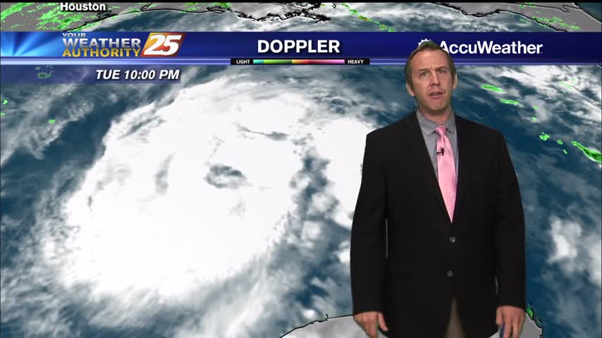
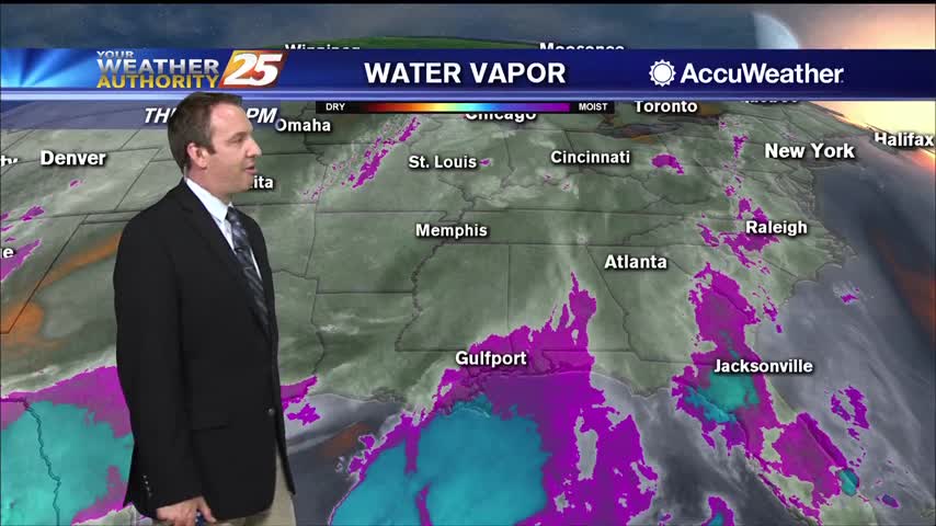
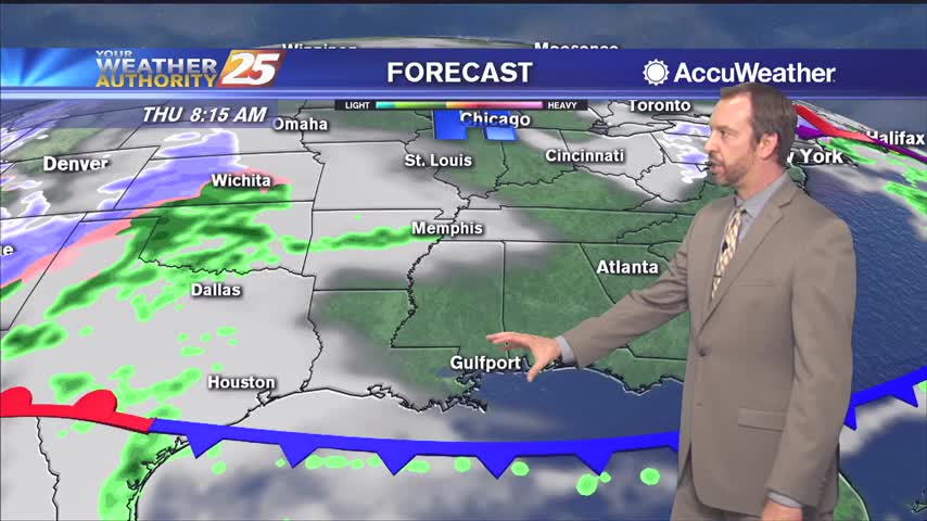
Clouds gave way to more sunshine this afternoon across South Mississippi. Clouds will continue to clear out into tonight. Northerly winds on the western side of low pressure…
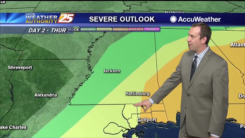
The risk for severe weather today will be greater than what we saw yesterday, with the main risks being damaging straight line winds around or > than 60mph, large…
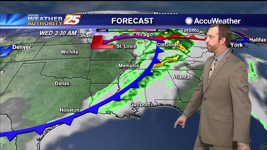
A weak boundary still forecast to sink southward and stall near the coast for today and tomorrow. While widespread showers and storms are not expected, the boundary should…
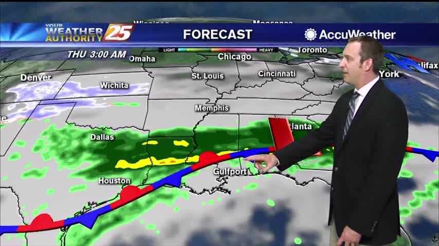
The main concern in the short term will continue to be the potential for thunderstorms and possible severe weather. We’ll remain in northwesterly upper flow today with…

An upper level low-pressure system currently centered in the western Atlantic will move west into FL/GA today. At the same time, an upper level disturbance to the NW will…
Going to be considerably warmer and more humid than the weekend was, and get ready for a big change by the start of next week!
Don't expect much to change after our grey, foggy weekend, but things will get a little wetter as rain moves in.
Zeta remains a tropical storm for now, but will regain hurricane status as it bears down on the Gulf Coast tomorrow evening.
It's going to miss to the left, but Hurricane Laura is on its way and will bring us a few rainy days....
More nasty afternoon weather for another day or two, but much hotter and drier days are expected soon!

Not much has changed weather-wise over the weekend, but drier days do lie ahead though the humidity isn't going anywhere.
Only a small spot of rain today in South MS, but we saw plenty of clouds and high humidity again.
Expect the breezy conditions to linger through the night as a front closes in and brings strong storms tomorrow afternoon.

Clouds will continue to build through the night, but we won't see much in the way of rain until around sunrise tomorrow.
The front has moved a little closer, so rain chances are rising and dense fog remains on the coastline.
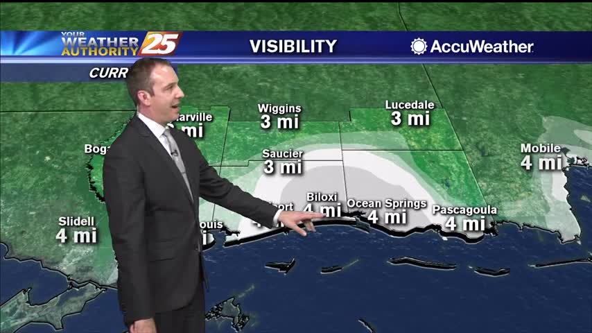
Dense fog advisories have been issued for South MS, and the approaching front isn't in any hurry so any changes will be slow.
The misty and muggy weather continued today, and will get worse through the night as a front slowly moves in.
Haven't seen much rain by this point in the day, but it'll continue to increase through the night as a cold front moves in.
Skies were cloudy today with a little sun peaking through around sunset, but more clouds and rain are moving in slowly.