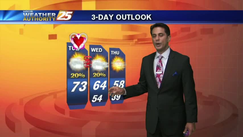
03/14 Ryan's "PI Day" Wednesday Night Forecast
I hope you've enjoyed the last few sunny days, because they'll be coming to an end for a bit as we finish off the week. Don't worry though, tomorrow will be great, but after that....

I hope you've enjoyed the last few sunny days, because they'll be coming to an end for a bit as we finish off the week. Don't worry though, tomorrow will be great, but after that....
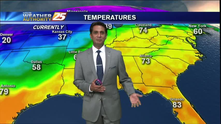
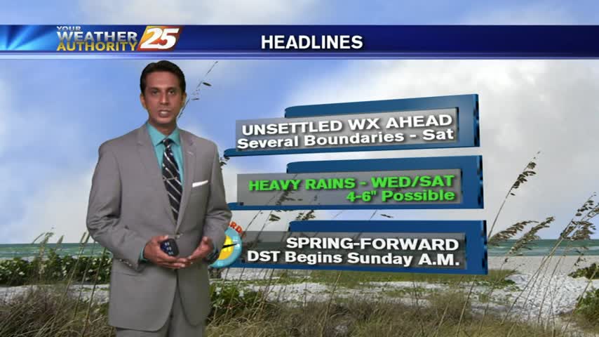
It warmed a bit today, but remained on the cooler side and just as dry as the last few days. Changes arrive for the weekend though....

It'll be significantly warmer tonight than it has been over the last few as Gulf moisture and warmer air is pushed inland by southerly winds. Click this link for the full forecast.
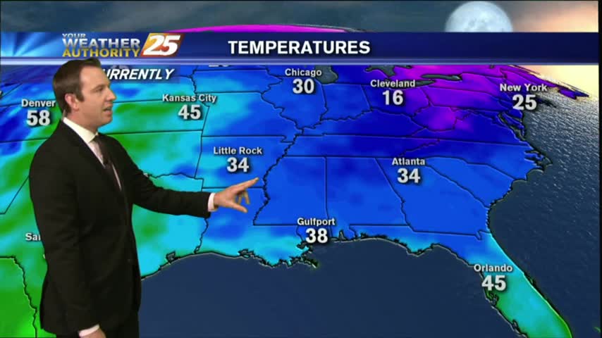
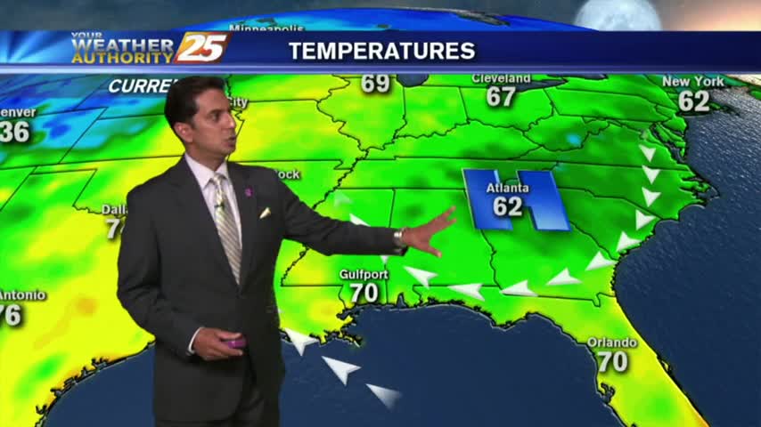
This afternoon warmed slightly compared to yesterday, but tonight will be significantly warmer than last night which produced a light frost. Click the forecast link for more information.
Rare astronomical phenomenon will occur tonight as we'll experience a "Super Blue Blood" Moon during the overnight hours in the very early morning. Watch the full forecast for details.
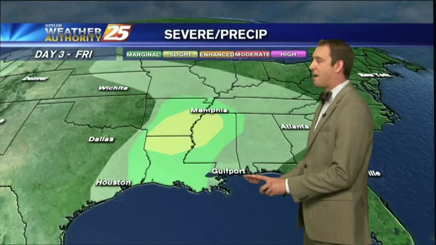
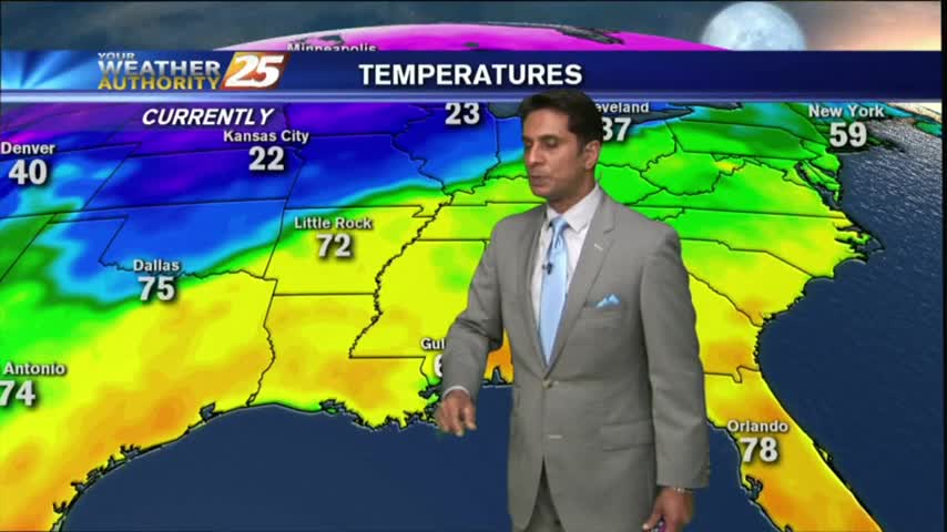
It was much cooler this afternoon than it was the day before, but expect it to be only slightly colder tonight. We'll see rapid changes from tomorrow through the weekend though, so watch the full forecast for the details.
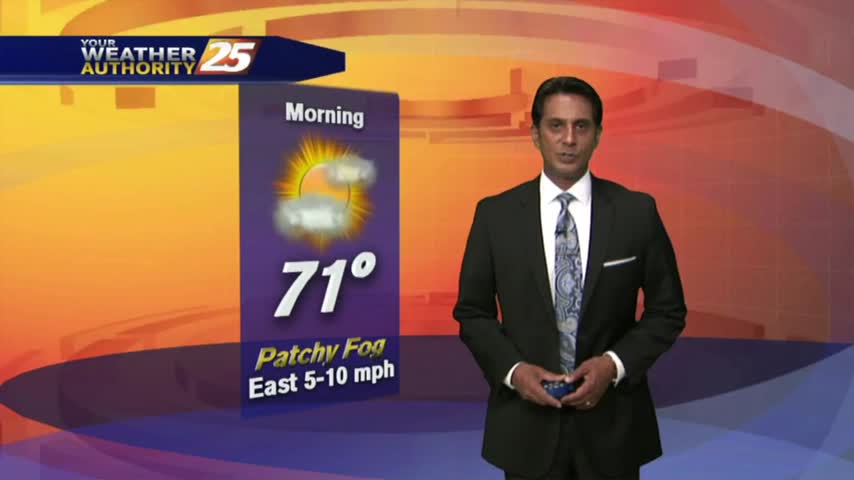
After a few VERY COLD mornings, the humidity has increased...bringing warmer temperatures and areas of patchy fog this morning...
Patchy morning fog is out of the area as temps continue to warm into the upper 70s under a few clouds along the immediate coast...
After another CHILLY morning...changes in the patter is bringing a more humid and unstable air mass in advance of an approaching cold front...
This morning starred out with a few clouds and cool temps, with both increasing this afternoon...
Dense fog burned off earlier this morning, with now partly cloudy skies and breezy conditions setting up...
Mostly clear skies overnight with increasing humidity has developed areas of PATCHY fog this morning...
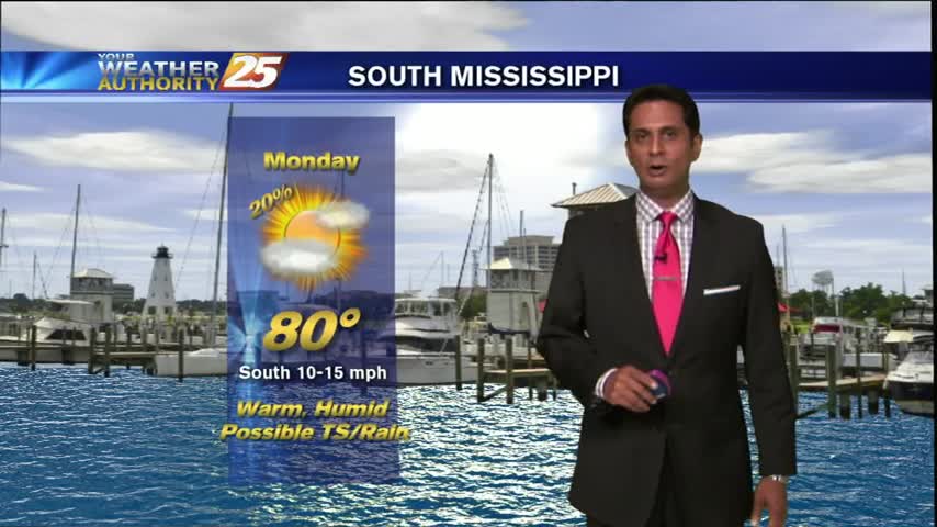
Yesterday afternoon our winds switched to the SW and remained there overnight; with MUCH warmer temps this morning...
After a CHILLY weekend, it's a COLD start with the warming trend beginning later this afternoon...
After areas of patchy DENSE FOG earlier this morning, Light rain is moving in from the SW...
As low-level humidity has been on the increase...areas of PATCHY FOG has developed. A DENSE FOG ADVISORY is in effect through 9 a.m...
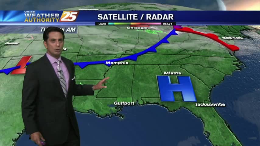
Isolated showers are hugging the outer-coastal waters, as an area of low-pressure developed in the NW'tern Gulf last night,
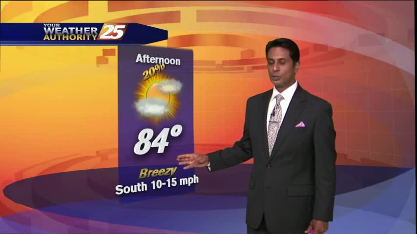
As the mercury climbs into the upper 80s, low-level clouds will provide for isolated t-storms...
After a foggy start under mostly clear skies, the clouds have increased with HUMID conditions...
Daytime heating has thinned the clouds with temps around 80 degrees...
After a beautiful weekend, the clouds will begin to increase along with windy conditions from he south...