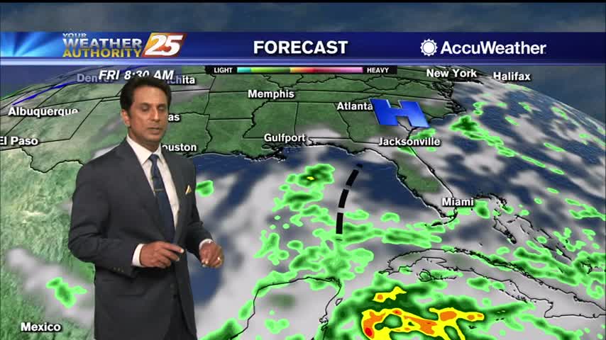
11/3 - Rob Knight's "Cloudy, Light Rain" Afternoon Forecast
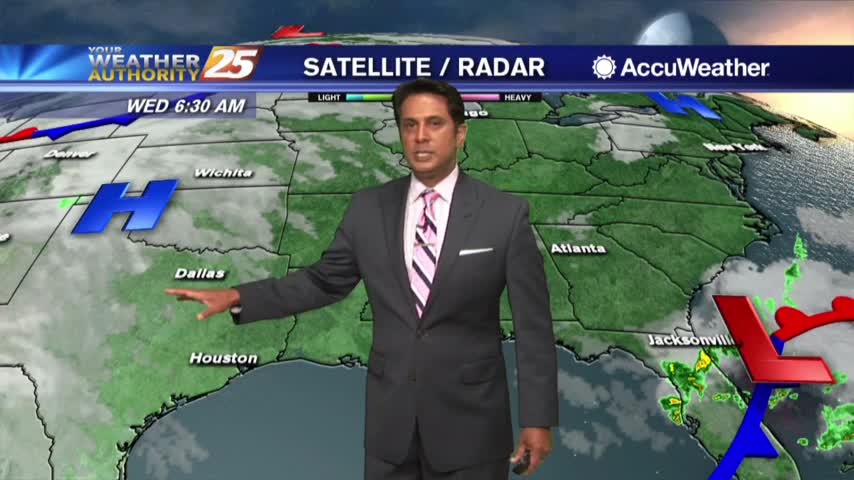
A cold front from the west will move SE. As a blow-up in activity is expected in the NE GOM, our area will see light rain. A…
A cold front from the west will move SE. As a blow-up in activity is expected in the NE GOM, our area will see light rain. A…
High pressure will remain anchored along the eastern seaboard and northern Gulf Coast region through most of the period. Southerly return flow around the high will keep us in the same weather pattern we have been in for the past…
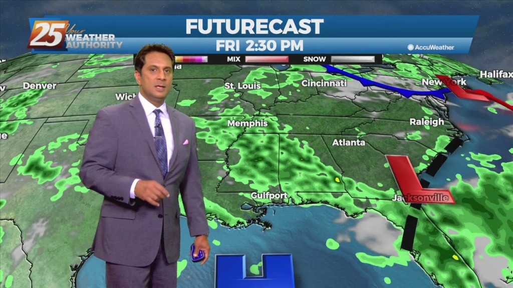
Moisture flow will continue to fall off over the next few days. As we fall back into a drier regime, a more October like pattern should show itself. But with no good cold fronts moving through at least through Friday,…
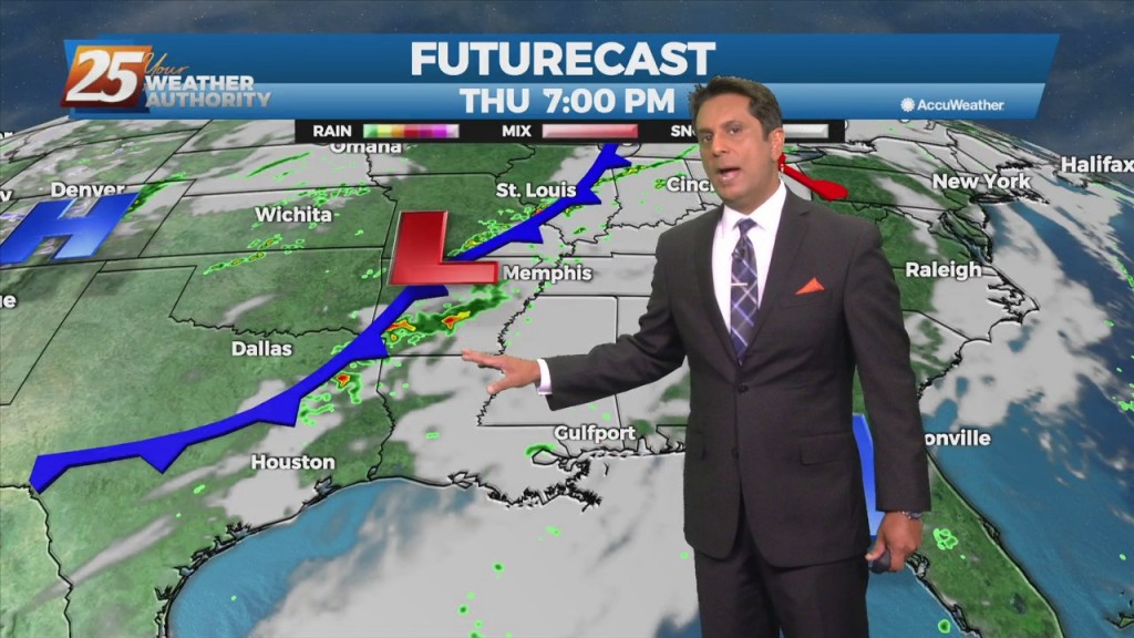
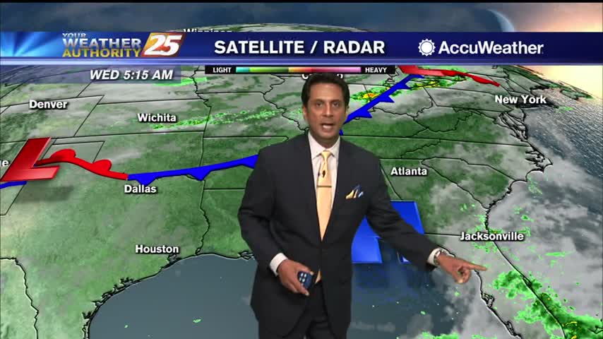
A surface low associated with Tropical Depression Ida will continue to move NE, dragging a weak cold front into south Mississippi Thursday morning. Northwesterly flow aloft will develop across the area today between the upper level High pressure over Texas…
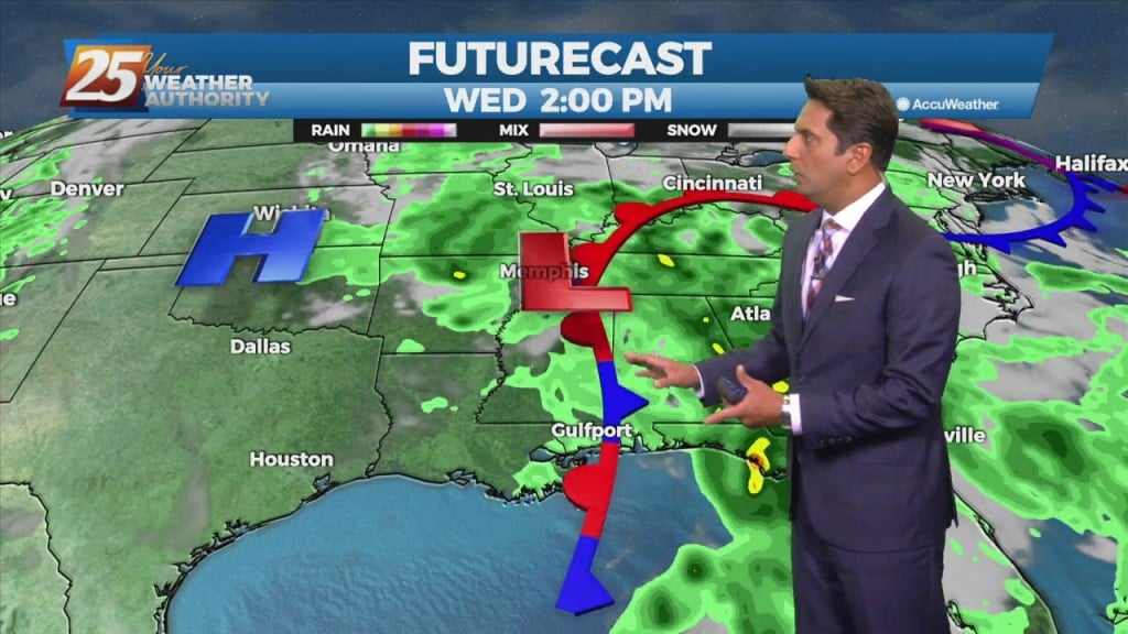
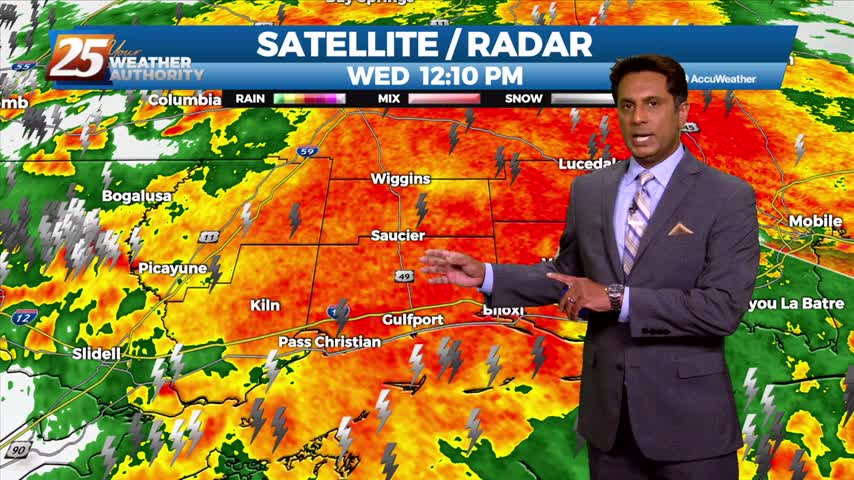
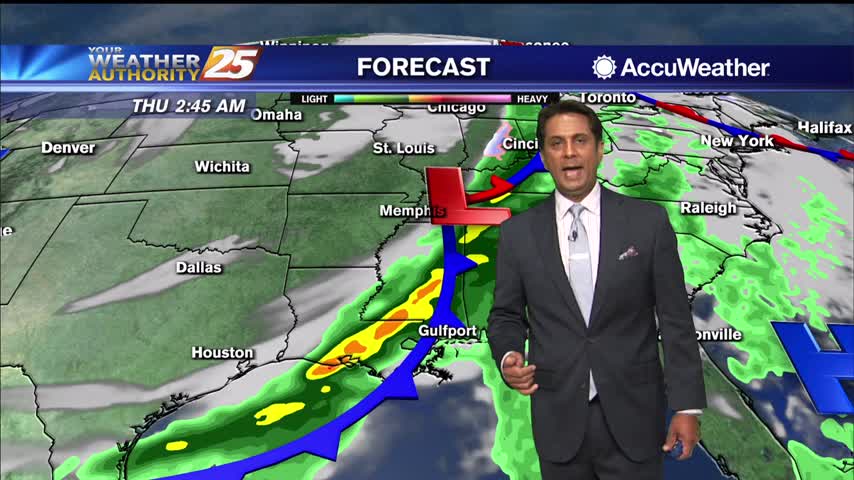
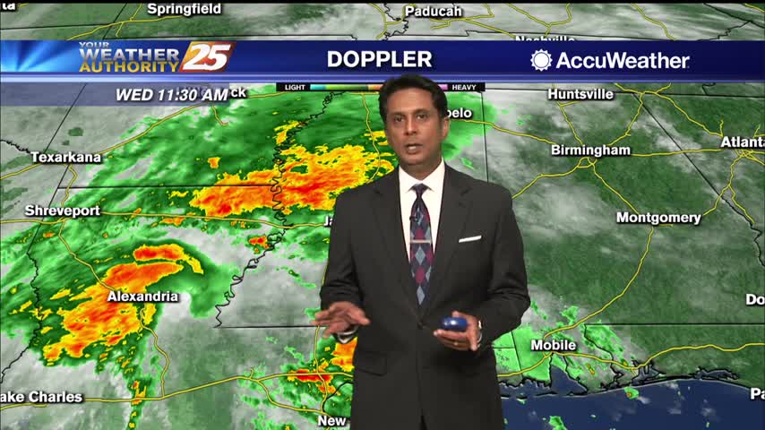
A frontal boundary remains stalled from the Carolinas to southeast Texas, with a weak impulse of low-pressure currently over south central Louisiana. The boundary will remain stalled over the area today thus widespread showers and thunderstorms will develop along it…
T-Storms and heavy rain will begin to taper-off by mid-afternoon...

The threat for SEVERE WEATHER will be in the area this afternoon though mid-evening...
Areas of DENSE fog this morning, then the possibility for SEVERE WEATHER this afternoon/evening...
Upper clouds continue to thin and move east as temperatures climb into the mid-70s...

A beautiful sunny afternoon ahead as winds will switch to the south...
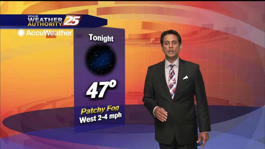
Another very cold start but the air mass will begin to modify later today...
A beautiful sunny afternoon with cool temperatures...
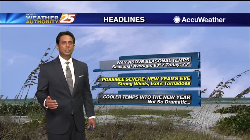
A very warm start to the day as the WAY ABOVE seasonal temps will continue...
A warmer start this morning as a vigorous weather system will move through tonight...
Warmer temperatures will continue through the rest of the workweek...
Another beautiful start to the day with slight warmer overnight low temperatures...

Warm temperatures and a few/party clouds skies heading into this afternoon...
Light patchy fog has dissipated as temperatures begin to warm...
Showers and t-storms from the SW will continue to move NE into south Mississippi...

Slightly warmer temperatures as you're heading out the door this morning...

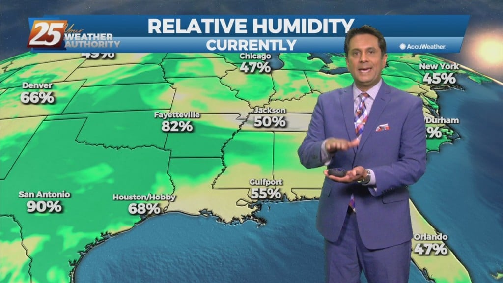
A very muggy morning with areas of light patchy fog north of the interstate...
A very pleasant start to the day with warm temperatures and low humidity...

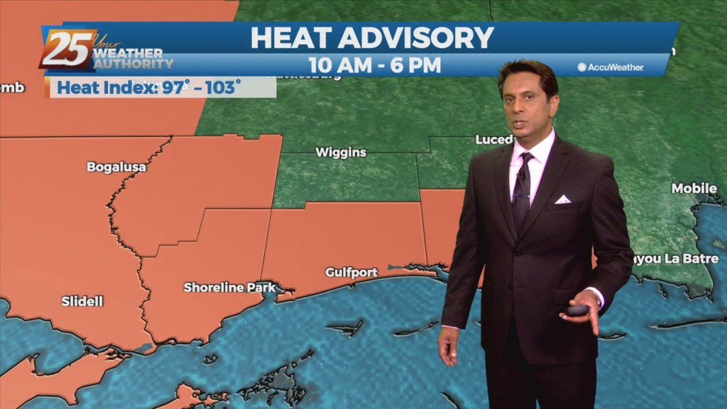
Boy O' Boy is it HOT...and it feels SO MUCH HOTTER with the heat indices...
Another cold start to the day with clear skies and a dry wind coming from the north...